
Things to Do
Hear Live Music Inside NYC's Catacombs
Enter to win a pair of free tickets to an intimate concert performed inside the catacombs of The Green-Wood Cemetery!
Enter to win a pair of free tickets to an intimate concert performed inside the catacombs of The Green-Wood Cemetery!

Explore the home of Free Shakespeare in the Park at the first open house event of the season!


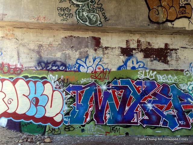
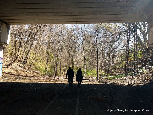
What may become the Queens High Line, the city’s next elevated, 3.5-mile long pedestrian and bike path, is still very much just another ghost of the New York’s past. Yet a short walk down a portion of it in its current, rawest state reveals that it can be just as enchanting as even the city’s most delicately planned parks. The surroundings of what is now named “Queensway” are at once history, nature, vandalism, and working class single-family homes. Told you New York had it all.
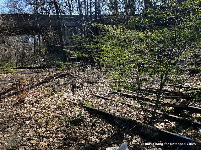
The tracks of the former Rockaway Beach branch of the LIRR (or, less formally, the White Pot Junction line) tear down the center of Queens””starting at Rego Park going toward Howard Beach””and then hang east on trestles toward the Rockaways. It was possible, then, for some residents of Queens to get to Penn Station in half an hour, give or take. As nice (an currently unimaginable) as it was, the point was not convenience to Midtown Manhattan, but the beach, another half hour going the other direction. In a recent Queens Gazette column, Gregory Bresiger breaks down what was apparently quite a scenic route:
By 1881, it linked up with the LIRR’s Atlantic Avenue branch at Woodhaven. Those going on to the Rockaways transferred at Ozone Park. Just a half mile or so beyond Ozone Park, the service continued to Rockaway Park or on to the LIRR’s other branch on the peninsula, which terminated at Far Rockaway.
Until the line fell to infrastructural and financial burden about fifty years ago, the independently operated line carried passengers from central and southern Queens to and from Ozone Park. Part of the line was absorbed as part of the A train in 1956 and is now the southern terminus of the potential QueensWay. (Apparently, the Ozone Park stop can still be seen from Lefferts Boulevard just past the 102nd Street stop.) Another section lives on as a part of the LIRR’s Rockaway Beach branch, originally going from Glendale to Rockaway Park.
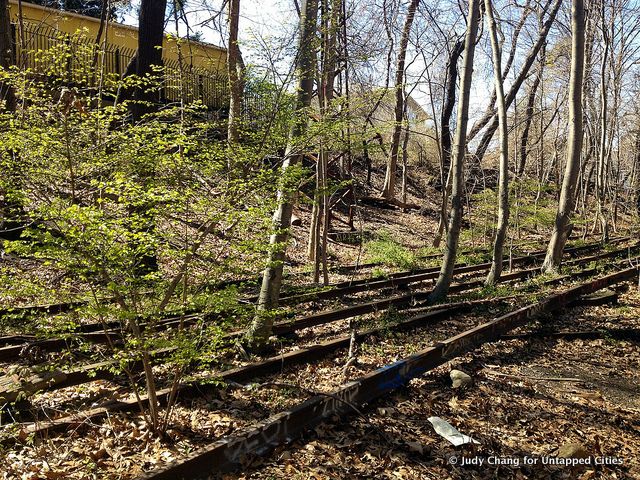

The tracks, mostly quite visible, never quite left the radar of those who either grew up or around them, or in homes that were constructed right next to them after the line was abandoned. And now this Queens High Line is slated to be one of innumerable projects around the world whose hopes of turning old infrastructure into functional, well-designed public space had been realized thanks in part to the completion of the High Line. The Trust for Public Land has announced a partnership with Friends of the QueensWay and the City of New York””who now own the trestles and land underneath the””to produce a feasibility study, cost estimates, and programming to solicit community input. Until then, this abandoned Queens High Line, a New York City asset, can still be viewed in its most exciting state””one that reflects the city’s unrelenting eye for unbridled, trash-into-treasure potential. If you haven’t seen the third section of the High Line in its raw state, check it out before it’s turned into a park.

Subscribe to our free newsletters
Free Newsletters
Get the best stories and things to do sent straight to your inbox.