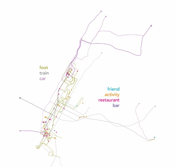
The routes we physically occupy determine our understanding of our city. We create mental maps, conforming our idea of the shape of the city to the way we experience it geographically. But of course, our geographic experience is shaped by the exterior forces of our lives. Thus, our lives shape our cities perhaps as much as our cities shape our lives.
This map titled “I Visit My Friends Pretty Regularly. New York City, 1999-2004.” by Bill Rankin, the creator of RadicalCartography.net, examines this process and translates it into visual data. Rankin created a series titled “My Cities” of six maps of cities he had “lived in or [knew] well,” displaying “only those routes and destinations [he] actually use[d].” Notice that his travel routes are the only actual lines used and yet the distinct outline of Manhattan remains visible. Where Rankin has never traversed, the map disappears just as it does in the city dweller’s personal concept of the city.
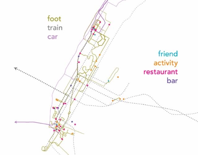
We previously featured Bill Rankin’s maps of Manhattan taking a vacation and visiting other cities in the US. See the rest of the “My Cities” series here and the rest of Bill Rankin’s collection of his own and other maps at his website.
Get in touch with the author @youngzokeziah. See more maps in our Fun Maps column