
Architecture
NYC Views from the Gothic Windows of the Woolworth Building
Find out what you can see from the 26th floor on an exclusive access tour!
Find out what you can see from the 26th floor on an exclusive access tour!

Explore "Democracy Matters" on a docent led tour!
Discover how the criminal justice system has impacted music history throughout the 20th century!


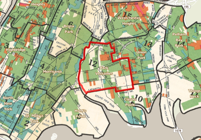
1940s Bronx neighborhoods map. (Courtesy of CUNY Mapping Service)
In the conversation about oddly named neighborhoods in New York City, Parkchester probably comes across as one of the more normal-sounding. Spuyten Duyvil and Morrisania have Parkchester beat in that department. However, the name is rooted in two historic Bronx neighborhoods that were fused together, Park Versailles and Westchester Heights, combined to create the more recognizable, “Parkchester.” What has become a transit and cultural center in the East Bronx was once a staple for the suburban expansion of the Bronx, exemplifying the diversity of the borough in its years of rapid growth in the 1940s.
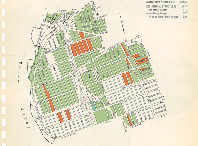
Park Versailles in 1943 from the New York City Market Analysis. (Courtesy of CUNY Mapping Service)
This larger portion of the area that formed Parkchester is another example of French elegance attempted in the Bronx, much like the architecture along the Grand Concourse. Park Versailles was originally the Mapes Farm, established by Leonard Mapes in 1851. As Bill Twomey, author of The Bronx, in Bits and Pieces explains,
One of his sons decided to auction off the old family farm but needed an attractive name for the land. No one knows why, but he finally decided on Park Versailles. The name appeared on some early real estate maps but never really caught on. The name was revived in 1920 when the remaining 200 lots were auctioned, but most locals kept calling it the Mapes Farm.
According to the 1943 New York City Market Analysis provided by Steve Romalewski from the CUNY Mapping Service, Park Versailles had almost 55,000 residents, 99% of which were white of native or foreign-born descent. Its modern day equivalent includes Parkchester, Soundview and West Farms.
Courtesy of CUNY Mapping Service
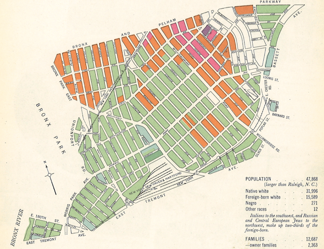
Westchester Heights in 1943 from the New York City Market Analysis (Courtesy of CUNY Mapping Service)
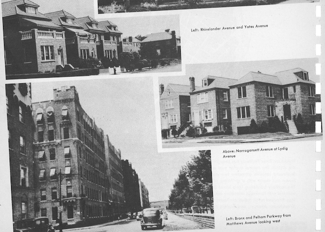
Slightly smaller with close to 48,000 residents (though larger than Raleigh, NC at the time) is Westchester Heights, comprising the present-day areas of Morris Park, Pelham Parkway, and Van Nest. Once again the population is immensely homogenous with less than 1% of its residents non-white.
There is much less written about the etymology of the name Westchester Heights. An educated guess would be to relate it to the annexation in 1898 of 20 square miles of “Westchester County” east of the Bronx River (and thus New York City). The area of Westchester Heights aligns closely to the eastern banks of the river.
Courtesy of CUNY Mapping Service
What’s in a name? Check in on our History of Streets column if you like dissecting names of streets and neighborhoods. Don’t hesitate to check out CUNY’s Mapping Service, where you can see the historical districts from the 1940s of each borough and flip through artifacts just like these about your favorite neighborhoods. Get in touch with the author @uptownvoice.

Subscribe to our free newsletters
Free Newsletters
Get the best stories and things to do sent straight to your inbox.