


From its start, New York City has been mired in territorial disputes. The Native Americans, the Dutch, the British, New Jerseyans, and even New Yorkers have all fought against one another, and themselves, for control of the land that comprises New York City. In some ways, border disputes are still on-going today, with less bloodshed, over the naming and boundaries of neighborhoods. Going back in time, here are eight territorial disputes that have affected New York City, waged between countries, states, cities, boroughs, and more.
1. The Dutch-Indian Wars
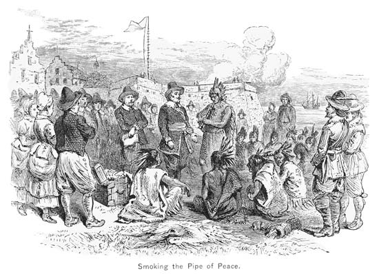 Image via Wikimedia: public domain
Between 1641 and 1664, the Dutch and Native Americans fought a series of wars for control of the nascent Dutch Colony, New Amsterdam. Kieft’s War, the Peach War, the First Esopus War, and the Second Esopus War are largely forgotten today but had an indelible impact on the history of New York. For example, Kieft’s War, also known as the Wappinger War, was started at the behest of Governor Willem Kieft who sought to avenge the theft of pigs from the Staten Island Farm of David de Vries.
Ultimately, it was determined that other Dutch settlers had stolen the pigs and Kieft used the incident as a pretext for taxing the tribes or to take over some of their land. Kieft’s War ended tragically with the destruction of many of the colony’s settlements and the deaths of many on both sides of the dispute, including Puritan settler Anne Hutchinson and six of her children. Kieft was recalled back to Amsterdam and was replaced by Peter Stuyvesant, beginning a new chapter in the city’s history.
2. The Anglo-Dutch Wars
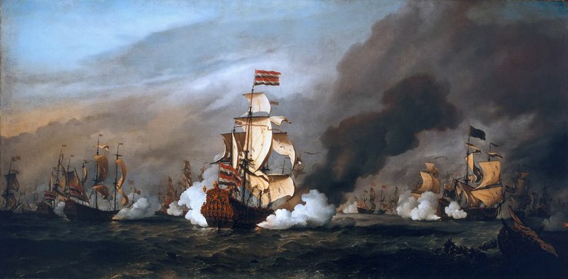 The Battle of Texel during the Third Anglo-Dutch War, shortly after the incident in Sandy Hook. Photo by in the National Maritime Museum, Greenwich, London. Image via Wikimedia: public domain
The Anglo-Dutch Wars began in the 1650s and did not end until the 1780s, with aspects of them continuing through the beginning of the nineteenth century with the Napoleonic Wars. It was during the course of the Second Anglo-Dutch War that England took control of the Dutch colony of New Amsterdam and the colony of New York was conceived. The rest is history, or that is what most people believe.
Excised from the most common narratives of New York City’s history is an incident during the Third Anglo-Dutch War. On August 7, 1673, the Dutch fleet anchored off the coast of Sandy Hook, New Jersey. Over the course of the next two days, a contingent of 600 Dutch soldiers captured the British governor, Lovelace, took control of New York, and renamed the territory New Orange. New York would triumph once again. Per the terms of the Treaty of Westminster, ending the Third Anglo-Dutch War, the British regained their colony and the Dutch were vanquished from New York for the last time.
3. Border Disputes Between New York/New Jersey
From time immortal, or since their creation in 1664, New York and New Jersey have fought over their northern border. The border between the two colonies was originally demarcated by “a branch of the Delaware River that no one could definitively locate.” This led to New York’s own hundred years’ war. For the next century, New Yorkers and New Jerseyans engaged in cross border skirmishes, including a final hand to hand combat battle in which no weapons were used but it took place on the Sabbath. The dispute ended with King George III establishing a commission, which set the boundary in 1769 at latitude 41 degrees 21 minutes on the Delaware River and 41 degrees on the Hudson.
The debate emerged again in 1998 when the Supreme Court ruled that the landfill portion of Ellis Island actually belonged to New Jersey, including a section of the historic immigration building. No wars erupted but then-Mayor Rudolph Guiliani was aiming for his own modern-day skirmish.
Also join us for our tour of the abandoned Ellis Island Hospital to learn more about the history of the complex:
Behind-the-Scenes Hard Hat Tour of the Abandoned Ellis Island Hospital
4. Arbitration Rock Between Queens and Brooklyn
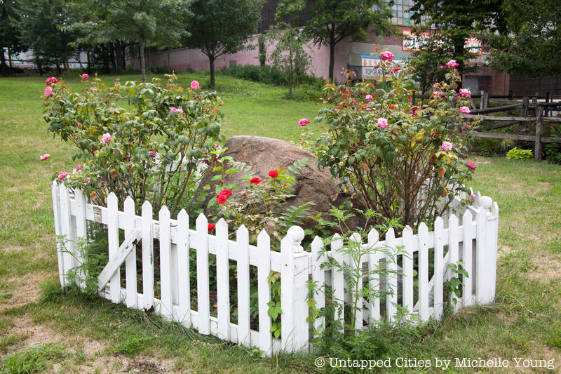 Arbitration Rock
The Pilgrims have Plymouth Rock and New Yorkers have Arbitration Rock. Beloved by residents of the outer boroughs, Arbitration Rock helped solve a border dispute that lasted for over a century. Before the consolidation of New York City, many of the current neighborhoods in Queens and Brooklyn were their own towns and villages. Two of these, Newtown and Bushwick, fought over a shared border from 1660 until 1769 when an official survey was completed.
Part of the surveyor’s line included a rock “to a noted heap of stones, with a stake in the middle, know by the name of Arbitration Heap, and from thence in the same direct line up to the hill or mountain until it meets the line of Flatbush.” As a result of its inclusion in this momentous peace survey, the rock was renamed Arbitration Rock and has remained in situ ever since. Or has it?
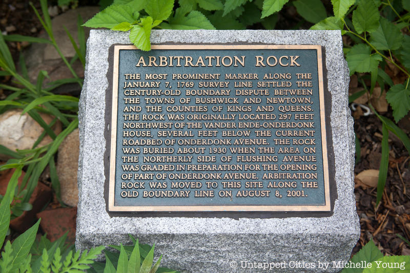
According to a nineteenth century account the rock, which per the Brooklyn Charter form part of the 18th Ward’s border, “was blown to pieces, and removed, by individuals who probably knew not its value as an ancient and important landmark.” The rock was purportedly found in 1880 then lost again for 20 years and then rediscovered and lost again. This game of hide and seek continued until 2001. After a seven year research quest by William Asadorian, the librarian with the New York Public Library was confident he knew where the rock lay. The City of New York agreed to do the dig, as utility work was already in the pipeline, and brought up the rock from underneath the streets.
It was placed in the backyard of the Vander Ende-Onderdonk House, a Dutch stone house that is a New York City, State and federal landmark, along the original boundary between Brooklyn and Queens. Since the original boundary was adjusted in 1925, this places Arbitration Rock on the Queens side, much to the ire of Brooklyn politicians.
5. Marble Hill
Historically, Marble Hill formed the northernmost part of the Island of Manhattan. In 1895, the Army Corps of Engineers rerouted the Spuyten Duyvil Creek, separating Marble Hill from Manhattan as a separate island. In 1913, the Creek was filled in, and Marble Hill physically became a part of the Bronx. However, at the time, its residents insisted on remaining a part of the county of Manhattan and voting in Manhattan elections (even though the area has a Bronx zip code and area code). Bronxites were not ready to let a slice of Manhattan abut their mainland borough.
Just before noon on a cool, blustery Saturday in March, 1939, a limousine pulled up to the corner of 225th Street and Jacobus Place in the Marble Hill neighborhood of Manhattan. James J. Lyons, the Bronx Borough President, had come with the express purpose of claiming the neighborhood for the Bronx (he compared it to Hitler’s annexation of the Sudetenland). Lyons planted the borough’s flag, emblazoned with “Ne cede malis” (Yield not to Evil). Smiling widely to the cameras, he proclaimed that the territory of Marble Hill would henceforth be a part of the Bronx.
While this territorial dispute has mostly calmed down, it still flares up every few years. In 1984, a woman from Marble Hill was summoned to jury duty in New York County. The woman alleged that she should not have to serve on the jury because she was a resident of Bronx County. In order to quell this situation, the New York state legislature passed a law declaring that Marble Hill is part of the Borough of Manhattan and the County of New York.
For more information about Lyon’s Marble Hill coup check out our previous coverage: On This Day in NYC History: The Bronx Borough President Attempted to Invade Manhattan in 1939
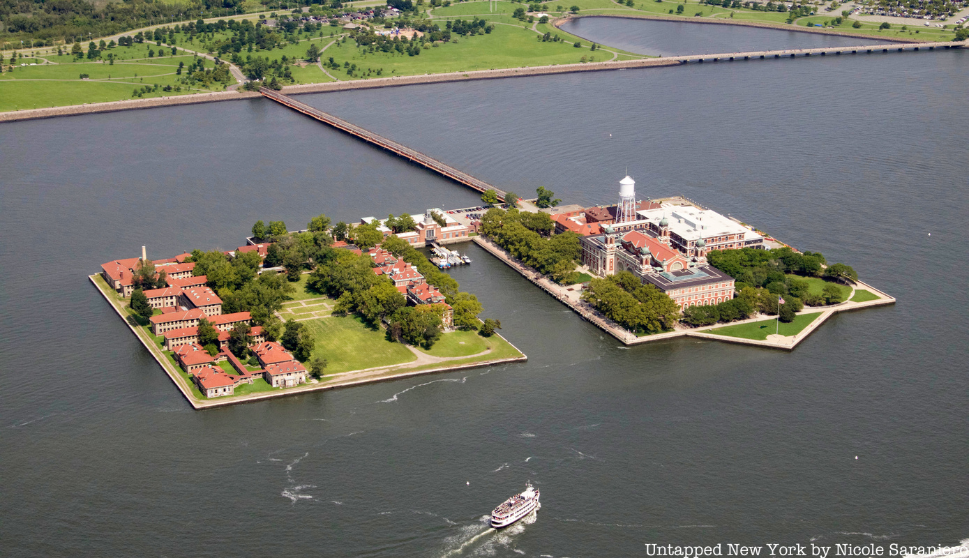
6. Ellis Island
 Ellis Island. Image via Save Ellis Island.
Visitors to Ellis Island rarely give a thought as to which state Ellis Island belongs. They are content to wander the Guastavino–tiled halls and imagine what life was like for immigrants over a century ago. Nevertheless, individuals at the highest echelons of the New York and New Jersey State governments have spent the better part of two centuries fighting over sovereignty of the Island.
In the colonial period, New Jersey had jurisdiction over all land west of Long Island, which would include Ellis Island. An 1834 compact conceived by delineated the border between New York and New Jersey “as the middle of the Hudson River” and “provided that Ellis Island, then three acres, was part of New York, despite its location on the New Jersey side of the river.” However, New Jersey retained sovereign rights “over submerged lands on its side [of the Hudson River].” The small island that existed completely changed over the course of the nineteenth century as the federal government added landfill to suit its changing needs from a small battery to a large immigration depot.
In 1954, the immigration station closed and New York and New Jersey once again tried to claim the island for themselves. On January 4, 1956, a party from Jersey City, led by Mayor Berry, commandeered the Coast Guard Cutter, Tuckahoe, “to land an expeditionary force” on Ellis Island. Mayor Berry “favored planting the New Jersey flag on the island,” although no one brought one along. “There was some discussion about going back…to get one. But it was finally agreed that planting the flag would only infuriate New York, and who could foretell where that might lead!” Nothing came of this pseudo-military expedition, though it is worth noting that while New Jersey wanted to turn the island into a park, New York was interested in using the “facilities for its Departments of Welfare and Corrections.”
It took until 1998 for the Supreme Court, with the assistance of Special Master Paul R. Verkuil, to finalize the matter once and for all. The Court ruled 6 to 3 that every inch of landfill on the island belongs to New Jersey. Justice Stevens dissented, arguing that it was a “bizarre decision” to make divide the main immigration building between the two states: the building’s kitchen and laundry are in New Jersey.
Also join us for our tour of the abandoned Ellis Island Hospital to learn more about the history of the complex:
Behind-the-Scenes Hard Hat Tour of the Abandoned Ellis Island Hospital
7. Liberty Island
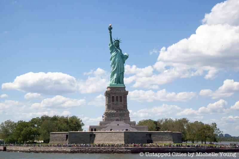
According to the auestions for the Naturalization Test for United States Citizenship, acceptable answers for the location of the Statue of Liberty include New York (Harbor), Liberty Island, New Jersey, near Near York City, and on the Hudson (River). As prospective citizens are taught, the sovereignty of Liberty Island remains unsettled.
Control of the Harbor Islands was possibly settled in the seventeenth century. When the British took control of New York, certain aspects of the colony’s border with New Jersey was in doubt. The Duke of York proclaimed that all islands that could be circumnavigated within twenty-four hours would become part of New York. Captain Christopher Billopp took up this endeavor and encircled Staten Island and possibly some of the Harbor Islands ensuring that New York would retain sovereignty over them. Sadly, the New York Times has now determined that the story is more likely an apocryphal old wives’ tale.
Unlike with Ellis Island, the Supreme Court has never definitively settled the issue of Liberty Island. To New Yorkers remains an integral part of New York, while for New Jerseyans, it is part of their birthright.
Next, read about the Secrets of Ellis Island and the Secrets of the Statue of Liberty.