


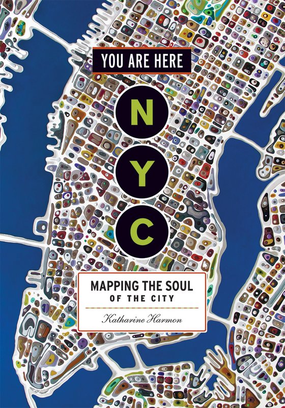
 Cover, published by Princeton Architectural Press, 2016.
Here at Untapped we like to share with you fun maps that depict New York City in a strange, new, funny or exciting way. In You Are Here: NYC: Mapping the Soul of the City, a stunning collection of some 200 maps of 400 years of New York City history, author Katharine Harmon delivers charts every representation of the five boroughs and the cultures and people that have shaped each neighborhood, creating colorful and interesting representations of the city’s past, present and future. Below you’ll find complied a list of some of the interesting perspectives Harmon’s collection has to offer.
1. Greatest New York
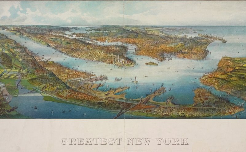 Henry Wellge: Greatest New York, 1911. Lionel Pincus and Princess Firyal Map Division, New York Public Library
German-born map artist and publisher Henry Wellge produced more than 150 perspective renderings of small US cities. This bird’s-eye view of New York City was a popular cartographic form in the 1840s through the earlier 20th century. It offers an oblique aerial vista from an imaginary perspective, certainly giving the city an impressive and grand feeling.
2. The Bronx Grand Concourse – A Cultural Map
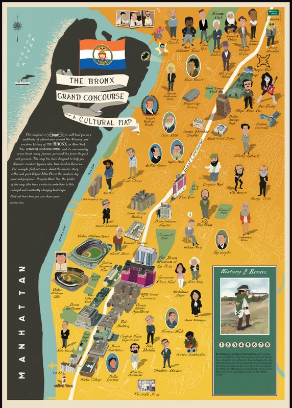 The Bronx Museum of the Arts: The Bronx Grand Concourse—A Cultural Map, 2013. Design by Kevin Waldron, research by Terry Wasserman, additional research and produced by Tamzin Barford
The four-mile long Grand Concourse was built at the turn of the 19th century as the Champs-Élysées of the Bronx. An interactive version of this map is available from the Bronx Museum where you can learn more about the history of this “boogie-down borough” through its prominent locals, past and present.
3. NYC Storm Surge Buffer States
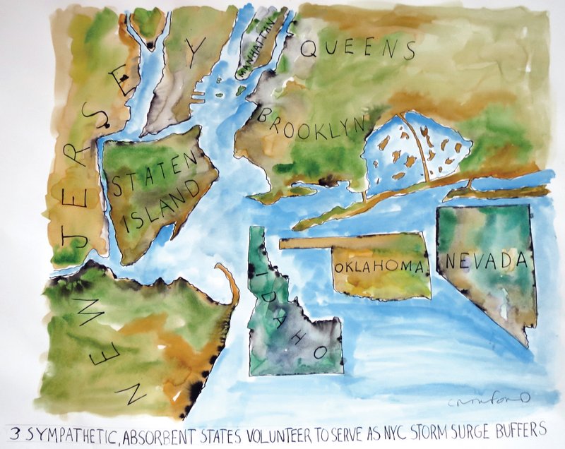 Michael Crawford: Three Sympathetic, Absorbent States Volunteer to Serve as NYC Storm Surge Buffers, 2012
While this may not be completely accurate, it’s what Harmon describes as “a nice gesture. It’s simply a matter of getting them to us on time.”
4. Brooklyn Constellations
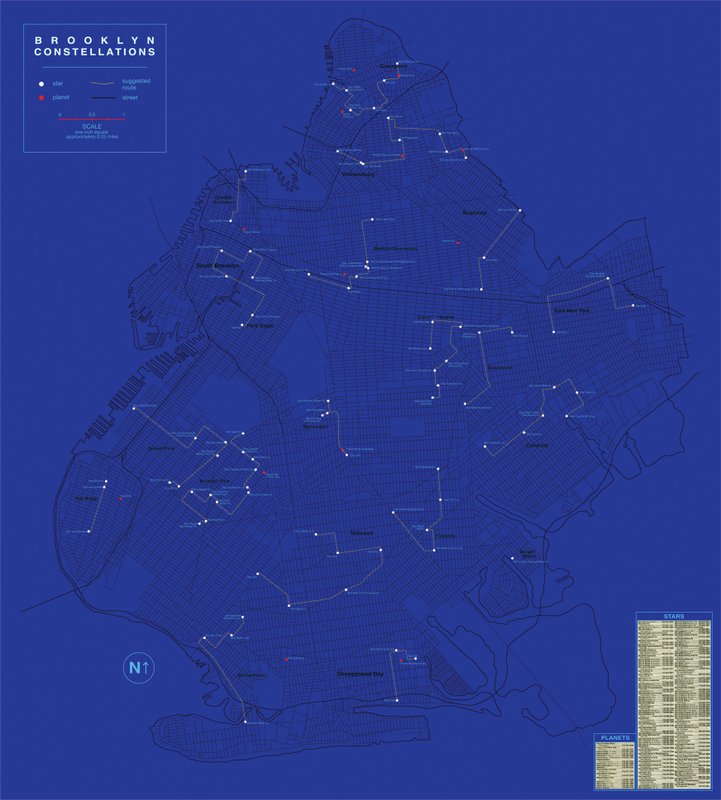 Katarina Jerinic: Brooklyn Constellations, 2007
Brooklyn artist Katarina Jerinic created here a map of the astronomy of Brooklyn using the Yellow Pages. The white dots are stars, the red dots planets, and the dotted lines are street routes that create constellations. Some star and planet names include Star Cits, Star Sporting Goods, Star Deli, Planet Brooklyn Music, Star Self-Service, and Planet Kidz Fulton. Quirky but beautiful, it paints the picture of a calm Brooklyn that can be admired from afar.
5. The East Village
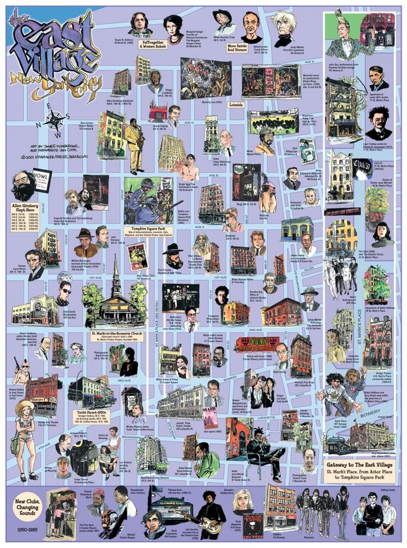 The East Village, New York City, 2001. Concept by Marc H. Miller, artwork by James Romberger and Marguerite Van Cook, design by Kevin Hein
The East Village used to be the home of some of New York’s most notable beatniks, artists, hippies, activists, writers, musicians, and poets. At a time when the rent was cheap, these characters gathered together to make the East Village creative enclave of the city. This map shows off that culture with 68 walking-tour sites from the former apartments of Abbie Hoffman and Robert Mapplethorpe to Joan Mitchell’s studio and mural by Keith Haring.
6. The High Line
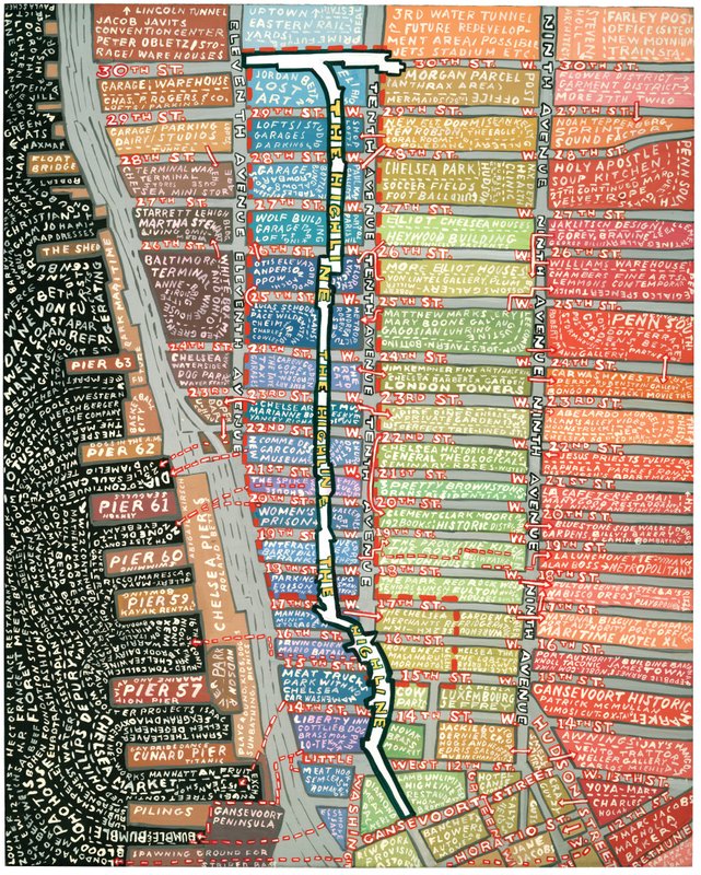 Paula Scher: High Line, 2005
Manhattan’s High Line has become one of the city’s most popular attractions, visited by five million people each year. When James Corners design was chosen for this railway, Paula Scher of Pentagon Designs became involved with the efforts to bring this wonderful design to life, including designing the logo and overseeing promotional materials. The map above was created by Scher as a fundraising poster.
7. 49 Waltzes for the Five Boroughs
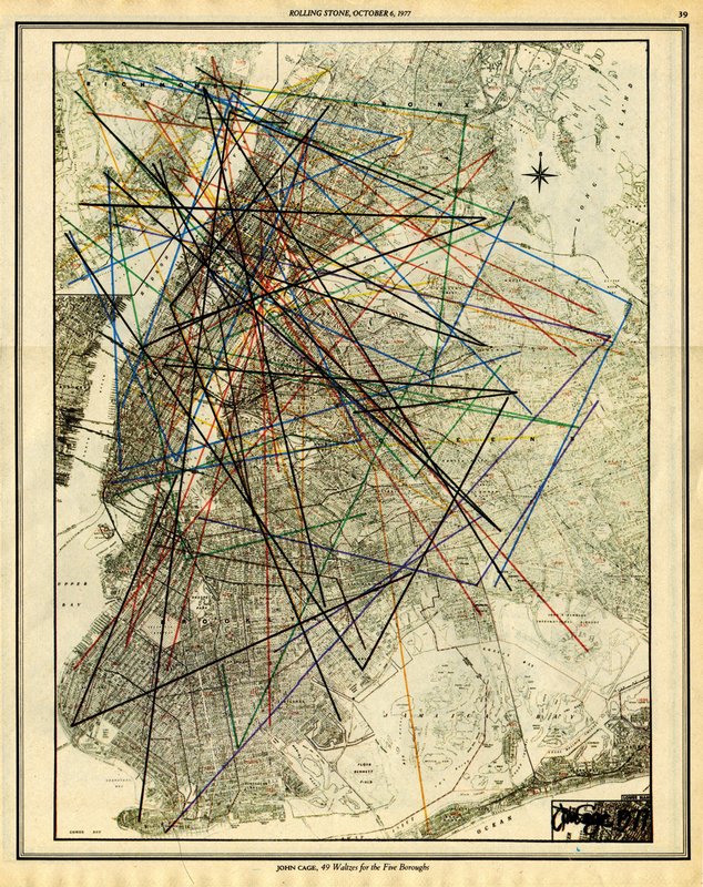 John Cage: 49 Waltzes for the Five Boroughs. From Rolling Stone, October 6, 1977
When Rolling Stone move from San Francisco to New York, American composer John Cage was commissioned by the magazine to commemorate the move. The map is a drawing of 49 triangles, or “waltzes,” with each triangle point corresponding to actual coordinates where at any time or day could listen to the changing sound of the city at a total of 147 sites. An accompanying score lists 147 street addresses for “performer(s) or listener(s) or record maker(s).” The concept essentially makes the city the performer.
The project has lived on on a few platforms since its creation. After Cage’s death in 1992, a colleague made video recordings at each site, subsequently released on DVD. In 2012, Avant Media created an online site where people can upload pictures and audio or video recordings taken from the waltz sites.
Want more fun maps? Check out an NYC subway map “City of Women” that shows a system where every stop is named after women. Or try some more judgmental maps if you’re looking for some humor.