

3. Gerritsen Creek Once Went Twice as Far Inland into Brooklyn
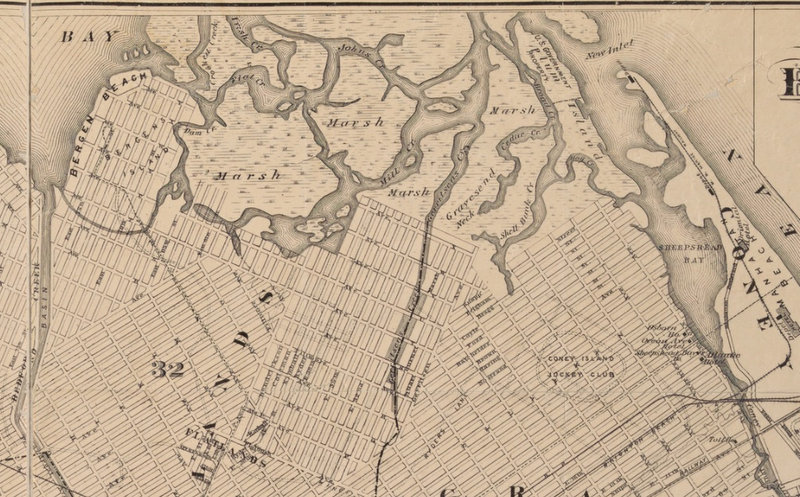 1898 “Map of the Borough of Brooklyn Published for the Brooklyn Directory” from NYPL Digital Collections. In this map south is at the top of the map, and north is at the bottom. Gerritsens Creek runs down the middle of the map.
Alyssa Loorya, an urban archaeologist and founder of Chrysalis Archaeological Consultants, serves as the Vice President of the board of the Lott House Preservation Association. She says that a location for the Underground Railroad stop at the Lott House makes sense. Gerritsen Creek, a freshwater stream, used to come up closer to the Lott House, which is en route to Weeksville, a neighborhood in Brooklyn founded by freed slaves in present-day Crown Heights. The 1898 “Map of the Borough of Brooklyn Published for the Brooklyn Directory” shows Gerritsen Creek reaches to nearly Avenue R.
As the NYC Parks Department reports, around 1920 “the creek north of Avenue U was converted into an underground storm drain. Yet it continues to supply the salt marsh with fresh water, which helps the marsh support a wide range of organisms.”