


5. A Lost Brook Below Astoria Park Can Be Spotted on Beers Maps from 1873
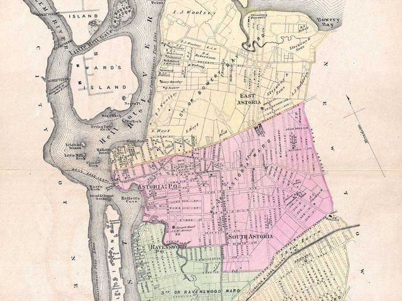 An example of Fredrick W. Beers’ map of the Long Island City, published in 1873
Linden Brook still courses underneath the southern end of Astoria Park, although you wouldn’t be able to tell based on maps of New York City today. Watercourses, a site dedicated to locating lost streams, rivers and the like, notes the following:
Linden Brook is hard to find on maps. Apparently it was a small stream, and by the time the area was settled enough for good maps to be produced, it had mostly disappeared underneath urbanization.
Even so, you can still spot evidence of the stream’s existence on 1873 Beers maps of Long Island City. See close-ups of the maps here.