

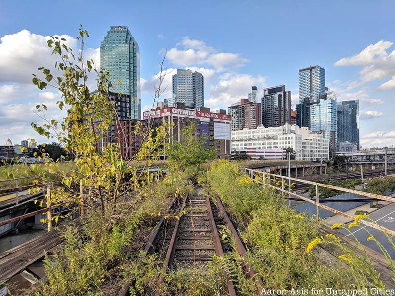
Across New York City, there are plenty of remnants of abandoned and lost rail lines, some of which have been defunct for over a century. Some of the rail lines have been revitalized, including the High Line, while others have been abandoned and left to wither away over the years. Some have become photo-worthy spots and have been renovated, while others are probably unknown to even those living in the neighborhood where the tracks degrade. Many were operated by the Long Island Rail Road and were rerouted over the years. Here are 10 abandoned and semi-abandoned rail lines across the five boroughs.
1. Parts of the Bay Ridge Branch
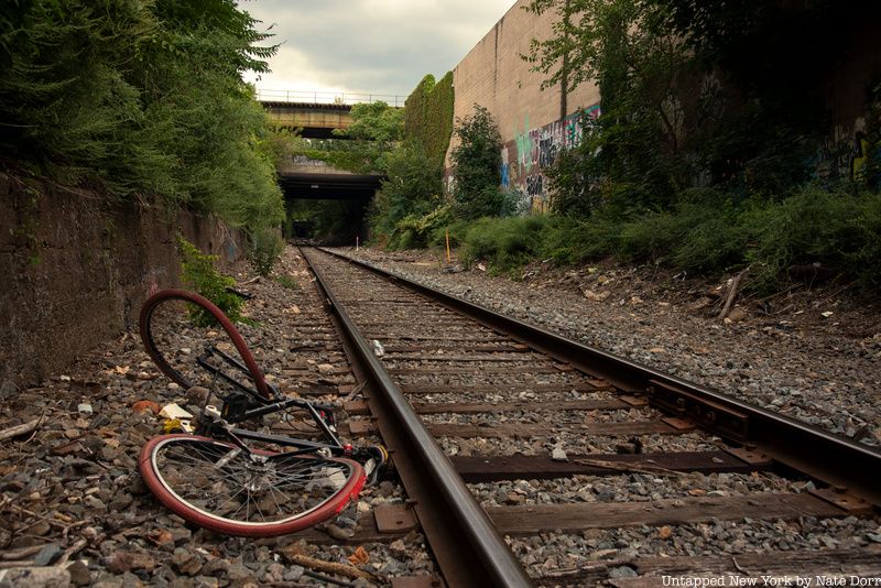
The Bay Ridge Branch of the Long Island Rail Road opened in 1876 as part of the New York and Manhattan Beach Railway. The tracks, which pass through heavily forested areas, curve from their terminus in Bay Ridge through southeast Brooklyn into Jackson Heights. Declining ridership forced passenger service to close in 1924, and it is now one of the few dedicated freight rail lines on Long Island, meaning parts are semi-abandoned. The 14-mile line is currently owned by the Long Island Rail Road (LIRR) and CSX Transportation, a private freight rail company. Only one or two trains run per day throughout the Brooklyn section.
The Interborough Express, which would be New York’s newest rapid transit link if brought to fruition, would revitalize the semi-abandoned 14-mile freight rail corridor that traverses Brooklyn and Queens. Governor Hochul backed the idea to create the Interborough Express, as detailed in the MTA’s feasibility study. The Interborough Express would bring back passenger service and provide a crucial link between the two outer boroughs with an estimated 80,000 daily riders. An environmental review process is expected to begin in late 2022 or early 2023, after which the MTA would launch a five-year capital plan in 2025 before choosing a contractor.
2. New York and Manhattan Beach Railway / LIRR Manhattan Beach Branch
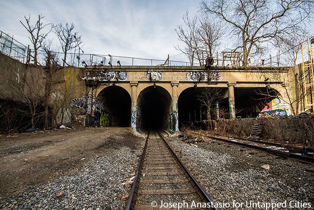
The New York and Manhattan Beach Railway opened between 1877 and 1878 and would become the Manhattan Beach Branch of the LIRR. The branch, which closed in the 1930s, still exists in remnants at the former Neck Road LIRR station in Homecrest, Brooklyn, whose entrance has been bricked off. In East New York, there is an abandoned platform that indicates there was a station by the tunnel that was once part of the New York and Manhattan Beach Railway, which connected Long Island City and Bay Ridge to Manhattan Beach.
A semi-abandoned East New York freight tunnel sits by this platform. Built in 1918, the tunnel has four tracks though only one is active today. That track functions as a short-haul freight run from Fresh Pond Yard to Bay Ridge. The tunnel was built for freight, which would connect New Jersey to the Northeast, but there was also passenger train activity. The passenger rail line opened in 1877 and closed in 1924, just six years after the opening of the East New York freight tunnel. The former northbound passenger track was lifted in 1939 with its tunnel sealed. The tunnel has been the site of television and movie sets, as well as graffiti works.
3. Port Morris Branch
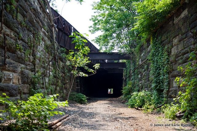
The Spuyten Duyvil and Port Morris Railroad traversed the West Bronx and South Bronx, specifically from Spuyten Duyvil Creek to the Harlem River to the northwestern shore of the East River. The railroad was built in 1842 and was bought 11 years later by the New York and Harlem Railroad. By 1871, the railroad connected the Hudson River Railroad to what would become the New York and Putnam Railroad. The line was rebuilt in 1906 and was realigned along Marble Hill.
The Port Morris Branch was expanded in 1905, but by World War II, it faced underutilization due to rampant violence and poor drainage. After the construction of the Oak Point Link, the Port Morris Branch shut down in 1999 and was formally abandoned four years later. Due to garbage buildup and a homeless encampment that was removed in 2015, the corridor earned the nickname the “Mott Haven Swamp.” The branch remains abandoned today and was photographed over the years by James and Karla Murray.
4. Harlem River Branch
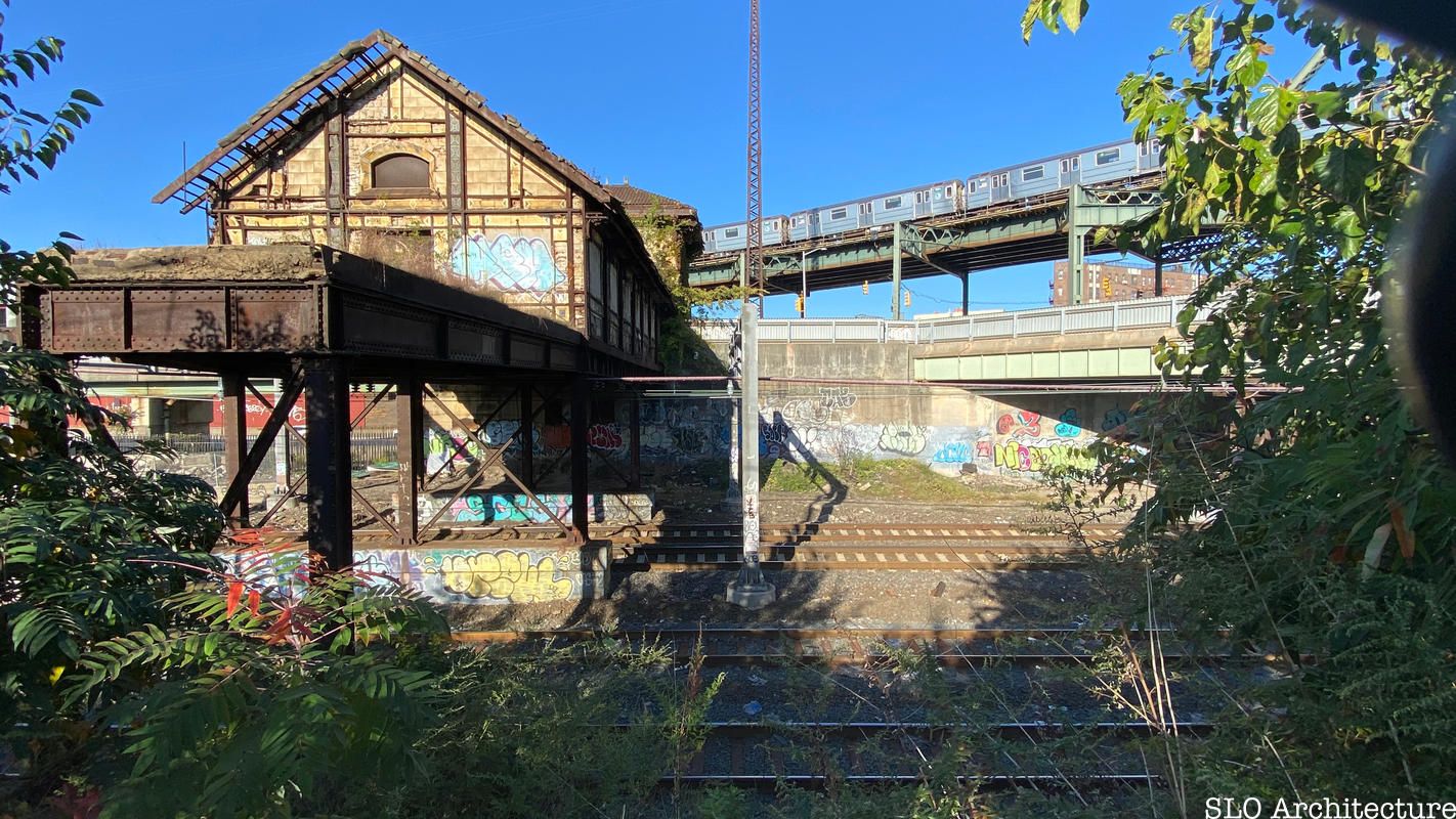
In 1904, the New York, New Haven, and Hartford Railroad upgraded its Harlem River Branch, which went from the Harlem River to New Rochelle. As part of this expansion, Cass Gilbert, the architect behind the Woolworth Building and Alexander Hamilton U.S. Custom House, built some stations. The Bartow station on the line had a rustic feel, but now the station is a roofless wreck. The Morris Park station is now abandoned and was painted to resemble an American flag, while the Hunts Point station still has its red-slate roof but is covered in graffiti. The decaying Westchester Avenue Station also still retains some of its architectural features.
Both the Hunts Point and Westchester Avenue stations are cued for revitalization, though no trains have stopped there since the 1930s. An innovative rehabilitation project by SLO Architecture is attempting to revitalize the Westchester Avenue station through Bronx River Right-of-Way, in which the station would be relocated to a spot over the Bronx River. A pedestrian bridge and ramp from the station down to Concrete Plant Park will be added.
5. Montauk Cutoff
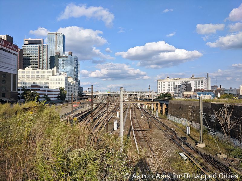
A haven for urban explorers, the Montauk Cutoff was a railroad line built in the 1900s and located in Long Island City. The Montauk Cutoff helped transport trains in and out of Sunnyside Yard and turned locomotives on weekdays, operating frequently until the 1970s when freight traffic in Long Island City declined. Since there was no turntable in Long Island City, trains were gathered and reversed in the evening.
Abandoned completely in the 1990s, the Montauk Cutoff was used by Sextantworks (Wanderlust Projects) for a speakeasy and urban exploration mixed event. In 2011, urban farm collective Smiling Hogshead Ranch formed a guerrilla garden on the abandoned tracks. The Montauk Cutoff was officially decommissioned in 2015, though there have been revitalization plans to transform it into an elevated park.
6. The forgotten half of the High Line
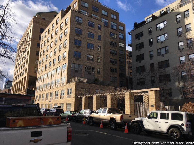
The High Line, which was once abandoned, became one of the most popular attractions in Manhattan over the past few years. However, the High Line used to be about 50% longer than it is today, running through the West Village all the way to St. John’s Terminal in Tribeca. Though most of the other half was demolished, some parts still remain. The High Line was the first part of Robert Moses’s West Side Improvement Project, which removed street-level freight trains from 10th Avenue, infamously nicknamed “Death Avenue” at the time. The High Line stretched 2.15 miles from 35th Street and 11th Avenue, though by 1960, St. John’s Terminal was abandoned and part of the High Line was disused.
In 1980, the Jacob K. Javits Center replaced a section of the High Line, with another five blocks of tracks between Gansevoort and Bank Streets, which were demolished 11 years later. A piece of old trackbed still sits in the Westbeth artists residence, formerly the Bell Labs building. There are also still remnants of the forgotten portion of the High Line on other buildings, whose exterior walls clearly show where the tracks were.
7. Rockaway Beach Branch
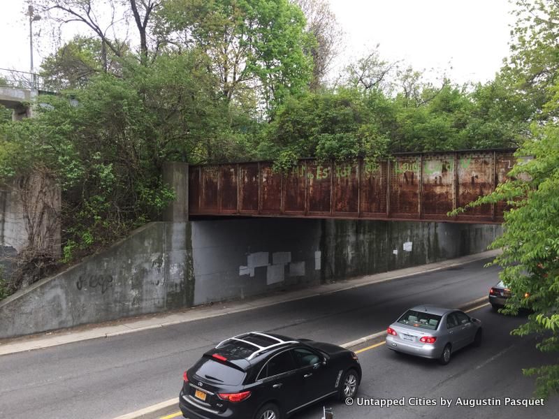
The QueensWay project is a plan to convert the former LIRR Rockaway Beach Branch into a public park. Construction for the Rockaway Beach Branch began in 1877, though it was not fully completed until the 1920s. The branch connected the Rockaways with White Pot Junction near Kew Gardens, Queens. Track fires in the mid-1900s by Jamaica Bay led to the decline of the branch, which was abandoned since 1962. The southern section of the branch was converted into subway lines by the city in 1955, followed a year later by reduced LIRR operations between Rego Park and Ozone Park.
There have been proposals to reactivate the branch, though all have failed due to costs, environmental impacts, and negative effects on residents. Instead, the Friends of the QueensWay project was created in 2011 to create a park around the abandoned tracks, which extend for 3.5 miles. The project has received support from figures including U.S. Representative Grace Meng and Senator Toby Ann Stavisky. The QueensLink is another proposal for a new north-south transit link in Queens that would simultaneously make new park space adjacent to the revitalized transit route.
8. Evergreen Branch
The Evergreen Branch of the LIRR ran between Greenpoint, Brooklyn and Ridgewood, Queens. The branch began in 1874 as the Glendale and East River Railroad, and the extended Evergreen Branch was approved in 1877. Stations including Humboldt Street and Grand Street opened in 1881. Service ran predominantly during the summer season from around May to September. Passenger service on the branch from Greenpoint to South Side Crossing ended in 1886, meaning that the remainder of the line between South Side Crossing and Cooper Avenue was used for freight only.
The branch was completely abandoned in 1984, and developments were built over much of the remaining track. From the Myrtle-Wyckoff Avenues station, passengers can see an abandoned lot that faintly shows where the line traversed. There are a few other spots in that area of Brooklyn that hint at the abandoned line’s presence.
9. Parts of the Lower Montauk Branch
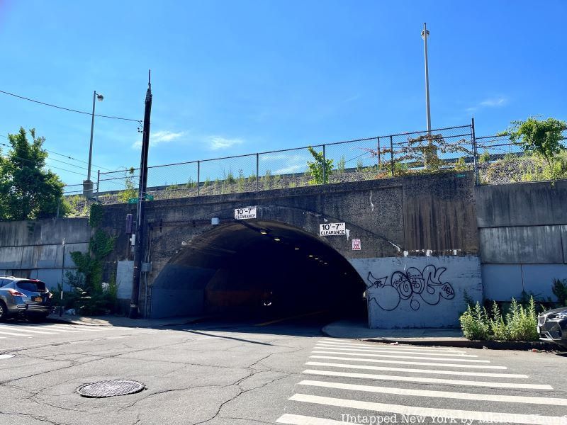
Though the Montauk Branch still runs today, the Lower Montauk portion in Queens includes multiple abandoned stations. The branch still operates non-stop trains between Jamaica and Long Island City, but there are many defunct stations that have preserved this history. The Lower Montauk Branch originally had nine stations, though by 1940, four had closed. In March 1998, the remaining five had closed, including Richmond Hill, Glendale, Fresh Pond, Haberman, and Penny Bridge, because of low ridership and new coach cars that were incompatible with the platforms.
The Richmond Hill station, with its canopy and tracks, still remains and is located on a massive concrete viaduct. The other stations show plenty of wear and tear, including some abandoned structures covered with graffiti. The Department of Transportation has considered repurposing the Lower Montauk Branch for rapid transit operations or light rail service, though little work has been done and the stations will likely remain abandoned for some time.
10. Whitestone Branch
The LIRR Whitestone Branch connected Willets Point to Whitestone, crossing the Flushing River and running along Flushing Bay. It was originally conceived as part of the Flushing and North Side Railroad, later becoming a subsidiary of the Long Island City and Flushing Railroad. The branch opened in 1869 and was electrified in 1912, though service declined in the 1920s. The line was abandoned in 1932 after attempts to consolidate it with the subway system.
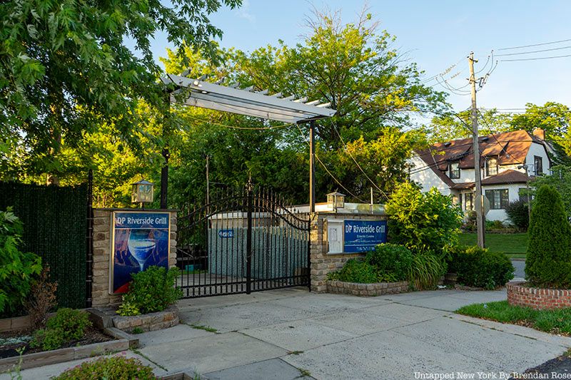
Parts of the branch remained after the branch’s decline, including a small section leading to Corona Yard that was kept into the 1970s and a portion east of the Mets-Willets Point station that remains today. A spur of the branch near the Flushing River was abandoned after going underwater in 1983. Though no tracks remain, there is a gate to the former Beechhurst Yacht Club that corresponds to the former northern terminus of the branch.
Next, check out 12 of NYC’s Lost Subway and Rail Lines!

