Last Chance: The Annual Orchid Show Soars at the New York Botanical Garden
The vibrant colors of Mexico come to NYC for a unique Orchid Show at NYBG!


With autumn well underway, it’s the perfect time to hop on your bike or go for a long walk or jog before the weather gets chilly. One of the best places to do so is along New York City’s East River Drive, which has a 9.44-mile pedestrian route running parallel to the Franklin Delano Roosevelt (FDR) Drive. Its pristine views of the city make it ideal for uninterrupted biking, jogging and walking.
With the exception of the section between 34th and 83rd streets, the East River Drive stretches from The Battery at the southern tip of Manhattan and ends all the way in East Harlem at 125th street. Along the way are small parks that are worth strolling around or taking a break in. Starting from uptown going south, here is a guide to ten parks and playgrounds to check out along your route.
A track at Thomas Jefferson park. Image via the New York City Department of Parks and Recreation
Thomas Jefferson Park’s story goes a while back; the Board of Alderman planned and named it in 1894, and then purchased land for it in 1897. It opened in 1905 to provide play space for the children of East Harlem and six years later, a children’s farm garden opened as a place for child laborers to be at ease. Robert Moses expanded the park’s amenities in the 1930s, and it now contains football, soccer, basketball, handball and baseball fields, grilling areas, tracks, and fitness equipment.
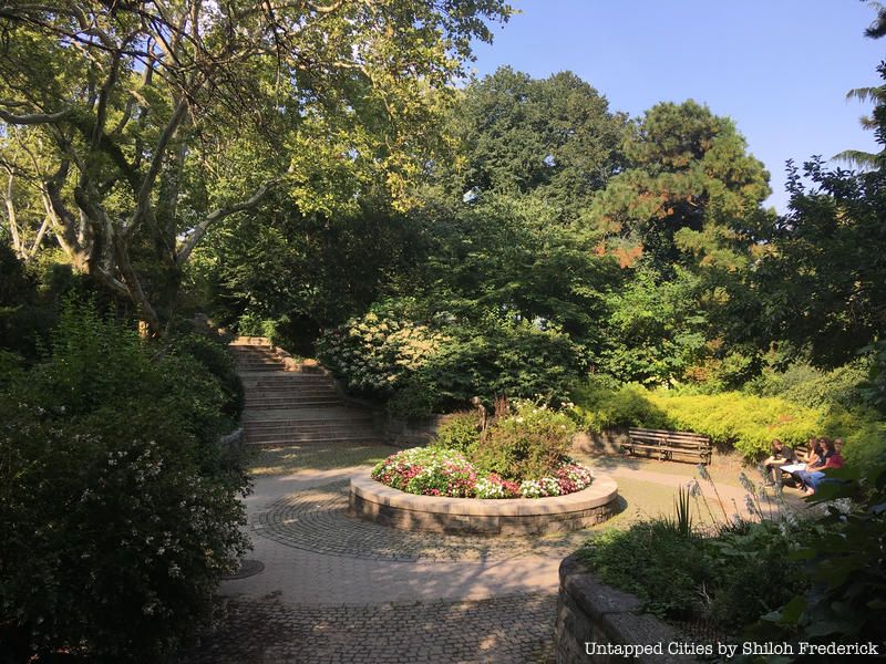 A staircase leading to a statue of Peter Pan. Courtesy of New York City Department of Parks and Recreation
With its beautiful views of both Roosevelt and Randall’s Islands, Carl Schurz Park is a lesser-known gem among New York City parks. This 14.9-acre park contains a small bridge, a peaceful lower level with a 1928 statue of Peter Pan, a lively upper promenade, two dog parks, large fields perfect for picnicking and ball-playing, and a playground.
More significantly, it is also the site of the bright yellow Gracie Mansion, the official home of the Mayor.
Once again, Robert Moses reconstructed this area in 1935, and though it entered into a decrepit state by the 1970s, a community group called the Carl Schurz Park Association revamped it. Carl Schurz was a German-American Secretary of the Interior in 1910, and became the first German-American to be elected to the U.S. Senate.
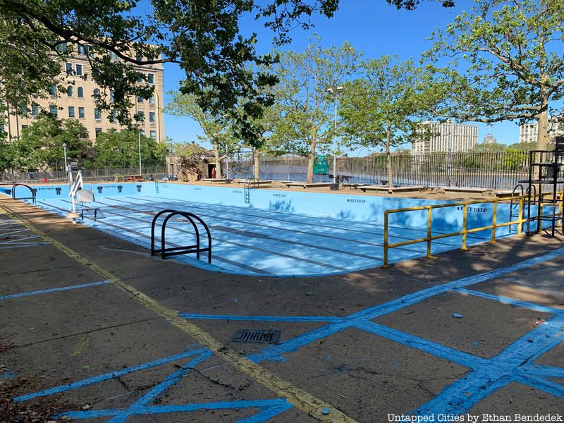
Rather than having trees and quiet bench areas, John Jay Park is more recreational with its outdoor swimming pool and sprinklers as well as playgrounds, athletic courts and fitness equipment. In 1906, the city opened a public bath house in this area, and the area was renovated in 1941 as part of a Work Projects Administration project. This renovation resulted in the creation of facilities like gyms and recreation rooms. In the summer, John Jay Park’s outdoor pool becomes very popular.
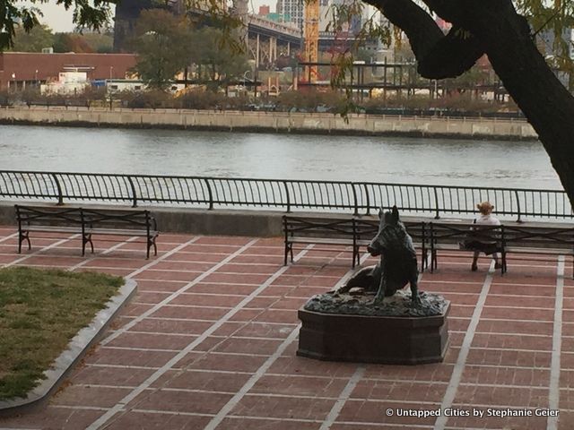
Wild Boar at Sutton Place Park
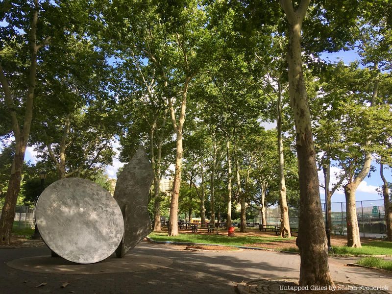
Five cozy, distinctive pocket parks, created during the FDR Drive’s construction in 1938, span these five blocks. The park on 57th street contains a 1972 replica of the Renaissance sculpture, Wild Boar, while another between 53rd and 54th streets centers around a 1971 sculpture of a celestial globe.
Ship merchant and entrepreneur Effington B. Sutton was part of the minority of prospectors that succeeded during the Gold Rush. He built brownstone homes between 57th and 58th streets in 1875 with the vision of creating a residential area. The surrounding picturesque townhouses and an unusually quiet atmosphere allow for a comforting sense of privacy with excellent views of the Queensboro Bridge and Long Island City.
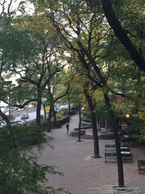
A view of part of Peter Detmold Park from atop the pedestrian crossover
It’s easy to walk past the Peter Detmold Park without noticing it, as it is located at the bottom of a long, steep staircase with a blue pedestrian walkway overhead. The park is named after a World War II veteran and former president of the Turtle Bay Association, where he fought against plans to commercialize 49th street.
The park itself has a nicely secretive feel and serves as an escape from New York City’s constant bustling. It isn’t particularly scenic, though it’s possible to see views of Long Island City and the Queensboro Bridge from here.
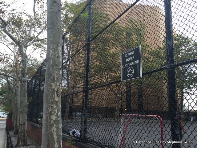
The outside of basketball courts at Robert Moses Playground
Fittingly named after the man responsible for its creation, the simple, 1.3-acre Robert Moses Playground sits on First Avenue right next to the United Nations building. Its amenities include basketball, hockey and handball courts.
The land for this park was a portion of the area set aside for the Queens Midtown Tunnel, and was received in exchange for losing St. Gabriel’s Park for a roadway in 1937. Construction of the park ended in 1941 and named after Moses forty years later. Since around the time of its renaming, three different groups have tried to reclaim this land for building projects, including the United Nations.
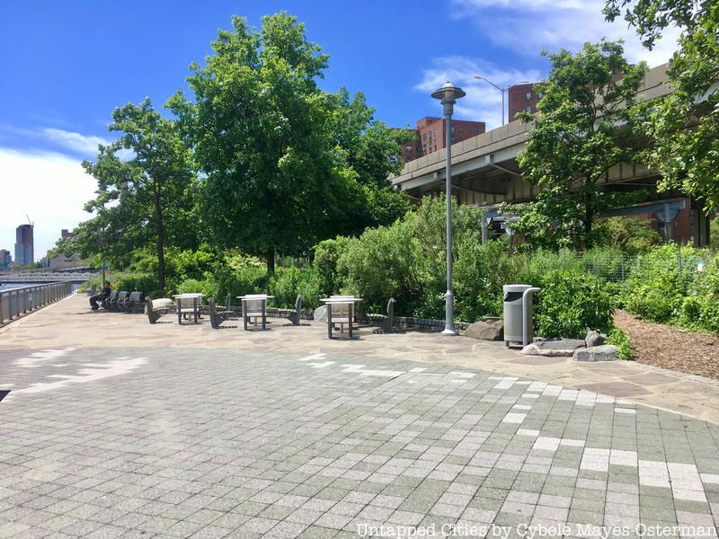
The smaller Stuyvesant Cove, a 1.9-acre park, connects to the Captain Patrick J. Brown walk as it approaches 23rd street. It includes a few dirt path trails, an empty lot, and several tables and chairs. There have also been events like free music series and kayaking.
The park rests on a former brownfield (land formerly contaminated with industrial pollutants) of a cement plant and a parking lot. Once a barren stretch, the city initially planned to develop it into a luxury area.
However, in 1991, New York City’s Economic Development Corporation decided on a different plan since the less sustainable, original plan would have severed nearby residents access to the East River: Stuyvesant Cove Park. Here, you can relax on a bench and enjoy a view of the Edward Koch Memorial (Queensboro) Bridge.
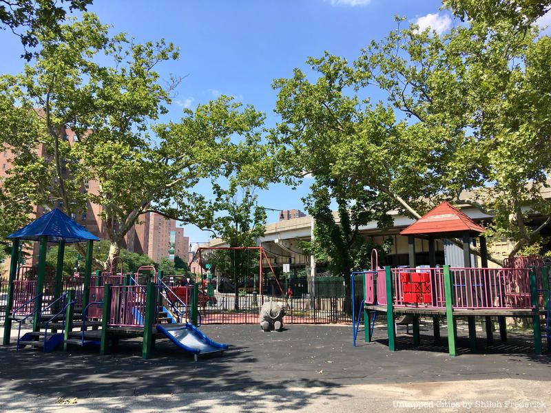
The Department of Parks received land for Murphy’s Brother’s Playground (also called “Murphy Park”) in 1903. The department developed it over time, naming it the “17th Street Park” in its early years. It has been called three different names since its creation. Aside from fields, hopscotch, and a basketball court, the park also has four Norway maple trees in the playground.
The park was named after John J. Murphy, who was a Democratic Assembly leader for the 12th district. In 1985, however, new park signage started to honor Murphy’s accomplished brother Charles, rather than John. Nine years later, children and community leaders gathered to rededicate the park to both brothers.
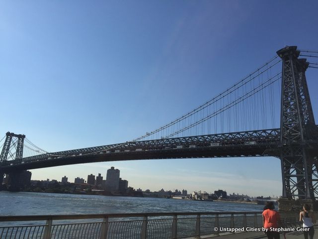
A view of the Williamsburg Bridge from the East River Park
At 57 acres, the John V. Lindsay East River Park is the largest park along the East River Drive. Complete with a view of the Williamsburg Bridge, barbeque areas, tennis courts, baseball fields, exercise equipment, soccer field and 400-meter track, people naturally flock here for fitness and recreation.
In addition having impressive facilities, the park also boasts an impressive history. Like quite a few other areas in New York City, the park’s story starts with “master builder” and urban planner Robert Moses. He decided to build the East River Park as he planned the FDR Drive in the early 1930s. Having a prior affinity for parks and knowing that the Lower East Side needed more park area, he decided to create an esplanade with recreational facilities.
The park has changed since its establishment, with certain sections being cut or expanded. The 10th street pedestrian overpass, built in 1951, finally connected the residential neighborhood with the park itself. A now obsolete amphitheater was also built in 1941.
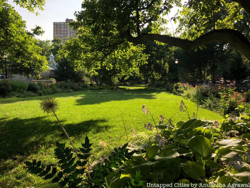
With magnificent views of the Williamsburg, Manhattan and Brooklyn Bridges, this park has an interesting history as well. It is located near the start of the FDR Drive, on what used to be a dense marshland used by Lenape Native Americans to land canoes. Mid-17th century Dutch settlers capitalized on this region’s gentle coastal incline to load vessels.
The park’s unusual name partially derives from the fact that the region used to be hook-shaped. It is also named for the Corlears – a family of Dutch landowners from the 1600s who controlled much of the property in the area.
For more on New York City parks, try 13 of the Best Pocket Parks in NYC. To read more about Robert Moses’s impact on New York City try The NYC That Never Was: Robert Moses’ Lower Manhattan Expressway (LOMEX) and 5 Things in NYC We Can Blame on Robert Moses.
Get in touch with the author at @sgeier97
Subscribe to our newsletter