NYC’s Forgotten ‘War on Christmas Trees’
Discover how an obscure holiday crackdown affects festive street vendors today!


Ten minutes outside the Peripherique lies the oft-forgotten industrial underbelly of Paris: the Seine-Amont. The architecture of the region is a juxtaposition of 19th century industrial infrastructure with 20th century modernity, with a sharp contrast between traditional residential homes and public housing projects.

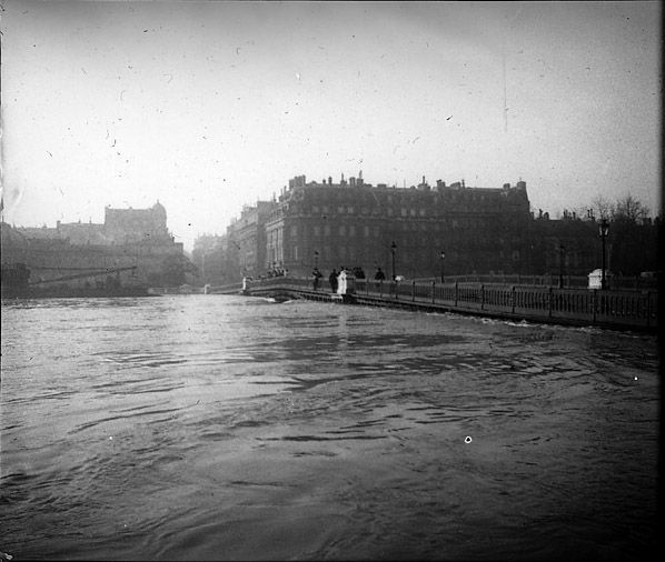
Photo of Paris floods of 1910 by Emile Feuillaude, provided by Augustin Pasquet from his family collection.
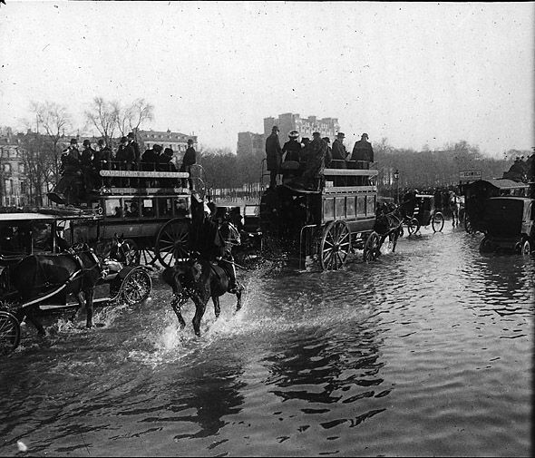
2010 marks the centennial of the devastating floods that crippled Paris in 1910. Despite the damage, contemporary media accounts show that the flood was nonetheless “celebrated” as a way for Parisians to come together. Furthermore, the disaster was documented in photography and painting, as covered by the Paris Inondé 1910 exhibition at the Galerie des Bibliothèques earlier this year.

Photo of Paris floods of 1910 by Emile Feuillaude, provided by Augustin Pasquet from his family collection.
Although the flood is commonly known as the “100 Year Flood,” the chance of flooding is far more frequent than once a century. The term actually refers to the magnitude of the flood and the frequency of occurrence. The severity of flooding is determined by both the amount and frequency of rainfall. As seen in the map below, the risk to Paris is high because of the number of tributaries that feed into the Seine from the east. In 1910, the Seine-Amont was particularly hard hit and current flood maps show that the region remains particularly vulnerable.


Many of the embankments along the Seine today were constructed in response to the events of 1910 but would potentially fail in a large flood. Of particular concern demographically in the Seine-Amont is population increase, high unemployment rates and the number of suburban housing developments under way in the flood region. In terms of population, Ivry-sur Seine grew 9% between 1999 and 2006, a figure 6% higher than the growth in the city of Paris. Quotes from advertisements indicate that the developers are utilizing the positive elements of the Seine as a selling point without acknowledging potential risks: The developments “will enable the Choisyens to rediscover the Seine and its banks,” (“va permettre aux Choisyens de retrouver la Seine et ses berges,”), to “open the city on her river,” (“ouvrir la ville sur son fleuve,”), “boasting an exceptional natural environment with the Seine at its feet,” (“Bénéficiant d’un environnement naturel exceptionnel avec la Seine à es pieds…).
In the next series of posts, Untapped Paris will explore the architectural and historical aspects of this region (including a private tour of a storage facility for the museums of Paris!).
For more information on the flood, please visit the following websites:
https://www.crue1910.fr/#
Val de Marne website with floodmaps
à Žle-de-France website
Special thanks to the DIREN IdF office for their presentation and to Eva Ward, Columbia GSAPP student for additional research.
Get in touch with the author @untappedmich.
Subscribe to our newsletter