NYC’s Forgotten ‘War on Christmas Trees’
Discover how an obscure holiday crackdown affects festive street vendors today!


The irony of searching for a lost stream in Manhattan was not lost on those of us who took an Atlas Obscura tour with Undercity’s Steve Duncan, a “guerrilla” historian and urban explorer. The tour followed the 1.5 mile route of the now buried Minetta Brook, which originally ran above ground in Greenwich Village. The stream flowed through the western section of Washington Square Park, which was then just a marsh and ran out to the Hudson River at what is now Charlton Street.
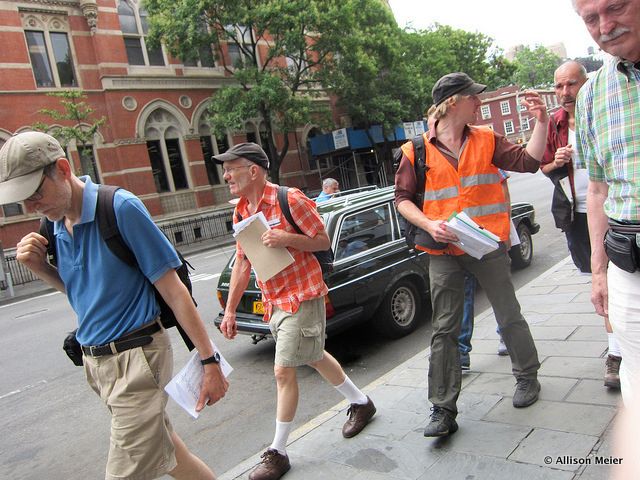
Steve arrived wearing an orange mesh vest, a well-worn cap and nice leather shoes, ringed with bits of dried mud. The twenty of us stood at the Union Square Forever 21, listening to his introduction of the world under our feet. Rushing rivers under Union Square? Hard to imagine, we thought. Steve continued with an enthusiasm that wouldn’t flag over the course of three hours on the black tar streets of Manhattan.
Our first stop was a Subway sandwich shop. Too late for lunch, I wondered what the deal was. We paused long enough for Steve to point out the first of dozens of manhole covers he would point to throughout the day. It was in the middle of the street, partially under a parked car, partially under a big MTA bus rumbling by.
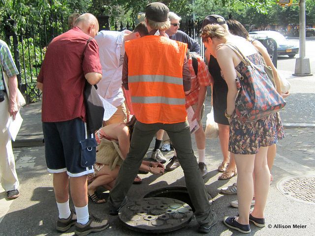
At our next stop we paused, at the corner of 14th Street and 5th Avenue to notice the designs engraved in the various covers sprinkled throughout the intersection. Was there a diamond pattern, squares, or grates? They all meant something and in all cases spoke to which municipal department needed it: electrical, sewage, water supply, runoff, subway, you name it. This one was easy. It said WSNY, which stands for Water Supply New York. The stop was brief and our motley crew of city dwellers wandered south along 5th Avenue, making a right on 12th Street, and pausing in front of the First Presbyterian Church. Standing in the shadow of the Gothic revival building dedicated in 1846, just after the stream was covered up, it became clear why the river was forced underground. One word: expansion.
Manhattan comes from the Indian word for “island of many hills.” Bet you thought Manhattan was flat. It only became that way because it was graded down in the name of progress. Then the rivers were slowly covered over because the marshy, wet land around them was interfering with the downtown building boom. First they were covered with boards, so people could cross. Then they were diverted, so people could build. Then they were completely covered up. At the beginning you could probably still hear it. Eventually it was just a flicker of the past, the only remnants we can see now are lush vegetation in certain places, a few streets named Minetta and a plaque on a building on 5
thAvenue.
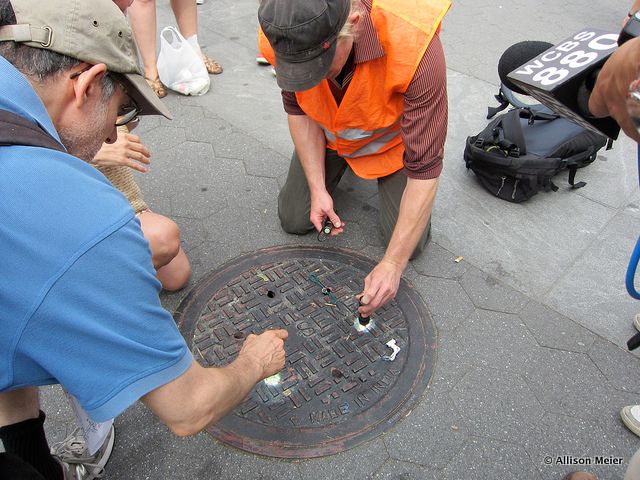
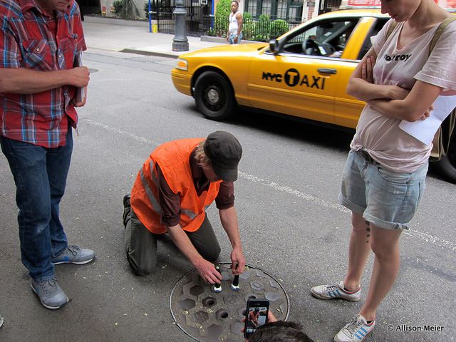
As we zig-zagged our way through the Village, we walked down streets and alleys, learning how to read the signs of a world we didn’t know existed. With a shrug, Steve took off his backpack and stopped us at one of the more idyllic manhole covers, this one on the sidewalk of West 9
thstreet. Getting on his knees, he pulled flashlights and tiny telescopes out of his bag and urged us to join him on the ground to peer through the tiny holes in the cover. I’ll admit, I wasn’t one of the takers. I kept my spot, standing tall on two feet while the others, mostly the men, kneeled down to look. Steve grinned, “That’s it? No one else?” Then with a laugh, he took out a hook like contraption and pulled the grate up and out and, with a refreshing moment of joking, said he always liked to see how many people he could get on the ground.
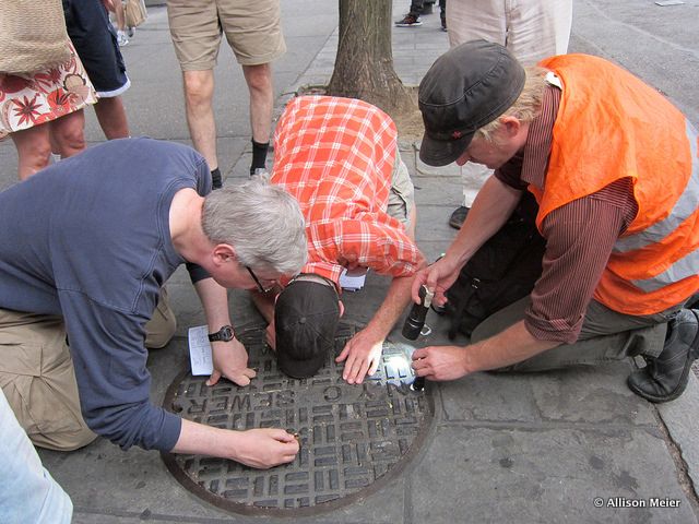
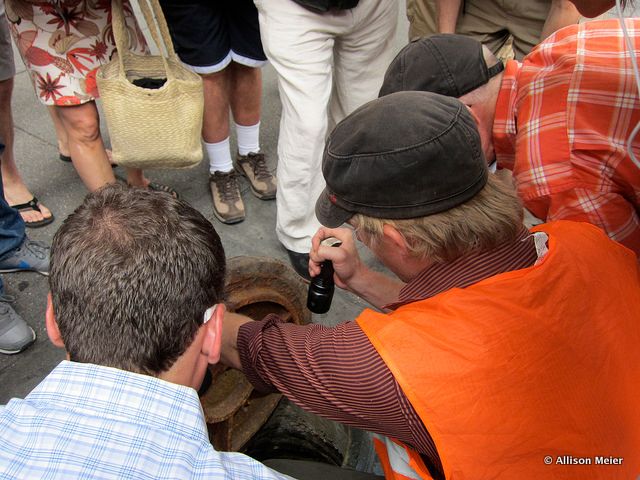
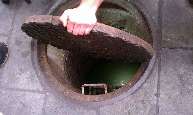
I pulled up close to the edge and looked in. I saw bricks ringing the opening and going down about twelve feet; I saw cockroaches crawling around to get out of the sunlight; I saw, way down at the bottom, a stream. It wasn’t rushing and it was certainly low enough to walk through, but it was water all right. I felt like Indiana Jones finding the Holy Grail. Well, kind of.
As interesting as the tour was, I found the people on the tour just as fascinating. A Swiss woman in town for a month, a professional NYC tour guide, a cameraman, a NY Historical Society volunteer, two guys from the Botanical garden and more. Asking questions of my fellow tourists was almost better than looking into the manholes.
Our tour ended with a bit of a whimper at the Hudson river. No rushing water to behold, no stream to kayak. A few days later I realized Steve was still with me. Walking across the streets of my neighborhood, looking down for once at the metal grates I crossed and the covers I passed, I wondered, what’s down there?
Atlas Obscura documents stumbled upon entities, encouraging travelers’ exploration of something new and exciting. Be sure to check out their upcoming explorations: Friday, July 27: Lost Waterfronts of New York or Saturday, August 18: The Fall of the American Movie Palace with Untapped Cities’ After the Final Curtain columnist, Matt Lambros.
Photographs by Allison Meier
Subscribe to our newsletter