How to Make a Subway Map with John Tauranac
Hear from an author and map designer who has been creating maps of the NYC subway, officially and unofficially, for over forty years!


Outside of the Revolutionary War, New York City is rarely viewed in terms of its military history. This is unfortunate since the City is home to a large number of military sites spanning its history. Presented below are some of its more prominent forts by historical era, beginning with the Dutch period.
 1916 Redrawing of The Castello Plan, map of 1660 New Amsterdam via Wikimedia Commons
According to the Seal of the City of New York, the City was founded in 1625. That date was chosen because it is the year in which Fort Amsterdam was first constructed. The Fort which was situated at the tip of Manhattan (near present day Battery Park, which received its name from the artillery batteries that were once located there) and remained until 1790. There are currently two plaques commemorating its existence, one is affixed to the facade of 1 Broadway and the other is inside of the Alexander Hamilton Customs House.
During the Revolutionary War, numerous forts were constructed throughout the City. None of the forts remain today. After the Colonists were defeated, and retreated, the forts were utilized by the British for the remainder of the War.
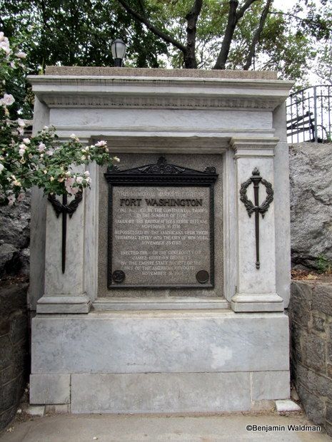
Fort Washington is commemorated by an ornate plaque in Bennet Park. It was constructed in June 1776 by a group of Pennsylvania troops and was described as an earthenwork fortress with no barracks, casemates, or water within the fort itself. The fort possessed between 20 and 30 cannons, which were primarily installed in order to keep British ships from sailing up the Hudson River. However, the armaments were unable to reach the River, so redoubts has to be constructed closer to its banks.
The fort did not last long under American control. On November 16, 1776, the British under Sir William Howe captured the fort, with the help of one of the first American traitors in the war, William Demont. In the nineteenth century, James Gordon Bennett, the publisher of the New York Herald built a house on the site, which is why today it is known as Bennet Park.
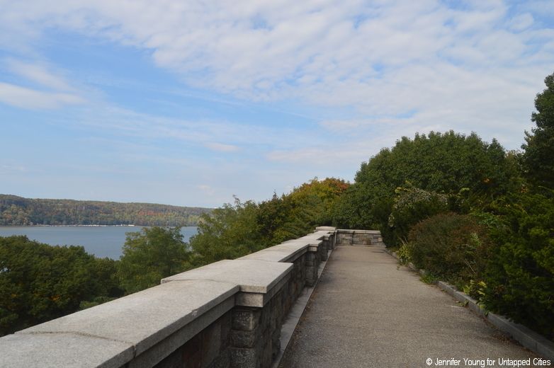
Fort Tryon was originally the northern outwork of Fort Washington. After the fort was captured by the British in November 1776, the British renamed it Fort Tryon after Sir William Tryon, a Governor of North Carolina and the last British Governor of the Province of New York. It was here when John Corbin died that his wife Margaret took his gun and continued fighting until she too was killed. Visitors to the site today will not find any remnants of the Fort. However, they will discover fragments of the wealthy industrialist Cornelius Kingsley Garrison Billings’ estate, Tryon Hall, which was built on the site of the fort and named in its honor.
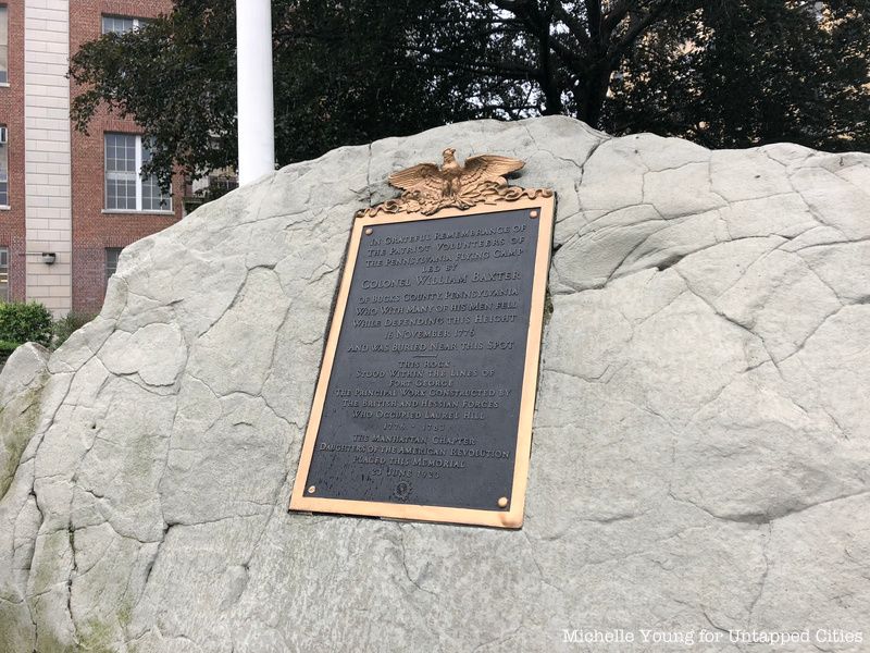
Fort George is noted by a simple plaque on a boulder on the grounds of George Washington High School and is honored in two street names in the vicinity. Fort George was constructed in 1776. It was utilized by the Continental Army to hold the British back following the Battle of Brooklyn, thereby allowing General Washington and his trooper to escape into Westchester and New Jersey. Between 1895 and 1914 the land was used for an amusement park, after which most of it was incorporated into High Bridge Park.

In 1776, Fort Putnam was constructed, under the supervision of Major General Nathanael Greene atop what is now the high ground of Fort Greene Park. The fort was likely named for Colonel Rufus Putnum, who was the chief engineer responsible for fortifying Long Island. Fort Putnam was connected to Fort Box, Fort Greene, the Oblong Redoubt, and a series of intrenchments in order to protect Brooklyn Heights from the British. These forts were unsuccessful in their mission and were taken over by the British after the Battle of Long Island (Battle of Brooklyn). Fort Putnam was rebuilt for the War of 1812 and rechristened Fort Greene. In 1845, the land was converted into Washington Park, which was ultimately renamed Fort Greene Park. Today, it possesses the largest Revolutionary War memorial in the country.
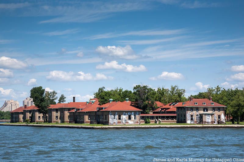 Photo by James and Karla Murray
After purchasing the formerly private Ellis Island, the United States government proceeded to fortify it and had a role in various wars. First, a twenty-gun battery, magazine, and barracks were built after acquisition in 1808, known as Fort Gibson. During the War of 1812, the island served as a garrison and POW camp. By 1861, the fort was decommissioned and replaced with a naval magazine. During the Civil War, it served as an ammunition supply depot. Remnants of the fort can be seen today.
In preparation for, and during the course of the War of 1812, New York City sought to protect its many waterways to ensure that the British would not be able to sail inland as they had during the Revolutionary War. A number of forts from the War of 1812 remain, though they never ended up being used during the War.
 Photo via Wikimedia Commons from Library of Congress
The first fortifications were built on Governors Island by the Continental Army during the Revolutionary War. In 1794, Congress authorized upgrades to these earthenworks to prepare for a possible British or French invasion. The result was Fort Jay, which was constructed using sandstone and granite in 1808 and would be renovated throughout the following decades. Fort Jay was named for John Jay the Federalist governor of New York. When Thomas Jefferson and his Democratic Republicans came to power they renamed the fort after Columbus in order to erase the memory of the Federalists. John Jay’s name was restored under Theodore Roosevelt’s administration.
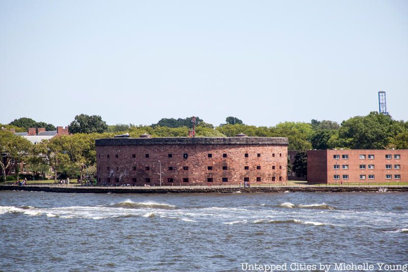
Built in 1807, Castle Williams was another component of the City’s harbor defense system. It was also situated on Governors Island. During the Civil War, it served as a Prisoner of War facility. Allegedly, Captain William R. Webb was the only Confederate prisoner to escape from the Island and went on to become a United States senator from the state of Tennessee.
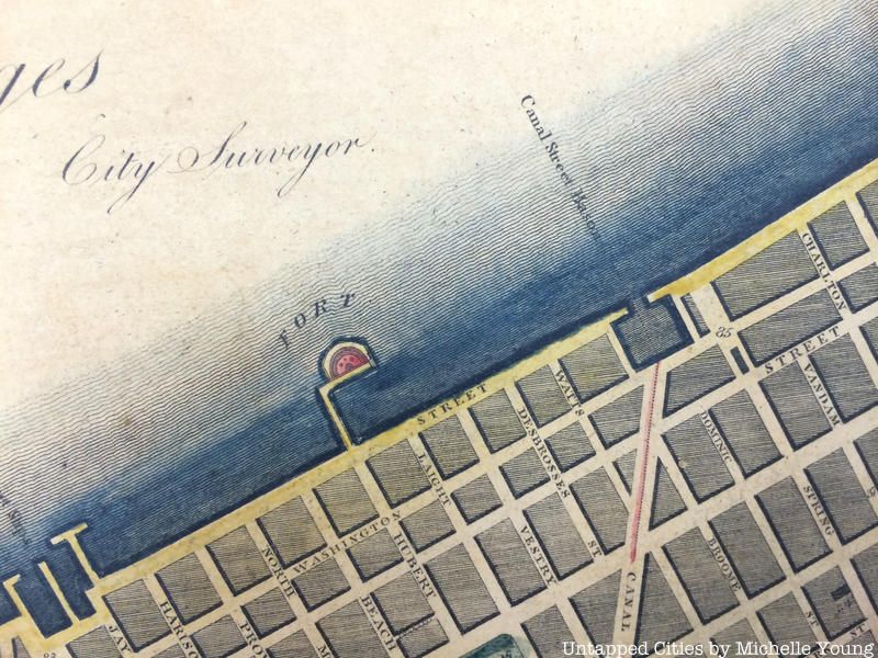
Known as the “Red Fort,” this structure at Hubert and Laight Streets below Canal was part of the larger harbor defense plan that included Castle Clinton, Castle William on Governor’s Island and Fort Gibson on Ellis Island. According to the Tribeca North Historic District report by the Landmarks Preservation Commission, “The name “Red Fort” suggests that the hemi-cylindrical structure was constructed of reddish sandstone, as were those at the Battery and Governor’s Island.
It was situated on a square block pier separated from the West Street bulkhead by a narrow bridge pier.” It would have sat just north of Pier 26 in today’s Hudson River Park. Also note that the land has been extended further into the Hudson since this map as well.
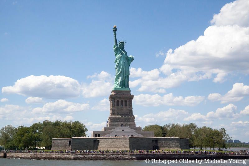
Constructed between 1807 and 1811, Fort Wood on Liberty Island (then Bedloe’s Island) was in the shape of an eleven sided star. The pedestal of the Statue of Liberty was constructed atop the old fort.
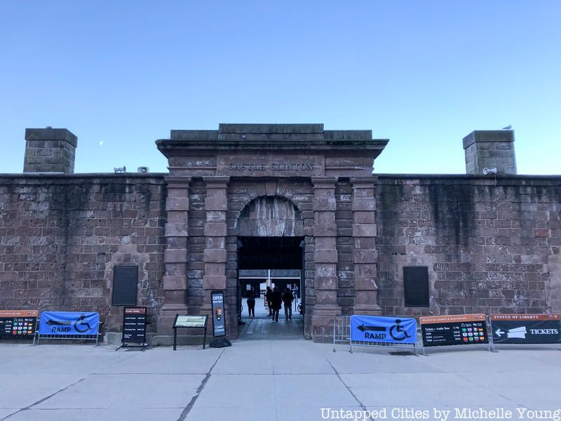
Castle Clinton was originally situated off the coast of Manhattan. However, as a result of landfill, it is now fully surrounded by land and sits in Battery Park. It was constructed between 1808 and 1811. After being decommissioned, the fort was used as the country’s first immigration center, a theater, and an aquarium before almost being demolished by Robert Moses. It was designated a National Monument in the 1940s and is currently run by the National Park Service.

The Blockhouse, located in the northern section of Central Park, was completed in 1814, two days before the treaty that ended the War of 1812 was signed. It was constructed on the remains of a Revolutionary War era fort.
After the War of 1812, the United States began to buttress its harbor defense system. New York City, with its numerous waterways, greatly benefited from this construction boom.
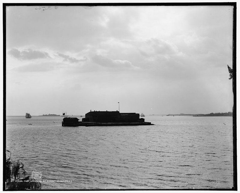 Photo via Library of Congress
Fort Lafayette, originally Fort Diamond, was an island coastal fortification constructed between 1812 and 1818 off the coast of Fort Hamilton. It was demolished in 1960 to make way for the foundations of the Verrazano-Narrows Bridge.
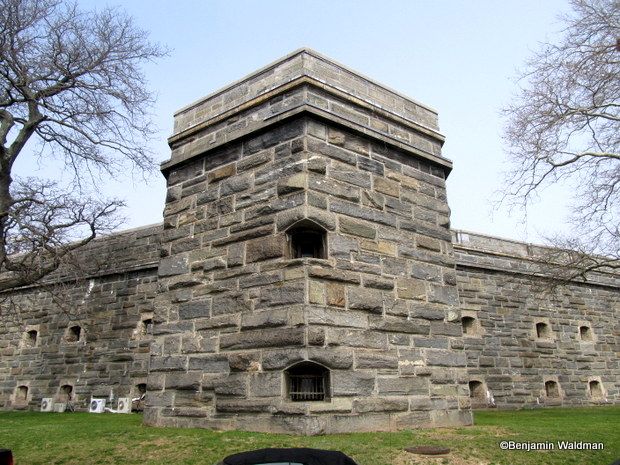
Fort Schuyler was constructed in 1833, on what is now the Bronx side of the Throgs Neck Bridge. During the Civil War, the fort housed prisoners of war. It was decommissioned in 1911 and became the home of SUNY Maritime College (formerly the New York State Merchant Marine Academy). In addition to the school, it currently houses the Maritime Industry Museum.

Located on the Queens side of the Throgs Neck Bridge, Fort Totten was constructed in 1862. It is currently overseen by the New York City Parks Department and open to the public. It also houses the Bayside Historical Society which is located in the former Fort Totten’s Officer’s Club.
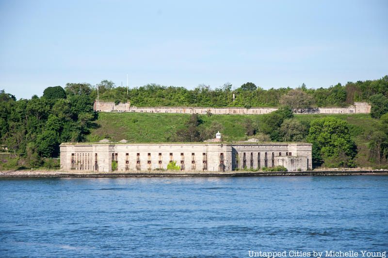
Fort Wadsworth is located in the shadow of the Verrazano-Narrows Bridge, in Staten Island. Its military roots date to the 1660s and prior to closing in 1994, it was possibly the longest continually-manned military installation in the country. Its most prominent feature is Battery Weed, which was completed in 1861. When it was decommissioned, it was transferred to the Park Service and is now open to the public.
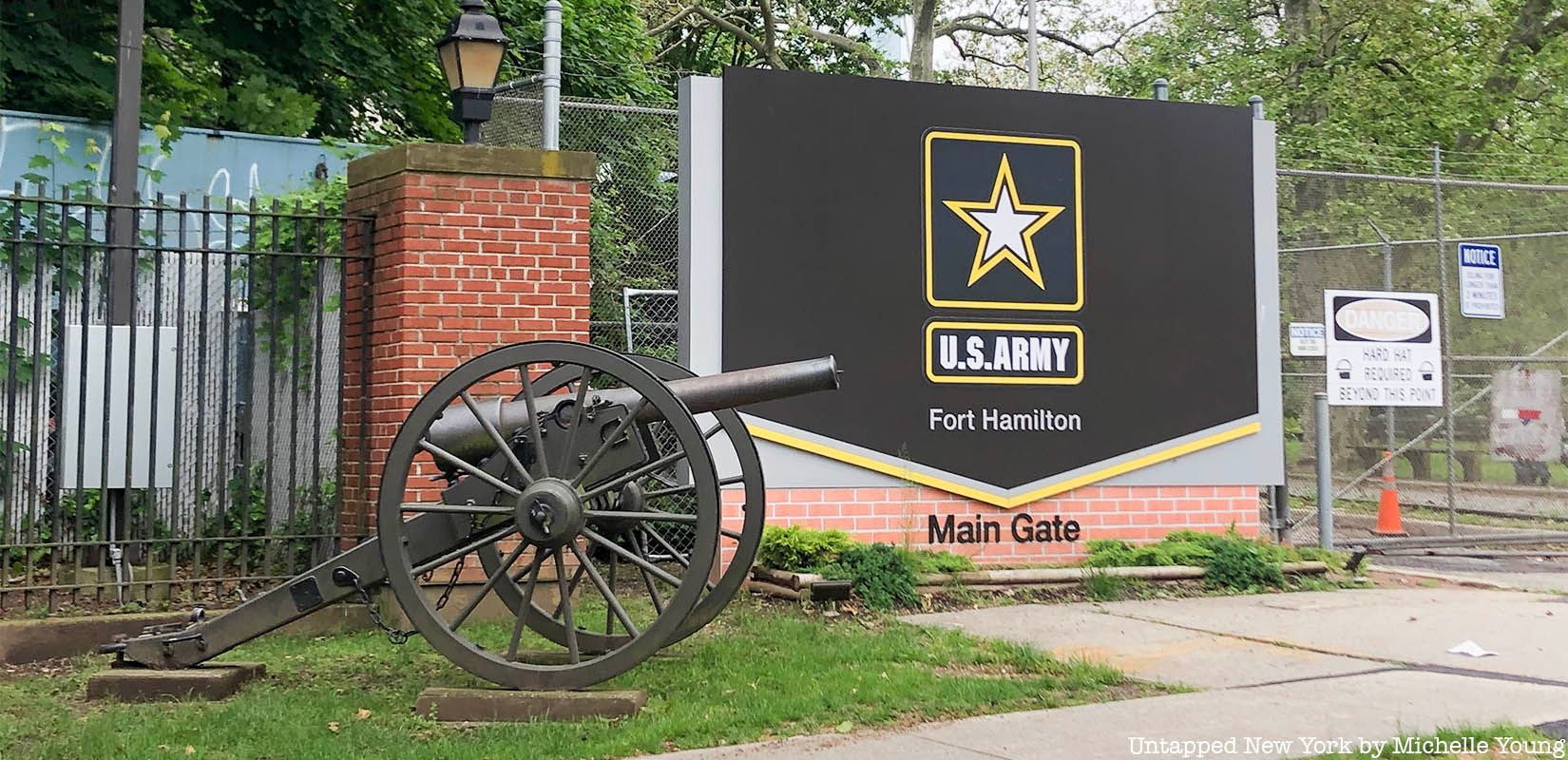
Located on the Brooklyn side of the Verrazano Bridge, Fort Hamilton is the only active military fort in New York City. Construction was begun in 1825 and Robert E. Lee and Stonewall Jackson both served there. It currently houses the Harbor Defense Museum and is the second oldest continuously garrisoned federal post in the nation after West Point.

New York City’s only 20th-century fort is Fort Tilden, located in the Rockaways. After serving as a coastal artillery installation, the fort went on to house Nike missiles. It is currently run by the National Park Service and is open to the public.
To learn more, read our past coverage of Fort Tilden and our Urban Exploration of the Abandoned Fort Totten. Curious about nautical architecture? Check out our roundup here.
Next, read about the Top 10 Secrets of Grand Central Terminal.
Subscribe to our newsletter