

9. The Red Fort
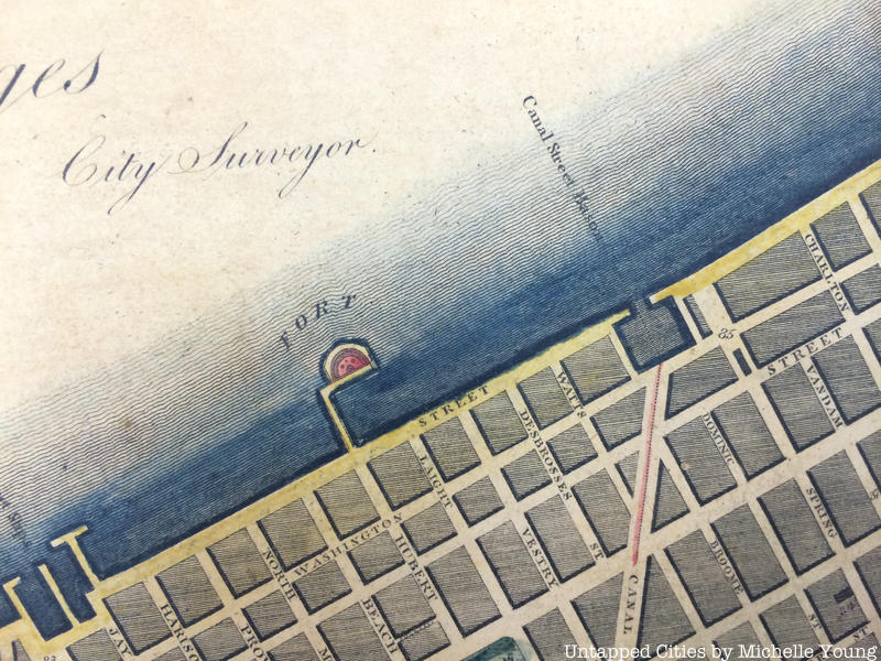
Known as the “Red Fort,” this structure at Hubert and Laight Streets below Canal was part of the larger harbor defense plan that included Castle Clinton, Castle William on Governor’s Island and Fort Gibson on Ellis Island. According to the Tribeca North Historic District report by the Landmarks Preservation Commission, “The name “Red Fort” suggests that the hemi-cylindrical structure was constructed of reddish sandstone, as were those at the Battery and Governor’s Island.
It was situated on a square block pier separated from the West Street bulkhead by a narrow bridge pier.” It would have sat just north of Pier 26 in today’s Hudson River Park. Also note that the land has been extended further into the Hudson since this map as well.