
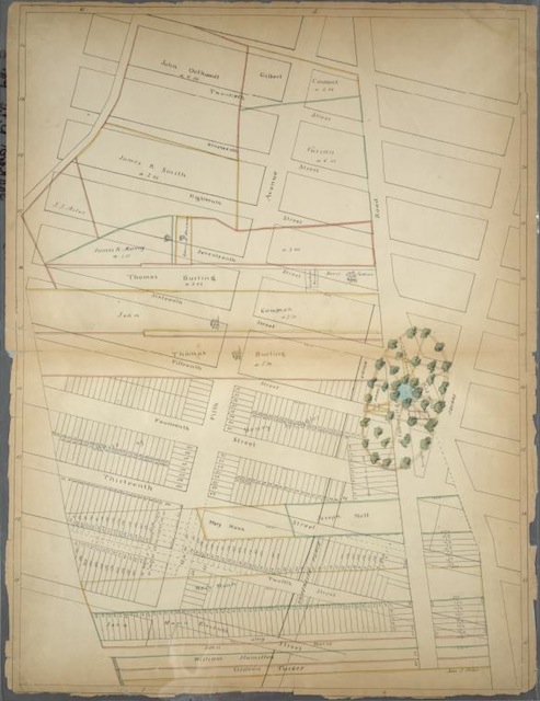
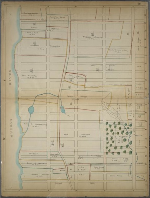
There were farms on Manhattan. What?! Yes! And these maps from the New York Public Library’s digital gallery’s Atlases of New York City collection show exactly where they were. But here’s the interesting question to ask about these maps: which existed at the time they were created? The streets or the farms? Which was mapped “over” which?
The answer is that these maps show proposed streets over existing farms. This specific group of 26 maps printed on linen, “Maps of farms commonly called the Blue book, 1815: drawn from the original on file in the street commissioner’s office in the City of New York, together with lines of streets and avenues / laid out by John Randel, Jr., 1819-20,” were drafted as maps of the future. The process of mapping these streets over these farms on paper would later occur in reality as per the Street Commissioner’s (very Robert-Moses-like) Plan.
This map is bounded by East 21st Street, Union Square, East 11th Street and 5th Avenue:
This one by West 94th Street, 8th Avenue (Central Park West), West 74th Street and Hudson River.
More maps from the NYPL’s digital gallery’s Atlases of New York City collection will be posted, but they’re all available here if you want to explore for yourself.
Get in touch with the author @youngzokeziah.