NYC’s Forgotten ‘War on Christmas Trees’
Discover how an obscure holiday crackdown affects festive street vendors today!


Although the banks of the Seine River in Paris are a UNESCO World Heritage site, the historical mark has not stopped the city from creatively adapting its embankments. In fact, the city has an on-going initiative called Les Berges to enable its residents to “reclaim” the river. Les Berges, which includes the pedestrianization of the roadways along the Seine, aims to
respond to a great ambition—to allow residents of the metropolis and all those who love Paris to reclaim the Seine and the heart of the city. [translated from official signage in Paris]
All of this is part of Mayor Bertrand Delanoë’s greater plan to reduce car traffic in Paris and increase “soft” methods of transportation. Transit options like the Velib bicycle share program and the Autolib electric car sharing form one pillar of the plan. Pedestrianization of the banks of the Seine and of Place de la République are another more urban design aspect. New programming and spot infrastructure aim to bring people back to the river, while activating sites with new functions.
In the mid-18th century, the embankments of the Seine were constructed to facilitate river traffic and navigation. By the late 18th century, the banks were being utilized for recreation and health. River access provided an escape from the dense urban fabric of Paris. In the early 19th century, Napoleon began to transform the banks from pedestrian to industrial, building quays to facilitate mercantile exchange. By the mid-20th century, the banks of the Seine were given to the automobile, and memory of a pedestrianized embankment mostly lost in collective memory.
The forgotten history of the Seine was a linchpin argument in a 2011 government report on the Seine embankment projects. These sentiments were echoed by Mayor Delanoë last month at the opening of the new Place de la République in Paris: “My predecessors handed the square over to the car. We wanted to put beauty, the values of the République, and a joie de vivre at the heart of this transformation.”

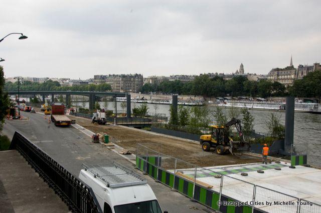
The floating barges of Les Berges under construction in mid-June 2013
What makes Paris’ pedestrianization plans unique, apart from its macro strategy, is that there is a requirement for flexibility to make initiatives truly for the people. Built interventions must be capable of being moved, extended if popular, taken down quickly if ineffective. This applies even to large-scale proposals like stadium seating. Flexibility is also useful for environmental reasons: Paris is overdue for its “100-year flood,” the last which crippled Paris in 1910.
Not surprisingly, Delanoë’s strategy hasn’t always been popular in political circles or in the conservative press. For a city so strongly rooted in history, temporary installations pale in comparison to Paris’ architectural icons. The pedestrianization of the Voie Georges-Pompidou, the highway on the Left Bank of Paris was blocked by the prior conservative government, who argued that closing off the main artery would increase traffic elsewhere. Many studies, even a mathematical theorem called Braess Paradox, show otherwise. Thanks to a change in government, the second section of the pedestrianized banks opened in Paris on June 19th (the first section opened earlier this year).
Whether politicians agree with Delanoë’s initiatives or whether residents like the urban design changes that have taken place is pretty moot. What is clear is that Delanoë has been able to shape the collective understanding of urban projects in Paris–projects that intended for the people first. The mayor’s more permanent long-term legacy, however, is the rebuilding of Les Halles, a development that has met with ambivalence from architectural critics but with approval by politicians.
Here is a sampling of the urban interventions that can be experienced along the Seine this summer in Paris:
Paris Plages
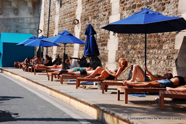
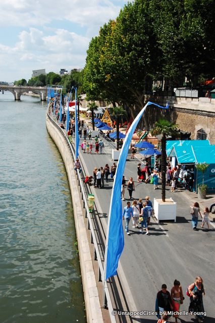
Some portions of Les Berges will become part of the programming for this year’s Paris Plage, the popular annual beach that takes over the banks of the Seine between July and August. Inaugurated in 2002, Paris Plage was originally criticized as an excess of public expenditure. Now a beloved tradition, the Plage has expanded to three different areas along the river. New additions this year include mini-golf, BMX biking (even for kids starting age 8), go-kart racing and bowling.

Archipel Floating Barges
A new series of floating barges called “Archipel” opened next to the Sewer Museum in late June. The five barges are planned in accordance with the biodiversity map of Paris. The semi-aquatic vegetation between the barges cleans the banks of the Seine while the landscaping offers different opportunities for the public to experience the space. Each “island” barge has a different theme with plants native to Paris. According to Les Berges:
For the lazy , the chairs of the island mists are waiting for you
For the wild, find the open aviary bird island
For the romantic, walk in the tall grass prairie of the island
For those seeking the country, sit in the shade of an apple orchard on the island
The barges are also designed to withstand flood levels higher than those of the 1910 flood. On other sections of Les Berges, there are orchards, a “Zen” platform for yoga and pilates, outdoor sports and educational activities.
Life Size T-Rex
This aluminum dinosaur by Philippe Pasqua is actually a private endeavor, commissioned by the daughter of the founder of the Bateaux-Mouches, the boat company that operates tours along the Seine. At 4 meters tall and 7 meters long, the sculpture is intended “to support and promote contemporary art along the river.” But we think there’s definitely a marketing motive too–it’s already become a tourist attraction, as visitors try to angle their cameras to depict the T-Rex devouring the Eiffel Tower.
Get in touch with the author @untappedmich.
Subscribe to our newsletter