How NYC Subway, LIRR, and Metro-North Responds to Snowstorms
Snow blowers, throwers, plows, and more specialized equipment help keep NYC moving in the snow!


Courtesy of @vic.invades
The New York City Subway is one of the oldest public transit systems in the world, so it’s no surprise that Manhattan has its fair share of abandoned subway stations. We previously toured the unused City Hall station but there are many more, hidden from the public eye. We’ll begin first with the abandoned subway stations in the system, then move onto the system’s abandoned levels, platforms, and sections.
Also make sure to join us on our upcoming tour of the New York City subway, where you’ll learn about the history of the largest rapid transit system in the world.
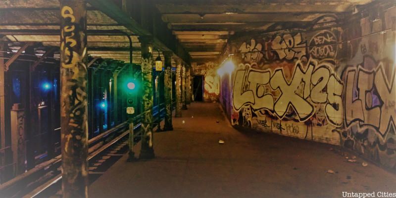
Just a few blocks from the 96th Street subway station along the 1/2/3 lines sits the abandoned 91st Street Subway station. It was in service since 1904 and was part of the first subway. But with a 200 foot platform, the station was retired in 1959 for similar reasons as the abandoned Worth Street and 18th Street stations. With the extension of neighboring subway stations–96th Street in this case–some stations simply became too close to each other. With one entrance to the 96th Street station just 100 feet from 93rd Street, there wasn’t much use for the 91st Street stop anymore but you can still see it when you’re riding the 1 train.

Abandoned NYC Subway Stations

Courtesy of @vic.invades
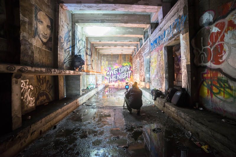
Underneath Williamsburg at South 4th Street there’s a 6-track station of the IND line that was never opened. In 2009, over the course of a year, street artists PAC and Workhorse invited 100 street artists in and out of the station to create work there overnight. dubbed The Underbelly Project. The idea was to create an underground gallery, but as PAC describes, apart from recruiting artists they could trust from pre-existing relationships, everything “happened organically along the way.” This video tells the story and shows the art well, and the project went on to be replicated in Paris. Whether the art still exists in the New York City subway station remains a question, but most we’ve spoken to feel that the MTA sealed off the station and it has remained relatively untouched.
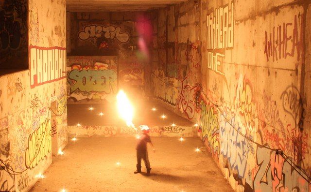
Photo of the Echo Vault by the f/11 Crew, shared with Untapped Cities
The evening we spent here with Wanderlust Projects, the same group of underground events responsible for the Night Heron Speakeasy in a watertower, goes down as one of the most incredible experiences we’ve had in the New York. With impeccable coordination, 200 of us climbed down through a hatch in the midst of a busy area of New York City and entered an unused station. Lines of what would have become tracks became places to run around and explore. Staircases led to openings that looked down on a central “Echo Vault” on which performances were shortly about to take place.
Then the Extra Action Marching Band turned the whole thing into a rocking, other worldly event, which Gothamist writer John Del Signore captured perfectly as an “exorcism disguised as a dance party.” The dispersal was just as magical (apart from a slight, hilarious delay where the staff couldn’t get the hatch lock to work). We emerged from the hatch onto the city streets and left in all different directions, calmly into the night reinserting ourselves into society. We’re keeping this location mum.
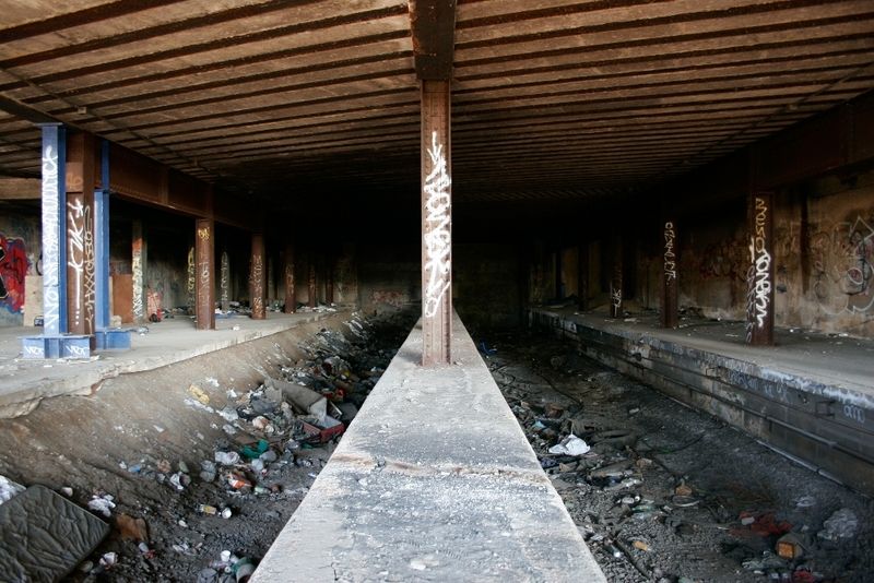
Abandoned Sedgwick and Jerome-Anderson station in the Bronx. Image via Vanshnookenragen
A remnant of the elevated subway days, Sedgwick Ave and Jerome-Anderson Ave are forgotten railway terminals and elevated rapid transit link near the Harlem River in the Bronx. Both opened in 1918, they were an extension of the 9th Avenue El, a service known for its “Suicide Curve” at 110th street. In 1958, the service closed down after the city’s consolidation of its three subway systems. While the steel elevated structure was removed in Sedgwick Ave, the ground level portions and the tunnel of the station still remain today. You can take 4, B or D trains to 161 St, and travel across the footbridge over Sedgwick Ave and the Major Deegan Expressway. From there, you should be able to see the outdoor portion of the platforms in the bushes, and the ground level station hidden under the highway, marked by an old stone wall. For Jerome Ave, walk west on 162 St, and the remains of the station are on the west side of Jerome Ave on the hillside.
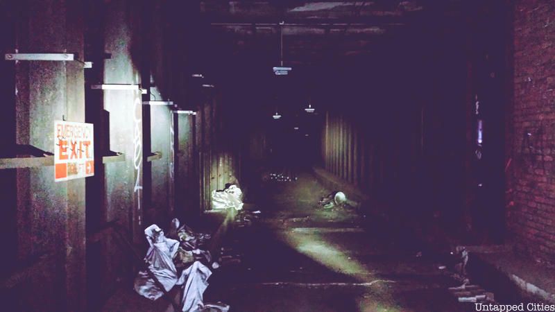
Before the Great Depression, a Second System was planned for the IND line to connect the Rockaways and midtown Manhattan. A full station and tracks were installed in Queens that were to connect to the Roosevelt Avenue-74th Street stop but were never used. You can see remnants where these tracks now dead-end at 78th Street. In addition, many active stations have unused levels and platforms which we explore in a follow-up piece here.
Closed in 1956, Myrtle Ave subway station used to run on the Brooklyn-Manhattan Transit line between Manhattan Bridge and DeKalb Avenue. The DeKalb Ave section ran into a lot of problems as it was the chokepoint for the entire BMT Broadway subway operation, “with a lot of merges and some routings crossing others at grade in the switches on both sides of the station,” writes Joseph Brennan. The entire area was rebuilt in 1956, and this caused Myrtle Ave to lose its southbound platform. The northbound platform still exists, but has been closed ever since.
An artwork called Masstransiscope by Bill Brand is located in the abandoned Myrtle Ave station. Installed in 1980, the piece works like a giant zoetrope. When the train moved, riders would see an animated cartoon, not 228 hand-painted images. The piece was restored in 2008 and 2013.
You can view this by taking the Manhattan bound B or Q trains departing from DeKalb Avenue.
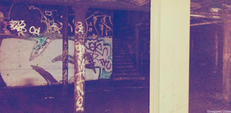
18th St, also on the IRT Line, was formerly sandwiched between 14 St-Union Square and 23 St. After World War II, the Board of Transportation embarked on a platform extension program, and this allowed 14 St and 23 St to lengthen their platforms and post new entrances at 15th street and 22nd street. As a result of the close proximity, 18 St was closed down in 1948. According to Joseph Brennan of Abandoned Stations, the underground stop was often used for publicity photos because it possessed no unusual features. The sealed off station is easily visible when riding the 6 train (and 4, 5 trains if no local trains obstruct the view) between 14 St and 23 St. See a video of the abandoned station here.

Photograph via Wikipedia by 3am.nightly
Another abandoned stop on the former IRT line, the Worth St station was closed to passengers in 1962 due to its proximity to the Brooklyn Bridge station which had extended its platform north. Once the full-sized Brooklyn Bridge station opened, Worth St became, well, worthless. However, the station’s name bears significant meaning as it was named after General William Jenkins Worth, a hero of the Mexican War in the 1840s. On a slow moving 6 train, the word “Worth” and terra-cotta “W”’s can be spotted on some of the station’s tile-encased support columns and walls, respectively. However, it may be difficult to see much as the station is heavily defaced by graffiti.
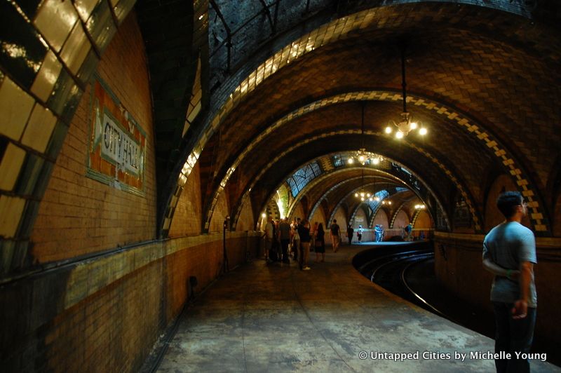
Opened in 1904, the old City Hall station with its beautiful architecture and curved platform was intended to be a showpiece of the Interborough Rapid Transit Company’s (IRT) new subway line. It was also the chosen place for hanging the commemorative plaques dedicated to those who designed, built and financed the underground train system. Contrary to popular belief, there was no plaque here honoring Alfred Ely Beach’s early pneumatic subway. The station was closed just a few decades later in 1945 because its curved platform wasn’t able to accommodate the IRT’s newer, longer cars. Today, the subway stop still remains closed but you can get a quick glimpse of the platform by taking the 6 train past its last stop at Brooklyn Bridge. For those who want a full-blown tour, you can become a member of the MTA Transit Museum to access the City Hall station.
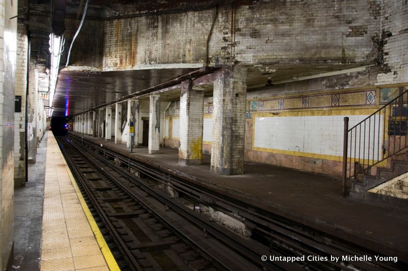
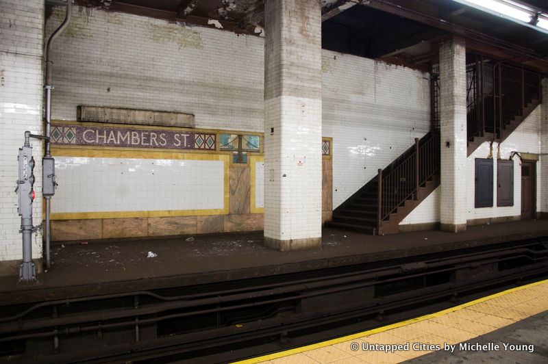
At Chambers Street, one side of the station is significantly deteriorating across from actively used platforms
The Chambers Street station has a long history of changes, with trains entering the station from the Williamsburg Bridge originally, then the Manhattan Bridge when it was completed. There was also a Rockaway Beach service that originated from Chamber Street from 1913 to 1917, operated by the Long Island Rail Road and Brooklyn Rapid Transit.
In 1931, the Nassau street subway (now the J/Z lines) opened running south from Chambers Street. As part of this plan, two platforms were closed. Part of the station was converted into the basement of the Municipal Archives. Another platform was removed to accommodate the expansion of Brooklyn Bridge station.
The platform from which all the photographs were taken from is still accessible, as the the downtown J/M trains still stop on one side on weekdays.
A staircase exit from this formerly used platform:

With its historic metal treads still in place (they have been replaced every other New York City subway station), the Bowery station is infamous for the decrepit state of its abandoned section. But lately, it’s been in the news for two very different reasons. First, the abandoned platform was used as a training site for an NYPD terror drill and then a graffiti artist known as “VEW” created a Star Wars-themed “Anti-ISIS” mural.
The station was originally designed with four tracks and two island platforms (meaning each platform was between two tracks). Now, however, the station only has three tracks, since the fourth track, located on the abandoned northbound portion of the station, was removed in 2004 during renovations. Only two of the tracks are actually in use.
Along each side of the Bowery station is a mezzanine. The west mezzanine is closed, and there were escalators running up to the east mezzanine in the original construction. One side of the station even has a raised ceiling where a proposed subway was supposed to run through.
The south end of the station contains newsstands, restrooms, a mezzanine, and stairway-all of which are closed. Another sign of the station’s abandonment is the complete lack of benches on the platforms.
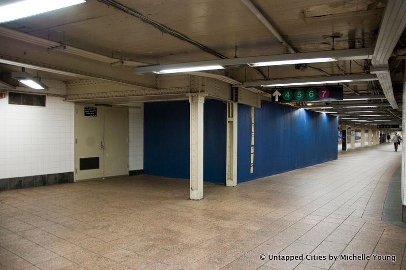
One side of the long walkway between the 42nd Street Shuttle and Grand Central Terminal was going to be a subway track and platform
The New York City subway system used to be made of private lines like the Interborough Rapid Transit (IRT) and the Brooklyn Rapid Transit (BRT, later the BMT). As we showed in this vintage video of the first subway line, it ran up Park Avenue, crossed Manhattan at 42nd Street and then went up Broadway.
In 1913, the Public Service Commission created an initiative called the Dual System of Rapid Transit which required the IRT and BRT to operate portions of the new system. To fill in a 400 foot gap between the old system and the new at 42nd Street, a subway station was built. According to Brennan of Abandoned Stations, “trackways were built continuing east under 42 St, to bring those two tracks into the new station, which was a narrow island platform between the two tracks. It was expected that two tracks would be more than adequate for the shuttle.”
Demand for the Shuttle was far larger than expected and after a temporary closure, officials hastily finished up the tracks as a walkway between the Shuttle and Grand Central which is still in use today. The shuttle re-opened with three subway tracks.
The columns shown were intended to go down the middle of the station that was never finished. This shot is looking towards the Shuttle:

A new office has been been built for the Rapid Transit Operations (RTO)’s Cold Weather Reporting Station. This has further concealed remnants of this old subway platform and track:
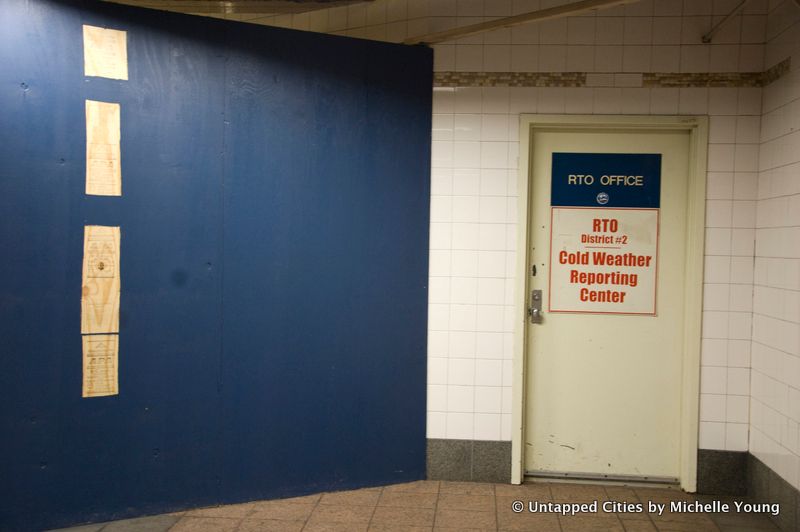
Here’s a photograph from Joseph Brennan of the space in the early 2000s that show the narrow paired columns which has now been incorporated into the RTO office
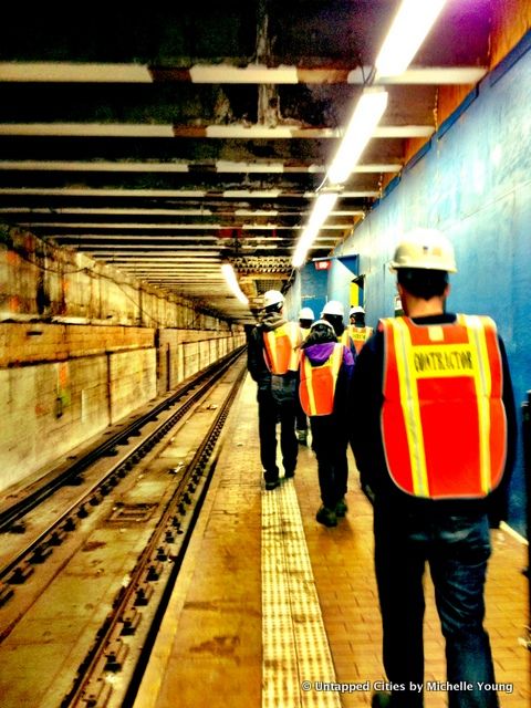
This image comes from a tour we took of the Second Avenue Subway construction. Along the F train platform, the thin blue construction wall is the only thing that separates daily subway passengers from an existing subway tunnel that’s being retrofitted and connected to a Q line extension. The tunnel had actually been constructed for the Second Avenue Subway in the 1970s before plans stalled.
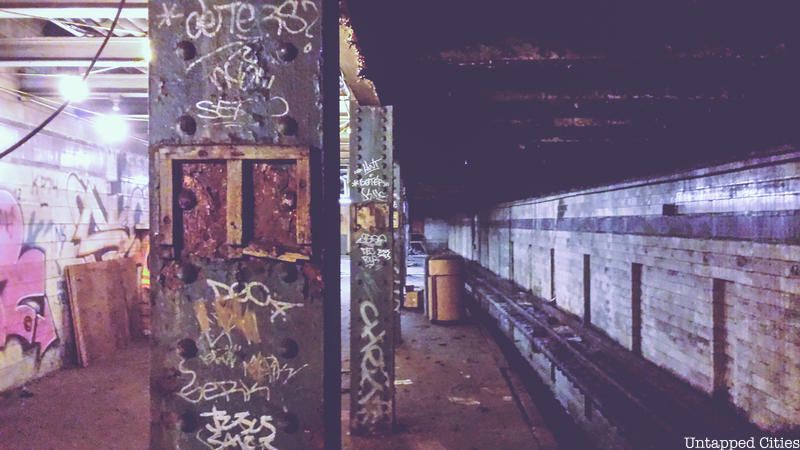
It’s unclear why the the lower level of the A/C/E track was constructed, as it never operated as part of the IND or IRT systems but it was used between 1959 and 1981 as the origin for the special Aqueduct Racetrack train.
According to NYCSubway, the platform was on the southbound side, “one track, underneath the downtown local track on the upper level, and one side platform underneath the island platform.” The entrances were all sealed, except for one under a trap door on the “south end of the southbound platform,” at the time Peter Doughtery was writing. Today the tunnels beneath Port Authority have been converted into the 7 line subway extension, of which you can see the progresshere in our behind-the-scenes photos of the construction
.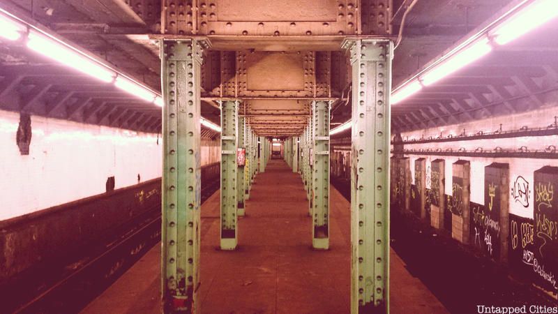
One platform was closed off to public view in 2001. While most of the wall of the Canal Street subway station on the J/Z line has been redone and patched up, you can spot the old platform through an opening (above).
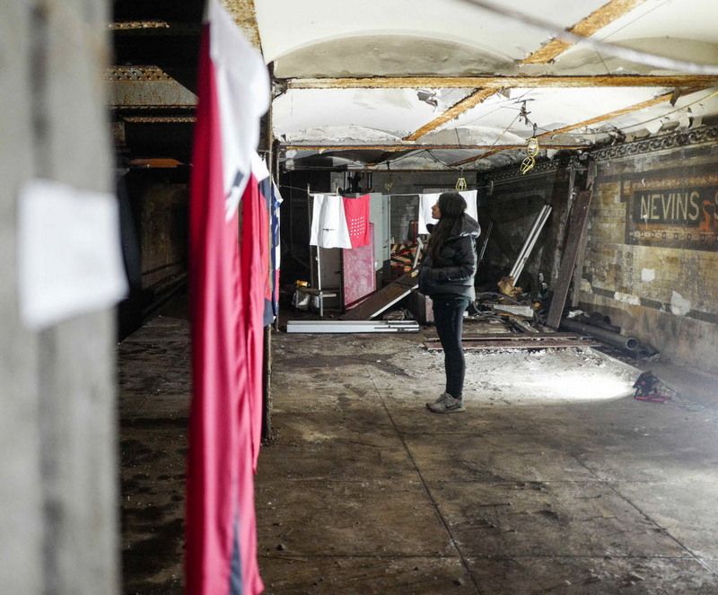
Photo by Phil America
The ornamented railings at the active level of Nevins Street are from the original subway system and lead down to the underpass, which was formerly a platform. The locked doors lead out to the platform, which can also be accessed via the Hoyt Street station (not something we recommend). In 2016, the artist and activist hosted a guerrilla exhibition inside the abandoned level of the Nevins Street station, highlighting mass shootings in America.
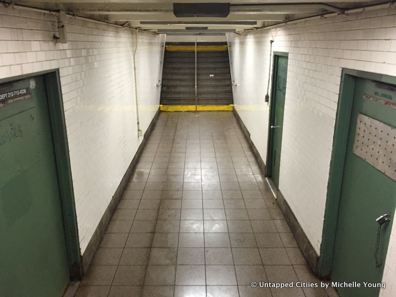
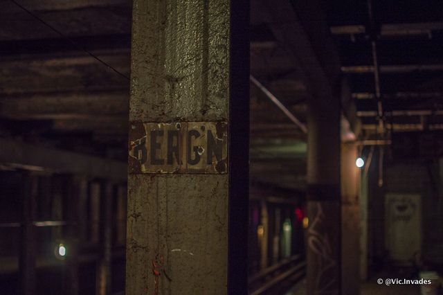
In Brooklyn, an abandoned level below the Bergen Street station is a favorite spot for urban explorers, one of many New York City subway stations that have abandoned platforms. Renovations to the station, which serves the F and G trains, in the early 1990s damaged the lower platform, which had been used from time to time over the course of the station’s existence since 1933. Silver doors on the upper level conceal open staircases that go down to the lower level.
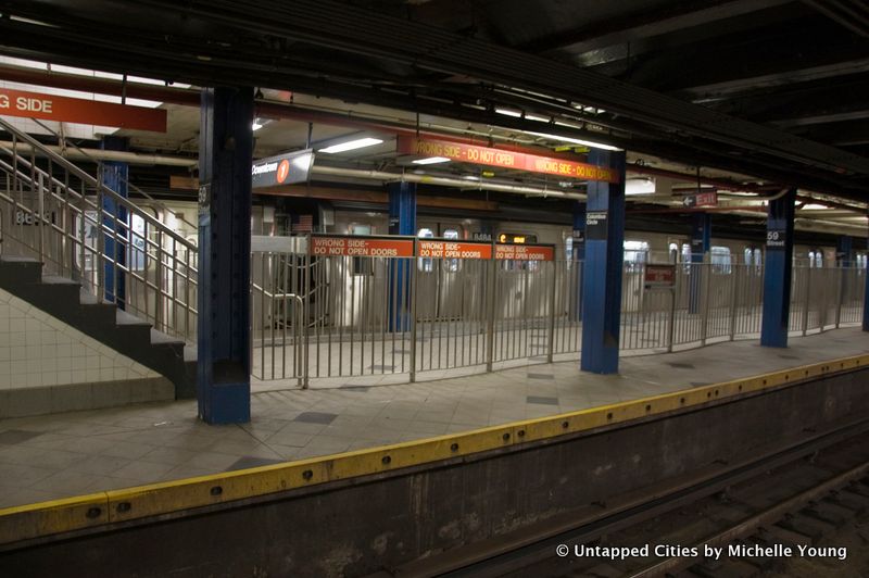
For those that frequently pass through the Columbus Circle, you’ll notice that the center platform is now used as a walkway connecting the A/C to the 1 train. Brennan explain its origins:
Express trains [on the IND line] opened doors on both sides in rush hours. On the old subway cars, conductors stood between cars to open doors and could do both sides from the same location. On newer cars, conductors had to open doors from an inside cab, and move to the next car to open the other side, so use of the center platform was discontinued in 1981 because it delayed train service at the busiest time of day.
This portion of the platform isn’t used as the crossover and is devoid of the undulating metal barrier:
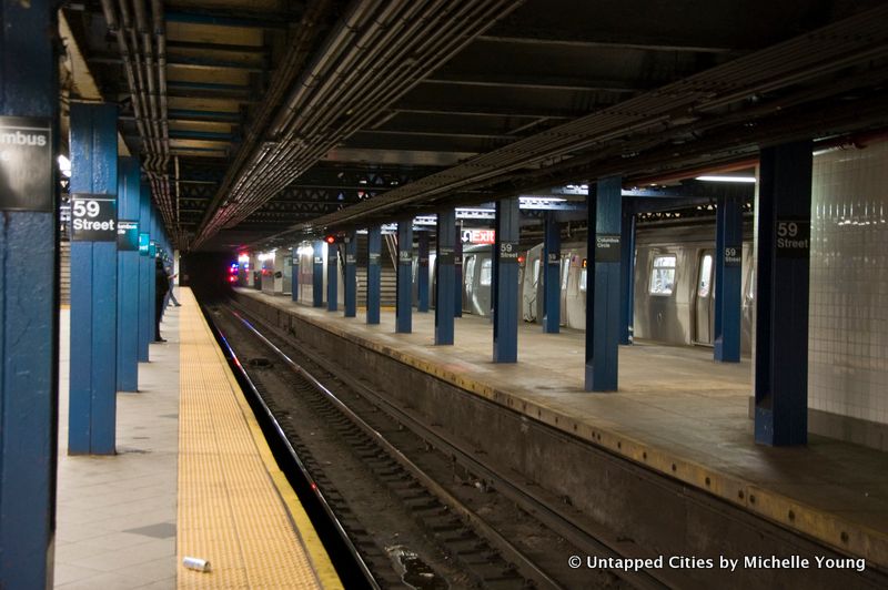
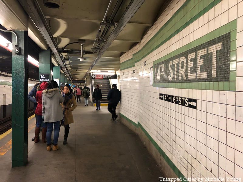
According to urban explorer Matt Litwack, author of Beneath the Streets: The Hidden Relics of New York’s Subway System, you can walk from 7th Avenue to Church Avenue in Brooklyn on the F train without ever seeing a platform through an entire abandoned level, which is a replica of the active tracks above it.
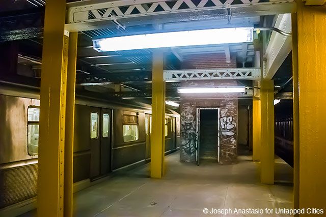
When most people think of abandoned stations at City Hall, they think of the ornate abandoned station located along the 6 line. However, there is another abandoned City Hall platform – this one located under the active N/R line station of the same name. During construction of the present day N/R/Q tunnel, the original plan was to have express trains serve lower Manhattan, using this station. When those tracks were diverted to the Manhattan Bridge, this part of the station became redundant. It quickly found re-use as a space to park trains overnight.
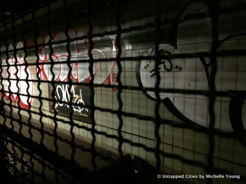
When the trains are going slowly enough at Bleecker Street, you’ll notice that the platform of the uptown 6 actually continues beyond an added wall. There, you’ll see green tiling (in the style of the newer Chambers Street tiling above), some ads that were left from when the section was closed off, and a standing pay phone.
In 2012, the Bleecker Street subway station was renovated to create a much-needed transfer from the uptown 6 train to the B/D/F/M trains, as previously transfers were only available to those on the downtown 6. The modification necessitated a shift in the subway platform south, and a northwards extension of the subway platform that was itself added in the 1950s to accommodate the longer 10-car trains closed.

Abandoned NYC Subway Stations
Next, check out 6 abandoned subway entrances in NYC and 20 of NYC’s abandoned places. Get in touch with the author @untappedmich.
Subscribe to our newsletter