How to Make a Subway Map with John Tauranac
Hear from an author and map designer who has been creating maps of the NYC subway, officially and unofficially, for over forty years!


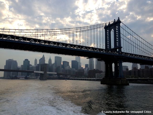
The East River has seen an unprecedented amount of growth and development over the course of the Bloomberg administration, and the Openhousenewyork architectural boat tour of the East River emphasized that. We joined OHNY and speakers Justin Davidson, the architecture critic of NY Magazine, Robert Balder, executive director of Cornell’s College of Architecture Art and Planning in NYC, Andrew Winters, the director of capital projects and planning for Cornell Tech on Roosevelt Island, Deborah Marton, senior vice president of programs for the New York Restoration Project, and Philip Orton, a research scientist at Stevens Institute of Technology, for an architectural boat tour of the East River. As they pointed out some key sites, the experts discussed what makes for successful vs. unsuccessful urban planning on the waterfront. Here are some highlights:
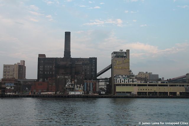
There are high hopes for Two Trees’ highly anticipated conversion of the abandoned Domino Sugar Refinery on the Williamsburg waterfront. The complex will include residential and retail space as well as open space for public use. Part of the development plans involve extending streets which had previously stopped short all the way to the waterfront. For a refresher on what the factory looks like inside, check out our video.
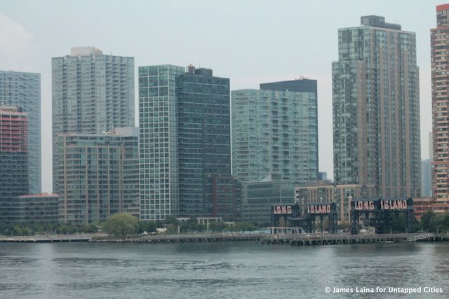
City planners and public advocates are looking toward Long Island City as the next waterfront property to develop. Our guides explained that planners interested in Long Island City are looking to correct the Bloomberg administration’s mistakes when it comes to waterfront development. Whereas in Williamsburg, the city offered developers big incentives, like the right to construct huge towers with minimal requirements for parks and public space, Long Island City will see the opposite happen. Here, the city is investing in public amenities, like the new waterfront park, in order to attract developers. The city is also pushing for more affordable housin, as seen in the approved plan for Hunters Point South.
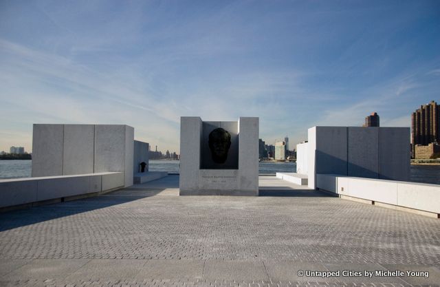
FDR Four Freedoms Park was forty years in the making, and we were there to witness its opening last fall and its construction prior to that. Louis Kahn’s unfinished design was meant as a testament to Franklin Delano Roosevelt, who fought to ensure that all Americans and people around the world would have the “Four Freedoms”: Freedom of speech and expression, freedom of worship, freedom from want, and freedom from fear. The park stands at the southern tip of Roosevelt Island, near the abandoned Smallpox Hospital. Many people don’t realize that Roosevelt Island is actually New York City’s oldest settlement.
If you are or become an Untapped Cities Insider, you can join us for a tour of the modernist architecture at FDR Four Freedoms Park on September 17th!
[mepr-show if=”rule: 518547″][uc_booking_button title=’Book Now’][/mepr-show][mepr-hide if=”rule: 518545″][uc_insider_button title=’BECOME A MEMBER TO JOIN THIS TOUR FOR FREE!’ url=’/plans/insiders/’][/mepr-hide][mepr-show if=”rule: 518546″][uc_insider_button title=’UPGRADE YOUR MEMBERSHIP TO JOIN THIS TOUR FOR FREE!’ url=’/plans/insiders’][/mepr-show]
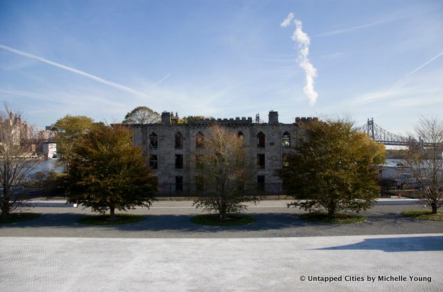
Built in 1856, Roosevelt Island’s abandoned Smallpox Hospital is the city’s only landmarked ruin. The Four Freedoms Park organization hopes to turn it into the park’s visitors center. We can expect to see a lot of development around the hospital and on Roosevelt Island in the years to come. Our guides explained that 12,000 people live on the two-mile long island, and transportation is key. Though there is little commercial development there, city planners hope that Roosevelt Island will be in the lead on new development, as businesses stake out territory in Brooklyn and Queens.
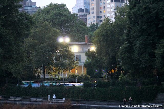
Located on the waterfront in Yorkville between 84th and 90th Streets, Carl Shurz Park is considered one of the city’s best kept secrets. This little park has views of the northern end of Roosevelt Island, Randalls and Wards Islands, and Gracie Mansion, the mayor’s official residence (though Bloomberg has never actually lived there).
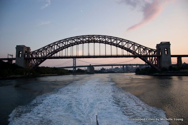
Built between 1912-16 by engineer Gustave Lindenthal and architect Henry Hornbostel, the Hell Gate Bridge was once the longest steel bridge in the world and the only four-track long-span railway bridge ever built. It connects Astoria to Randall’s/Wards Island (which are now joined into one island) and the Bronx. The original design called for a steel lattice structure on the long approach ramps, but it was changed to smooth concrete to make it more difficult for asylum inmates on Randall’s Island and Wards Island to escape. Hell Gate was named for the dangerous rocks and perilous waters at the point where the East River and the Harlem River connect, around which the infamous HMS Hussar sank with almost a million British pounds in gold.
See photos of an urban exploration to scale Hell Gate Bridge.
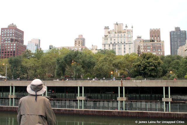
A notable sight on the East River, FDR Drive was designed by Robert Moses, who created many of the city’s most reviled infrastructural features, including the BQE that cuts through Brooklyn and Queens. We have to understand that back when Robert Moses was developing New York City, it seemed as though the future lay in automobiles, though today that is obviously not the case. Our guides explained that in order for today’s city planners to avoid Moses’s mistakes, they must take a much longer view of the future, planning not only for the next ten, twenty or even thirty years, but for the next hundred or two hundred years. Fun fact: The FDR Drive is made of rubble from WWII in Europe.
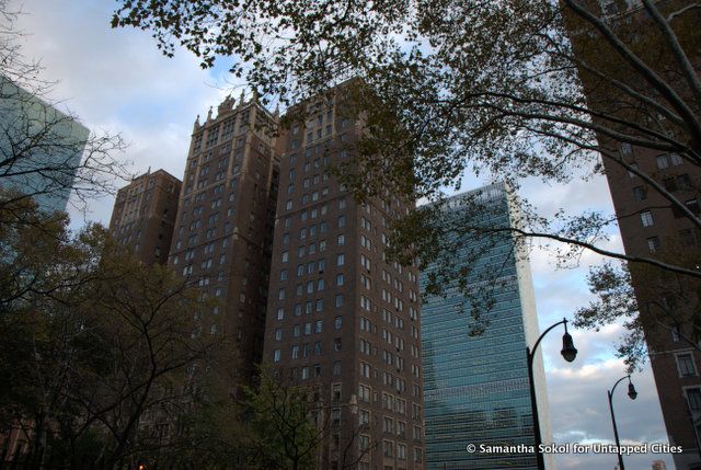
Tudor City on East 42nd Street, which was the first residential skyscraper complex in the world, is considered one of the failures of urban planning. When it was completed in 1932, the architects turned their backs on the waterfront and built facing in instead of out. The resulting complex doesn’t take advantage of the spectacular views onto the East River. However, the Tudor City Bridge is a great vantage point for seeing Manhattanhenge, the phenomenon when the setting sun aligns perfectly with Manhattan’s grid.
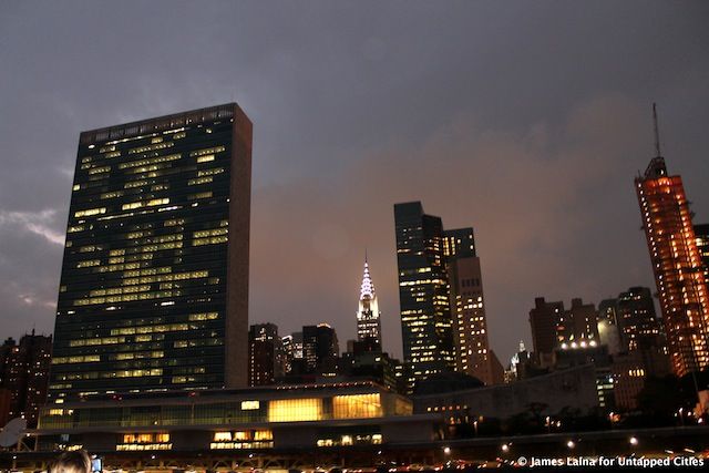
Constructed from 1948-1952 and designed by Le Corbusier and Oscar Niemeyer, the United Nations building is a sovereign nation. The design incorporates elements of William Zeckendorf’s Dream City to rival Rockefeller Center, which never came to be. In 1946, Nelson Rockefeller (John’s son) bought the East River property from Zeckendorf and donated it for use as the UN Headquarters. While on a visit, don’t miss the reopened Delegates Dining Hall open to the public.
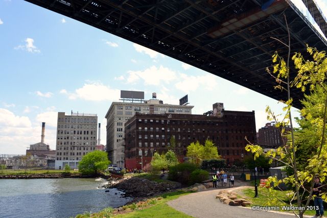
Brooklyn Bridge Park is one of the greatest successes in recent development history. The 1.3 mile park wraps around the waterfront in Dumbo and has acted as a catalyst for the area’s revitalization. This stretch of the waterfront, which used to be industrial and unsafe, has become one of Brooklyn’s most popular spots for locals and tourists alike. The area still shows relics of its industrial past, like a historic tobacco warehouse. It will continue to undergo development in the near future with the revival of the Empire Stores warehouses.
Read about NYC’s 13 Most Important Architectural Sites on the Hudson River and Openhousenewyork’s Other Islands boat tour. Learn more about Openhousenewyork on its website.
Subscribe to our newsletter