Last-Minute NYC Holiday Gift Guide 🎁
We’ve created a holiday gift guide with presents for the intrepid New Yorker that should arrive just in time—


Following the devastation of Hurricane Sandy in 2012, President Obama initiated the Hurricane Sandy Rebuilding Task Force with the U.S. Department of Housing and Urban Development (HUD), sponsoring a competition called Rebuild by Design with the aim of “identifying the unique structural and environmental vulnerabilities Hurricane Sandy exposed in communities throughout the region, and developing fundable solutions to protect residents against and prepare for future climate events.”
On Monday, a year after Sandy, the competition held a reception in which ten teams presented 41 design opportunities (3-5 each) for the Sandy-affected region. A jury of experts will select one project for each team to pursue. Between November and March, teams will work with “decision-makers, stakeholders and communities” to hone their plans into feasible, fundable projects. In April 2014, the expert jury will select a few proposals to be funded by HUD disaster relief money as well as other public and private-sector funding.
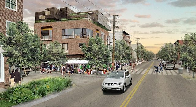
A plan by HR&A Advisors, Inc. with Cooper, Robertson & Partners to protect, connect, and diversify Red Hook: “activated ground floors on Van Brunt and Columbia Streets will activate the area and connect the neighborhood to Red Hook Houses. Floodable ground floors, home to temporary or moveable commercial structures, will allow businesses to recover and reopen more quickly after disasters.”
After the plans were presented on Monday, one person from each team joined Eric Klinenberg, director of the Institute for Public Knowledge which assembled the Research Advisory Group for the competition, on stage for a panel discussion. Most of it centered on rebuilding for “resilience,” very much the buzzword of 2013–also a focus of the recent Municipal Arts Society annual Summit for NYC. The consensus of the panel boiled down to the idea that infrastructure for resilience against extreme weather should also improve daily life and create more successful and and lively communities. “Community” was perhaps the second buzzword of the morning, with much focus on community input and involvement in the crafting and execution of the plans and the importance of social fabric to achieving resilience after disasters.
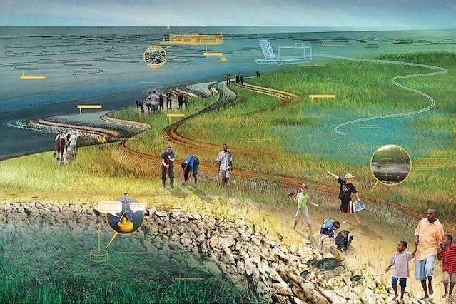
A plan by Scape/Landscape Architecture for Barnegat Bay, NJ to help “regenerate lost ecological systems, recalibrate sediment cycles, and step down risk for waterfront communities.”
In Klinenberg’s closing statement he summed up the panel neatly:
“We can’t just design climate security against a storm surge, but [it’s] also an opportunity to improve life all of the time–not just hard infrastructure, but the social infrastructure. Drawing people out of their homes into social life, providing places where people can connect. [We have to think about] how we are going to live inside of the places that we make in anticipation of extreme weather.”
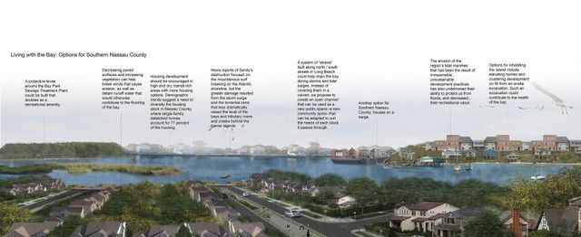
Interboro Partners looks to create inlets to prevent flooding that would put creeks through Long Beach and southern Nassau County
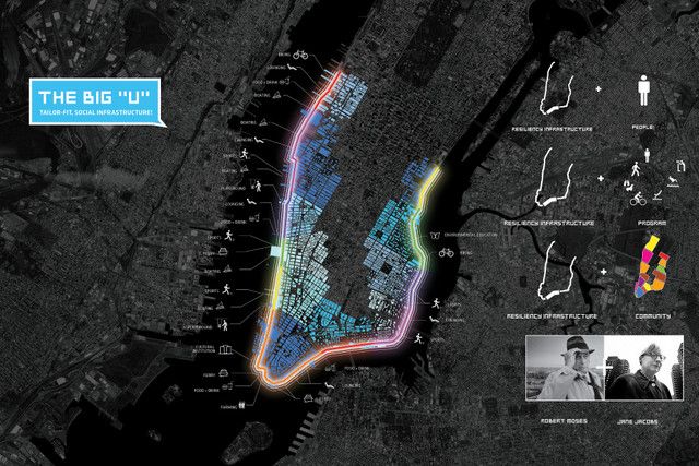
“The Big U,” as proposed by BIG TEAM is a protective system around Manhattan from West 54th street south to The Battery and up to East 40th street
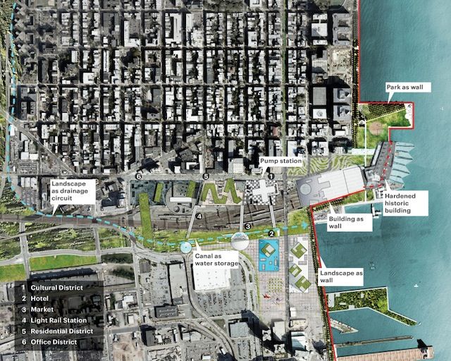
Hoboken Station Redevelopment Plan by OMA: “The redevelopment of Hoboken station can help offset the costs of a coastal defense solution that will include park and building as defensive elements. The development will afford flood defense and other civic amenities to both Hoboken and Jersey City.”
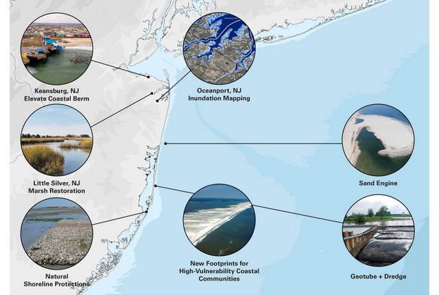
WXY and West 8 propose a paradigm shift in coastal planning
See more of the plans, including those by WXY, Arup, HR&A Advisors, PennDesign, BIG TEAM, and MIT here.
Subscribe to our newsletter