


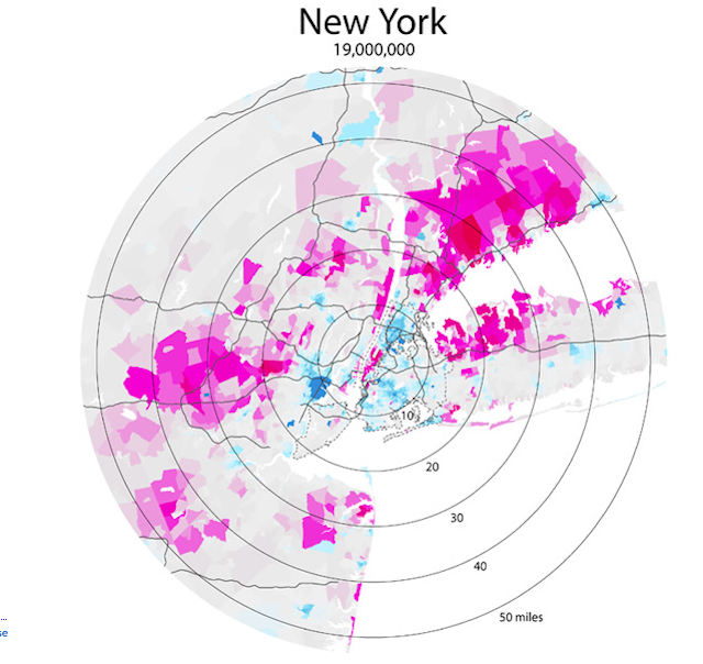
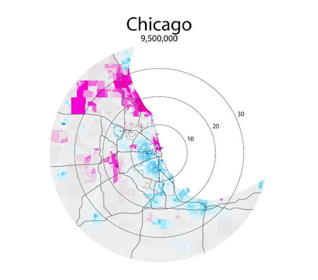
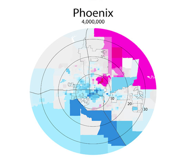
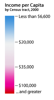
This map series by Bill Rankin tests the “donut” hypothesis: “the idea that a city will create concentric rings of wealth and poverty, with the rich both in the suburbs and in the ‘revitalized’ downtown, and the poor stuck in between.” Rankin mapped the 25 largest metropolitan areas in the US (populations over 2,000,000). This first map of New York City and the surrounding metropolitan area reflect this pattern to a T.
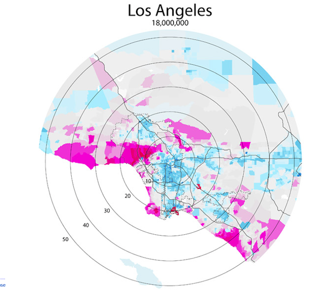
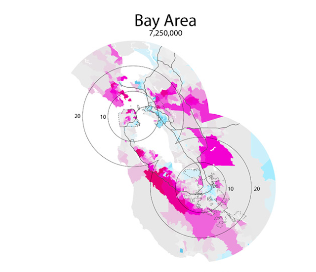
Rankin notes: [The “donut” theory] does seem to have some validity in older cities like Boston, New York, Philadelphia, or Chicago, but in newer cities it is not the case. Instead of donuts, one finds “wedges” of wealth occupying a continuous pie-slice from the center to the periphery. Just from visual inspection, it also seems that poverty donuts all tend to have about a five-mile radius, regardless of the size of the city. Perhaps this is the practical limit for commuting without a car?”
But these maps use data from the 2000 census and do not reflect current patterns as they are, especially since so many cities are seeing gentrification, the poor pushed to the suburbs, and such a blurring of the city-suburb line, and the proliferation of subdivisions and edge cities. Speculating about how the colors may have shifted around is what makes these maps so fun to revisit.
Check out the entire series here. And also explore the rest of Rankin’s incredible maps. We previously featured Bill Rankin’s maps of Manhattan taking a vacation and visiting other cities in the US. And his own travels around various cities.
Get in touch with the author @youngzokeziah. See more maps in our Fun Maps column.