


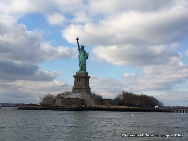
Anyone who has taken the free, round-the-clock Staten Island Ferry has been able to sneak some pretty spectacular views of New York Harbor’s big tourist draws: Ellis Island’s Renaissance Revival turrets, Port Elizabeth’s towering cargo cranes, and of course, Ms. Liberty from a flatteringly low angle. But the rest of the city is relatively obscured from the water – not only is access difficult, but the city’s architecturally significant attractions have historically clustered further inland. Until recently, the water’s edge has been the domain of docks, sewage treatment plants and highways.
But like the city itself, New York’s waterfront has been evolving quickly, and in interesting ways. So the American Institute of Architects launched a three-hour architectural boat tour, offering locals and visitors alike a front-row peak at some of the city’s greatest development sagas, past and present. Several days a week, the yacht Manhattan circumnavigates her namesake island, offering close-up views of every borough but (you guessed it) Staten Island.
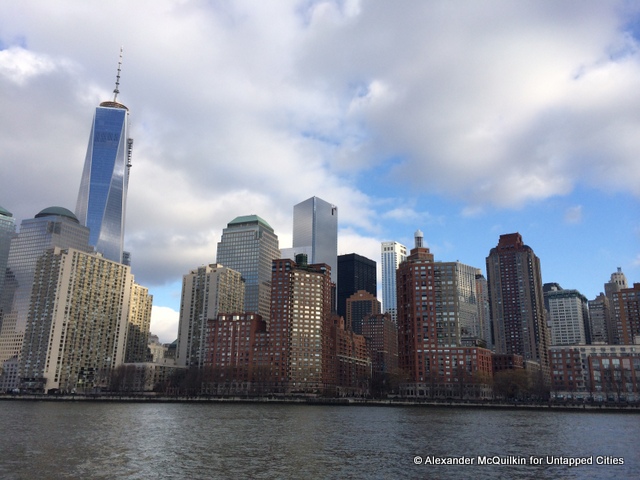
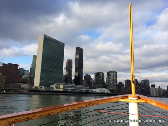
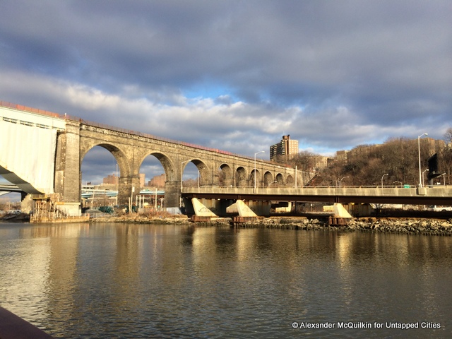
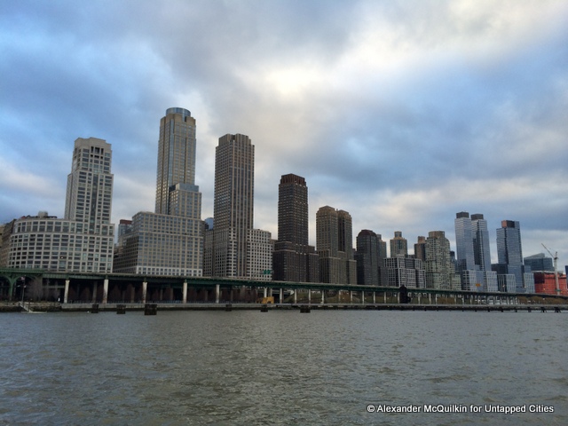
Our guide last weekend, Scott Cook, spoke engagingly, addressing the major landmarks and also calling out some lesser-known gems. The range of sights was startling. A wall of skyscrapers stands guard at the lower tip of Manhattan. At the other end, steep embankments shrouded in foliage make you forget you’re in the heart of a 20 million-person metropolis.
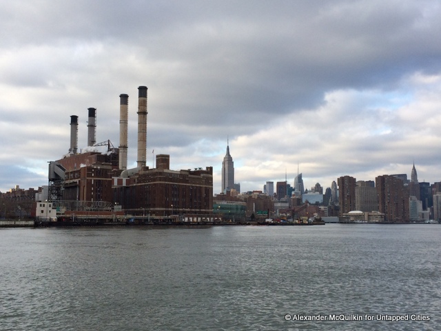
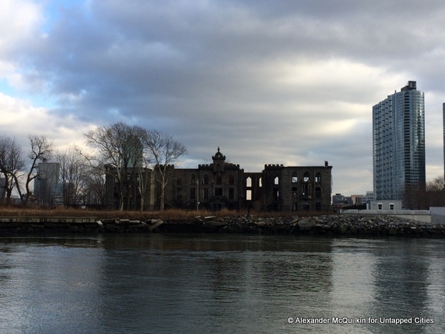
Glimpses of New York’s industrial past were not in short supply. Wooden pilings from long-abandoned piers dotted the waters off lower Manhattan and Brooklyn. The smokestacks of the 14th Street ConEd facility stuck up into skyline, striving to compete with Midtown’s spires. Most prominently, the decaying and graffitied Domino Sugar plant stood uneasily next to Williamsburg’s new glass apartment blocks.
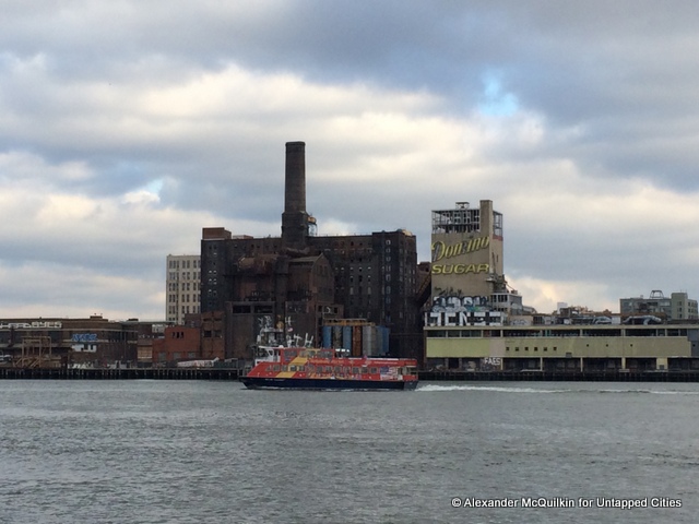
Of course that view is set to change drastically in the coming years, as SHoP Architects, the design team behind the Barclays Center teams up with a prominent local developer Two Trees to transform the site into a mixed-use development. Proof of New Yorkers’ decreasing aversion to waterside living was everywhere, from Dumbo’s converted loft buildings to Trump’s Riverside South. Other, less glamorous housing projects have abutted the waters for much longer. In the 1950s and 60s, city planners razed dozens of blocks of purportedly overcrowded slums in Harlem and the Lower East Side to erect vast forests of bland brick towers.
But the city’s mass transit system was not designed with this development in mind, so local officials have been trying to bolster the transportation options for these pioneering residents, like with the popular East River Ferry linking eight pick-up spots in Manhattan, Brooklyn and Queens. Former transportation commissioner Amanda Burden called the city’s 166 square miles of water its “sixth borough.”
Of course the city’s newfound affinity for the water comes with significant risks. Our map showed what parts of the city were inundated by floodwaters from Hurricane Sandy in 2012. Some buildings were better off than others. ConEd’s 14th Street substation suffered an explosion that wiped out much of Manhattan’s electricity grid. Some skyscrapers near Wall Street were uninhabitable for weeks because of flooded basements and lobbies. Meanwhile, Jean Nouvel’s delicate glass box encasing Jane’s Carousel in Dumbo successfully kept the East River at bay.
While access to the water remains elusive, several attempts have been made to open pockets of open space to pedestrians. In 2012, WNYC Transmitter Park opened up a tiny patch of Greenpoint waterfront to local kids, dog-walkers and those bold enough to fish from the East River. City agencies have been working to enclose an “Emerald Necklace” of public walking/jogging/cycling paths around Manhattan. The grandest new open space is the Franklin D Roosevelt Four Freedoms Park on Roosevelt Island, opened in 2012 based on designs by architect Louis Kahn dating from the 1970s.
Even the Super Bowl is getting in on the action. For its home base and VIP hotel, lead sponsor Bud Light is chartering a Norwegian Getaway cruise ship to dock in the Hudson. Not-so-VIP fans of drinking on boats fret not: AIA’s cruise comes with a fully-stocked bar.
Find out more information about the AIA cruise here.
Get in touch with the author @alexmcqw