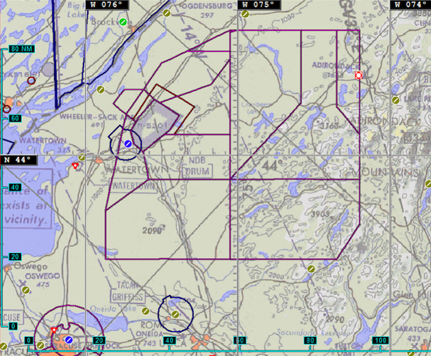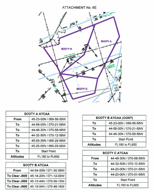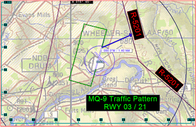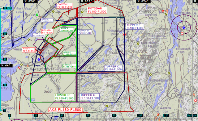
In 2012 the Electronic Frontier Foundation sued the FAA under the Freedom of Information Act for the publication of the files revealing who has applied for and been granted licenses to fly drones, or unmanned air vehicles (UAVs) domestically. The files that the FAA released are each an application from an entity that wished to procure a UAV license called a Certificate of Authorization (COA) which is needed to fly a drone above 400 feet or for the military, outside of restricted airspace—which means outside of bases. Each COA application includes maps of where the drones will fly.
Within the thousands of files they released, only two entities have applied for drone licenses in New York State. One was Cornell University, which applied in 2008 for licenses for a dozen homemade UAVs used to collect the fungal spores of plant pathogens (less than 100 microns in size) above agricultural fields.
Below are a photo of their homemade drones and the satellite image maps included in their application with their original captions. The captions on the maps aim to assure the FAA that the routes they plan to fly these little drones will not interfere with the regular national air space traffic.
The other entity is the New York Air National Guard’s 174th Attack Wing’s division called the 138th Attack Squadron (138 ATS). Their drone couldn’t be further from the cute, colorful, innocuous (by comparison) drones at Cornell.
What lives in Syracuse Hancock Field Air National Guard Base is the MQ-9B Reaper UAV. It’s a behemoth hunter-killer, the same one the CIA uses for targeted assassinations in northern Pakistan. It can carry massive payloads and film crisp surveillance video from two miles up in the sky. Since 2008 the 138th ATS has been a functioning drone school for not only American military but also for “international [drone] exchange students.” According to their COA application:
“This COA is critical to the combat mission training for the Air National Guard and has major implications for the Flying Training Unit (FTU) targeted for operation by the 174th Fighter Wing, essentially training pilots and sensor operators for the USAF and its International exchange students being trained by the U.S. Air Force under a partnership agreement between the U.S. government and cooperating nations.”
Below is a photograph of the Reaper as well as a handful of the eery and perplexing yet beautiful maps included in their COA application.


To see more maps from the Cornell COA application check them out on the Electronic Frontier Foundation’s website here. To see all of the COA applications with all of their unique and beautiful maps and satellite images including the NY Air National Guard’s you can dig through the many many many disorganized files available for download on the FAA website.
Get in touch with the author @youngzokeziah. See more maps in our Fun Maps column.


