See the New Times Square New Year's Eve Ball Up Close
Find out how you can take home a piece of the old New Year's Eve ball!


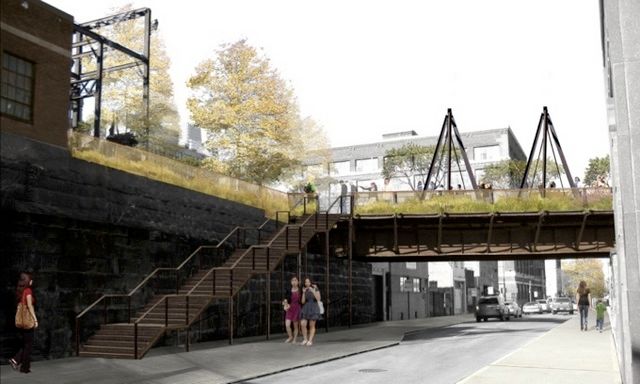
Reading Viaduct, rendering by Bryan Hanes
Back in December, we shared a list of 10 Plans for Elevated “High Line” Parks Around the World. One of these plans in Philadelphia has been in the works for more than 10 years, and is just now beginning to come into fruition. The Reading Viaduct is a mile-long stretch of elevated train tracks running through the Callowhill and Chinatown North neighborhoods of Philadelphia. Constructed in 1893, it carried commuters and freight to Center City Philadelphia for almost 100 years.
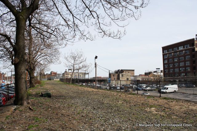
A small stretch of the Viaduct at N 13th & Noble St.
The Reading Railroad (whose name you may recognize from a popular board game) used the Viaduct to access what is now the Reading Terminal Market. In 1984, Philadelphia opened its Center City Commuter Tunnel, and the Viaduct has since been out of service.
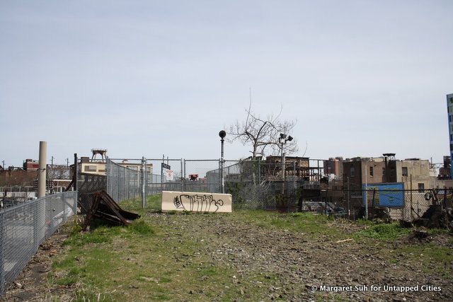
Graffiti along the Viaduct
Once an industrial landmark to the city, the Reading Viaduct is now very clearly abandoned, with its fair share of litter and graffiti. However, much of the tracks has also become home to impressively tall grasses and exotic flora. And the section at 13th and Noble St. is already a go-to spot for local dog-owners.
As early as 2003, residents saw the potential in the Viaduct to be transformed into a public park. Inspired by a presentation from a co-founder of the New York High Line, local volunteers founded the Reading Viaduct Project. In 2013, the team merged with Friends of the Rail Park, now the leading advocacy group for the park.
Advocates of the project, including Philadelphia’s Center City District, often cite the economic success of the High Line. In fact, Friends of the High Line was part of the initial team brought in by the City of Philadelphia to consult on the project. The team helped make the case that renovating the Reading Viaduct would be about 10 times less expensive than demolishing it.
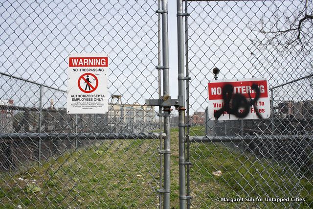
Sections of the Viaduct already blocked off from the public
But landscape architect Bryan Hanes, whose studio has been commissioned to design the first phase of the park, is quick to note that they are looking for something “a little more Philly.” Hanes’ renderings depict the park as less of a tourist destination, and more a shared public space for the neighborhood’s economically and culturally diverse communities. The Reading Viaduct’s 4.7 acres runs through 50 blocks worth of neighborhoods.
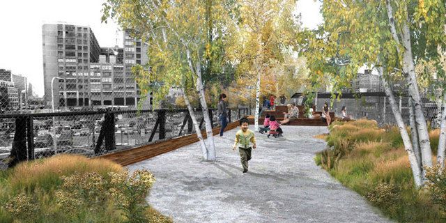
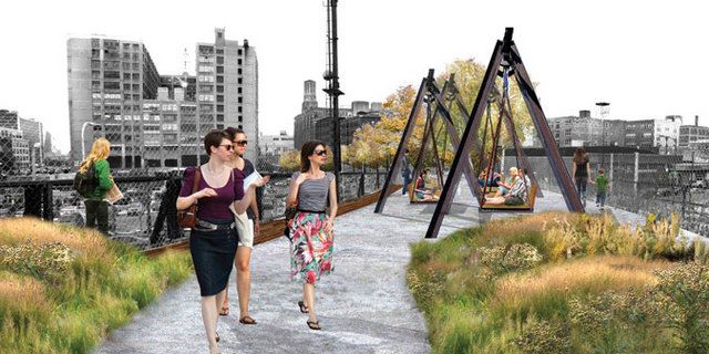
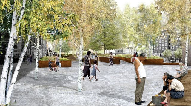
Renderings by Bryan Hanes
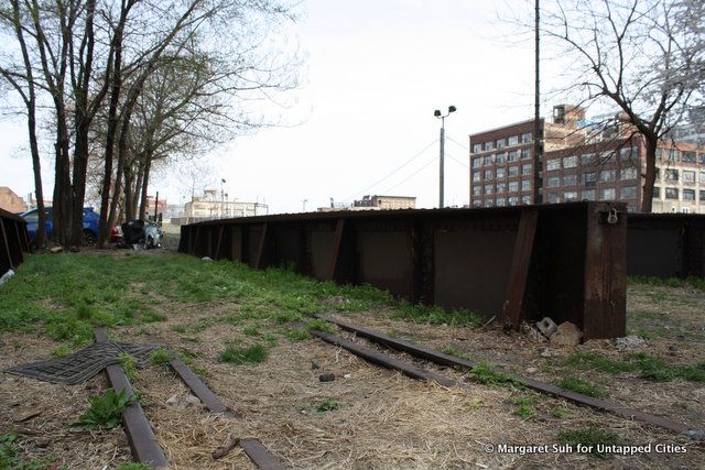
A glimpse at some of the old rail tracks
Still, the plan is to turn a set of abandoned railroad tracks into an elevated public park, which is exactly what the High Line accomplished. The Reading Viaduct will be similar to New York’s High Line in many ways—preliminary designs include multiple stairway entrances, generous landscaping, a paved walkway, plenty of benches, and some great views of the city skyline.
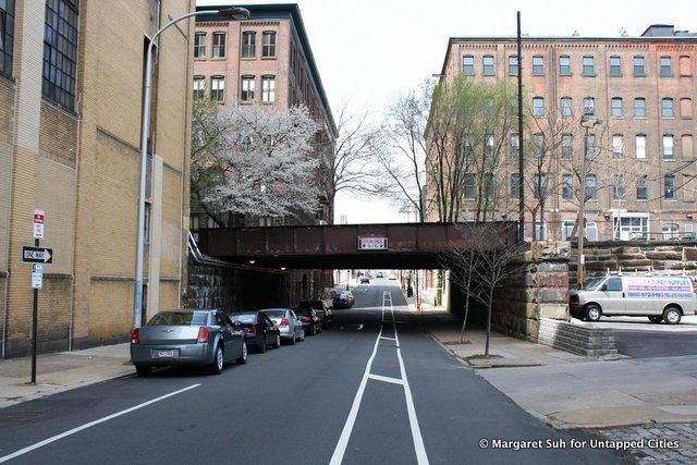
Current view of proposed entrance at N 13th & Noble St.
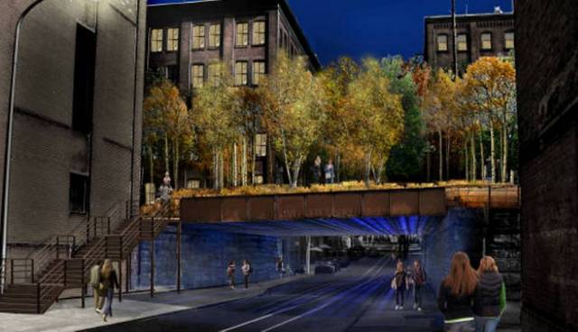
Rendering by Bryan Hanes
The focus now is on the “spur,” a quarter-mile long section owned by SEPTA (which is a cooperative public transportation agency). Renovation of this section alone is estimated at $8.6 million. In recent budgets, the city and state together have pledged over $5 million, though that sum is not guaranteed. Advocates are depending on continued private donations (they’ve raised about $70,000 thus far) to make the Reading Viaduct Rail Park a reality.
Subscribe to our newsletter