


Co-written by Samantha Sokol
The Southern tip of New York City wasn’t always as wide as it currently is. Originally, the eastern shoreline of Manhattan was in the vicinity of the current Pearl Street, as shown in the map below. As the shipping industry and the port of Manhattan grew to become the engine behind the thriving economy of New York, expanding the shoreline the city could add more piers and docks which could service the increasing sea traffic. As a result, the Dutch started using landfill to expand Manhattan’s area, and Water Street, Front Street, and South street were completed by 1815.
The extension of Manhattan’s coastline continued throughout the 18th century. South Street was paved in 1798 and a seventy-five foot border was created between the houses and shops and the slips and piers. The width was necessary because the ships docked on the shoreline, and bows would extend onto the street. South Street became the center of the city’s shipping industry for two hundred years.
At that time, New York City had 62% of the import business in the entire country. In fact, according to Gotham: A History of New York City to 1898 by Edwin G. Burrows, on one day in 1836, there were 921 vessels on the East River waiting to load or unload onto South Street, while an additional 320 waited on the Hudson.
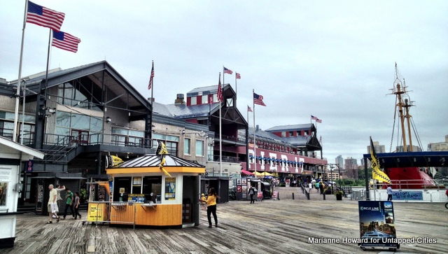
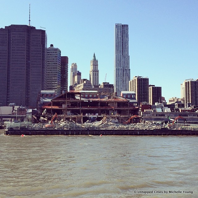
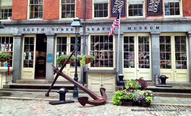
Most notable in this area today is the popular tourist destination South Street Seaport. This is the result of a redevelopment project which began in the 1960s, designed to preserve and protect this area. At that time, developing the east coastline piers for shipping stopped due to increased air commerce. Unfortunately, by the late 1950s, piers 15, 16 and 17 were mostly empty. In 1983, the cheerful (but tacky) Pier 17 opened to the public, but as of today it nearly demolished.
The Howard Hughes Corporation plans to completely re-vamp Pier 17. They intent to create enhanced open space on the pier and develop retail venues and restaurants for the community. The new pier is slated to open in 2015, and will be architecturally in line with the re-do of Pier 15 just next door. New York City architectural firm SHoP (who also did the South Street Seaport Master Plan and the Barclays Center in Brooklyn) will be replacing the mall with a new structure.
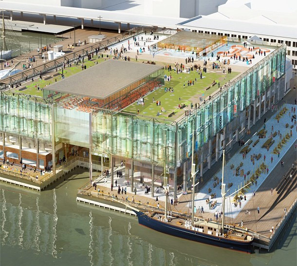
Planned changes to the shopping center at Pier 17, South Street Seaport. via SHoP

Image via Howard Hughes Corporation
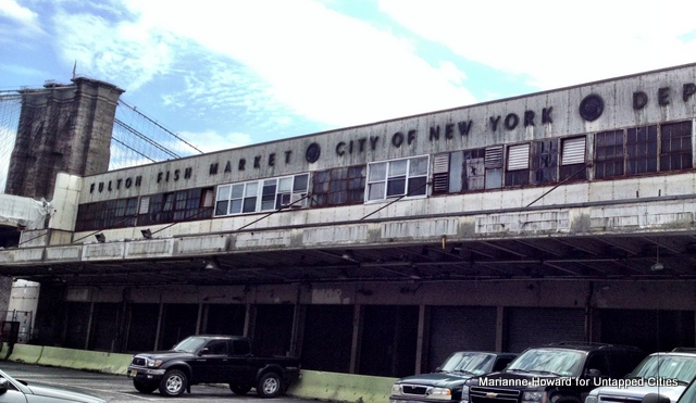
However, not everyone is on board with this plan. Local residents are concerned with the idea that a development corporation is not including the community’s own vision in its project. The coalition Save Our Seaport met with New York City Council Member Margaret Chin (Representative for Lower Manhattan, District 1) to introduce a plan to develop a Community Oversight Committee to the planning of the seaport area. Included in their plan is a goal to reactivate the Fulton Fish Market buildings, which have been vacant since 2005.
The Hughes corporation also has plans of building a 50-story tower by South Street Seaport. Another South Street Seaport task force has been meeting privately with the Howard Hughes Corporation for the past three months. This group consists of elected officials, community leaders, and representatives from the Howard Hughes Corporation.
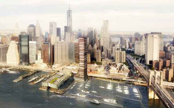 Proposed skyscraper at South Street Seaport
Last week, the Seaport Task Force Group officially opposed Hughes’ skyscraper because it was “too tall for the neighborhood.” They are pushing for the building to be shorter to keep with the neighborhood’s historic character and have demanded new open spaces along the waterfront, a revitalized South Street Seaport Museum, and improved walkways and bike paths. As Curbed previously noted however, the Howard Hughes plan “does include a marina, improvements to the East River Esplanade, and restoring the Tin Building.
One thing is for certain–the eastern coast of Lower Manhattan has been moved, restored, elaborated upon, but it still stands as a badge to the nautical history which powered the city hundreds of years ago. In a recent Metropolitan Waterfront Alliance conference, Jonathan Boulware, President of the South Street Seaport Museum pushed for the preservation of history at the seaport, which he spoke of as “truly at one point the front door to the United States of America.” In the debate about what should be done next, which side of the rope will you pull on?
For more on South Street Seaport, check out the history of nearby Maiden Lane and our coverage of the area’s development on our South Street Seaport tag.