Transit
Last Chance to Catch NYC's Holiday Notalgia Train
We met the voices of the NYC subway on our nostalgia ride this weekend!
We met the voices of the NYC subway on our nostalgia ride this weekend!

It was a first not just for NYC, but for the nation!

From midnight bike rides to morning cold plunges, discover alternative ways to ring in 2026!


Several street names are repeated throughout NYC–sometimes more than twice. Why is this? New York has amassed its size through the annexation of smaller towns, the streets of which were laid out and named in similar ways to those on Manhattan. In some cases, the names were intentionally repeated for clarity’s sake, even if that doesn’t quite make sense today. We decided to round up all these confusing repetitions in the hopes that taking Rockaway Parkway to Rockaway Boulevard to Rockaway Point Boulevard on the way to Rockaway Freeway will be less confusing when all you wanted was a nice day at the beach.

Bowling Green. Image via Library of Congress as seen in the book Broadway by Michelle Young
“Broadway” is one of the only street which appears in all five boroughs, along with Main Street. The most notable “Broadway” originates at a bull in Lower Manhattan before snaking its way 33 miles north to a small village by the name of Sleepy Hollow (yes, the one from the ghost story) in Westchester. But that Broadway is just one of five, and Brooklyn’s 4.5 mile thoroughfare of the same name notably carries the oldest section of rapid transit rail tracks in the city–the elevated BMT Jamaica Line (J-M-Z). This Broadway served as the dividing line between the old City of Brooklyn and the Town of Bushwick before the former annexed the latter in 1854.
Queens boasts two Broadways – the first a notable northwest-southeast thoroughfare from Ravenswood to Elmhurst. Most New Yorkers, though, probably have not heard of the other Broadway, which is a one-block suburban drive in Springfield Gardens near JFK Airport. And then, for symmetry’s sake, there’s a Broadway in Staten Island. It runs north-south along the border of Port Richmond and Randall Manor.
Order the book Broadway by Untapped Cities founder Michelle Young, filled with nearly 200 vintage photographs of the street in Manhattan.
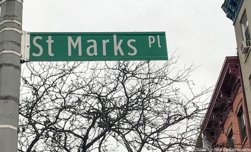
You have definitely heard of the East Village’s St. Mark’s Place. Named for St. Mark’s Church-on-the-Bowery, it runs east-west for three blocks on what is otherwise known as 8th Street. If you’ve lived in or frequented Brooklyn for some time, you probably know of its counterpart, spanning two blocks of Boerum Hill before morphing into St. Mark’s Avenue further east. But only a savvy New Yorker would know of St. George’s St. Mark’s Place, running along the escarpment a few blocks above the Staten Island Ferry terminal.
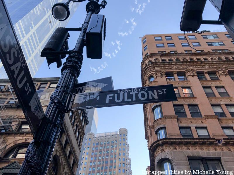
Though separated by a river so wide no physical crossing existed until 1883, the two Fulton Streets of Manhattan and Brooklyn share an etymological connection. Both are named in honor of inventor Robert Fulton, whose steamboat began to traverse the East River in 1807, linking Lower Manhattan to Fulton Landing in the Town of Brooklyn. Brooklyn’s original street survives today as Old Fulton Street and Cadman Plaza West before banking hard to the east and continuing as Fulton Street (originally, Ferry Road). Unintentionally, both Fultons today are most notably associated with mainstream retail, at South Street Seaport in Manhattan and Fulton Mall in Brooklyn.
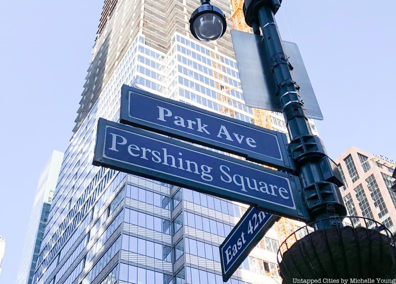
Though Manhattan’s Park Avenue has long been associated with high-end real estate and Corporate America’s elite, we urge you take a drive north of 96th Street through El Barrio. Here, you will find that the avenue has much more in common with the Park Avenue of Brooklyn, which runs through the not-so-scenic parts of Clinton Hill and Bedford-Stuyvesant. The two avenues bear wide unsightly medians to accommodate rail and road infrastructure like Metro North’s tracks in Manhattan, and the Brooklyn-Queens Expressway in Brooklyn. As a result, both avenues jarringly split their respective neighborhoods in two.
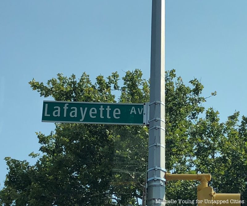
Don’t confuse Lafayette Avenue with Lafayette Street, the Manhattan north-south thoroughfare that features, among other things, the original home of the Blue Man Group at Astor Place Theater. Brooklyn’s Lafayette is both a commercial and high-end residential corridor in Fort Greene, Clinton Hill, and Bedford-Stuyvesant, with abundant green space and all the other lovely things that make a neighborhood “genrtifyable.” Likewise, Lafayette Avenue of the South Bronx won’t be seeing much redevelopment any time soon, though it does boast cozy multi-family homes and detached houses.
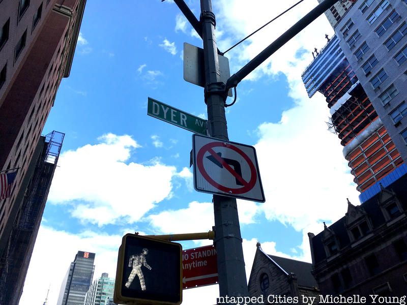
In this rare scenario of reversed borough fortunes, Dyre Avenue of the Bronx is longer, more prominent, and more well-known than its homonym, Dyer Avenue of Manhattan. The Bronx version carries an eponymous Subway line of the former IRT and is known as a commercial spine for the Eastchester neighborhood. Manhattan’s Dyer Avenue is nothing more than a glorified three-block extension of the Lincoln Tunnel‘s entrance ramp. Things only get more dire for this Dyer, as it is so short that it hosts no building addresses.
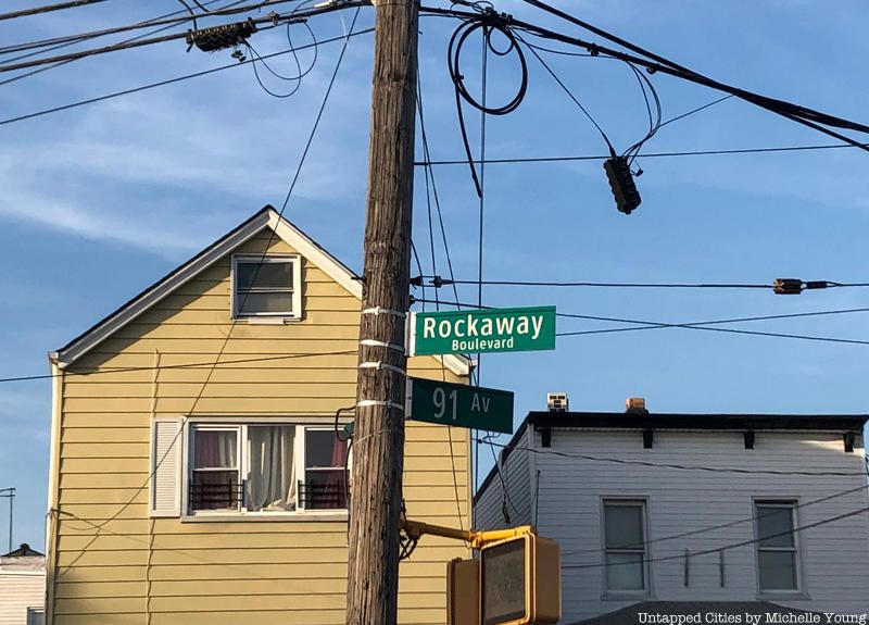
Technically, the given name “Rockaway” is never succeeded by an identical suffix, unlike all of the other streets on this list. Nevertheless, a ride through the southern neighborhoods of Brooklyn and Queens will yield a seemingly endless array of “Rockaways,” including Rockaway Parkway (Canarsie), Rockaway Freeway (Bayswater), Rockaway Point Boulevard (Breezy Point), Rockaway Beach Boulevard (Belle Harbor), and just plan old Rockaway Boulevard (Ozone Park) and Avenue (Brownsville). It remains unclear which “Rockaway” can truly claim to be the elder statesmen, but Rockaway Beach Boulevard was undisputedly the first major road to service the Rockaway Peninsula, dating to 1886.
It doesn’t help that even within boroughs, numbers will be granted to streets that intersect, placing NYC in an especially unique place when it comes to depending on suffixes (street, avenue, etc.) for clarity. Generally speaking, there are nine major numbered schemes, two of the most famous are the east-west streets and the north-south avenues of Manhattan’s Grid Plan. This plan was extended north after New York County annexed the lands of Westchester County in 1874 and 1895, creating The Bronx. This designation scheme became so popular that Brooklyn and Queens adopted similar patterns.
While Brooklyn’s plan follows the same directional orientation as that of Manhattan, Queens reverses the scheme, so avenues run east-west to the dizzying number of 149. To a Manhattanite, this total is madness. The two lesser-known number schemes are in Williamsburg and the Rockaways. The old city of Williamsburg numbers its east-west streets as North or South relative to Metropolitan Avenue. The north-south streets of the Rockaways are all listed with the prefix “Beach,” numbers 2 through 25 not forming anything close to a rational grid (and there is no “Beach 1st Street”). These extend across the peninsula to number 249, which means there are more “Beach” numbered streets than there are numbered streets of the iconic Manhattan Grid Plan.
Learn more about the history of NYC streets here, and get in touch with the author on his website and @thisisnotreale.

Subscribe to our newsletter