


As part of the Open House New York Weekend, on Saturday, October 11th Manhattan Borough President Gale Brewer will offer the public an exclusive look at a series of original maps housed in the Municipal Building at 1 Centre Street. Highlights will include the 1811 Commissioners’ Plan and the Randel Farm Maps, two snapshots of the history of the development of Manhattan’s streets as we know them today.
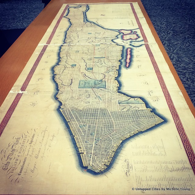
In 1807, the New York State Legislature appointed a special committee to create a proposed blueprint for the region above 23rd Street, made up at that time of forests and family estates. The result was an orderly grid that rejected the narrow and often confusing streets of downtown Manhattan, and put forth a network of 2000 blocks that reached all the way to 155th Street, which they left untouched to allow “space for a greater population.” Untapped Cities founder Michelle Young dives deeper into the quirks of this map in 14 Fun Facts About the Original 1811 Commissioners’ Plan for NYC.
The maps of the secretary, surveyor, and chief engineer for New York City’s commissioners, John Randel Jr. will be highlighted as well. From 1807 – 1811, this man surveyed the area of Manhattan by foot measuring elevations, recording property ownership, and marking streets that informed the grids for the 1811 Commissioner’s Plan. He was the real hero of the project, encountering strong resistance from those who didn’t like having their land trespassed on. Years later, Randel recalled that during his work he had been arrested, attacked by dogs, and even barraged by vegetables by a street vendor. You can read more about his struggles in this New York Times article.
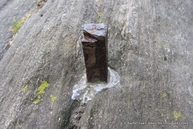 Bolt put in by John Randel, now Central Park.
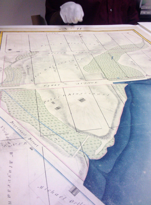
Guests of the OHNY event will also have access to original copies of John Randel’s Farm Maps. These painstakingly hand-drawn and colored maps document the areas of Manhattan as they were originally in the 1810s, before construction of Manhattan’s new grid began. Untapped Cities contributor Judy Chang gives an exclusive look at these fascinating maps here.
 An image of John Randel’s Farm Maps, Image via Judy Chang
The Map Display will take place on Saturday, October 11th at the Municipal Building at 1 Centre Street as part of Open House New York’s weekend program. Check OHNY’s website on September 30th for the official program. Online registration for events will begin at 11 am on October 1st.
Untapped Cities is all about documenting fascinating and fun New York City maps! Check out our some of our coverage here.
Have a city map you’d love to share? Get at Anna Brown using her Twitter handle @brooklynbonanza!