


“…each block is covered with several layers of phantom architecture in the form of past occupancies, aborted projects and popular fantasies that provide alternative images to the New York that exists.”
A map tool that opens with a quote from Rem Koolhaas’ Delirious New York? How could we resist? Urban Layers by Morphocode allows you to trace the building history of New York City starting in 1765–with an added bonus of using up-to-date mapping tools like Mapbox to make everything look pretty and open source data like PLUTO and NYC Building Footprints. Those of us in the urban planning world use these data sets frequently, but this is a wonderful and fun way to introduce the general public to it.
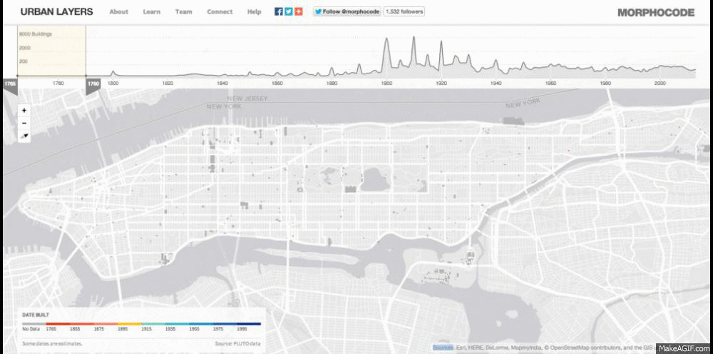
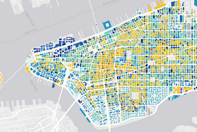
You just have to drag the timeline scale left and right to get to different date ranges. Though this doesn’t show the mix of building age within an area, it clearly demonstrates which points in time there was a building boom. For example, 1880 to 1915 (shown in yellow) was the dawn of the skyscraper age. The images below are a composites of all the years.
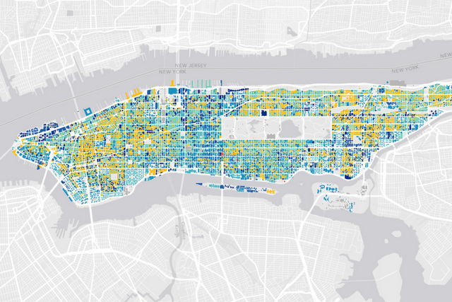
To show all of New York City, there would be over 1 million buildings, which according to Morphocode “proved to be too much to display at once.” Looking at just Manhattan gave them 45,968 buildings. Nonetheless, there are definitely inaccuracies in the data, which Morphocode admits: “The ‘year built’ data is not entirely accurate. Some of the dates are estimates. There are also dates that seem to be wrong.” This is for sure something we’ve experienced ourselves when using ZoLa and other NYC data tools.
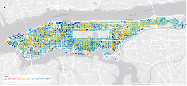
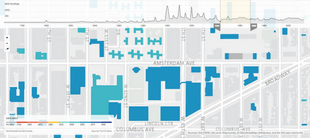
Zoom in to find a specific neighborhood. Here we looked at Lincoln Center area whose building footprints are all from the 1940s and later with the construction of Lincoln Center and Amsterdam Houses after the demolition of the San Juan Hill neighborhood.
Head over to Urban Layers for some historical map fun! Check out more Fun Maps here.