


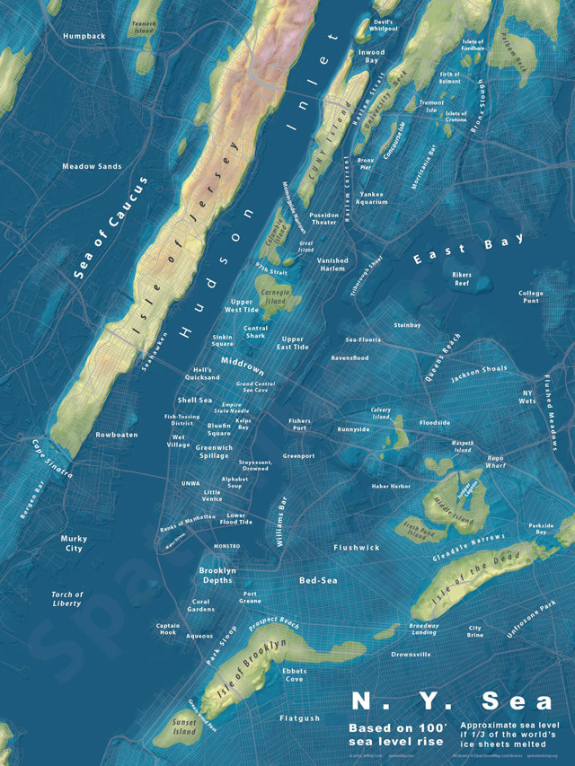
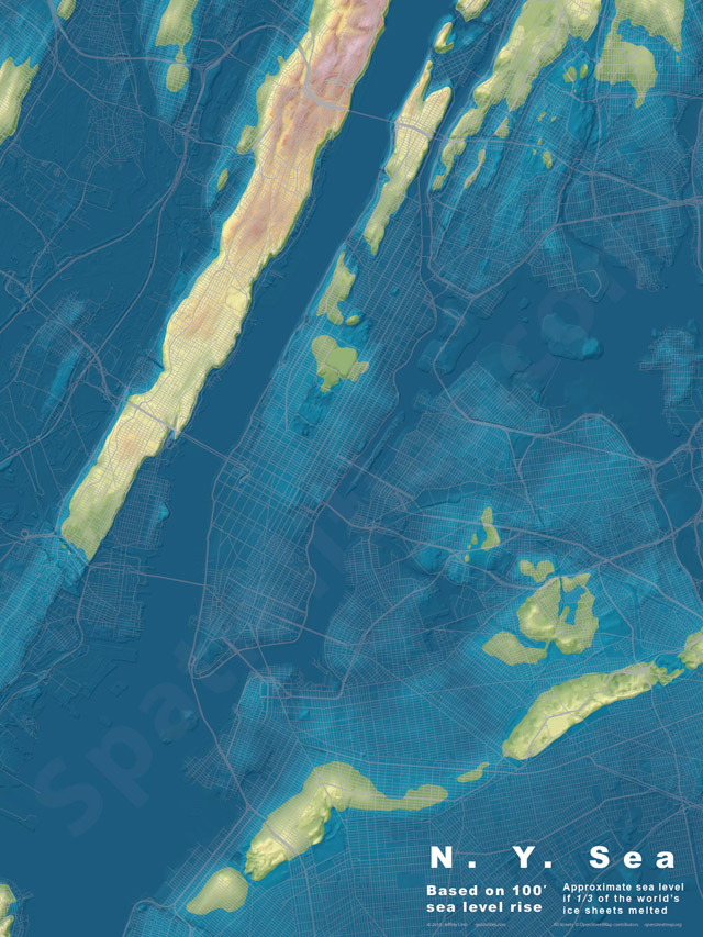
We’ve had a slew of (not so) Fun Maps on Untapped Cities recently, like the map of subway bacteria from all of NYC’s stations (yum). Well, here is a look at New York City, should sea levels rise 100 feet. It’s been called a “doomsday scenario” by Business Insider, who broke news of the maps, but the maps themselves have a “Judgmental Maps”-like quality to them. What’s clear is that 1. Mapmaker Jeffrey Linn from Seattle loves puns and 2. Most of Manhattan, Brooklyn, Queens and the Bronx would be underwater. 3. Staten Island doesn’t count as part of New York City apparently.
These maps show a scenario where 1/3 of the world’s ice sheets have melted. The real worst-case scenario is about 260 feet, according to the United State Geological Survey. Linn, an urban planner, has been posting these maps, and other cities, on his website Spatialities.
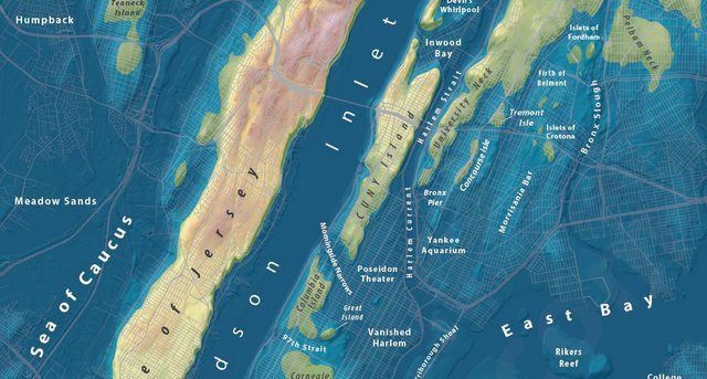
Puns here range from “Sea of Caucus,” “97th Strait,” “Port Greene,” to “Flushwick,” and many many more.

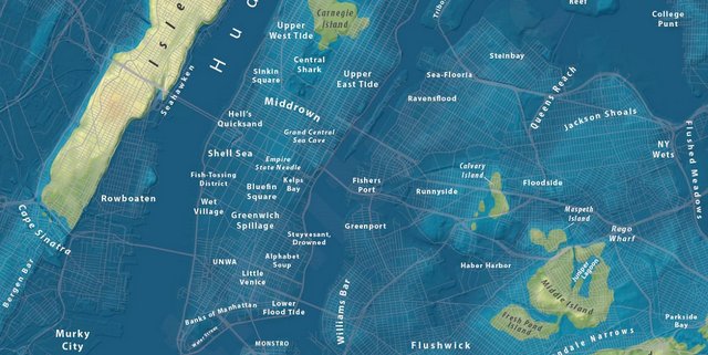
Here’s a nice view without the names:
See what the NYC subway system could look like in a 40-inch snow storm. See more maps in our Fun Maps Column.