Rediscovering WPA Poster Art of the National Parks with Ranger Doug
Join "Ranger of the Lost Art" Doug Leen for a virtual book talk about preserving the lost 1930s art of America's National Parks!


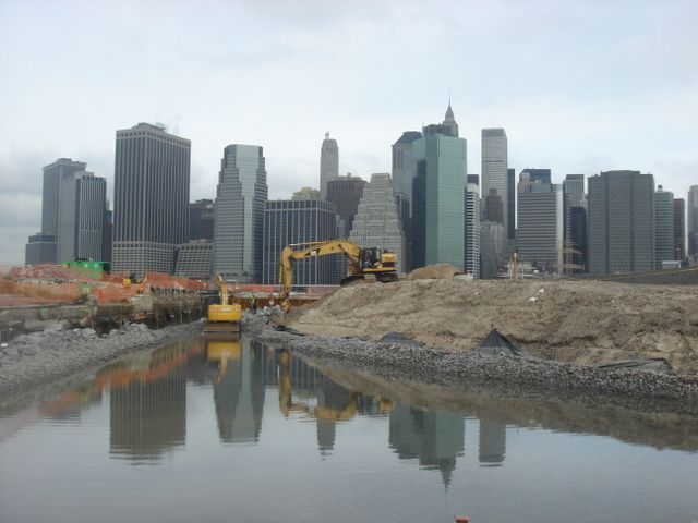
Brooklyn Bridge Park Salt Marsh before, photo by Julienne Schaer
With all the activity along Brooklyn Bridge Park these days, it can be hard for visitors (and even some newer residents) to recall what the New York City waterfront looked like even just a decade ago. After all, it was only in 2011 that the city’s comprehensive waterfront plan, Vision: 2020 was passed. But this document was a culmination of various waterfront redevelopment projects already in place, some from the mid 1980s, a manifestation of both grassroots and governmental push to rethink New York City’s “last borough.”
March 10th, 2015 will mark the 5th anniversary of the popular Brooklyn Bridge Park and the organization has shared with Untapped Cities before and after photographs of the piers and greenway, a reminder of how the changes that have come to this area of Brooklyn. The captions are written by Maureen Lynch, Communications Manager for Brooklyn Bridge Park.
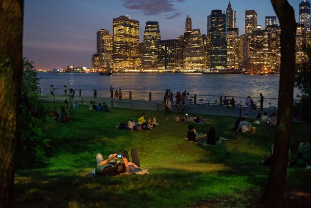
Pier 1 after, photo by Julienne Schaer
Pier 1 is the largest of the park’s piers. The first section opened in March 2010 and features waterfront promenades, lawns, a playground and the Granite Prospect. An additional 5 acres opened in summer 2010 including a boat ramp and terraced freshwater gardens. Pier 1’s three lawns provide a great open space and are often the location for many of the park’s free events and public art installations.
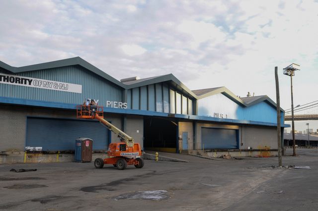
Pier 1 before, photo by Julienne Schaer
Pier 1 is landscaped with dense and diverse plantings that were chosen to stand up to the East River’s harsh climate. A tidal salt marsh at the southern end of Pier 1 creates a haven for sea life and marine birds. Freshwater gardens naturally filter rainfall before collection in the park’s stormwater retention tanks. The design also re-uses clean fill from the MTA’s East Side Access project in the creation of new landforms on Pier 1.
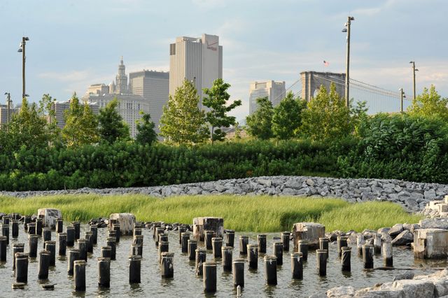
Salt March after, photo by Julienne Schaer
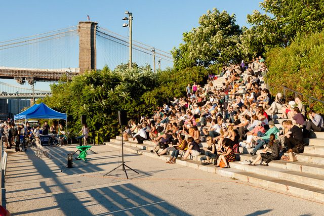
Granite Prospect after, photo by Etienne Frossard
The Granite Prospect is a dramatic set of steps along the western edge of the pier built from granite salvaged from the Roosevelt Island Bridge reconstruction.
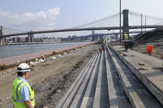
Granite Prospect before, photo by Julienne Schaer
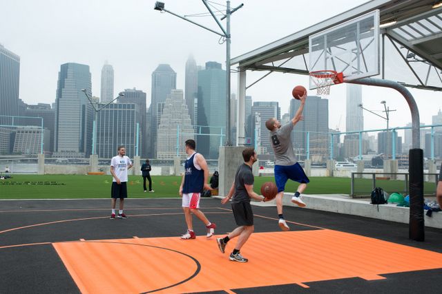
Pier 2 after, photo by Julienne Schaer
Pier 2 is approximately 5 acres and is the park’s second pier dedicated to active recreation. The space features courts for basketball, handball, shuffleboard, and bocce, as well as a full size roller rink, swings, picnic tables, fitness equipment, half an acre of play turf and restrooms. Portions of the original storage shed structure were selectively retained to provide shading and shelter from the rain.
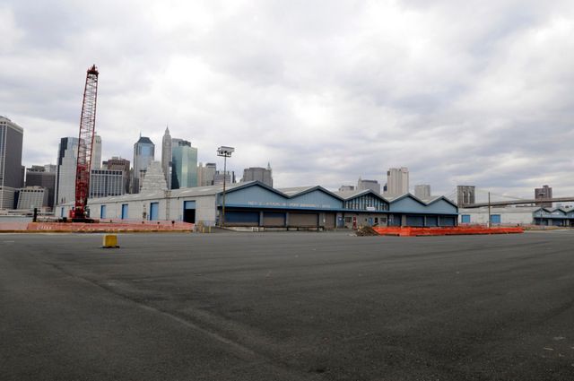
Pier 2 before, photo by Julienne Schaer
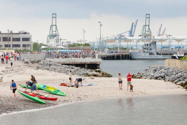
Pier 4 Beach after, photo by Etienne Frossard
Built from the remnant of a railroad float transfer bridge that has settled on the river bed, Pier 4 Beach is planted with native species to assist its ongoing evolution as a protected habitat preserve. The design incorporates structures designed by ECOncrete to mimic natural tidal pools typically found along rocky coasts. Some of these pools are accessible to visitors providing an interactive demonstration of the diversity of park habitats for marine animals and plant life.
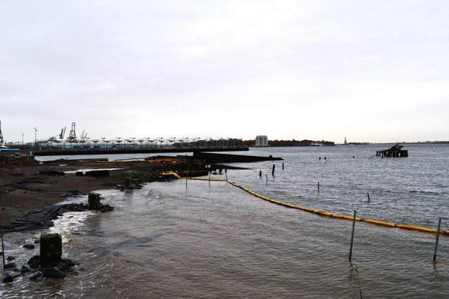
Pier 4 Beach before, photo by BBP
Offshore from the beach is Bird Island, an inaccessible nature preserve. Bird Island is planted with a variety of salt-tolerant shrubs, grasses and trees to encourage the growth of a diverse ecology. An Osprey platform has been installed to attract large fishing birds.
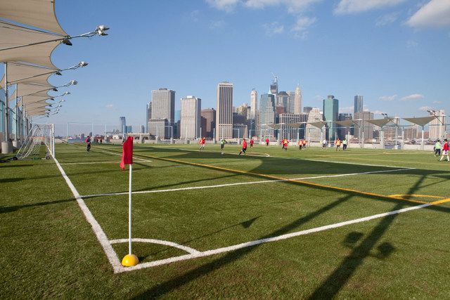
Pier 5 after, photo by Alexa Hoyer
Pier 5 is the Park’s first space dedicated to active recreation. The 650-foot-long pier features playing fields capable of several configurations to adapt to soccer, lacrosse, rugby, flag football and ultimate Frisbee. Players and spectators can watch games from bleachers and benches along the sidelines. At Picnic Peninsula, visitors can sit at our banquet-length picnic tables made of salvaged wood and barbeque using one of our many grills.
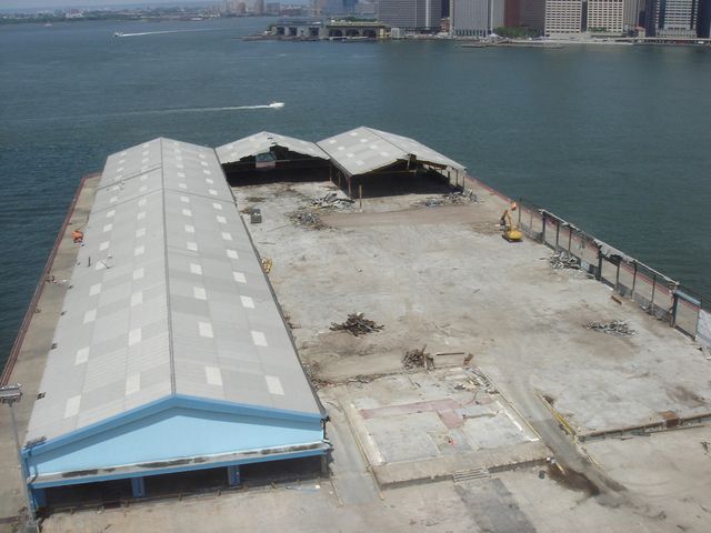
Pier 5 before, photo by Julienne Schaer
The Pier also features a 30-foot wide promenade surrounding the fields, offering a unique opportunity for visitors to take in the magnificent views of New York Harbor. An area for fishing equipped with bait preparation tables and fish cleaning stations is located at the western edge of the pier. Two playgrounds and a concession (Ample Hills Creamery) are also located at the foot of the pier.
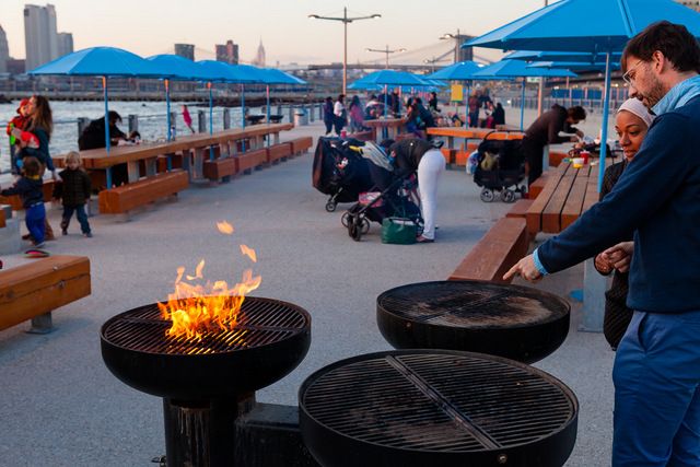
Pier 5 after, photo by Etienne Frossard
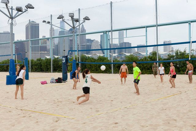
Pier 6 after, photo by Etienne Frossard
Seven acres opened in June 2010 including a 1.6-acre destination playground featuring Slide Mountain, Swing Valley, the Water Lab, Sandbox Village, the Exploratory Marsh, as well as dog run. In May 2011 an expanded section of the pier opened featuring sand volleyball courts, a concession building, lawns and pathways. Pier 6 also features a seasonal ferry to Governors Island.
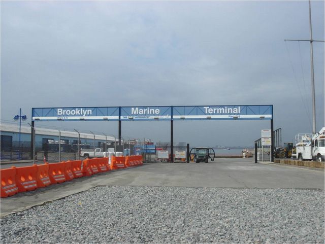
Pier 6 before, photo by Julienne Schaer
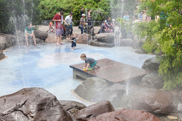
Pier 6 after, photo by Etienne Frossard
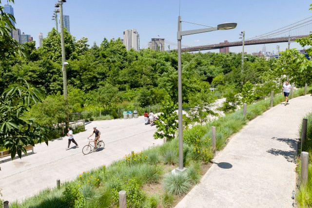
Greenway after, photo by Etienne Frossard
The park’s greenway embodies a major connective thread through the park and along Brooklyn’s East River waterfront. This shared pedestrian and bicycle pathway is an important link in the 14-mile Brooklyn Waterfront Greenway, which stretches from Sunset Park to Greenpoint. The park’s greenway allows visitors to traverse the waterfront via a safe, off-street and scenic thoroughfare.
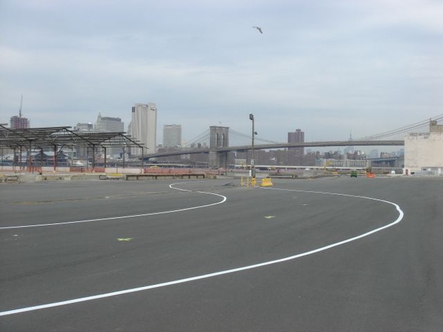
Greenway before, photo by Etienne Frossard
Read on for the Top 10 Secrets of Central Park.
Subscribe to our newsletter