

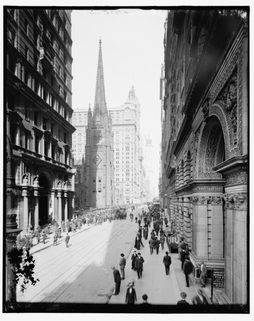
 Lower Broadway c. 1908-1913. Image via Library of Congress as seen in the book Broadway by Michelle Young
Here at Untapped Cities, we have a soft spot for vintage photographs–and not just for the nostalgic aspect. It’s also because what earlier photographers chose to document and what they chose to leave out give weight to the importance of certain moments in history and the consequence of the buildings that awed their aesthetic sensibilities. Releasing next week is the new book Broadway by Untapped Cities founder Michelle Young about the history of Broadway as a street in New York City. Reproduced below is a modified excerpt from the forthcoming publication.
The history of Broadway, from its origins as a Native American trail to its iconic status in global culture today, tells the story of the city of New York as it grew from a Dutch colony into a world class metropolis. Broadway has been the site of many firsts and many superlatives: the first subway line in the city, the tallest buildings, and one of the longest streets in the world.
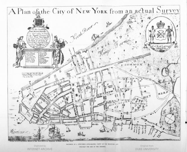 The Bradford Map, first map of NYC printed within the municipality from 1730. As seen in the book Broadway by Michelle Young. Map from New York Public Library.
As a thoroughfare, Broadway can be traced back to the Native American Wickquasgeck Trail that was carved through the bush of Mannahatta. It became one of the two main streets formed during the settlement of the Dutch West India Company. Known at the time as de Heere Straat, or “Gentlemen’s Street,” Broadway originated at Fort Amsterdam and followed a natural ridge of land that led northwards through the fields and farms of New Amsterdam. De Heere Straat extended to the wall that protected the Dutch colonists from English encroachment along present-day Wall Street. First constructed as a simple a picket fence in 1653, the wall developed into a twelve-foot fortification. There were only two entry gates, with one situated on de Heere Straat opposite Trinity Church.
Under the English, New Amsterdam was renamed New York, after the Duke of York, brother to King Charles II. Fort Amsterdam, located at the foot of Broadway, was renamed Fort James. The fort and environs became the center of political and social life in the new colony, and it is not surprising that the first meeting to protest the 1765 Stamp Act took place at Burn’s Coffee House on Broadway opposite Bowling Green.
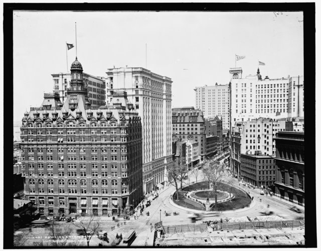 Bowling Green. Image via Library of Congress as seen in the book Broadway by Michelle Young
Bowling Green has had many lives, even prior to its designation as the first public park in New York City. It was a parade ground, a cattle market, a public gathering place and a political meeting point. It can be hard to imagine today a singular space used for bonfires and for the signing of war treaties, but such was this public space at the beginning of Broadway.
The city’s first government institutions were also located at Bowling Green following the Revolutionary War, but as the city moved northwards, so did the various political, commercial and cultural institutions. Even the city’s pleasure gardens—19th century entertainment venues—would move to wherever the new outer boundary of settlement would be at the time.
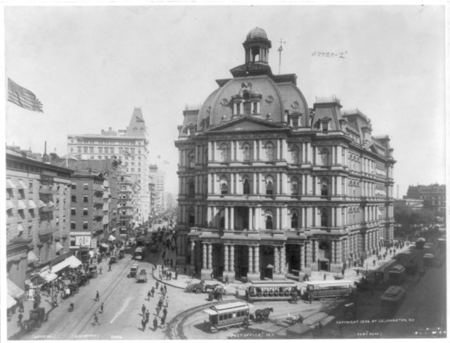 The former City Hall Post Office, nicknamed Mullet’s Monstrosity, was widely disliked. Built in 1869, demolished 1939. Image via Library of Congress as seen in the book Broadway by Michelle Young.
Throughout history, Broadway has been at the forefront of the city’s urban developments. Downtown, the street was a testing ground for the new, soaring skyscrapers. By City Hall, the architecture reflected both the aspiration and corruption of a young nation defining its legacy. The angle of Broadway against the gridiron streets enabled the formation of public spaces that served as meeting grounds for the country’s social movements. New York City’s theater tradition originated further downtown than the area that made it famous, but the theaters were always densely situated around Broadway. The Interborough Rapid Transit, the city’s first subway line, opened in 1904 and ran predominantly along Broadway and solidified the importance of the street in future development.
Purchase the book on Amazon.
Stay tuned for more articles featuring Michelle’s favorite photographs from the book, which include historical images sourced from the Library of Congress, New York Public Library and National Archives, as well as contemporary photographs of Broadway today.