✨You Can Touch the Times Square New Year's Eve Ball!
Find out how you can take home a piece of the old New Year's Eve ball!


Whether you’ve made the trek from New York City to the Hamptons and Montauk, to the North Fork wineries or perhaps to the Revolutionary War spy town of Setauket, you’ve likely either sat on a crowded Long Island Railroad train or been in bumper-to-bumper traffic on the Long Island Expressway. A water alternative, The Sea Jitney (operated by Seastreak and Hampton Jitney), has just opened, bringing passengers from East 35th Street in Manhattan to Port Jefferson, from where you can either explore the historic area or board a Hampton Jitney that goes to Southampton, East Hampton, Sag Harbor and Calverton.
We recently took a ride to the ferry’s ribbon cutting ceremony and we realized the best part of the ride, in addition to be just under two hours, is what you get to see going in and out of Manhattan. One after another, “untapped” gems from abandoned islands to notable lighthouses passed into view. Here’s a preview of what you’ll see:
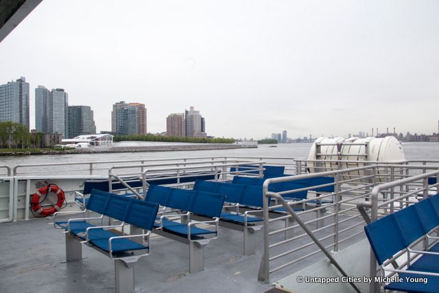
As the Seastreak heads north (at what felt like breakneck speeds compared to the usual speed of the leisurely boat arounds around Manhattan), you’ll see FDR Four Freedoms Park, the monument to Franklin D. Roosevelt finally completed forty years after initial plans began. Next to it is the city’s only landmarked ruin, the smallpox hospital designed by James A. Renwick.
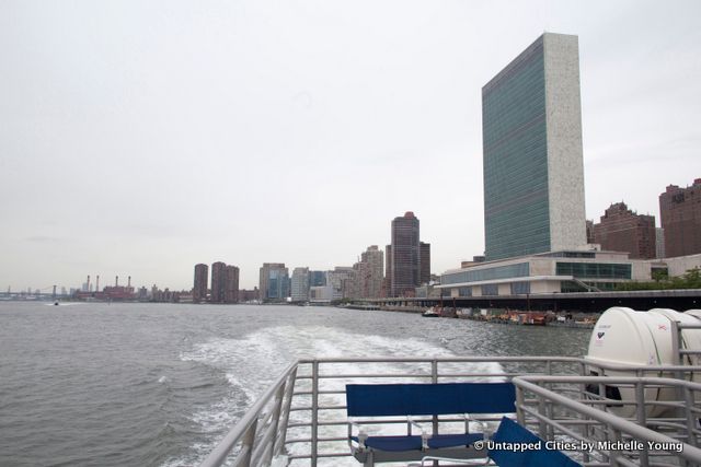
Across the way, you’ll also see the newly renovated United Nations Building, with its Mad Men-era interiors.
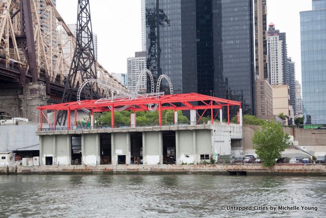
As you pass under the Queensboro Bridge, you’ll see what looks to be the remnant of a roller coaster of sorts. It’s actual the remnant of a 1994 art installation by Alice Aycock (who did last year’s Park Avenue Paper Chase sculptures), who was commissioned to turn an unused sanitation facility into a public plaza. East River Roundabout has recently received a fresh coat of bright red paint, hopefully the sign of future rehabilitation.

Abandoned North Brother Island may be one of the most elusive places in New York City–unlike other abandoned places, the former Riverside Hospital complex will likely remain in a fairly raw state for the near future because it’s now a protected bird sanctuary. But as photographs from urban explorers show, trails from the New York City Parks department leave evidence that no place in New York City is truly abandoned.
From the Seastreak ferry to Port Jefferson (which operates only during the summer months), North Brother Island will pass within a stone’s throw to the west where the brick tuberculosis hospital and other abandoned buildings can be seen emerging from the thick brush.
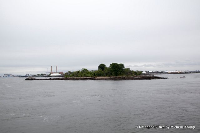
Across the way, within view of Rikers Island is South Brother Island. Both North Brother and South Brother were originally part of the Dutch West India Company, and from then until now, the two islands have always been etymologically connected to each other. The Dutch called them De Gesellen, which means “the companions.” Amazingly, South Brother Island was privately owned (over the years by several owners and development companies) until 2007 when it became a wildlife sanctuary. Another fun fact: it was part of Queens until 1964, when it was became part of the Bronx jurisdiction.

Rikers Island prison makes an impressive mark on the landscape. It’s one of the world’s largest correctional facilities and has been ripe with controversy. We spent time working in Rikers Island prison a few years ago–you can read about that experience here.
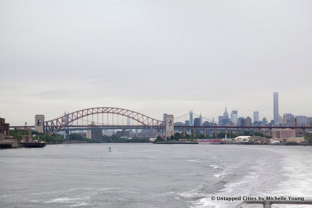
When you pass Hell Gate Bridge, you start to get stunning panoramic views of the New York City skyline with buildings like the Empire State Building, Chrysler Building and 432 Park Avenue coming into view. The name Hell Gate comes from the Dutch “Hellegat,” which refers to the dangerous waters in this area of the East River. The same architects that built the Queensboro Bridge, Henry Hornbostel and engineer Gustav Lindenthal built this one, and were acclaimed for achieving the sheer size of the bridge. According to NYC Parks, the elements “were considered almost excessive for the time.”
See photographs from an urban exploration onto the Hell Gate Bridge.
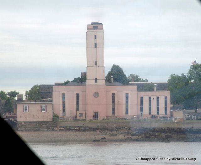
At Fort Schuyler, under the Throgs Neck Bridge is this Art Moderne building, a maintenance facility.
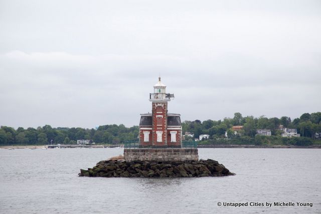
This is probably one of the most adorable lighthouses we’ve ever seen. The Stepping Stones lighthouse, brick with a mansard roof was built in 1875. 900 tons of boulders were brought by barge to form the foundation. In 2006, the lighthouse was deemed “excess” and the Town of Hempstead gained ownership of the lighthouse from the National Park Service. In 2014, a public-private partnership between Hempstead, Great Neck Park District and the Great Neck Historical Society was formed to save the lighthouse. The City Island Maritime Museum has also supported the preservation effort, and roof repairs have already been completed.
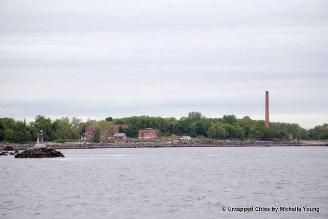
Located in the western Long Island Sound, Hart Island lies in close proximity to the Bronx–yet it is often unheard and unspoken of. The island doesn’t appear on the MTA Subway Map or the Department of Transportation’s bicycle map. The 101-acre island serves as a separate burial ground, the city’s last potter’s field, for those who are either unclaimed or whose families couldn’t afford a funeral. The island is uninhabited today, but more than 800,000 dead has been buried there since 1869, making it the largest tax-funded cemetery in the world.
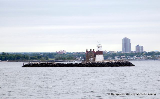
Just past Hart Island and Stepping Stones Lighthouse is Execution Rocks (where we’re taking readers on an Untapped Cities tour to this Saturday!). ccording to popular lore (and still claimed by the Travel Channel), Execution Rocks was named because of the executions that took place there under the British authorities before the American Revolution, who chained prisoners to the rocks at low tide to be drowned. There is no historical evidence that this is true, though a serial killer claimed to have done some of his macabre deeds near the island in 1920. The official history of the island’s naming refers to the dangerous passage for ships around the rocks at low tide.
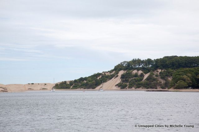
For the rest of the Seastreak ride, you’ll see the beautiful Gold Coast of Long Island. The areas of Manhassett and Great Neck form the setting of The Great Gatsby, and all along the way you’ll see historic and modern mansions dotting the coast.
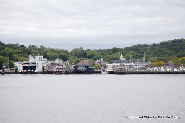
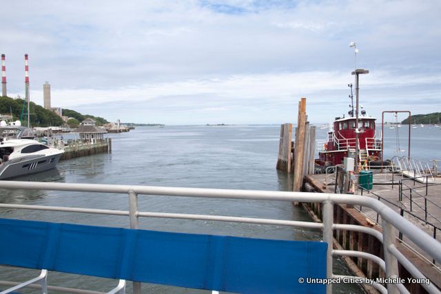
The ferry brings you to the waterfront town of Port Jefferson, where the Seastreak shares a ferry slip with the Bridgeport-Port Jefferson ferry. With a quaint Main Street, seafood restaurants and more, the area is a great day trip.

Roe Tavern in Setauket
The towns next door, Setauket and Stony Brook, date back to the Revolutionary War era and were featured in the AMC TV show TURN about the original spy ring.
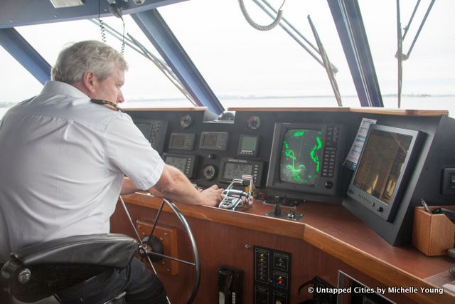
On the rest of the trip, we were given a glimpse of the captain bridge area where he commands the ship:
The tug boats that are ready for the boats and ferries coming into Port Jefferson:
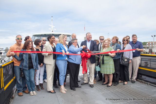
The ribbon cutting ceremony to launch the new Seastreak ferry service:
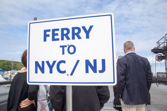
The ferry heads back to New York City:
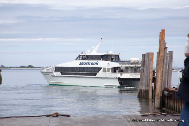
Get tickets to the Seastreak service from NYC to Long Island here. The Seastreak also has service between New Jersey (Jersey City, Hoboken and Sandy Hook) and New York City, to Martha’s Vineyard and Nantucket. Full schedule here.
Subscribe to our newsletter