
Things to Do
Alexander Hamilton's NYC Tour
You know the musical. Now see what it left out. Walk in the footsteps of Alexander Hamilton on a tour of Lower Manhattan.


New York City has some of the best drinking water in the country, but it didn’t come without a price. Most are familiar with the Croton Aqueduct, the first to bring fresh water to the city in 1842–updated in 1890. The Catskill Aqueduct was next (a push after Brooklyn was incorporated into the City of New York), built between 1917 and 1924, bringing 40% of New York City’s water from a series of reservoirs 163 miles from upstate New York. What New Yorkers may not know is that the six reservoirs of the Catskill Aqueduct, including Ashokan Reservoir which is New York City’s largest, were formed by flooding a dozen towns.
The plan for the Catskill Aqueduct began in 1905 when the New York City Board of Water Supply was formed, allowing for the acquisition of property by eminent domain and the construction of dams, reservoirs and and aqueducts. The area in question was formerly a farming area, with logging activity as well as the quarrying of bluestone, some of which ended up on the Brooklyn Bridge.
2000 people were relocated, including a thousand New Yorkers with second homes. 32 cemeteries were unearthed and the 1,800 residents buried elsewhere, to limit water contamination. Residents were offered $15 from the city ($65 later for the Delaware Aqueduct) to disinter their relatives and rebury them elsewhere.
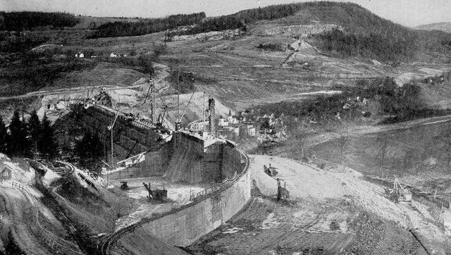
Construction of the Ashokan Reservoir in 1910. Image from New York City Department of Environmental Protection
Buildings and industries were relocated or burned down, trees and brush were removed from the future reservoir floor–all the work done predominantly by local laborers, African-Americans from the south and Italian immigrants. To control the fighting that arose between labor groups, a police force which became the New York City Department of Environmental Protection (NYCDEP) Police, was created.
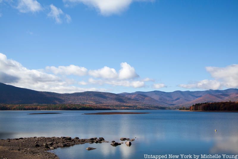
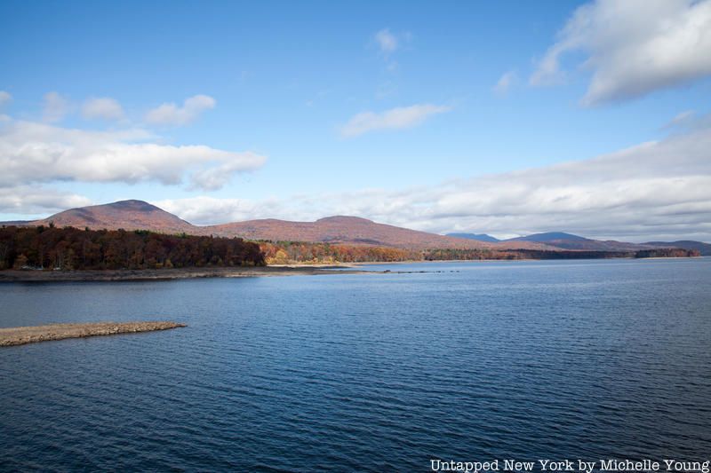
The Ashokan Reservoir today
In sum, four towns were submerged while eight were relocated to build the Ashokan Reservoir. When the dam was completed, steam whistles were blown for an hour warning residents that the water was coming. Today, remnants of foundations, walls, and more can still be seen, particularly when water levels are lower–often in the fall. Although access to the reservoirs has been limited since 9/11, you can see some of those archeological finds from bridges. You can also hike and bike along a ridge of the reservoir.
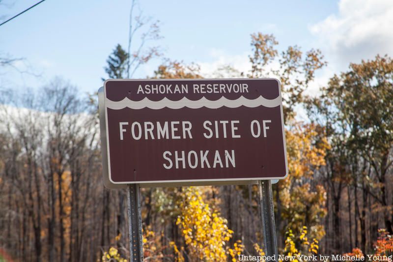
The last of the eminent domain lawsuits in the Ashkoan Reservoir area was not settled in 1940 and it was not until 2002 that New York City made any moves to acknowledge the history in the Esopus Valley. The NYCDEP installed an outdoor exhibition in Olive, New York that commemorated the lost towns and the feat of the aqueduct itself, with the intention to add exhibits at five other reservoirs (although we were not able to find that the exhibition or any others are still available). Signage now shows the sites of the former towns.
The Delaware Aqueduct is the most recent of the city’s aqueducts and its story is similar to the Catskill Aqueduct–the Pepacton Reservoir (aka the Downsville Reservoir or the Downsville Dam) was formed by not only flooding four towns, but also submerging half of the existing Delaware and Northern Railroad. This reservoir provides 25% of the city’s drinking water, and combined the Catskill and Delaware Aqueduct provides 90% of the city’s water.
In total, the construction of these reservoirs and aqueducts resulted in the destruction of 25 communities and the relocation of 5,500 people across five New York State counties. Something to think about the next time you run the tap in New York City.
Next, track down remnants of the original Croton Aqueduct in New York City. For an in-depth look at the story of New York City’s drinking water, have a look at Empire of Water: An Environmental and Political History of the New York City Water Supply. Get in touch with the author of this article @untappedmich.

Subscribe to our free newsletters
Free Newsletters
Get the best stories and things to do sent straight to your inbox.