


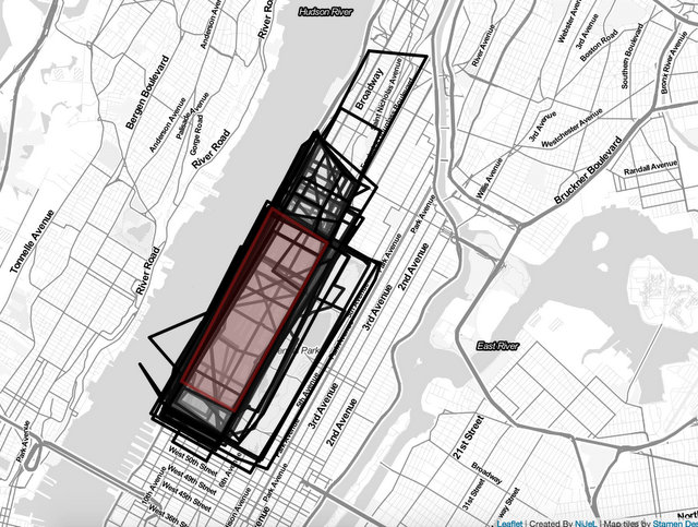
 Our interpretation of the Upper West Side (in red)
New Yorkers are having a field day with this data visualization tool from DNA Info, drawing where they believe are the boundaries of their New York City neighborhoods. Urban planners will know well the struggle with the shifting delimitation of boundaries, having to line up data sets between information from the Census, Community Districts and more. And none of this takes into account resident’s psychological understanding of neighborhood edges, or real estate creativity in concocting new neighborhoods.
After you draw the boundaries of your neighborhood, you’ll see what other people have drawn. Then, separately, you can compare it to the NYC Neighborhoods Map on NYC.gov, or the Neighborhood Tabulation Areas from the NYC Census blocks (which may vary slightly from the Community District map). According to the NYC Department of City Planning, there aren’t any official borders.
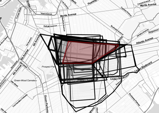 Untapped Cities staffer who just moved to Crown Heights makes a newbie attempts
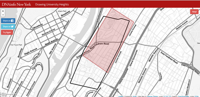 Here’s our addition to University Heights in the Bronx, with only one previous attempt
Next, check out more from our Fun Maps column.