Turtle Bay: the home of the United Nations, secret waterfalls, ornate mansions, and slaughterhouse history. Located east of Lexington Avenue from East 43rd to East 53rd Streets, the neighborhood houses the Chrysler Building and dozens of UN missions, making it one of the borough’s most diverse neighborhoods. However, Turtle Bay wasn’t always the diplomatic powerhouse it is today; just a century ago, the area was filled with breweries and factories that pushed away many wealthier residents to other neighborhoods. Today, Turtle Bay features secrets on every block, from odd architectural gems to historic residences to just about every country’s flag blowing in the wind. Here are the top 16 secrets of Turtle Bay, Manhattan!
1. The United Nations has a subterranean complex, a piece of the Berlin Wall, and formerly a private apartment
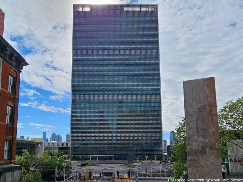
The United Nations, perhaps the defining feature of Turtle Bay, houses many secrets behind its rather heavily guarded boundaries. For instance, the United Nations has a massive subterranean complex only accessible to delegates and staff. Offices, a gym, maintenance, and storage facilities are found on levels below what most people consider the “basement.” There is also a parking lot for UN vehicles and diplomatic cars on these lower levels. These levels (and the entire building) are technically in international territory and not in New York City. Additionally, the UN used to have a private apartment for the Secretary-General on the 38th floor of the Secretariat Building. Photos from the 1950s show a living room with large windows spanning the width of the room, a modest kitchen and bathroom, and a single bed in the bedroom.
Also hidden in plain site is a piece of the Berlin Wall, one of five sections located in New York. A Berlin Wall piece, which used to be at Potsdamer Platz, stands in the United Nations Sculpture Garden. It was gifted from Germany in 2002, presented by then-President of the German Bundestag, Wolfgang Thierse to then-UN Secretary-General Kofi Annan. The side facing the East River, “Trophy of Civil Rights,” depicts two people reaching over the top of the wall in an embrace. The other side of the wall, facing 1st Avenue, is a graffiti work made by German artist Kani Alavi, who has painted other sections along the wall’s East Side Gallery.
2. The Chrysler Building used to have apartments, a car showroom, and a speakeasy
The Chrysler Building, technically within the borders of Turtle Bay to the east of Lexington Avenue, is an Art Deco masterpiece and defining feature of the city skyline that hides rather surprising features that have mostly been forgotten. On the 66th to 68th floors of the Chrysler Building, there was once a venue called The Cloud Club. This space was initially designed for executives of the oil company Texaco, which occupied 14 floors of the building. The Cloud Club restaurant had Futurist, Tudor, and Old English design elements. It also featured a barber shop, and locker rooms used to hide alcohol during Prohibition. In addition to this swanky lunch spot, the Chrysler Building also housed numerous apartments on its upper levels, including the 61st-floor apartment of LIFE photographer Margaret Bourke-White. Walter P. Chrysler also owned a private apartment on the top floor, notably boasting the highest toilet in Manhattan.
The functions of the Chrysler Building only get more surprising. As the building’s name suggests, it was designed to act as the headquarters of automaker Chrysler, but that never ended up working out. Despite the fact that Chrysler never moved its offices into the building, there was an automobile showroom. The showroom could be found in the lobby and on the floor above it. It had yellow floors and Moroccan marble walls. The basement of the building hosted a water bottling plant, where bottles were filled and then distributed to the building’s tenants.
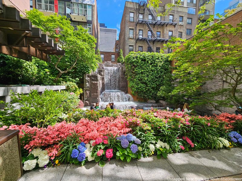
3. There is a secret waterfall in Turtle Bay
Amid the tall apartments and diplomatic missions of Turtle Bay is Greenacre Park, which boasts a waterfall and plenty of plants. The park is a privately owned, publicly accessible pocket park, which is typically smaller than an acre. The park is owned by the Greenacre Foundation, founded by Abby Rockefeller Mauzé, the granddaughter of John D. Rockefeller. It was listed on the National Register of Historic Places as of 2018.
The park was designed by Hideo Sasaki, a landscape architect who designed Washington Square Village, Forrestal Village in Princeton, and Bell Labs Holmdel Complex in New Jersey. The park features a 25-foot waterfall hidden away in the back, as well as honey locust trees and azaleas. There were fights to keep the park protected from tall development as part of the “Fight for Light” campaign, as some studies revealed more skyscrapers would keep the park in the shadows for most of the day.
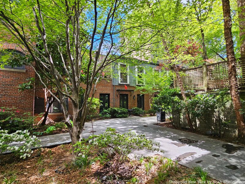
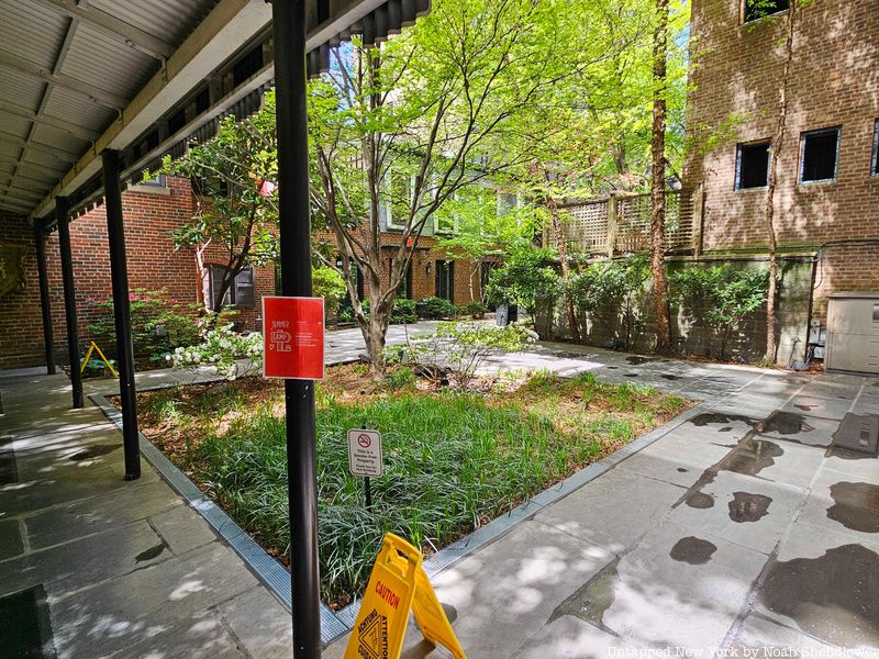
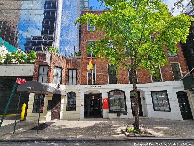
4. Amster Yard is a hidden enclave now owned by a Spanish nonprofit
The small enclave of Amster Yard between 2nd and 3rd Avenues and 49th and 50th Streets is a secret courtyard and architectural gem. The yard and five buildings that make up Amster Yard were built in the mid-1940s by interior decorator James Amster on the site of a former boarding house and station of the Boston Post Road. The five buildings were renovated by Ted Sandler and Harold Sterner, and they are now owned by the Instituto Cervantes, created by the Spanish government.
The entrance to Amster Yard is through the walkway of a building whose interior is filled with Spanish-language posters and fliers. The yard used to feature a Greek store where Jacqueline Kennedy would shop, though most of the buildings are now residences and offices. The courtyard includes cobblestone paving leading to a small auditorium, library, and even a wine-tasting room. The courtyard was a popular gathering place for Turtle Bay, including an annual Christmas carol concert that was shut down after complaints from residents. Amster Yard today is open to visitors looking for an escape from the hustle and bustle of the city.
5. The neighborhood may have been named for its “turtle feasts”
There is no precise history of how the neighborhood got its name, though there are a few hypotheses. According to the National Register of Historic Places, the name may derive from the abundance of turtles found in the area. A cove from 45th to 48th Streets was located off the East River, and a stream at 48th Street and Second Avenue flowed into the cove. It was said that local residents would hunt these turtles and consume them as part of “turtle feasts.”
It was only in 1712 that the neighborhood used the name Turtle Bay in official documents. However, some believe that the neighborhood’s name derives from the Dutch word deutal, which meant “bent blade” in reference to the bay’s knife shape. Regardless, what would become known as Turtle Bay Farm was a predecessor to the neighborhood, established in 1639 from 43rd to 48th Streets and from Third Avenue to the East River.
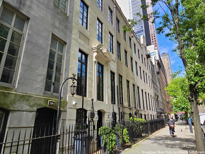
6. Turtle Bay Gardens is one of the smallest historic districts in NYC
As one of the city’s smallest historic districts, Turtle Bay Gardens consists of 20 rowhouses along 48th and 49th Streets between 2nd and 3rd Avenues. The rowhouses date back to the 1860s and were designed by Clarence Dean in the Italianate style. Most of the buildings are four stories and have rear attics, featuring cast-iron balconies, cartouches, and stucco detailing. The secluded rowhouses were designed such that their dining rooms faced the street and living rooms faced the interior, many of which face the center garden. The garden features a stone walkway and a fountain based on one at the Villa Medici.
The close-knit historic district has attracted many famous residents over the years. Katharine Hepburn and Ruth Gordon lived in one of the homes after 1918 renovations by Charlotte Hunnewell Sorchan. Conductor Leopold Stokowski, who appeared in the film Fantasia, also lived here, as did Henry Luce, founder of Time, Fortune, and Life. E. B. White notably wrote Charlotte’s Web while living on East 48th Street, while composer Stephen Sondheim and actress Mary-Kate Olsen have also called the buildings home.
7. A lost Turtle Bay mansion played a role in the Revolutionary War
To the north of Turtle Creek, or DeVoor’s Mill Creek at the time, there was a long-lost mansion called Mount Pleasant that played a significant role in the Revolutionary War. Mount Pleasant was owned by James Beekman, a New York City merchant, and the niece of Peter Delanoy, the city’s first post-independence mayor. Beekman, a Whig and namesake of Beekman Place, built the mansion in 1763 in the leadup to the war. Just over 10 years later, the British under General Howe would use the home as a headquarters. Beekman and his family left temporarily while the British took control, though the family would later return and live in the home until 1854. The mansion was torn down in 1874, and a parlor and bedroom from the mansion can still be seen at the New-York Historical Society.
While it is debated where the American Nathan Hale was actually hung for his intelligence gathering, firsthand reports suggest that the captive was taken to the Beekman Mansion property for his trial and sentencing. As written in the 1856 book Life of Captain Nathan Hale: the martyr-spy of the American Revolution, the greenhouse next to the mansion “was empty of plants, and is reported and believed by many descendants of Mr. Beekman to have been the spot where Hale received his sentence.”
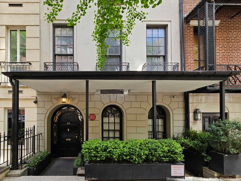
8. 23 Beekman Place is cantilevered over the street
23 Beekman Place is an architectural anomaly in a secluded residential neighborhood. The building features a four-story penthoused cantilevered over the street. It was designed by Paul Rudolph, the noted architect who designed the Yale Art and Architecture Building, and was known for his work in Sarasota, Florida. The building stands as a brownstone residence with a cantilevered portion with rear windows facing the East River. Many residents pushed back against the design fearing it would attract unwanted tourism and would block some residents’ views of the river. The steel penthouse was built in the late 1970s after Randolph bought the entire building in 1976.
Some early residents of the apartment included Charles P. Schmid, secretary of Schaefer Brewing Company during a time when Turtle Bay was a popular brewery destination. In 1922, actress Katharine Cornell moved in with her director husband Guthrie McClintic, though little is known about their personal lives at the apartment. The couple would host parties and engagements at the apartment, though they also owned property in Rockland County and Martha’s Vineyard. Recently, the building has been renovated by the Boyd family and Steven Campus, and it was designated an LPC landmark in 2010.
Though 23 Beekman Place is perhaps the most notable building on the block, a number of other buildings along the street have featured prominent residents. One Beekman Place was the residence of John D. Rockefeller III and Office of Strategic Services head “Will Bill” Donovan. 29 Beekman Place was built for CBS chief executive William S. Paley and was acquired by Iranian Princess Ashraf Pahlavi, the twin sister of Mohammed Reza Pahlavi. Right next door at 31 Beekman Place, now the Tunisian permanent mission to the UN, Welsh singer Tom Jones used to own the building.
9. Philip Johnson and other leading architects designed buildings in Turtle Bay
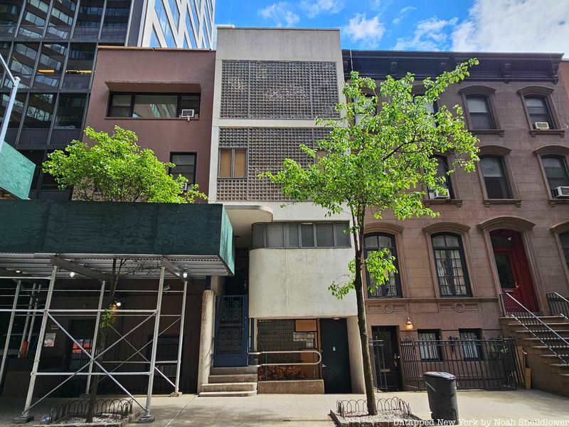
Throughout Turtle Bay are architectural anomalies that stand out from the rather ordinary brownstones and apartment buildings. The Rockefeller Guest House, which stands at just two stories, was designed by Philip Johnson, known for Connecticut’s Glass House, the two restaurants at the Seagram Building, and the Sculpture Garden of the Museum of Modern Art. It was constructed as a guest house for Blanchette Rockefeller, the wife of John D. Rockefeller III, with a first story of dark red brick and a second story of six glass panels divided by steel bars. The home originally hosted some functions of the Museum of Modern Art in its outdoor garden.
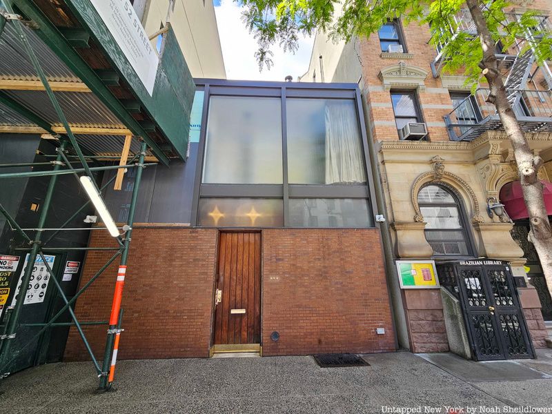
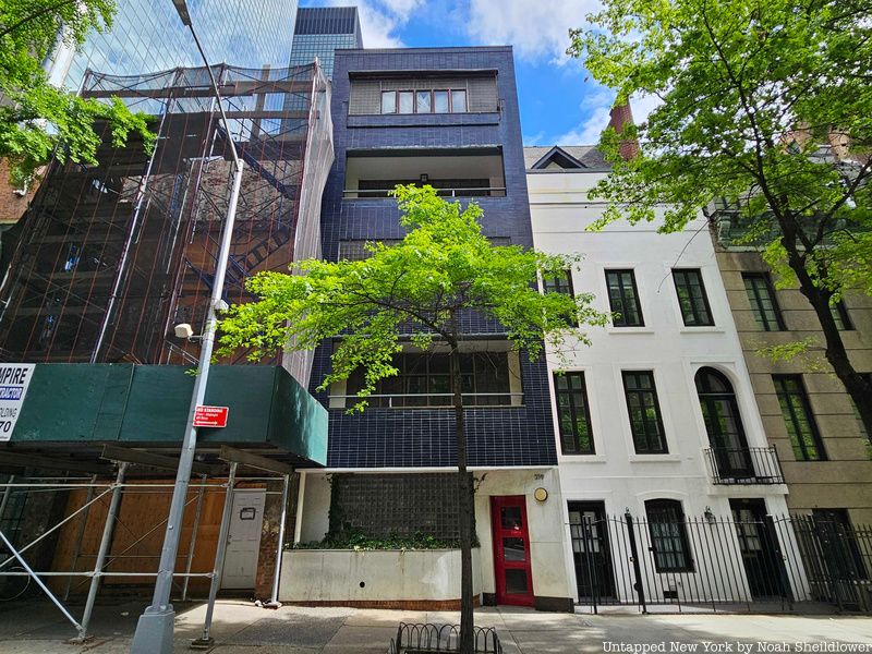
The four-story Lescaze House at 211 East 48th Street includes glass block windows and a white stucco facade, making it the first building in the city to employ such glass blocks. Its namesake architect, William Lescaze, also designed Manhattan’s Raymond C. and Mildred Kramer House and Manhattanville Houses. 219 East 49th Street, also known as the Morris B. Sanders Studio & Apartment, is another architectural gem with a dark blue brick facade and rectangular glass block windows providing insulation and privacy. The neighborhood also preserves older architecture, including the wooden rowhouses at 312 and 314 East 53rd Street dating back to 1865. Robert and James Cunningham designed the yellow, white, and black rowhouses, which are two of under a dozen on the East Side above 23rd Street. Residents have included New York City Ballet co-founder Lincoln Kirstein and literary critic Edmund Wilson.
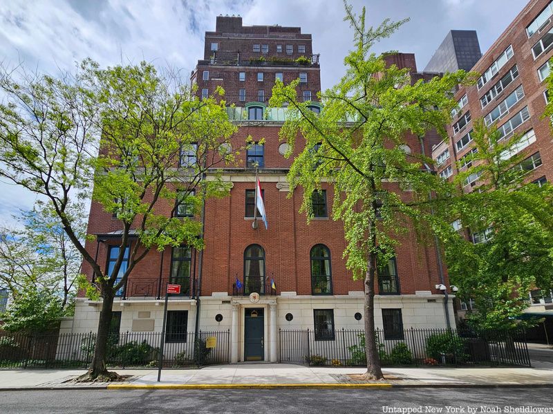
10. Luxembourg House was the home of a former Secretary of Defense and a famous composer
Located at 17 Beekman Place, Luxembourg House is now the Permanent Mission of Luxembourg to the UN. Prior to Luxembourg taking over the building, the mansion was home to a few famous historical figures. Located at the corner of East 50th Street, the building was constructed in 1932 next to Vanderbilt and Morgan mansions. Harold Sterner designed it for James Forrestal, the first U.S. Secretary of Defense. Forrestal was also the last Cabinet-level U.S. Secretary of the Navy under FDR and Truman.
The home was later owned by Irving Berlin and his wife Ellin Mackay. Berlin was known for hits including “Alexander’s Ragtime Band” and “White Christmas,” while his wife wrote short stories for the Saturday Evening Post and The New Yorker. Ultimately, Luxembourg purchased the home in 1990 and now hosts many international relations and cultural activities. The home, which faces the East River, includes a white marble base and three stories of red brick.
11. The neighborhood was the starting point of the NYC Draft Riots
The New York City Draft Riots occurred from July 13-16, 1863 in Lower Manhattan, in which predominantly white working-class men protested the Civil War draft. During the heat of the war, a mob torched the entire block between 45th and 46th Streets in Turtle Bay, starting at a military enlistment office on Third Avenue and 45th Street. Most of the rioters were Irish or of Irish descent and could not afford the $300 fee to hire a substitute for the war. Although originally a draft riot, the unrest eventually grew into race riots, as Irish immigrants attacked free Black residents due to increased competition for jobs. By the time the military was deployed on the second day of the riots, many public buildings, Protestant churches, and Black-owned homes were destroyed, including many in Turtle Bay. The final death toll is estimated to be around 120.
Elsewhere in the city, fighting occurred at sites like The Provost Marshal’s Office, which involved the cutting of telegraph lines, and the Colored Orphans Asylum, the first institution to take in Black children. The James McCune Smith Pharmacy, the first owned by an African American, was also destroyed. Another notable site of rioting took place at the New York Times office, in which owner Henry Raymond told staff to man Gatling guns pointed toward the mob. On the third day, Colonel James Barnet Fry decided to postpone the draft, and by the last day, order began to be restored, despite a deadly confrontation near Gramercy Park.
12. The neighborhood used to be home to slaughterhouses, breweries, and factories
Though Turtle Bay is one of the wealthier neighborhoods in Manhattan today, a century ago it was packed with slaughterhouses, breweries, and factories. Just a few years after the Draft Riots, Turtle Bay was filled with cattle pens, coal yards, railroad manufacturers, and gasworks. Many of the employees of these facilities lived in the neighborhood’s many cramped tenements. It was estimated that the neighborhood’s industrial plants produced more soot than other parts of the city, making the area undesirable for wealthier residents. Along First Avenue, there were an estimated 18 acres of slaughterhouses.
Also in the neighborhood was a Consolidated Edison Company powerplant that produced 367,000 kilowatts of electricity. The powerplant’s prominence in the neighborhood attracted immigrants who came for work. The southern part of the neighborhood was at one point known as “Goat Hill” since it had a large population of goats and squatters, and it became a center of Irish gang violence. Many of the neighborhood’s slaughterhouses and factories were cleared in the 1940s for the construction of the United Nations, which quickly shifted the area to more wealthy and diverse.
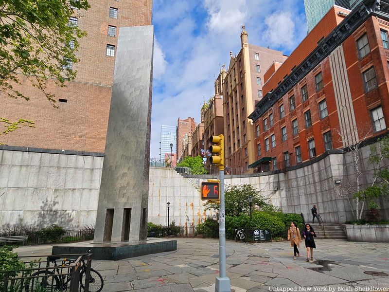
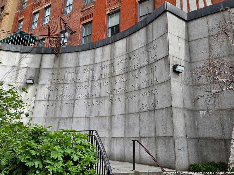
13. Ralph Bunche Park honors UN history
Ralph Bunche Park, a small park located across from the United Nations, was named in 1979 after the first African American winner of the Nobel Peace Prize. The park was dedicated as New York City’s first Peace Park along the stretch of First Avenue known as United Nations Plaza. The park is connected to Tudor City in neighboring Murray Hill via a granite staircase whose wall features the famous quotation from Isaiah: “They shall beat their swords into plowshares, and their spears into pruning hooks; nation shall not lift up sword against nation, neither shall they learn war any more.” The steps are named for Natan Sharansky, a Soviet dissident and chairman for the Institute for the Study of Global Antisemitism and Policy.
Bunche received the 1950 Nobel Peace Prize for his mediation in the decades-long Israel-Palestine conflict, negotiating an armistice between Egypt and Israel in 1948. For his work in the Sinai, the Congo, Yemen, Cyprus, and Bahrain, Bunche was awarded the Presidential Medal of Freedom in 1963. Bunche’s friend Daniel LaRue Johnson dedicated to Bunche a stainless-steel obelisk at the park called Peace Form One. The park also contains a plaque honoring civil rights activist Bayard Rustin.
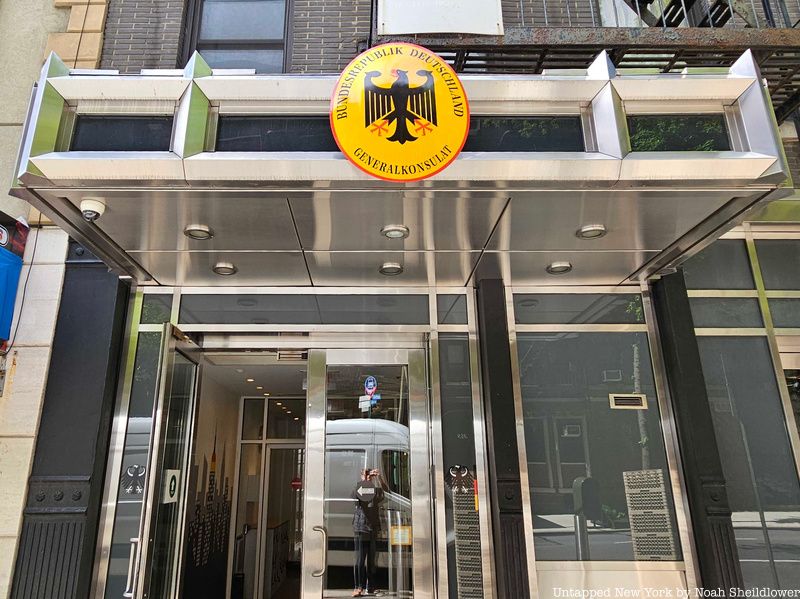
14. The neighborhood is filled with UN missions
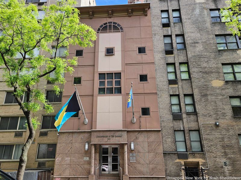
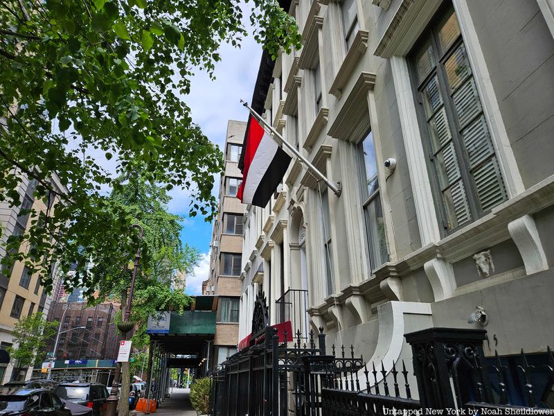
As to be expected, Turtle Bay is filled with missions to the United States and missions to the United Nations, some in miraculous buildings and others are hidden away with just a flag or small sign indicating their locations. There are around 10 missions to the U.S. in Turtle Bay, including Germany, Israel, Ukraine, the United Kingdom, and Saudi Arabia. Many of these missions are located as standalone buildings or within larger apartments. The neighborhood also houses offices of Avianca, Fujitsu, and Ethiopian Airlines.
In total, there are about 140 missions to the U.N., many located on and around United Nations Plaza. According to the official list of locations, many are also located on 2nd and 3rd Avenues, with just a few located within the rowhouses of the East 40s. While walking around, expect to see flags of countries including Bhutan, Kenya, Solomon Islands, Zambia, and Iceland, among dozens of others.
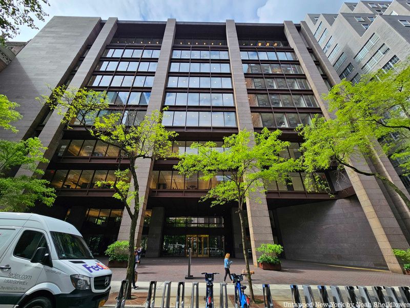
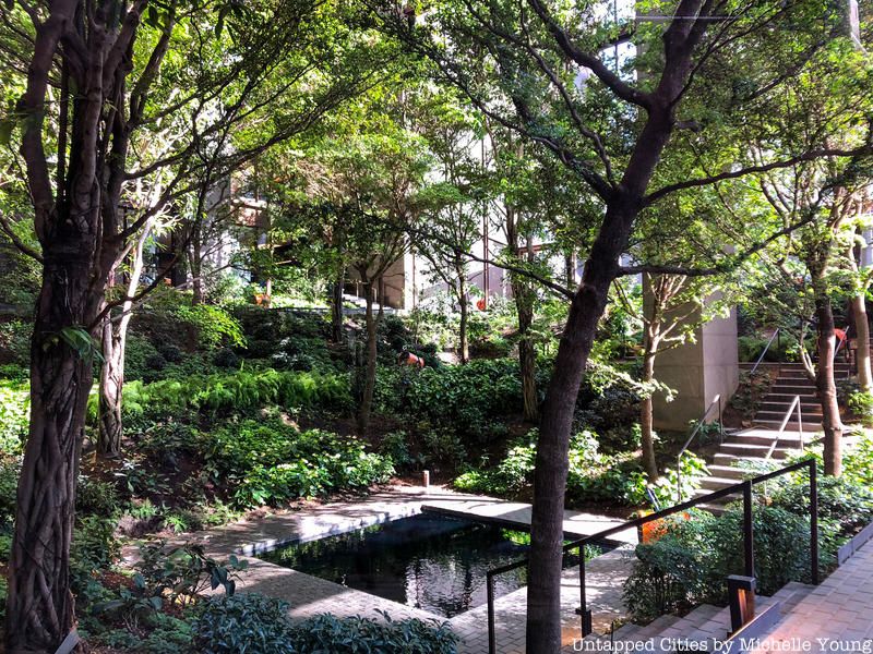
15. The Ford Foundation Building has an impressive indoor garden
One of the defining features of Turtle Bay, along with the U.N., is the Ford Foundation Building, a 12-story office building commissioned for its namesake foundation in 1963. At the time, the Ford Foundation was the largest American private foundation with the goal of advancing human welfare, founded by Edsel Ford and his father Henry. The building was constructed on the former site of the Hospital for the Ruptured and Crippled alongside East 43rd Street, located just south of the former Beaux-Arts Institute of Design.
The building was designed by Kevin Roche, who created the master plan of the Metropolitan Museum of Art and designed the Central Park Zoo and Museum of Jewish Heritage. Roche worked alongside John Dinkeloo, who took over Eero Saarinen Associates after its namesake died in 1961. The building appears as a glass-and-steel cube suspended by concrete and granite piers. The open atrium includes a garden illuminated by artificial light, inspired by the foundation’s philosophy of community-building; this influenced Roche’s design placing offices on only two sides of the atrium. The building was ultimately completed in 1967, the first building in the city with a public atrium, and it has recently been renamed the Ford Foundation Center for Social Justice.
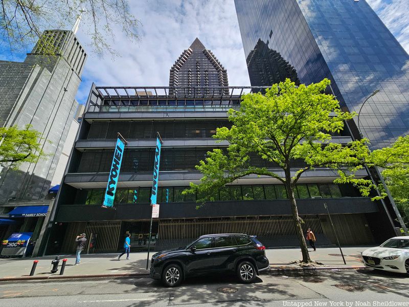
16. Japan Society was once led by the grandson of John D. Rockefeller
Founded in 1907, Japan Society is a nonprofit that promotes friendly relations between the U.S. and Japan. Japanese architect Junzō Yoshimura, who designed a traditional Japanese Tea House in the garden of the Museum of Modern Art, planned the structure in 1971. Japanese military leaders Tamemoto Kuroki and Goro Ijuin met with Shuzo Aoki, Japanese ambassador to the U.S., in 1907 and planned the creation of Japan Society. Within its first few years, founding member Lindsay Russell met with Emperor Meiji to discuss plans for similar societies across the U.S.
In 1915, Theodore Roosevelt and William Howard Taft attended a diplomatic banquet hosted by founding member Takamine Jōkichi, which accelerated talks about alliances during World War I. Ultimately, by the 1920s, Japan Society’s members stopped publishing any political commentary, which was particularly notable given the Second Sino-Japanese War of the late 1930s. After the bombing of Pearl Harbor, activities were put on pause until 1951, after which John D. Rockefeller III, the grandson of the oil magnate, took over as president for 17 years. The organization expanded under Rockefeller, and it was under his leadership that the society began construction of a permanent home.