The Berkshires Bowling Alley that Inspired "The Big Lebowski"
It’s been 36 years since the release of The Big Lebowski, the irreverent cult comedy by Joel and Ethan
It’s been 36 years since the release of The Big Lebowski, the irreverent cult comedy by Joel and Ethan

Find exciting new ways to rediscover your city with Untapped New York tours and events!

Get an exclusive look inside the Lott House, one of the oldest buildings in Brooklyn!


Inspired by architect Constant Nieuwenhuys‘ 1959 “New Babylon” collage that imagined a globe of interconnected, borderless cities, New York City-based collective ArtCodeData has created one about transit – combining all 214 subway systems into a single map. The root of the idea is conceptual, as ArtCodeData writes in a successful Kickstarter campaign, “The inner life of cities is made of their subways. What would happened if all the lines in the world would be reunited in a single system. Since the tube is the veins and circulatory system of the ‘animal-city’ if we gather all those possibilities, we could achieve a total circulatory entity?”
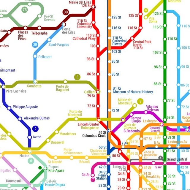
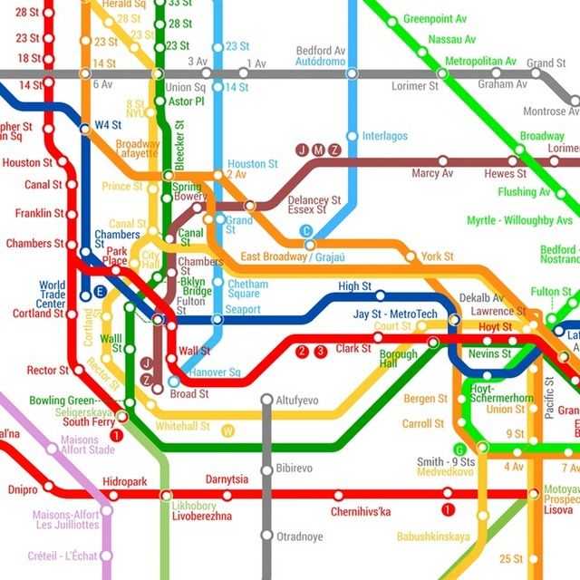
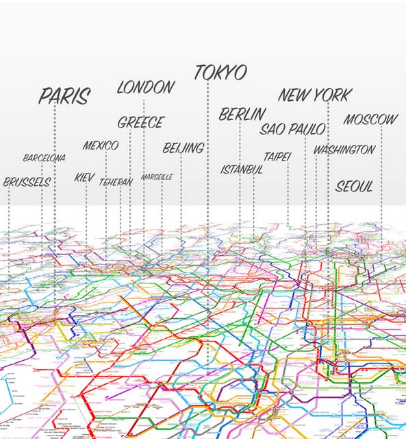
The final map contains 214 metro/subway systems, 791 lines and 11,924 stations, and they’re all connected. As As ArtCodeData explains, “You can create routes from Times Square Station NewYork all the way to Beijing National Library Station in China.” Meanwhile, New York City overlaps with Paris and you can transfer at 66th St-Lincoln Center to Robespierre, at 50th Street to Chateau de Vincennes, and many other spots. Other transfers in New York City get you to Moscow and Sao Paolo. As Gerardo Cid tells Fast Co Design, the oldest systems are centrally located on the map and newer ones further out.
You can only get this map, so far, via the Kickstarter, which has already raised $45,655, far above its initial $6,000 goal. The added bonus is that sales from this map support the Open Accessibility Initiative, a non-profit dedicated to supporting travel for people with disabilities.
Subscribe to our newsletter