NYC’s Forgotten ‘War on Christmas Trees’
Discover how an obscure holiday crackdown affects festive street vendors today!


 Image from MTA
Perpetual complaints about New York City’s transportation system are a significant part of New Yorkers’ love-hate relationship with the city. With Mayor de Blasio’s endorsement of the Brooklyn-Queens streetcar plan yesterday, here are five more transportation system plans that may become part of New Yorkers’ daily commute in the near future, and hopefully not part of their daily rant.

Image from Friends of the Brooklyn Queens Connector
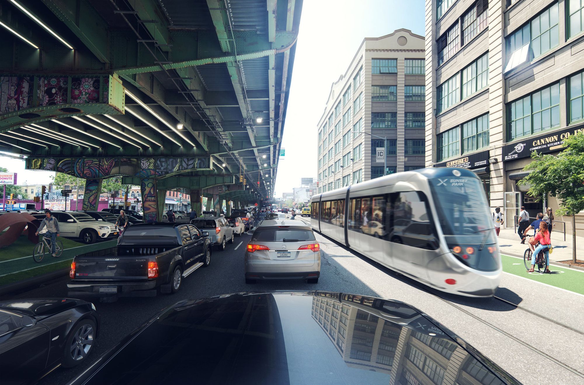
Also known as the Brooklyn-Queens Streetcar, this proposal aims to provide better transit options between Astoria, Long Island City and parts of South Brooklyn. The waterfront light rail will also link some of the fast-growing hubs in the two boroughs, such as Industry City in Sunset Park, Red Hook and Brooklyn Navy Yard. Despite mixed responses to the proposal, Mayor de Blasio is set to announce an endorsement of $2.5 billion to support the 16-mile scenic ride which would significantly change the city’s waterfront. The streetcars would move at approximately 12 miles per hour and it’s projected that a trip between Greenpoint and Dumbo would take 27 minutes, less than the speed currently by subway or bus.
But a lot could change between now and the projected date a streetcar system would be in effect, as construction would not begin until 2019 and service not until at least 2024,The New York Times
reports. While the proposal will not need approval from Albany or Governor Cuomo since it will only affect the streets, it will have to go through the Community Board review process, where it is bound to be controversial.
To ease the North-South connection between Astoria and South Brooklyn, and add new connections to Rockaway and the Bronx, another proposed transit proposal under De Blasio‘s administration is a city-wide ferry system that will connect all five boroughs. Currently, although there are ferries running along Hudson River and East River, but can be cost prohibitive for some at $4/ride. If all goes to plan, the first part of the proposal will be up and running in 2017, and will provide transfers between subway, bus and ferry.

Image from Office of the Governor
Governor Cuomo unveiled $3 billion expansion plan for Penn Station earlier last month, part of a larger infrastructure proposal he’s calling “the biggest construction program” in New York State history. The current Penn Station, built in 1968 is completely underground with two levels of concourses and train platforms on the lowest level. When/if complete, the new Penn Station will be named the Empire State Station Complex with underground tunnels connecting to a future retail hub at the James A. Farley Post Office Building. The proposal hasn’t been updated since its reveal in January 2015, and renderings of the new entrance, though not overly architecturally interesting, will at least bring back natural light to the station. While some applauded the plan to relocate Madison Square Garden, not surprisingly, there have been critiques regarding the proposal’s shortcoming in dealing with the station’s ever-growing passenger volume.
Join our next tour of the Remnants of Penn Station which addresses the past, present and future plans of this important transit station in New York City:
Tour of the Remnants of Penn Station

Image from Wikimedia Commons by the MTA
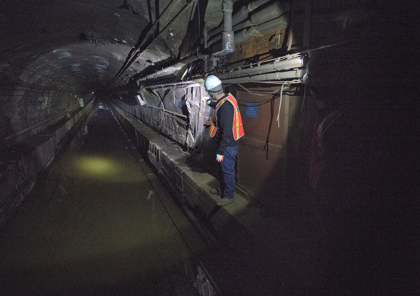
Since Hurricane Sandy, the L train’s Canarsie Tube has been seriously damaged and flooded by salt water. Earlier last month Governor Cuomo announced a plan to completely close down 30 subway stations for months long to be renovated, but the announcement that met with more rancor was the proposal to close down portions of the L train (either a section in entirety or one side of the Carnasie tube at a time).
The subway line that experiences more than 230,000 riderships everyday is estimated to be renovated in three years with partial closures, one to two years with a complete shutdown. While it is inevitable that the L train will have to be closed down to some extent, Streetsblog has proposed that a BRT will be a great alternative solution to reduce disturbances to L train passengers. However, if we consider the 35/100 rating of New York’s current BRT system, that will probably create another set of challenges for the MTA. There are no confirmed plans at the moment, but the project is due to commence in 2017, and anxious commuters will have to wait and see how the plans unfold in the next year.

Image from MTA
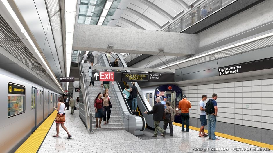
The Second Avenue Subway (SAS) is a New York subway line that was first proposed as an Independent (IND) subway line in 1920. After decades of planning and delay, the SAS finally began construction in July 2007 and its first phase was scheduled to be opened on December 31, 2015. Obviously that was not realized. Currently, the MTA website announces that the first phase of the Second Avenue Subway in December 2016, running from 93rd Street to 63rd Street as an extension of the Q line, but there was already in December 2015 there was a “moderate risk of delay.” We’re still holding our breath for an opening this year, and while the SAS is supposed to go up to 125th Street and down to Hanover Square eventually, the planning for those later phases have also been slow to come.
Next, check out our photographs from the construction of the Second Avenue Subway system last August and discover the Top 12 Secrets of the NYC Subway.
Subscribe to our newsletter