


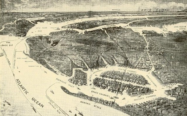
This visual is a fascinating find from @Discovering_NYC – a plan to create a canal from a new port in Jamaica Bay to Flushing Bay which had been in the works since at least 1910, when it was presented to the Barge Terminal Canal Commission at an estimated cost of $12 million. A bill for its construction failed to pass the New York State legislature in 1912 but in 1914 the state included the latest in its Annual Report of the State Engineer and Surveyor on the Canals of the State of New York showing a cost between $12.6 million and $21 million.
The canal would have provided a direct route for barge transportation from the Hudson River to a proposed “sub-port” in Jamaica Bay, by means of the Harlem and East Rivers, saving between 10 to 12 miles. The report states that this would avoid “the additional distance through the Narrows, the congested portion of the Hudson river and the rough seas at the entrance to Jamaica bay. In addition, the canal would have provided for “additional water-front, reclamation of a large area of marsh-land, the disposition of sewage” (nice) and real estate development along the canal.
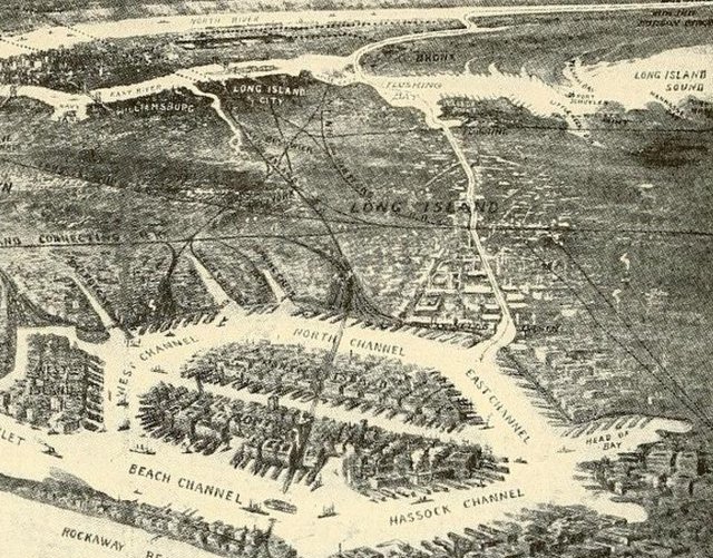
It was thought that this cross-section of Long Island afforded “natural lines for the location of a canal,” following the rising topography from Cornell Basin, one of several basins and creeks that were later landfilled to become JFK Airport, to cross the Ridgewood aqueduct and run northwest towards Flushing Creek, through what is now Flushing Meadows-Corona Park, and into Flushing Bay. Many options of canals were considered, from sea-level canal, high level canal to a tunnel constructed in the cut and cover method, which was favored by Queens authorities.
The state determined that to justify the cost of the canal, 70 million tons would have to go through the canal each year which was “more than the total freight handled on both sides of the Hudson river from the Battery to Yonkers in 1912.” As such, and with the other benefits not being worth the overall project, the Jamaica Bay to Flushing canal was dropped.
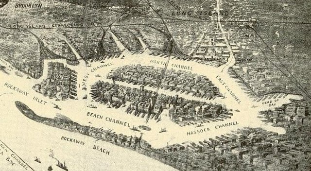
One of the most fascinating parts of this visual is the development and in-fill of the islands within Jamaica Bay. The densely populated potential islands were named. West Island, on the left below, north of Rockaway inlet became Floyd Bennett Field and connected to the mainland.
Jamaica Bay, of course, became a wildlife refuge and the port was never constructed. But still, it’s important to remember that canal proposals were common during this era of commerce building and the above report also referenced a potential canal between Gravesend and Sheepshead Bay. One proposal that certainly did go through was the construction of the Harlem River Ship Canal and the filling in of the northern portion of the Harlem River, which effectively sliced off Manhattan and attached the neighborhood of Marble Hill to the Bronx. To this day, residents remaining a part of the county of Manhattan and vote in the Manhattan elections, though the area has a Bronx zip code and area code.
Next, check out 10 Man Made Areas in NYC.