✨You Can Touch the Times Square New Year's Eve Ball!
Find out how you can take home a piece of the old New Year's Eve ball!


As New York City evolved and changed into the cosmopolitan city it is today, so did the transit lines connecting the city to the boroughs and Long Island. Here are 12 subway and rail lines that have been built, abandoned, then destroyed in New York City since the late 19th century some because of the construction of parallel underground lines, others because of changes in service patterns. With the triumphant return of the W line in the (supposedly) November 2016, we’re remembering some lines of the past.
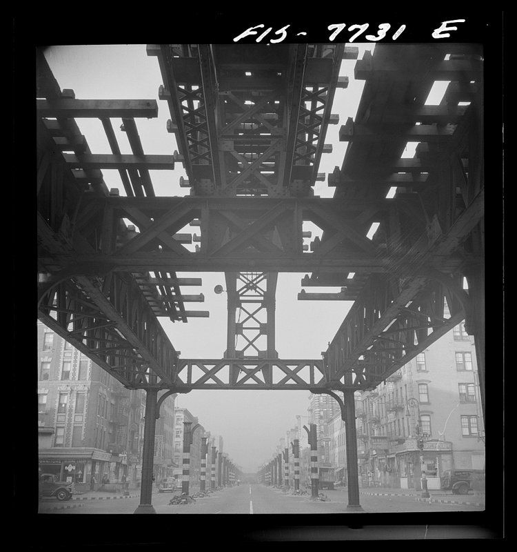
Looking south at 7 a.m. from 13th Street on Second Avenue, showing the elevated railway in midst of demolition. Photo by Marjory Collins from Library of Congress.
The Second Ave Elevated Line ran from 1880 until 1942. Construction began in 1879 by the Metropolitan Elevated Rail Company. Originally, there was thought to be enough room for a third rail, but when the first round of construction was done, only two rails were put down. On August 16, 1880, the line’s structures and tracks were ready to operate, running from South Ferry all the way up to 127th Street, the northern most limit at the time. Work on a third rail for the 2nd Ave el was completed in 1916 allowing for express services.
The last full length run of the train was on June 11, 1940. The line south of 60th Street continued to operate for about two more years. The New York Times reported on June 14th, 1942 one day after the 2nd Ave el was fully discontinued, that there were 200 passengers on the 6-car train as it pulled into South Ferry on its last run.
Construction for a Second Avenue Subway has been on-going, with a first section anticipated to open in December 2016 (though transit watchers are doubtful).
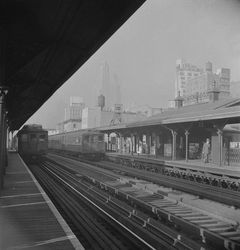 Image via Wikimedia Commons, Library of Congress
Constructed between 1875 and 1878, the 3rd Ave el ran from City Hall in Manhattan to the Harlem River. Through service between Manhattan and the Bronx began in 1896. This elevated line was the last elevated line to run in Manhattan with service to South Ferry ending in 1950 and City Hall in 1953. Northward, the 3rd Ave line had service from Chatham Square until 1955. However, service in the Bronx continued for a few years after operation ended in Manhattan. It ran between 149th Street and Gun Hill Road from 1955 to 1973. The line in the Bronx was completely demolished in 1977.
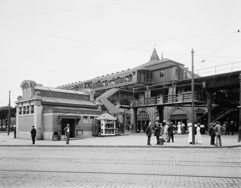
Image via Wikimedia Commons, Library of Congress
Originally known as the Brooklyn Union Elevated Railroad, the Fifth Avenue Bay Ridge Line opened in 1889 running from Park Row in Manahttan down Flatbush Avenue onto the 5th Avenue, ending at 65th Street by Stedman Plaza. This line stopped running in 1940. On June 25, 1923, there was a major train derailment that caused the death of eight passengers while injuring many others.
A 5th Ave el train derailed at the corner of 5th and Flathbush Avenues in Brooklyn where two cars fell of the elevated track, causing them to hang between the track and the street. Apparently, this wasn’t the first time an accident happened in this area. On January 24, 1900, not too far from the 1923 accident site, a train caught fire. Although no one was injured, it caused a lot of commotion.
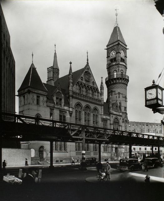
6th Ave el by Jefferson Market Courthouse in Greenwich Village, October 1935. Photo by Berenice Abbott from New York Public Library via Wikimedia Commons
Operation of the 6th Ave el, or Metropolitan Elevated Railway began June 5, 1878 with service from Church Street up to 58th Street with all stops on 6th Avenue. The cars on this line were painted a pea green color and cost 10 cents to ride in one of the finer cars at the time. This train ran until 1938 with demolition starting as early as August 11, 1924, with the IND line moving underground. The Fulton Elevated Line at the time was also in use, and in order to keep that particular line running and expedite the construction of the IND, the 6th Ave el needed to go.
There is some controversy surrounding where the metal of the demolished 6th Ave el went. There was speculation that the metal was being sold to Japan (remember some of the demolition occurred during World War II). The New York Times reported in 1938 that 20,000 tons of steel could “ultimately take the form of explosive shells raining down from Japanese bombers on a Chinese city.” But the Chairman of the Board of Transportation at the time, John H. Delaney, and former Borough President Stanley M. Isaacs both denied the shipping of the steel to Japan.
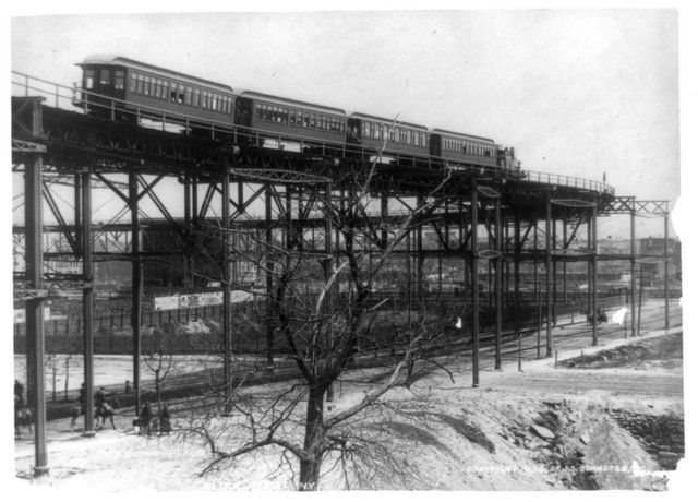
9th Ave el’s “suicide curve” at 110th Street, 1896. Image from Library of Congress via Wikipedia
The 9th Ave el was the first elevated railway in New York City opening on April 20, 1871. It was originally powered by steam locomotives, but in 1885, the Manhattan Railway Company added an electrified third rail making the 9th Ave el the city’s first electrified railway. At the height of its operation, the line spanned from Manhattan’s South Ferry all the way up to Kingsbridge Road in the Bronx.
As the first elevated railway in the city, there were many other “firsts” associated with it, such as the first line to have three tracks which in turn allowed it to be the first train with express service. In 1918 that meant that express services would go directly from 125th street to 155th street.
Service on the 9th Ave el ended in 1940 in Manhattan since the new A/C/E train on 8th Ave began running in 1932. Operation in the Bronx continued to run as the “Polo Grounds Shuttle” to Yankee Stadium, but shut down in 1958 when the New York Giants (baseball team) moved to San Francisco.
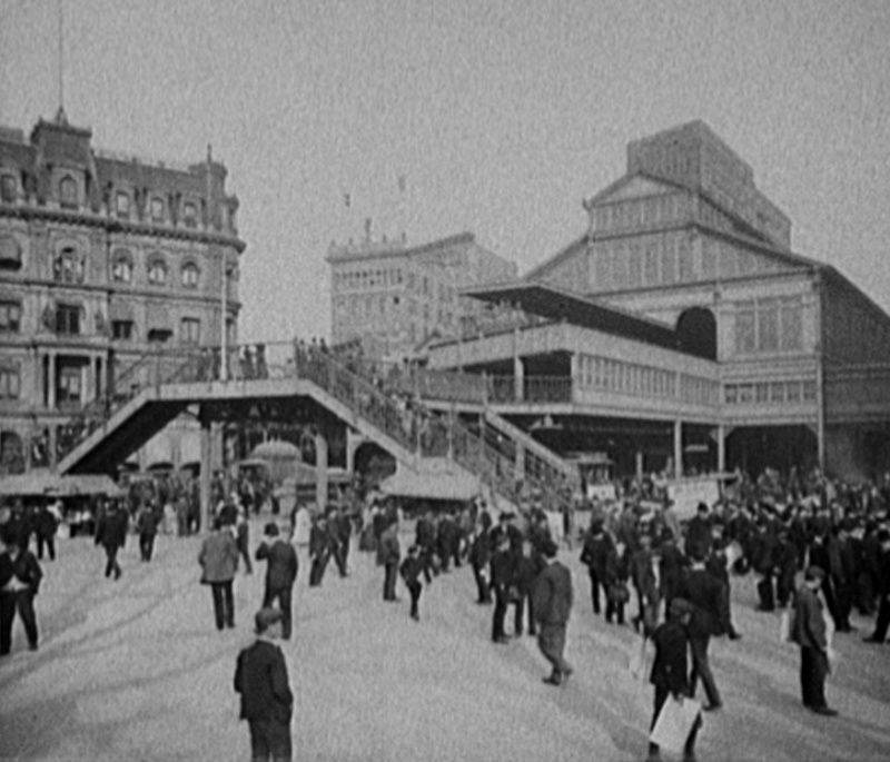 Image from Library of Congress via Wikimedia Commons, Detroit Publishing Co.
The Fulton Street el began running on April 24, 1888 originally from Fulton Ferry to Nostrand Avenue in Brooklyn. Over the next few years the line would extend until December 28, 1893 when it finally reached the Brooklyn city limit at Grand Avenue. On June 1, 1940, New York City acquired all the properties of the BMT (Brooklyn-Manhattan Transit Corporation) and the IRT (Interborough Rapid Transit Company) and abandoned all services from Fulton Ferry and Park Row to Rockaway Avenue.
The remains of the Fulton Street connection south of Atlantic Avenue were completely demolished in 2004. Even though the elevated line has been demolished, the IND Fulton Street subway runs pretty much on the same line since 1936, it’s just been duplicated underground.
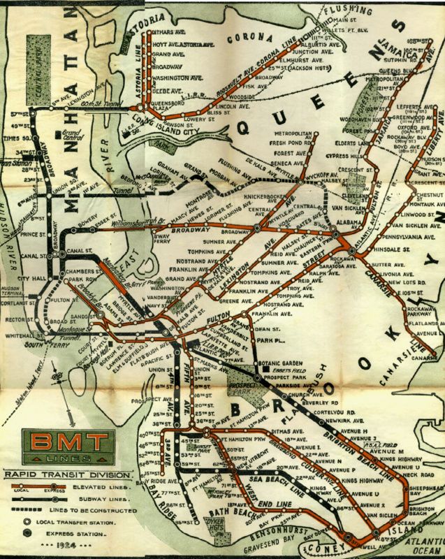
Image via Wikimedia Commons
This line, not to be confused with the IRT Lexington Avenue line, was the first standard elevated rail line in Brooklyn, which began running on May 13, 1885 from Washington and York Streets to Gates Avenue. This line was short lived because on April 27, 1889, the Lexington el began using the Myrtle Avenue Elevated line.
Service on the Lexington Line was not completely abandoned until October 1950. From 1904 to 1950, the Lexington Line basically ran on the elevated Broadway line. In the 1950s, ridership decreased because of the Myrtle Ave el and and underground line running under Lafayette Avenue, so the Lexington el was dismantled.
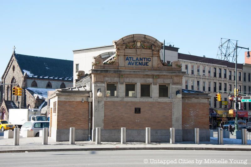
The Long Island Rail Road (LIRR) used to run south into Brooklyn past Atlantic Avenue and into Manhattan by Chambers Street. The LIRR would come up from underground at Atlantic Ave and ride on today’s J line at Fulton Street. In 1916, LIRR service to Chambers Street ended, deemed an unsuccessful experiment.
The LIRR ran from 1898 to 1917 from the lost Williamsburg Terminal to Far Rockaway during the summer. When the Williamsburg Terminal was demolished, the J train handled the service of LIRR to Far Rockaway from August 4, 1913 to 1916.
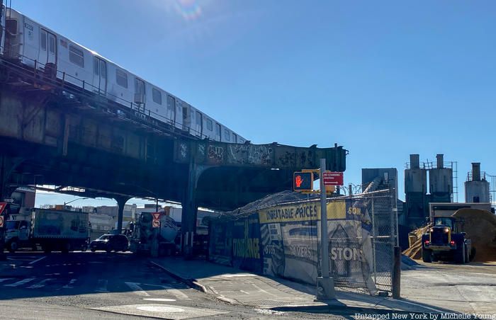
On June 19, 1875, the PP&CI railroad (Prospect Park & Coney Island) ran from Prospect Park to Gravesend Avenue and Neck Road. Until 1912, the line would go through multiple stages of ownership from the LIRR, the BRT, and then finally the South Brooklyn Railway.
On March 16, 1919, the Culver Elevated line was constructed from 9th Avenue to King’s Highway. Service eventually reached Coney Island on May 1, 1920. In 1954, new construction of the 6th Avenue IND connected it to the Culver el causing the elevated line between 9th Avenue and Ditmas Avenue to become practically unused. So, the MTA made the Culver a shuttle from 9th to Ditmas with stops at Fort Hamilton Parkway and 13th Avenue but eventually closed the shuttle in 1975. The structure was completely demolished in 1985.
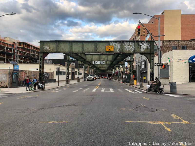
Today there is a Myrtle Ave line that runs through Brooklyn, but it is not the same one the past. What is used today follows the remnants of the old Myrtle Avenue Line which ran from Jay Street to Metropolitan Ave until it was abandoned on October 4, 1969. This particular line was the last one in the entire city to use the wooden cars typically operated on the elevated lines.
The Myrtle Ave Line opened in April 1888 running between Adams Street station in downtown Brooklyn and Grand Avenue in Clinton Hill. Through the next few years it would slowly branch out further until 1906 when it was finally extended to Metropolitan Ave. Today, the eastern most part of the line between Wyckoff and Metropolitan Avenues is still being used by the M subway line.
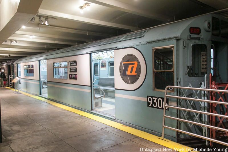
This line was created specifically for the World’s Fair in 1939 in Queens. The line started near the Forest Hills-71st Street stop along today’s M/R lines, by what the Queens Boulevard line of the IND, ran through Jamaica Yard, turned north at the east side of Flushing Meadows-Corona Park and rolled into the World’s Fair Terminal Station. The two-mile long track cost a total of about $1.7 million to build, operate, and maintain.
On January 15, 1941, demolition of this line began following expense issues and political pressure. There was some movement back then to keep the line working, but there wasn’t much need after the fair ended as Citi Field and the US Tennis Association hadn’t been established yet. Moreover, the line didn’t meet construction standards for permanent lines at the time which required them to be underground.
For more, check out NYC’s Lost World’s Fair Subway Line of 1939 and 1940.
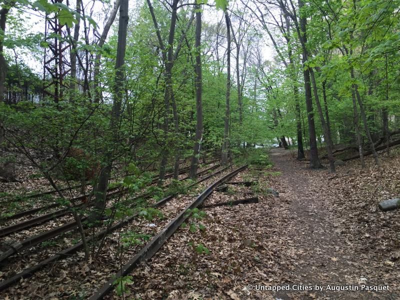
This defunct LIRR line is a 3.5-mile long stretch of rail that starts in Rego Park and ends at Rockaway Peninsula. Constructed in 1908-09, this branch was created to connect the LIRR to Rockaway Peninsula. Before the Depression in the 1930s, there was a plan to connect this line with the IND subway line, but the economic downturn ultimately shelved those plans. So the line remained a part of the LIRR until 1950, but fires on the wooden tracks led the LIRR to sell it to New York City who rebuilt the tracks and converted it into a subway line with service to the Rockaways in 1956.
The line was also connected to the LIRR Montauk Branch via the Glendale Junction which stopped operating in 1946. The north end of the Rockaway Line above Liberty Avenue maintained its services until June 8, 1962. In the end, decreased patronage caused the line to close down.
Today, there is an effort being made to convert the abandoned rail line into a park, or high line like on Manhattan. The project, dubbed the QueensWay, was started by The Friends of QueensWay (FQW) which aims to turn the railline into a park “enjoyed by bikers, walkers, joggers, visitors, tourists, workers and residents in Queens and the rest of the world.”
For more, see the entire 3.5 mile stretch of the QueensWay on video.
Next, check out Fun Maps: The Abandoned Subway Stations and Lost Subway Lines of NYC and 20 of NYC’s Abandoned Subway Stations, Levels and Platforms.
Subscribe to our newsletter