How to Make a Subway Map with John Tauranac
Hear from an author and map designer who has been creating maps of the NYC subway, officially and unofficially, for over forty years!


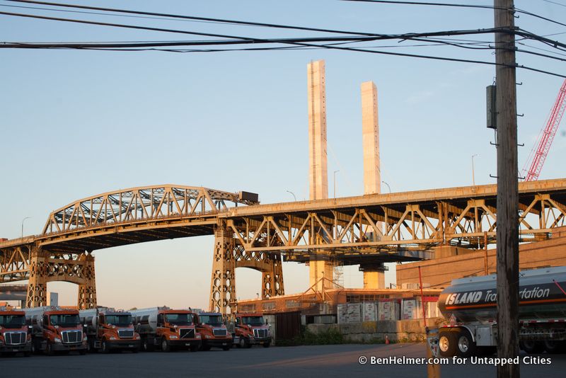
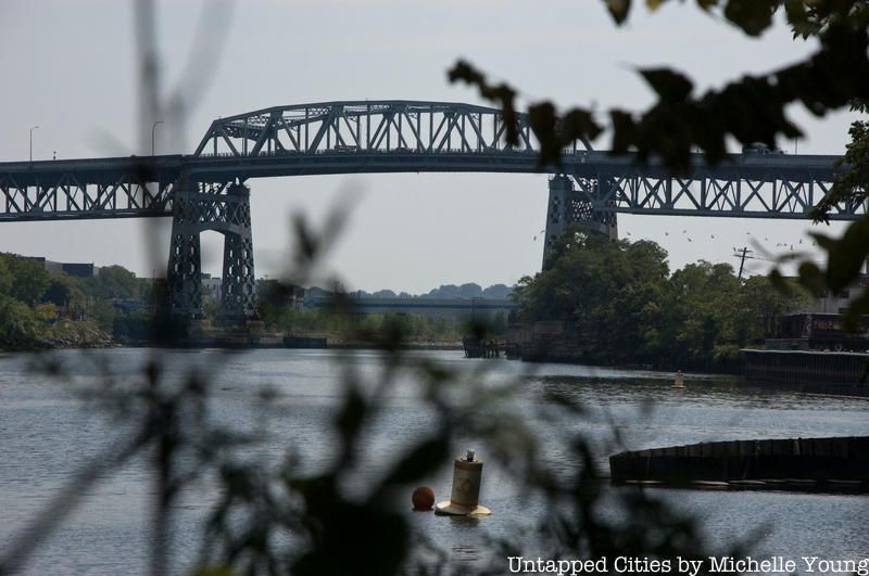
The current Kosciuszko Bridge next to the construction of its replacement
Eight years ago, in the face of an overwhelming consensus in favor of a complete replacement of the Kosciuszko Bridge, New York state’s Historic Preservation Office undertook a review to determine the structure’s historic and cultural value, stating:
“It is our opinion that the rehabilitation of the existing bridge – which represents a significant and unusual variation of the Warren truss type bridge – is a prudent and feasible alternative to demolition.”
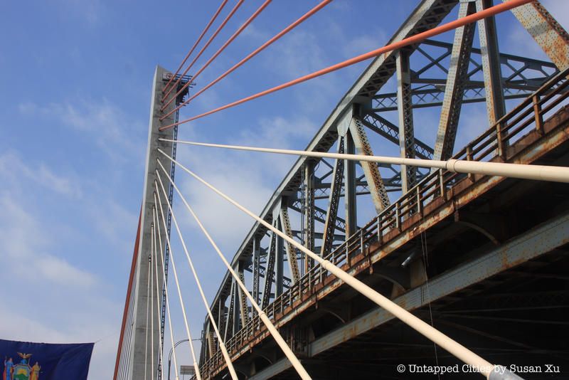
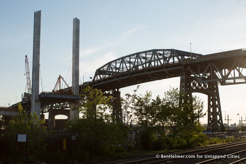
Construction has been completed on the first of two completely new spans that will be built adjacent to the existing structure, of which the 26 million pound main span came down on barges in late July 2017 and was floated down the East River. Concrete towers for the eastbound lanes currently loom like sentinels over the existing bridge. Sometime in late 2017, after the eastbound span opens to traffic, the seventy-eight year-old bridge, which connects north Brooklyn to western Queens, is scheduled to be demolished.
The new bridge promises what all new structures promise: to be better, stronger and more efficient at everything. It will sweep away all of the problems that have plagued the Kosciuszko during its troubled lifetime, a bridge that was itself heralded as a solution to the problems that plagued its predecessor.
The succession of bridges that crossed Newtown Creek at this particular location is a history of inadequate design, poor engineering, dubious construction, accidents and death. Efforts to improve a given bridge over the years were often stymied or endlessly delayed, leading to insistent calls for the offending structure to be replaced. It seems that the Kosciuszko Bridge is part of a continuum of inadequate, maligned bridges meant to cross a waterway that’s no wider than the length of a football field.
Here are twelve fun facts about the Kosciuszko Bridge and what the new bridge will look like:
An inspection of city bridges in 2008 flagged the Kosciuszko Bridge with twice as many violations as the next-worst bridge on the list, and designated it structurally deficient. It has been a money-draining maintenance headache for decades, as well as a notorious traffic bottleneck.
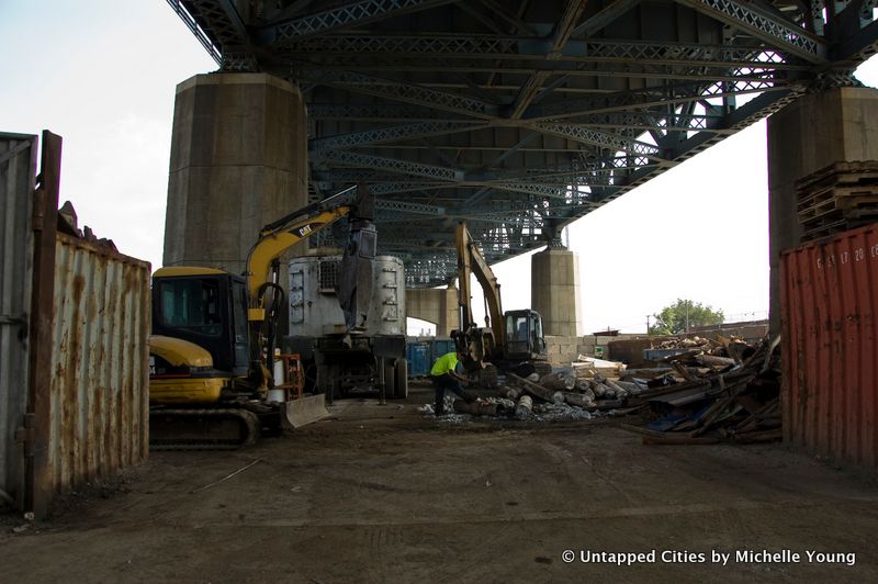
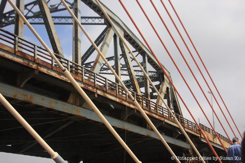
Underneath the Kosciuszko Bridge
There is an unusual radio frequency phenomenon on the Kosciuszko Bridge, instigated by various nearby radio stations, that has led bridge maintenance workers to receive shocks and or burns when they touched the bridge from a lift. According to a 2002 report by Steve Jensen Consultants, “Voltages induced on both bridge and man-lift range in amplitude from 30 – 120 volts open circuit depending on height above ground of both man-lift and bridge location. Total power intercepted by bridge is approximately 100 watts.” The New York State Department of Transportation hoped to reduce the voltage, and the report suggested some fixes. Ultimately, the report concludes that “Shocks are nuisance in nature and are not life threatening,” and did not pose a threat to people, traffic or equipment on the bridge.
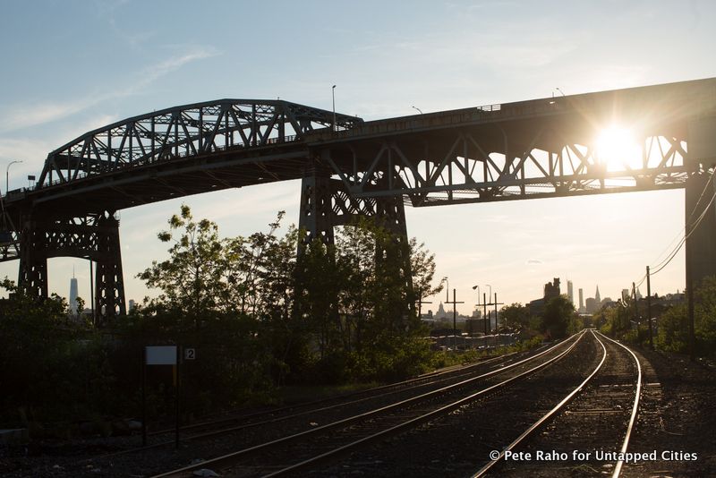
The Kosciuszko Bridge is the essence of a utilitarian, WPA-era steel structure, about which very little seems to be special. New York City is filled with similar public works: parkways, tunnels, post offices, bridges, schools and libraries. For the better part of a century, this understated aesthetic has served as an indistinct backdrop presence, and has shaped the city to no small degree.
The Kosciuszko was built in 1939 as a placeholder for a regional highway system that did not yet exist, and appreciating its history means understanding the modus operandi of Robert Moses, New York City’s long-standing, quasi-dictatorial builder of everything. Its birth was premised, not only on the thing itself, but on how it would facilitate all of the other unbuilt things yet to come.
The early planning stages of the bridge in the 1930s coincided with two other enormous construction projects: the Brooklyn-Queens Connecting Highway and the 1939 World’s Fair, both of which Moses initiated. The bridge’s public selling point was that it would provide a fast route from Brooklyn to the World’s Fair grounds in Flushing Meadows Corona Park, Queens.
But its longer-term value was to serve as a one-mile section of a future highway that would run through Brooklyn and Queens, and ultimately become the Brooklyn Queens Expressway. The Kosciuszko was the future for a much shorter period of time than one might expect of a bridge of its scale and scope of ambition. In 1966, the bridge underwent a renovation, and by then was already considered outdated, notorious for its many shortcomings.
“The draw is wider than that part of the old bridge left standing….A man not in his sober senses would have no difficulty in walking off from it into the water, and many a man in his sober senses might, on a dark evening, unconsciously stumble into the same trap.”
-Brooklyn Eagle, Nov. 2, 1869
This dry piece of wit describes one of the earliest crossings at Newtown Creek, a privately owned wooden draw bridge that, due to its toll, became known as the Penny Bridge. To read the newspaper accounts of this bridge over its lifetime is to encounter a perpetual litany of complaints about expensive repair costs, unwanted tolls, incompetent engineers and erratic builders. This has been a constant right up to the present.

Photo by @ChorBazaar
In 1882, a new steel structure was built to replace the wooden bridge, and also became known as the Penny Bridge. It was designed as a swing bridge, a type that featured a turntable mechanism set on its own island mid-point across the creek that swung open and closed, depending on whether carriage or boat traffic needed passage.
There were often problems. The turntable broke more than once, and the bridge was unusable at one point for three months. The island that supported the pivot took up almost a third of the entire width of the creek, leaving narrow boat passages on either side of it, resulting in constant slowdowns while boats crawled through the undersized chutes when they weren’t banging into the piers
In 1894, a newer version of the bridge was constructed as an overdue response to the delays caused by the ever-increasing demands of carriage and shipping traffic. But while this replacement was under construction, dozens of factory workers crowded onto the Queens side of the temporary wooden foot bridge, and the structure buckled, throwing them into Newtown Creek, ultimately leaving fourteen people dead.
And after the actual bridge opened, the Queens side of the crossing started to experience another serious problem. The bridge exited close to the railroad tracks, and because there was no road adjacent to it, people often walked along the tracks. By 1908, an average of twenty people a year were killed in this spot after being hit by trains. And it wasn’t just people wandering on the track
“The fatal Penny Bridge crossing at Laurel Hill added a new name to its already long list of victims this morning….four persons returning in a coach from an interment in Calvary Cemetery were instantly killed by a train. Both horses were also killed. The accident was due to the towerman sending the gateman for a piece of pie just before an express train was due to reach the crossing.”
-Brooklyn Eagle, June 14, 1907
This complex convergence of pedestrian, carriage, boat, railroad and pie needs at a single point was making the Penny/Meeker Ave Bridge infamous as a structure that did not serve any of its respective constituencies particularly well.
It was into this mess that the planners of the Kosciuszko Bridge stepped. In order to resolve the conflicts the swing bridge presented, the roadway was set at 125 feet above the water, high enough to clear the tallest ship, and the approaches to the bridge were extended thousands of feet into both Brooklyn and Queens, ensuring that car traffic would travel well above the railroad tracks.
The Penny Bridge had been known for generations as the crossing that took funeral processions from Brooklyn to Calvary Cemetery in Laurel Hill, Queens. The construction of the Kosciuszko effectively ended that tradition. The new bridge was, in its scale, unlike all the other bridges that preceded it. And it was all about the car.
The Kosciuszko begins its slow rise out of Queens near Calvary Cemetery, as Laurel Hill Boulevard runs downhill directly alongside it. This is a surprisingly deserted stretch of road, where the long Queens approach is bounded on the right by the pastoral grounds of the cemetery, and in the distance you can see the BQE’s roadway gently bend as it rises to the through-truss section of the bridge as it crests over the water.
It’s a striking view, and one that few people ever get to see, as the area is cut off from the rest of the city to a remarkable degree. This is largely because the Kosciuszko traverses, almost exclusively, industrial areas on both banks of Newtown Creek. There is really no pedestrian connection to the bridge at all, either by walking nearby it, or crossing over it. The Kosciuszko originally featured two pedestrian walkways on its opening, but they were closed in 1966 in order to allow more width for traffic lanes, a move that did little to ease the bottleneck anyway.
The city’s collective experience of the Kosciuszko comes instead from driving over its battered, borderline-unsafe roadway, a patchwork of steel grating, concrete and asphalt in some approximation of a road surface. It would be a dangerous stretch of road if you were averaging a decent speed, but you almost never are.
When the planners set the roadway as high as they did, the approaches to the bridge became steeper than usual, which leads cars, and especially trucks, to slow down as they cross. Combine that with narrow lane widths, poor sight lines and a lack of shoulders and you begin to understand why, as a driving experience, it can be so nerve wracking , and as a piece of traffic engineering, it’s considered such a exceptional failure.
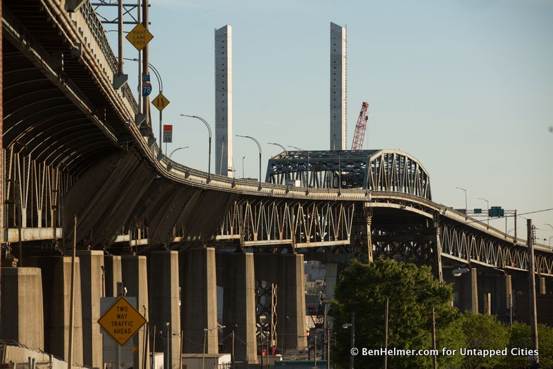
The new bridge will peak at an elevation thirty-five feet lower than the original, allowing cars to maintain a speed over a reasonable grade. There will be wider lanes, and six more of them, as well as bike and pedestrian lanes. As a traffic conveyor, it represents nothing but upgrade.
The Kosciuszko was originally designed to accommodate 10,000 cars per day, and it’s estimated that it currently carries something like 185,000. Whatever the current needs of the highway and the city are, it is bound to change again in the future. And at that point, if history is a reliable guide, the bridge may well have formed cracks in the roadway or failed at resolving traffic or successfully accommodating the self-driving car. After all, every previous incarnation of this bridge was eventually deemed an outdated failure. It’s not difficult to imagine the new Kosciuszko meeting the same fate.
In March of 2008, the State Historic Preservation Office, after completing its review, concluded: “We concur that there are no prudent and feasible alternatives to the demolition of this historic bridge…We find that correction of many of the substandard safety features would significantly alter character-defining features of the bridge.”
And with that, the faint discussion about the bridge’s worth went quiet.

The Kosciuszko Bridge anchors an area of the city that time and newer technologies have left behind, an industrioscape that has stayed remarkably unchanged over the years. It’s a place where streets come to an indeterminate end, and the whole concept of a public system of roads and sidewalks just falls apart. At night, it’s desolate and sort of sketched in, like an outline of a neighborhood that no longer really exists.
What the elements of this area contribute and add up to–the bridge, the 24-hour dumps, the railroad line, factory buildings and the opaque waters of Newtown Creek–is primarily the remains of a manufacturing sector that’s been mostly stripped out of New York City, holding on to less expensive real estate in the face of a likely eventual extinction. But they also comprise a rich visual and physical texture that was hundreds of years in the making.
Once the new bridge is built, upgrades to the surrounding area will follow. The city intends to create nine acres of parkland on the Brooklyn side, along the creek. It will open up the waterfront, but most likely in a way that we can probably guess: as a largely curated experience.
A new park is unlikely to end up even close to the unselfconscious appeal of the archaic industrial sprawl there now. This is not the kind of bridge or environment that is ever going to evoke calls for preservation. Few are much aware of it, and even fewer care.

The website historicbridges.org has a an extremely thorough page concerning the Koszciuszko. It’s dense with photos, technical facts, and clearly written explanations of bridge engineering, mixed with, right at the very end, some editorial pathos. It floats mid-page, one declarative sentence that is its own paragraph.
This bridge is unfortunately to be demolished and replaced by a modern bridge that will be devoid of historic significance.
Which is kind of great. Insofar as a new thing is self-evidently devoid of history.

In 2014, WNYC released a tool about “How to Speak New York” and the Kosciuszko Bridge was one of the stars. Tadeusz Kosciuszko was an American Revolutionary War general from Poland. Somewhat ironically for this bridge, Kosciuszko was trained as an engineer. He oversaw the construction the fortifications at West Point and was a celebrated military tactician not only in the American Revolution but also in Poland against the Russians.
Next, read about the Top 10 Secrets of the Brooklyn Bridge and the George Washington Bridge.
Subscribe to our newsletter