

1. U Thant Island
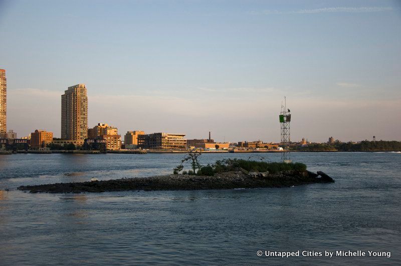
U Thant Island
First up was the 1/2 acre man-man island U Thant Island, situated halfway between the United Nations building and Long Island City, named in honor of the former United Nations Secretary General from Burma. The island was created from the materials excavated by William Steinway in his attempt to built underwater tunnels in the East River between Manhattan and his company town in Astoria, Steinway Village. Steinway died before completion of the tunnels, which were finished by August Belmont. Today the tunnels are still used by the 7 line train.
Not mentioned was the little outcrop just south of Roosevelt Island‘s Four Freedoms Park, where occasionally “Lou” the seal mans his perch.
2. Roosevelt Island
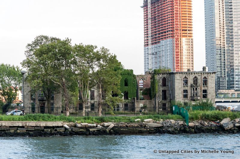
FDR Four Freedoms Park, adjacent to the abandoned James Renwick-designed Smallpox Hospital
As Roosevelt Island changed hands from Dutch to English to American, it subsequently underwent the necessary nomenclature changes–from Manning’s Island to Blackwell’s Island to Welfare Island. The latter name hints at the island’s functional role in New York City’s history as a location for prisons, a lunatic asylum, and a smallpox hospital.
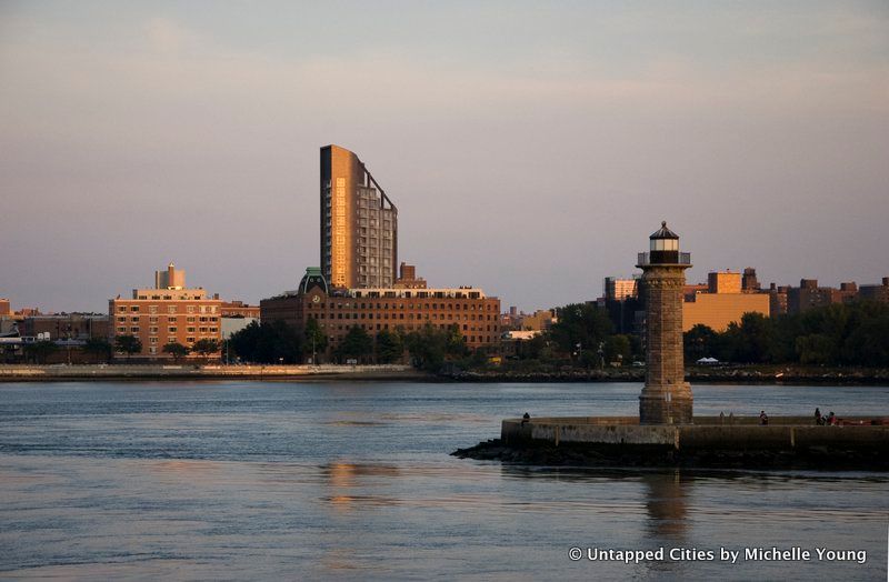
The lighthouse at the northern tip of Roosevelt Island was also designed by James Renwick
3. Mill Rock
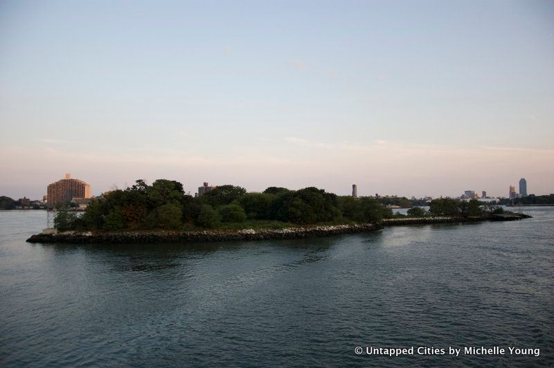
Mill Rock
Mill Rock, just south of Wards Island and Randalls Island, was originally two islands called Great Mill Rock and Little Mill Rock. The area was known as Hell Gate for the havoc it wreaked on ships. The islands were connected in 1885 through a massive detonation by the Army Corps of Engineers that was felt all the way in Princeton, New Jersey.
4. Randalls Island and Wards Island
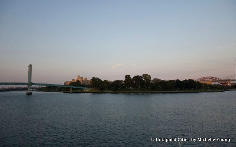
Randalls Island and Wards Island were also separate islands, connected via landfill by Robert Moses. The 103rd Street Footbridge, which connects the island to Manhattan can be lifted in the center to allow ships to pass. Randalls Island is now home to Icahn Stadium and many sports venues. There’s also a new bridge, the Randall’s Island Connector that connects to the South Bronx from the northern end the island.
5. North Brother Island
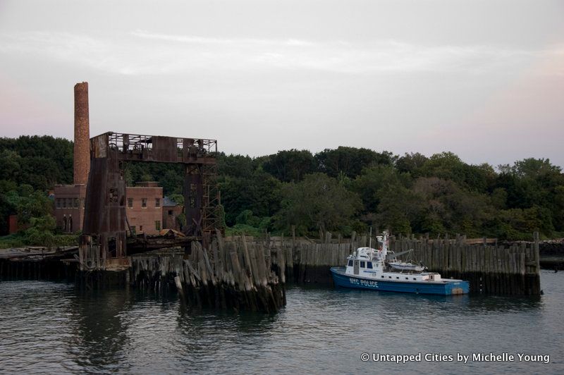
One of the most curious of the other islands is abandoned North Brother Island. Luckily on this boat trip, we were standing next to photographer Christopher Payne, author of North Brother Island: The Last Unknown Place in New York (along with Asylum: Inside the Closed World of State Mental Hospitals

and New York’s Forgotten Substations: The Power Behind the Subway)

. North Brother Island was the site of the General Slocum steamship tragedy where over 1,000 people perished, mostly immigrants. The island was also home to Typhoid Mary, where she was quarantined for the last two decades of her life.
Although there are no current plans for North Brother Island and it functions as a wildlife sanctuary, a study is underway to evaluate future public accessibility to the island. The structures on the island still remain, albeit in a state of decline, including a coal and boiler plant, and nurses quarters.
6. South Brother Island
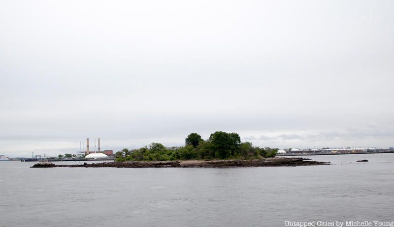
South Brother lacks in foreboding tales of the infirm but it makes up for it with humorous historical real estate ventures. Originally the property of Jacob Ruppert, owner of the Yankees largely responsible for bringing Babe Ruth to New York, the island’s only structure burned down in 1909. After Ruppert sold the island, the real estate transactions go something like this: private ownership to public ownership to private again to public again, with prices ranging from $10 from an investment firm in 1975 to $2 million of Federal Grant money in 2007.
Today, there are sandy beaches and remnants of a dock on the shoreline of South Brother Island.
7. Rikers Island
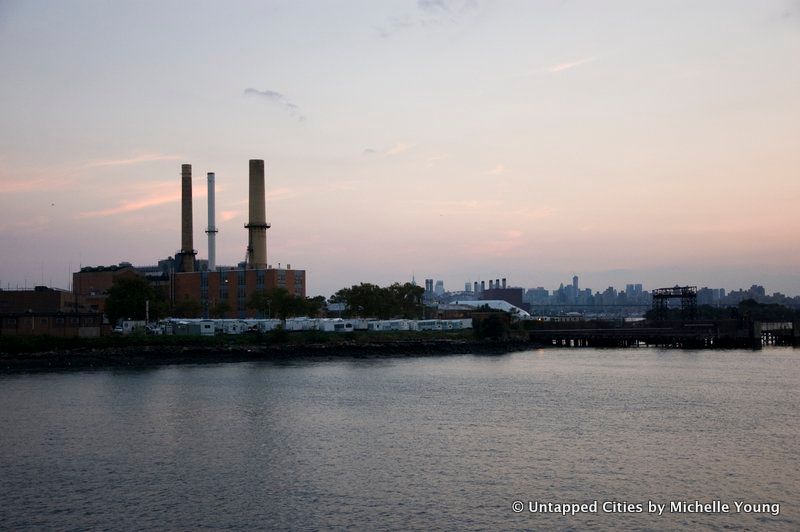
Rikers Island
We’ve had the opportunity to enter the the Rikers Island prison facility several times while working on a legal workshop for the incarcerated juveniles as part of the Rikers Island Project. Though there are moves to relocate Rikers Island to other potential sites in New York City, it still houses approximately 10,000 inmates making it one of the largest correctional facilities in the United States.
8. Hart Island
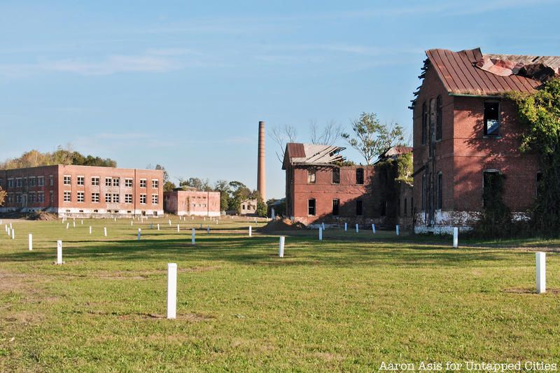
Home to the largest tax funded cemetery in the world, Hart Island has been the final resting place for over 800,000 since 1869. Jacob Riis documented the island in his book, How the Other Half Lives, and estimated that 1 in 10 New Yorkers were buried on the island by the end of the 19th century. Like North Brother Island, it has often been associated with society’s unwanted, though a recent interview with a former resident indicates that it did not always have such a haunting persona. Today, the Hart Island Project seeks to reconfigure the island’s image with the construction of a public park and has worked actively to expand access to the island, particularly for those related to the dead.
9. Execution Rocks Lighthouse
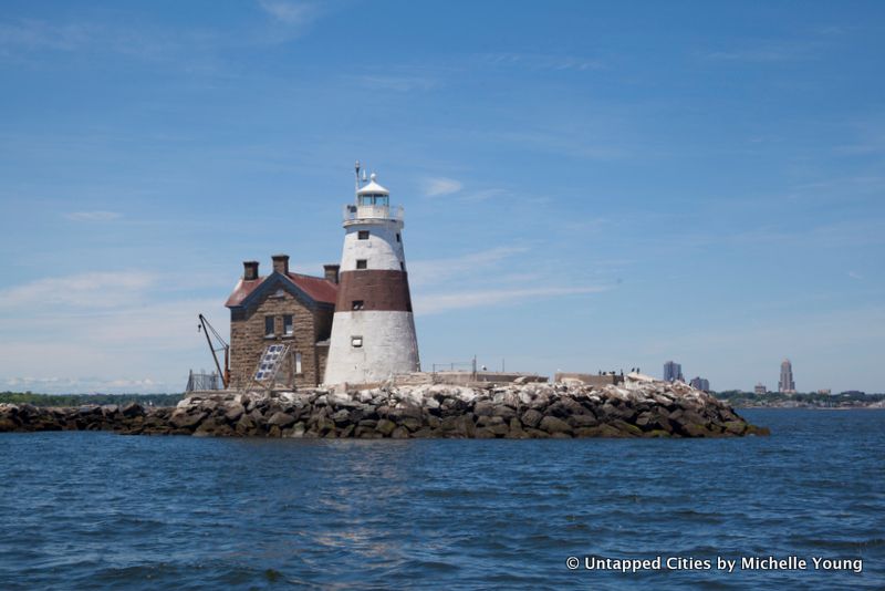
Though part of Nassau County, Execution Rocks lighthouse in Long Island Sound is worthy of note not only for its macabre history, but also because the route to get there passes by City Island and Hart Island, part of the Bronx. Legend has it that Execution Rocks was named because of the executions that took place there under the British authorities before the American Revolution, who chained prisoners to the rocks at low tide to be drowned. The official history of the island’s naming refers to the dangerous passage for ships around the rocks at low tide.
10. Shooter’s Island (Kill Van Kull)
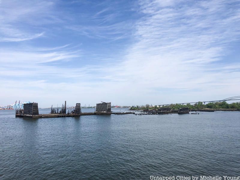
This 43-acre island straddles the border between New York and New Jersey and derives its name from the hunting activities that took place here during the Colonial Era. As New York grew as an industrial port, the island accommodated an oil refinery and shipyard during the 19th century. Today, the island is owned by the Department of Parks and Recreation, with the Audubon Society managing wildlife research. Many prominent historical figures from George Washington to Theodore Roosevelt and Prince Henry of Prussia once made great use of the island, with the former utilizing it as a location to drop off covert messages during the Revolutionary War.
11. Hoffman & Swinburne Islands

Hoffman and Swinburne Islands, a duo of artificial islands rest close enough to Staten Island‘s shore that a proposal once existed to fill the gap between the landmasses to create a park. Such a proposal might not have existed if the planners had known that the islands originally hosted quarantine stations during the height of immigration into the U.S. in the late 19th/early 20th centuries. Constructed entirely of iron in order to keep the structures as airtight as possible, the facilities on the islands included a crematory and a mortuary for the less fortunate patients.
Advances in medical treatment of infectious diseases led to the decline of such facilities, with these two closing in 1923. Having been owned by the Department of Parks and Recreation since 1966, the islands were ironically preserved in order to maintain the “natural” topography of the New York Bay.
12. Rat Island (City Island Harbor)
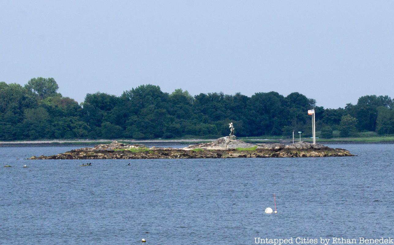
For every obscure real estate venture out there, there is always one that tops the last. Introducing Rat Island, a 2.5 acre mass of bedrock and broken glass with no vegetation between City Island and Hart Island. To the average investor, the island is as devoid of value as it is devoid of life. But you won’t be able to discourage Alex Schibli, a former Port Authority employee and City Island resident who purchased the island for $176,000 in 2011. Schibli claims that he has always wanted an island getaway, but perhaps he’s realized that such a development would be impractical on a landmass that is known for being completely submerged during average summer thunderstorms.
13. Mau Mau Island (Mill Basin)

Islands have historically played strategic roles for nations and their militaries, and those in the New York City are no exception. While the battles on Long Island and Manhattan have been well documented, the naval skirmish that took place on Mau Mau is a little less well-known. That might have had more to do with the post-battle bar hop, though. In 2011, the artist collective Swimming Cities hosted a raucous day of competitive naval events that pitted “gangs” sailing homemade vessels against one another. The manmade island sits across from Marine Park golf course and has attracted little media attention–save for the construction of a bird sanctuary–since.
14. High Island (City Island Harbor)
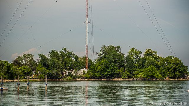
A stone’s throw from City Island, High Island has also proved a cozy home, first for sharks and then for humans. The bungalow dwellers were kicked out in 1962 to make way for a radio transmission tower, which was hit by a small place just one day before owner WCBS switched to an all-news format. A new tower has stood in place since the incident and has a day time broadcast frequency range from Cape Cod to Cape May.
15. Isle of Meadows (Fresh Kills)
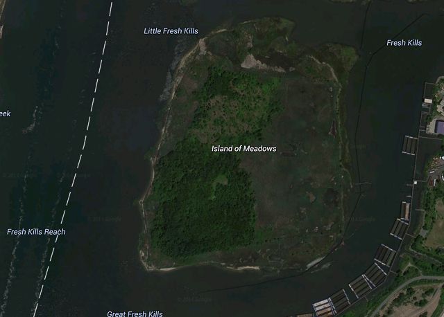
Source: Google Maps
This 100-acre plot of land is as natural as they come, which is why the Audubon Society has fought so hard for its preservation over the years. Plans for its inclusion in the Fresh Kills Landfill were met with volatile opposition in the early 1990s, and today the island consists entirely of a nature preserve. Once declining populations of herons, ibis, and egrets now call the island home, and it has been considered one of the most crucial such refuges in the New York area.
Next, read about 20 of NYC’s abandoned places. Get in touch with the author @untappedmich.


