
Architecture
NYC Views from the Gothic Windows of the Woolworth Building
Find out what you can see from the 26th floor on an exclusive access tour!
Find out what you can see from the 26th floor on an exclusive access tour!

You know the musical. Now see what it left out. Walk in the footsteps of Alexander Hamilton on a tour of Lower Manhattan.
Explore the major works of public art on view in this Manhattan neighborhood!


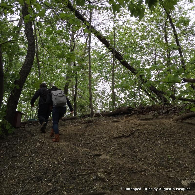
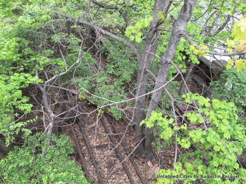
We recently took a trip to explore the potential QueensWay Park site with Andy Stone, director of the New York City program of the Trust for Public Land. While we have documented this former Rockaway Beach Branch line of the Long Island Railroad on numerous occasions previously, this visit showed the unique urban access challenges of the surrounding landscape and what the QueensWay Park hopes to address through the creation of the city’s next linear park.
Yesterday, the design process for the first half-mile of the Queensway Park was announced by the Friends of the Queensway, the Trust for Public Land, and elected officials that support the project.
Potential entrance to the Metropolitan Hub portion of the QueensWay
While Mayor Bill De Blasio and the City of New York have not backed the project at this time, phase one of the design process is funded through over $1 million in public and private sources including a $444,000 grant from the State Office of Parks, Recreation and Historic Preservation and Governor Cuomo’s Regional Economic Development Council, $250,000 from New York State Assembly Member Andrew Hevesi, $250,000 from Queens Council Member Karen Koslowitz, as well as other private donations.
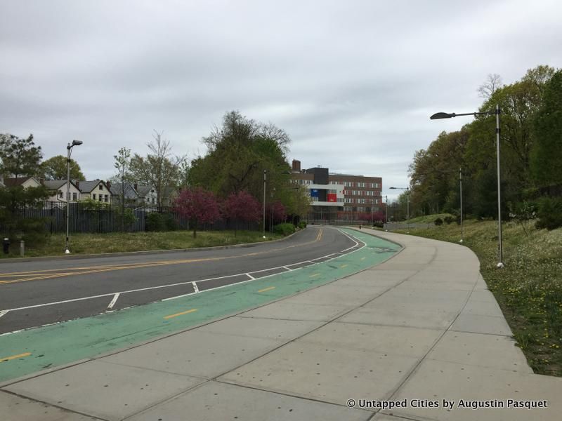
The Metropolitan Expeditionary Learning School and Queens Metropolitan High School in background, alongside embankment portion of the QueensWay, on the right
The first phase of design will be led by Susannah Drake, founder of DLANDStudio, the firm also behind Sponge Park on the Gowanus Canal. The portion of the Rockaway Beach Branch line to be addressed in this phase will stretch a half-mile from the “Metropolitan Hub,” an educational campus with over 2000 students on Metropolitan Avenue (home to the Metropolitan Expeditionary Learning School and the Queens Metropolitan High School), to Union Turnpike, before the beginning of Forest Park.
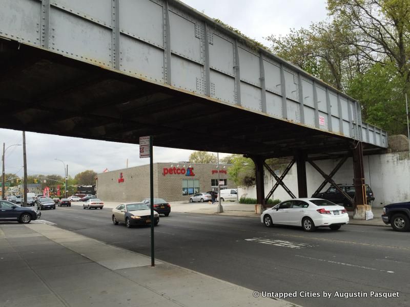
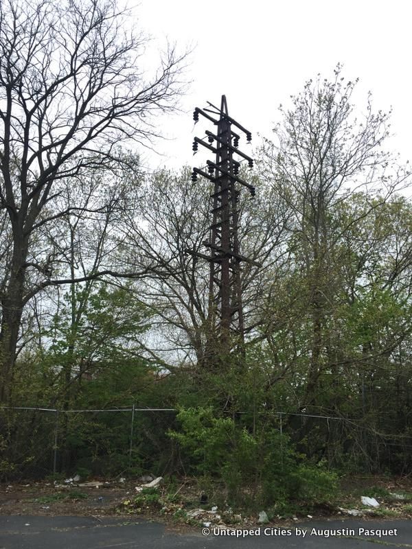
The current conditions along the future QueensWay vary dramatically, from an earthen embankment to dilapidated overpass bridges to a near-abandoned parking lot. Planned clearly with the automobile in mind, the area just adjacent to the first portion of the QueensWay is surrounded by big box stores like Home Depot, Stop & Shop, and the Sports Authority, each with large parking lots. The elevated 6-lane Woodhaven Boulevard runs alongside, traversed by a poorly maintained pedestrian bridge that provides access over the still-active Long Island Railroad Montauk Branch freight line.
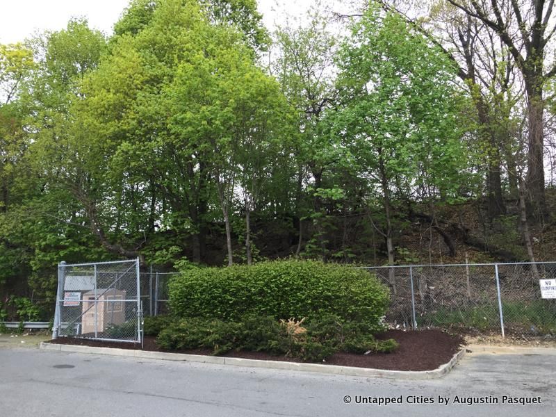
Some landscaping by Home Depot in their parking lot. Potential QueensWay line in background
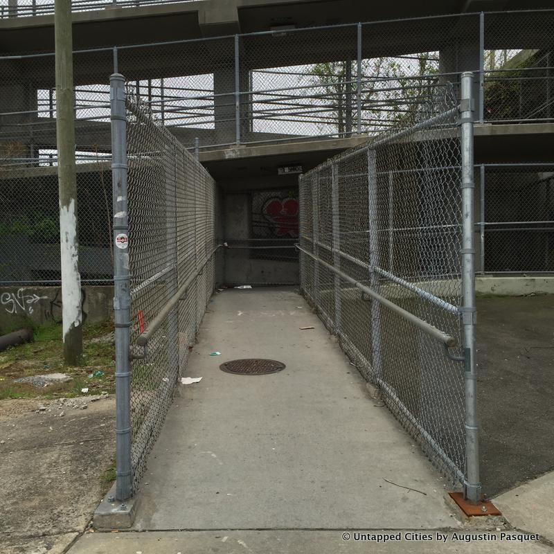
Pedestrian walkway
It’s clear if you attempt the haphazard, non-direct walk from Metropolitan Hub to Forest Park today what the benefit of the QueensWay could be in terms of access, if completed. In addition to improved connections and accessible green space, the current plan for this stretch aims to add outdoor nature classrooms, educational plantings, farmers market, and more recreational space. A barren parking lot behind Stop & Shop, now home to a batting cage run by the Glendale Little League and trash, will become a BBQ and picnic area, with a lawn and improved access to the baseball fields.
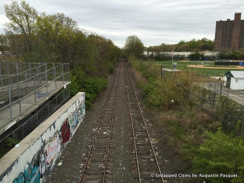
Montauk Branch freight line. Glendale Little League ballfield to the right
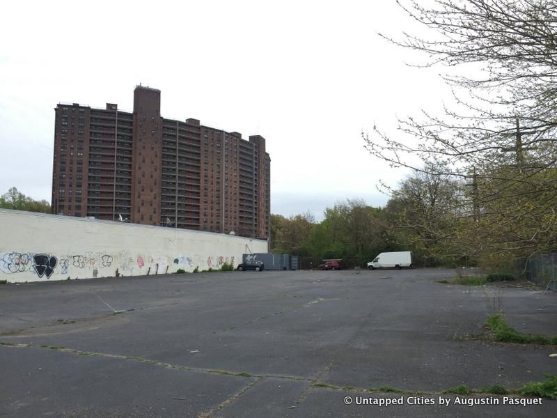
Empty parking lot behind the ballfields
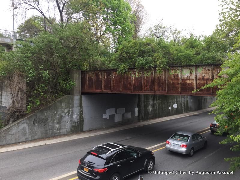
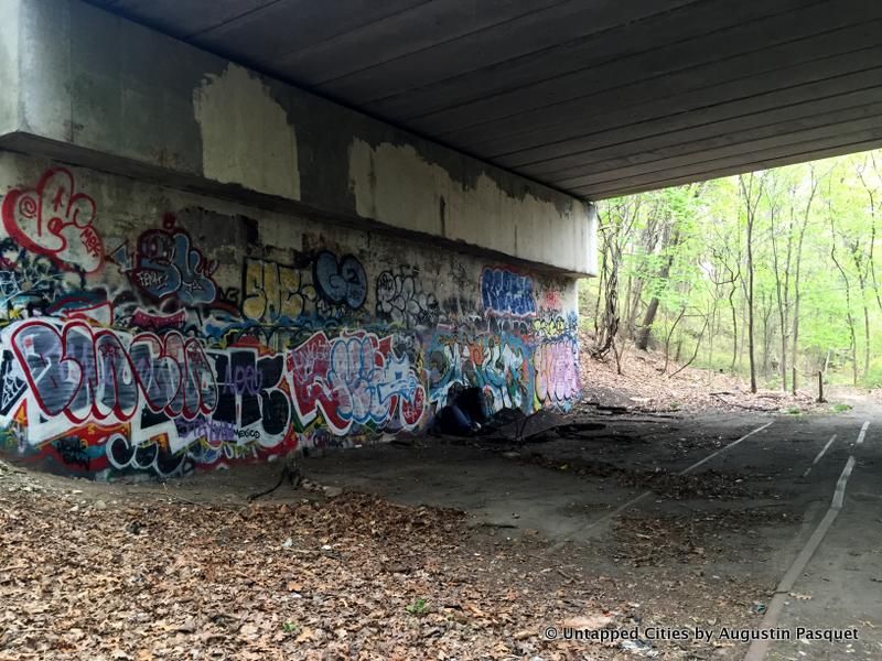
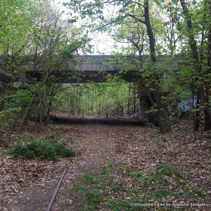
 Abandoned bridge over Union Turnpike
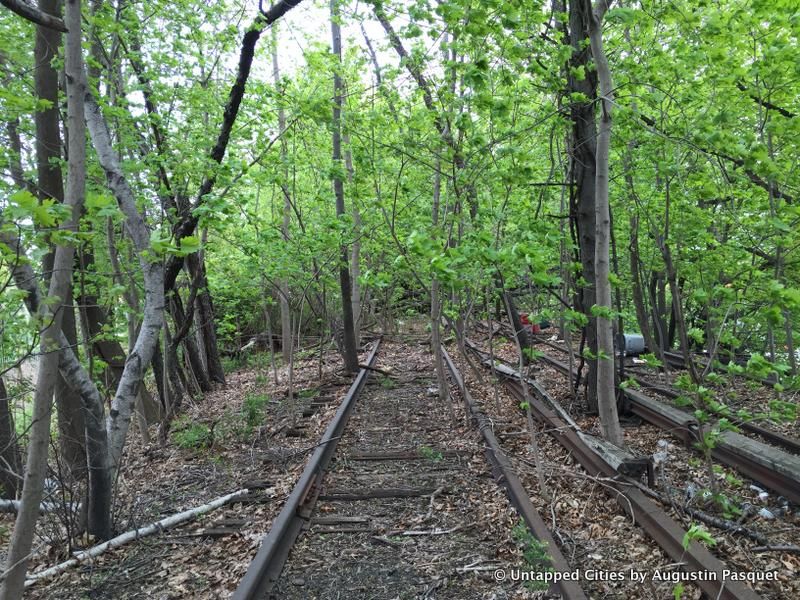
Parks converted from former rail lines have almost become foregone conclusions due to the success of the High Line and other similar parks around the world. But the QueensWay has its detractors too, particularly those that hope to see the rail line revived once again for public transportation. 1962 saw the last passenger train along the Rockaway Beach Branch, which closed due to low ridership.
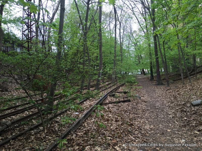
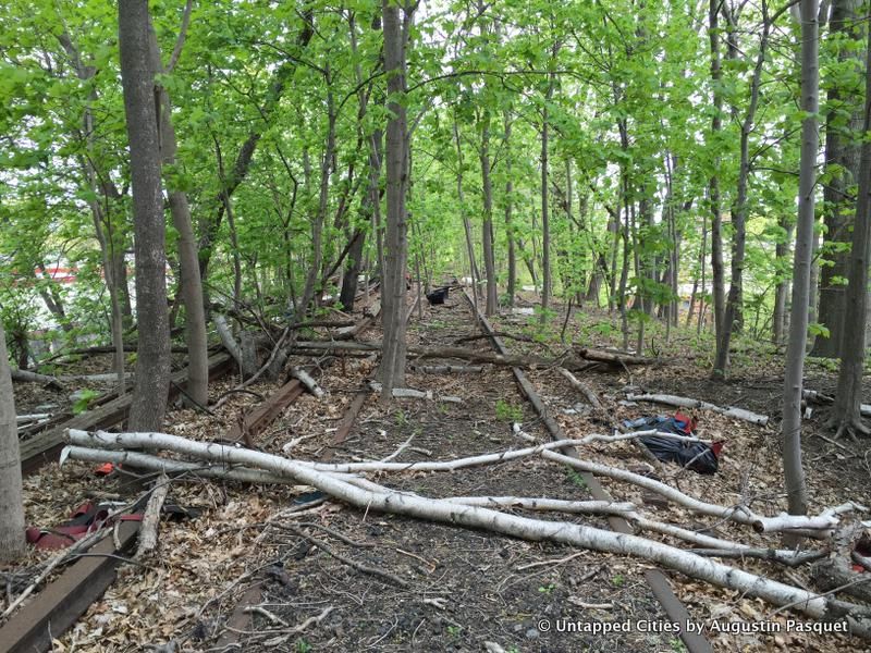
Portion of the QueensWay in Forest Park, not part of the phase one design process
Queens has developed significantly in the last half century and its become clear that the outer boroughs of New York City need better transportation, particularly within and between boroughs. Yet, as Andy Stone tells us, there have been several initiatives to study reactivation of the Rockaway Beach Branch by the MTA and the Port Authority, but none so far have come to fruition.
Portion of the QueensWay in Forest Park, not part of the phase one design process
Portion of the QueensWay in Forest Park, not part of the phase one design process
Currently, of the 47 acres planned for reuse as the QueensWay is managed by the Department of Citywide Administration Services (DCAS) and seven acres are dedicated parkland run by the NYC Department of Parks & Recreations. One way to make the QueensWay a reality would be to transfer the 40 acres from DCAS to the parks department, a process that would not require ULURP (the Uniform Land Use Review Procedure) since the city already owns the land. The Friends of the Queensway estimate that cost for the entire project would be $120 million.
Stay tuned for further developments on the QueensWay. Sign up for advance notice for an Untapped Cities tour of the QueensWay site:
( function () { const contact_forms = document.getElementsByClassName('contact-form'); for ( const form of contact_forms ) { form.onsubmit = function() { const buttons = form.getElementsByTagName('button'); for( const button of buttons ) { button.setAttribute('disabled', true); } } } } )();
Submit
Next, read about the Top 10 Secrets of the High Line.

Subscribe to our free newsletters
Free Newsletters
Get the best stories and things to do sent straight to your inbox.