Transit
Last Chance to Catch NYC's Holiday Notalgia Train
We met the voices of the NYC subway on our nostalgia ride this weekend!
We met the voices of the NYC subway on our nostalgia ride this weekend!

It was a first not just for NYC, but for the nation!

From midnight bike rides to morning cold plunges, discover alternative ways to ring in 2026!


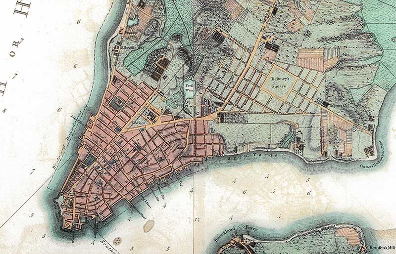
New York City has a long tradition of incorporating more than just a geographic location into a street name, dating back to streets in the Financial District that were named for commercial practices by early colonists. Whether honoring politicians or war heroes, these street names in neighborhoods all over the city offer a glimpse into the history of the neighborhood, how it was developed and who was critical in doing so.
And despite all of the numbered streets in New York, there are many named streets that, when seen as a collected group, create a common theme within their neighborhoods, from the Bronx to Brooklyn.
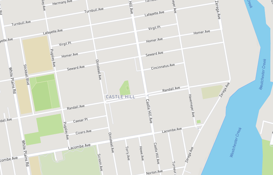
Virgil Place, Homer Avenue, Cincinnatus Avenue, Caesar Place, and Cicero Avenue of Castle Hill in the Bronx all run east-west for short distances, and take their names from ancient Greece and the Roman Empire. John McNamara wrote in his 1978 book History in Asphalt: The Origin of Bronx Street and Place Names that this small cluster of roadways all owe their street names to one realtor.
These east-west streets can attribute their classically inspired names to Solon L. Frank, a prominent realtor who developed this area in the early 1900s. McNamara suggests that it was Frank’s first name Solon, the same as an ancient Athenian statesman, which led to his desire to honor the ancient Greek and Roman poets and rulers.
The other east-west avenues that bound this group of classically-themed streets were all surveyed and named before Frank was working in the area. Lafayette Avenue, named after the Marquis de Lafayette, and Randall Avenue, named after the Civil War Brigadier General George W. Randall, were both named after war heroes. Seward and Lacombe Avenues both honor old New York judges from the 19th century, McNamara claimed. The Seward named here, Samuel S. Seward, was father to the more famous William Seward, Secretary of State for Abraham Lincoln and purchaser of Alaska.
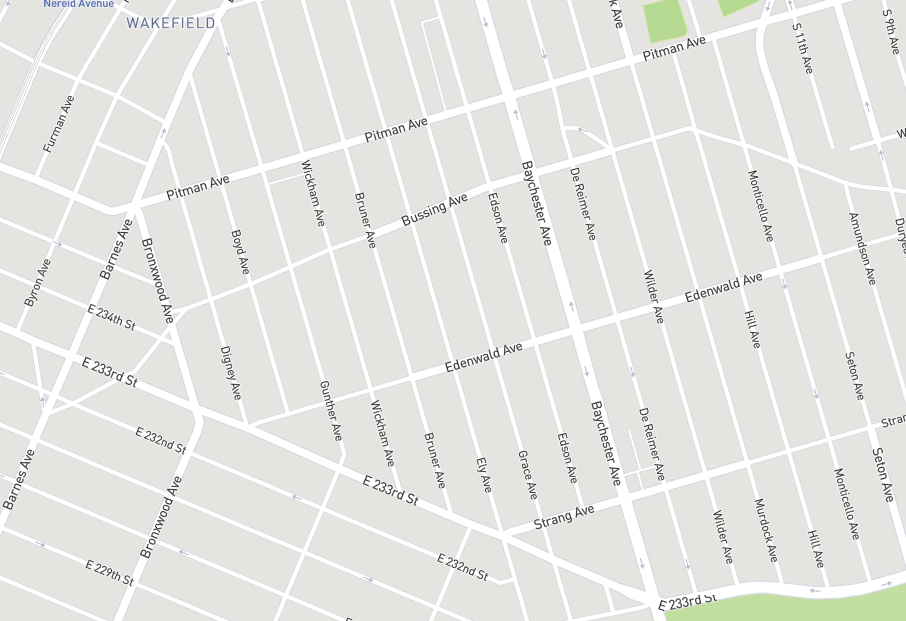
McNamara also found the northern half of Wakefield in the Bronx was littered with street names honoring old mayors of New York. From De Reimer Avenue west to Gunther Avenue, with the exceptions of Baychester and Bruner Avenues, six former mayors ranging from 1700 to 1886 have their names on street signs. Only William R. Grace served more than two years, as he was in office for two non-consecutive terms in the 1880’s and was best known for his battles against Tammany Hall.
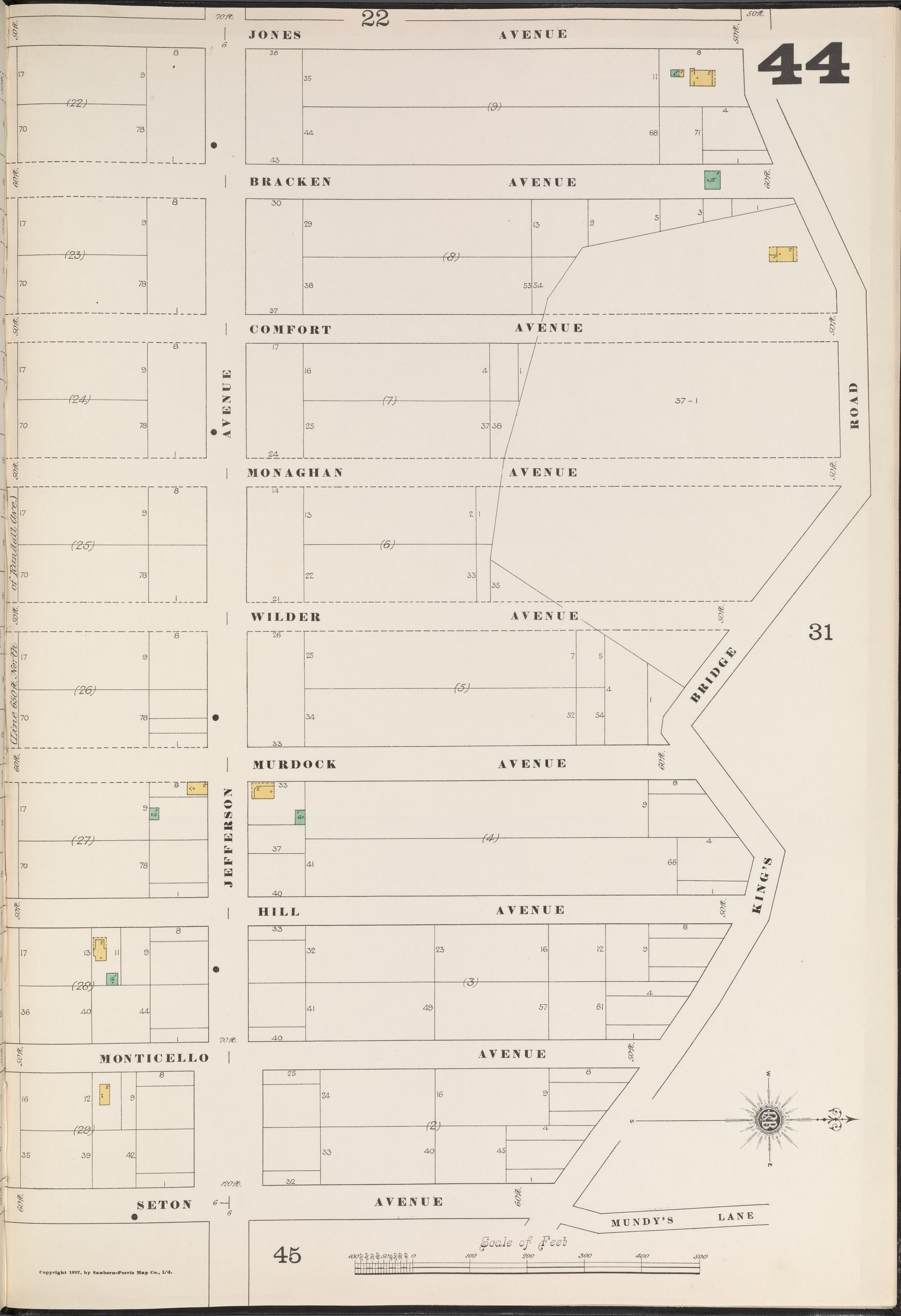
Edson Avenue also has a brief connection to the old Democratic Party political machine. Before officially honoring Franklin Edson, mayor of New York from 1883-1884, the street was planned to be named Bracken Avenue, according to McNamara. Henry Bracken was a prominent member of Tammany Hall in this area of the Bronx, and some old maps include his name for the street instead of Franklin Edson’s. This fire insurance map from 1897 shows Bracken Avenue in place of Edson Avenue, three blocks west of Wilder Avenue.
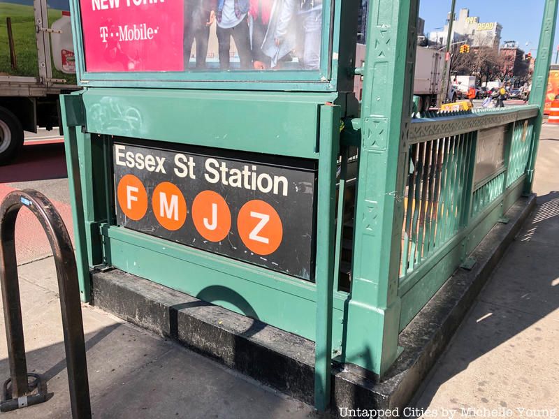
Down in the Lower East Side, there are three north-south streets that share their names with English counties: Essex Street, Norfolk Street, and Suffolk Street. The Street Book: An Encyclopedia of Manhattan’s Street Names and their Origins, written by Henry Moscow in 1990, confirms this connection to New York’s colonial past.
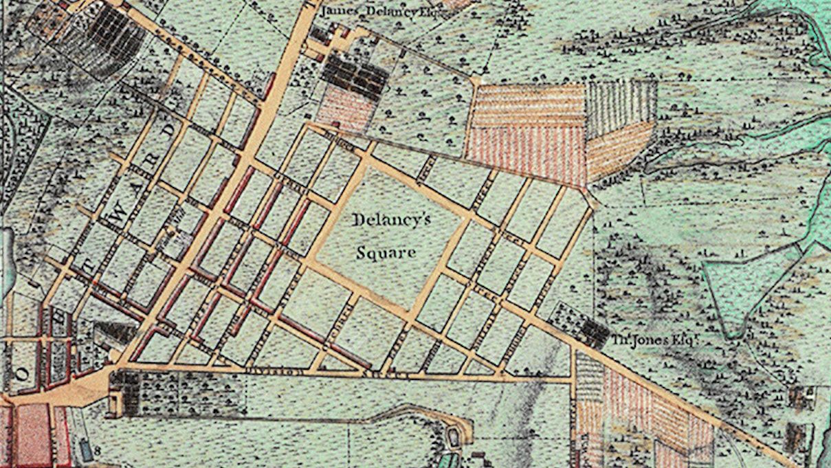
We can see the original plan for these streets on the Ratzer Map commissioned by King George in 1767, and recently restored by the Brooklyn Historical Society after it was found in their archives.
The Ratzer Map shows the creation of one of New York’s first grids in the Lower East Side to the south of James De Lancey’s estate. The former colonial governor of New York lends his name to the street that would later cross his property as seen on this 1817 map of lower Manhattan available in the New York Public Library.
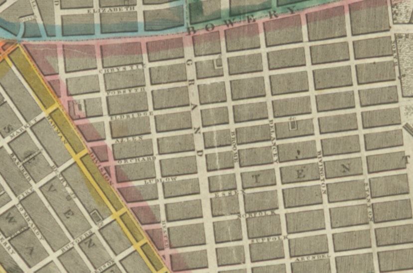
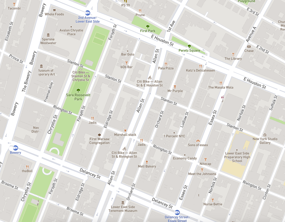
One major difference between the street names of 1767 and 1817 in the Lower East Side was the change of First, Second, and Third Streets to the present-day names of Chrystie, Forsyth, and Eldridge, respectively. Also, on either side of Orchard Street, Allen and Ludlow Streets were added to standardize the width of each block.
These five street names, and their appearance starting in 1817, can be traced to heroes from the War of 1812. Moscow explained that Lt. Col. John Chrystie, a Columbia University graduate, led two attacks during the Battle of Queenstown Heights in Ontario. Benjamin Forsyth died while fighting in upstate New York in June 1814 and Joseph C. Eldridge, a Lieutenant, was killed in Canada after a scalping by the Indians.
Both William Henry Allen and Augustus C. Ludlow served in the navy during the War of 1812. Allen was the youngest ship captain in the navy during the war before dying in 1813 and Ludlow took charge of the ship Chesapeake after his captain was wounded during a battle in Boston Harbor.
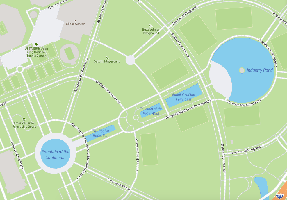
While parts of Flushing-Meadows Corona Park in Queens have gone to ruin, one reminder of the 1964 World’s Fair are all of the walkways, promenades, and paths, and their respective street names, that linked the old exhibition sites. Still shown on sites like Google Maps and Mapbox, these “streets” are inaccessible to car traffic, but pedestrians can still stroll down the Path of Commerce or the Dwight Eisenhower Promenade in the park. Other place names include Court of the President of the United States, the inspirational Avenue of Progress and Avenue of Discovery, United Nations Avenue, as well as Queens’ own Avenue of the Americas.
Read more about proposals to update the abandoned New York State Pavilion at the World’s Fair site.
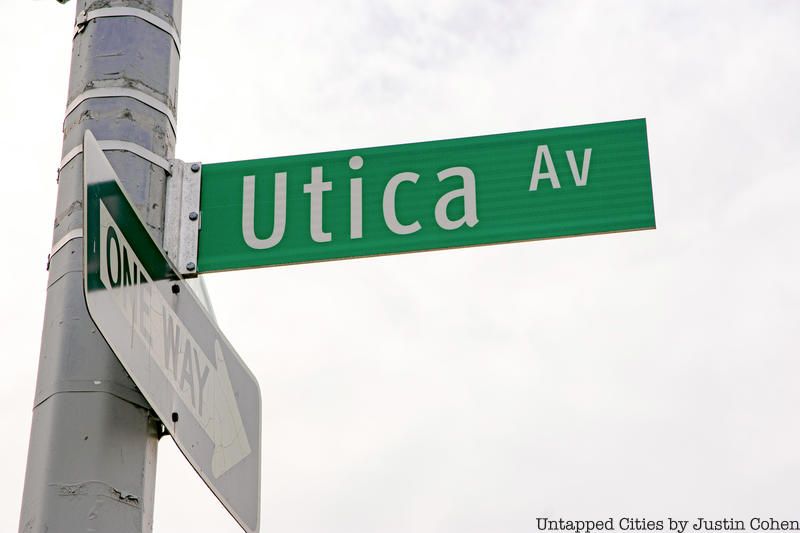
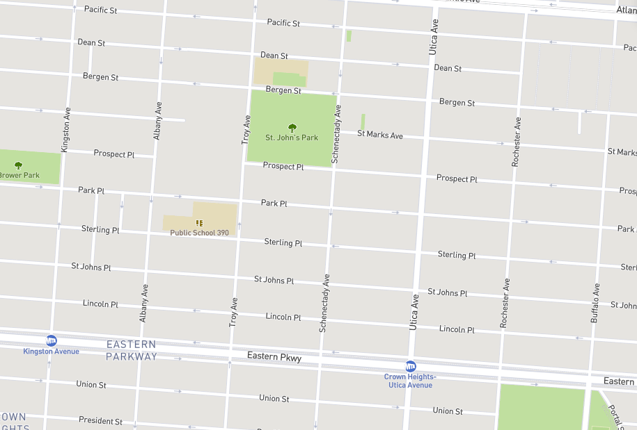
Heading southwest down to Crown Heights, Brooklyn, is a cluster of seven consecutive north-south avenues that all share names with cities in Upstate New York, and driving east down the Eastern Parkway, you’ll find city names that are progressively further from Brooklyn. Beginning with Kingston Avenue furthest west, named for the county seat of Ulster County, the avenue names follow a path north up the Hudson River, reaching the namesakes for Albany and Troy Avenues. From there, the path turns west at the fork with the Mohawk River to get to Schenectady and then Utica Avenues. Ditching the river path, the last two street names honor the second and third most populous cities in New York State: Buffalo and Rochester, respectively. Rochester Avenue comes first, however, if you’re driving east, since Rochester is roughly 50 miles closer to New York City than Buffalo.
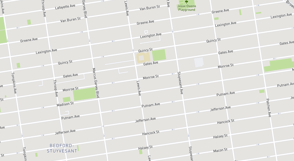
Continuing in Brooklyn, moving a few blocks north to Bedford-Stuyvesant, is a cluster of streets names serving as reminders of some of the country’s earliest presidents. Jefferson Avenue and Madison, Monroe, and Van Buren Streets honor the third, fourth, fifth, and eighth presidents, respectively. And while Quincy Street appears to be in reference to John Quincy Adams, the sixth president, the street is actually named after Josiah Quincy III, according to Leonard Bernardo and Jessica Weiss, authors of Brooklyn by Name. With no connections to New York or Brooklyn, Quincy served as a congressman, mayor of Boston, and president of Harvard College during the first half of the 19th century.
The street names surrounding the presidents are also remembrances from the revolution, according to Bernardo and Weiss. Hancock Street honors John Hancock, president of the Second Continental Congress, and Putnam Avenue is in remembrance of Israel Putnam, one of the commanders at the Battle of Bunker Hill. Lexington Avenue is named for the first battle of the revolution at Lexington, Massachusetts, and both Greene and Gates Avenues owe their street names to legendary Continental Army generals Nathanael Greene and Horatio Gates.
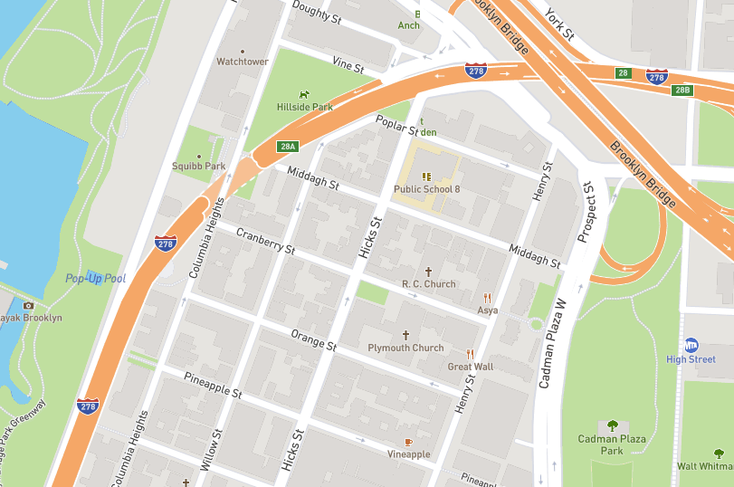
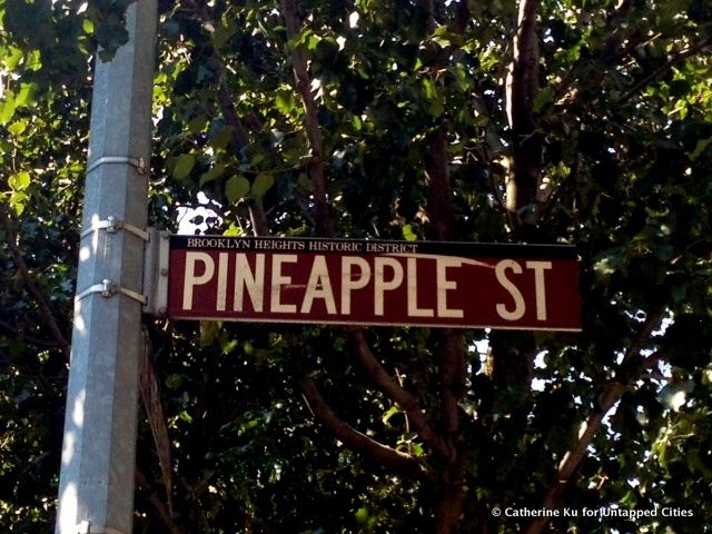
In Brooklyn Heights, three short, east-west streets are named after fruit: Cranberry, Orange, and Pineapple Streets. As covered in a previous Untapped Cities article, there are two competing theories as to how these streets just south of the Brooklyn Bridge got their names. One theory from NYC Parks attributes the tropical goods to local landowner Lady Middagh, who has a street named after her family just north of Cranberry Street. She was upset with the neighborhood’s streets being named after local aristocratic families (her own aristocratic family name must have slipped past her sense of irony), and tore down the street signs and installed her own.
The other theory, posed by the New York Times, places the seeds for these street names with the Hicks brothers, who unsurprisingly also have a street named after them in the neighborhood. The Hicks also owned real estate in the area and sold exotic fruits here, placing the street names to represent this commercial activity.
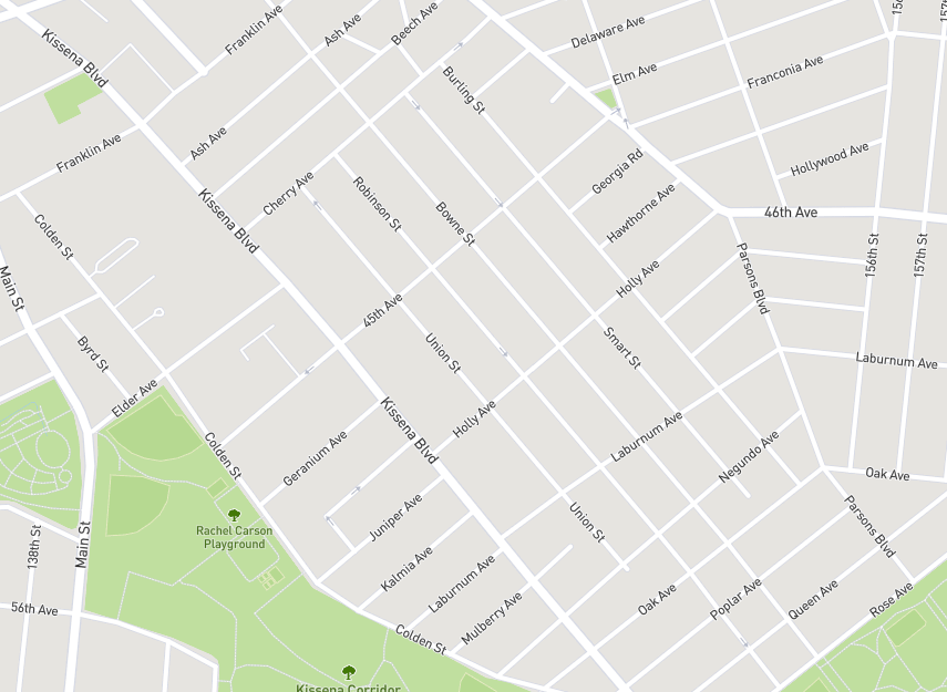
Another example of botanical street names pops up in Flushing, Queens where there are more than ten streets named after trees or other plants. Ranging from common names such as Ash Avenue and Oak Avenue to scientific names Kalmia Avenue (Kalmia is the genus for a variety of laurels) and Negundo Avenue (Acer negundo is the official name for the box elder tree). While these streets are not as evenly laid out as in the other neighborhoods, with perfect right angles or even distances between blocks, there is a method to the order of how these streets are named.
Starting with Ash Avenue in the northwest to Rose Avenue in the southeast, the street names in Flushing follow an alphabetical pattern along with their horticultural roots. Ash, Beech, and Cherry cover the first three letters. Not shown on the map above is Dahlia Avenue, which borders the Queens Botanical Garden to the north. From there, either Elm or Elder Avenues can come next, but there is no street beginning with “f.” (Perhaps the phonetic reading of 45th Avenue, right between Elder and Geranium, fulfills the “f” requirement.)
After Geranium Avenue comes Holly, Juniper, Kalmia, Laburnum and Mulberry Avenues, with a noticeable lack of a plant starting with the letter “i.” Negundo, Oak, and Poplar Avenues take us then to Quince Avenue, a non-native species of flowering tree most commonly found in Turkey and China. While the Mapbox map above lists the street between Poplar and Rose as Queen Avenue, the street is actually called Quince Avenue, according to street signs visible on Google Streetview.
Unfortunately, all of the reported street trees in this neighborhood are American Basswoods, which limits the ecological diversity of the area to simply the street names.
Whether they honor war heroes, English counties, or different fruits, New York street names provide more than a simple geographic marker by offering insight into the history of the neighborhood.
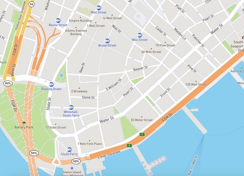
Back to the very beginning, many streets of Lower Manhattan were named for old Dutch colonial trade practices. Some examples include Beaver and Pearl Streets in the Financial District. Others take the name of indigenous local species, like Pine Street which is named after a pine wood that was on the Dutch farm the street went through. We can assume streets like Cedar Street and Cherry Street likely had similar origins.
Some streets names from the Dutch period that no longer exist that fall into this category include Brewer Street (originally Brouer), Marketfield Street (originally Marketveld) and Mill Street (now William Street, though a Mill Lane still exists and is one of the shortest streets in New York City). There was originally also a Beaver Path, which is now where 1 Broadway is.
While pedestrians can find several themes throughout Heartland Village in Staten Island – there’s an Alaskan theme (Alaska Place, Yukon, Klondike Avenues, etc.), a college theme (Purdue, Vassar, Rockne, Villanova and “Merrymount”) and a New England theme (Bowdoin, Copley, Bangor) – the most notable naming system uses the monikers of astronauts from the Mercury, Gemini and Apollo space programs of the 1960s.
The featured names include noteworthy space-explorers like James McDivitt, James Lovell, Wally Shirra, Frank Borman, Deke Slayton, Pete Conrad, John Glenn, Scott Carpenter, Alan Shepard, Gordon Cooper, and Gus Grissom.
Next, check out a map showcasing all 1,678 honorific street names in New York and learn about different streets that owe their names to their old utilitarian functions.

Subscribe to our newsletter