
Architecture
NYC Views from the Gothic Windows of the Woolworth Building
Find out what you can see from the 26th floor on an exclusive access tour!
Find out what you can see from the 26th floor on an exclusive access tour!

Explore "Democracy Matters" on a docent led tour!
Discover how the criminal justice system has impacted music history throughout the 20th century!


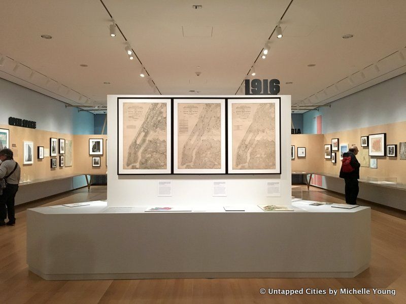
If you love maps and urban development, the exhibit Mastering the Metropolis New York and Zoning, 1916-2016 at the Museum of the City of New York is the place for you. Zoning is the primary tool of development for New York City and much of the built environment – the nature of neighborhoods and the shape of buildings are often dictated by the demands of the zoning code. As we previously detailed, the history of zoning is clearly visible in how the New York City skyline evolved.
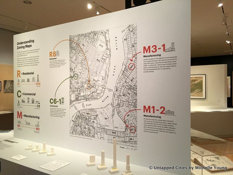
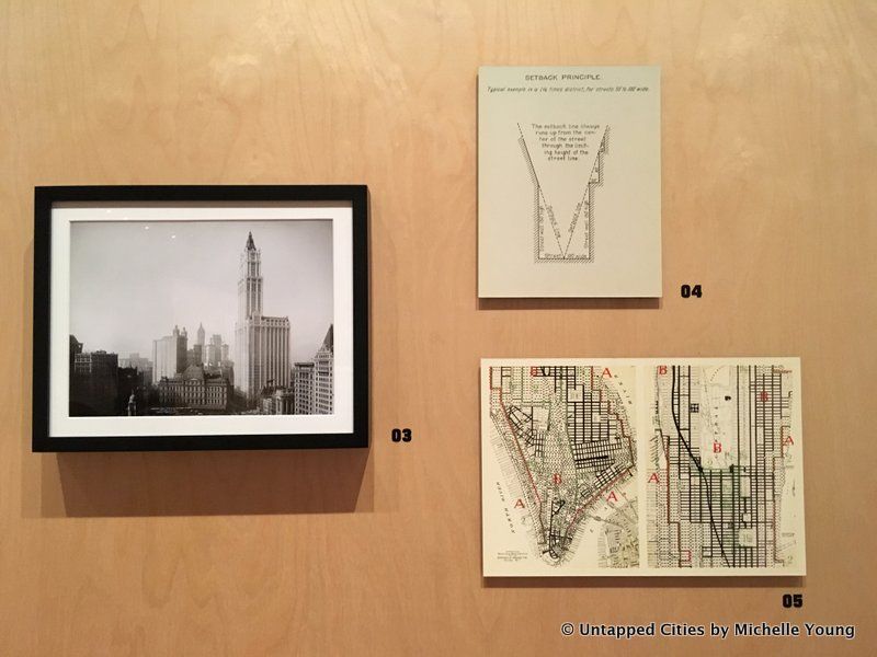
Timed with the 100th anniversary of the 1916 Zoning Resolution, the country’s first comprehensive zoning ordinance, the exhibit shows how the zoning code is structured, how it impacts a building’s height, width, even shape. It shows how zoning organizes the different usage of land, and how that has changed over time. Things we take for granted as natural to New York City, perhaps architecture that is indigenous to the city like setback skyscrapers and large public plazas, all come from the zoning code. It even explains why Staten Island is so residential.
The exhibit points out that the 1916 zoning code was so novel in its scope “that the authors were not sure it would withstand a legal challenge. The law was sweeping, giving city officials the right to regulate the height, bulk, and use of every new building across the city, but it was employed in a conservative manner to ensure support from both reformers and real estate interests.” In addition, like good politicians, the commissioners who laid out the 1916 zoning ordinance “decided to err on the side minimal restrictions and to embrace existing patterns of growth,” giving legal structure to patterns that continued to exist into the 21st century – industry on the waterfront and commercial skyscrapers in Lower Manhattan, for example. They also focused on the important issue of the time period – public health – as a means to garner support for the ordinance.
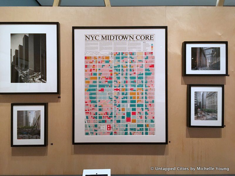
An update to the zoning ordinance in 1961 added Special Purpose Districts that helped preserve the character of neighborhoods like The Special Theater District in Midtown, and Contextual Zoning, that laid out guidelines for now how new buildings would fit into existing the architectural fabric in terms of bulk and height, like on the Upper East Side. The takeaway here is that zoning must be regularly re-evaluated – what was critical before may not be as relevant in the decades or centuries after. But the city as we know it, architecturally and and urbanistically, is generally more controlled than most people think.
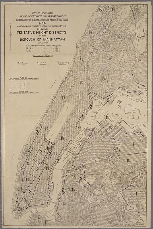
Commission on building districts & restrictions map accompanying tentative report of March 10, 1916, showing tentative height districts in the Borough of Manhattan, 1916. Courtesy of The Lionel Pincus and Princess Firyal Map Division, The New York Public Library, Astor, Lenox and Tilden Foundations
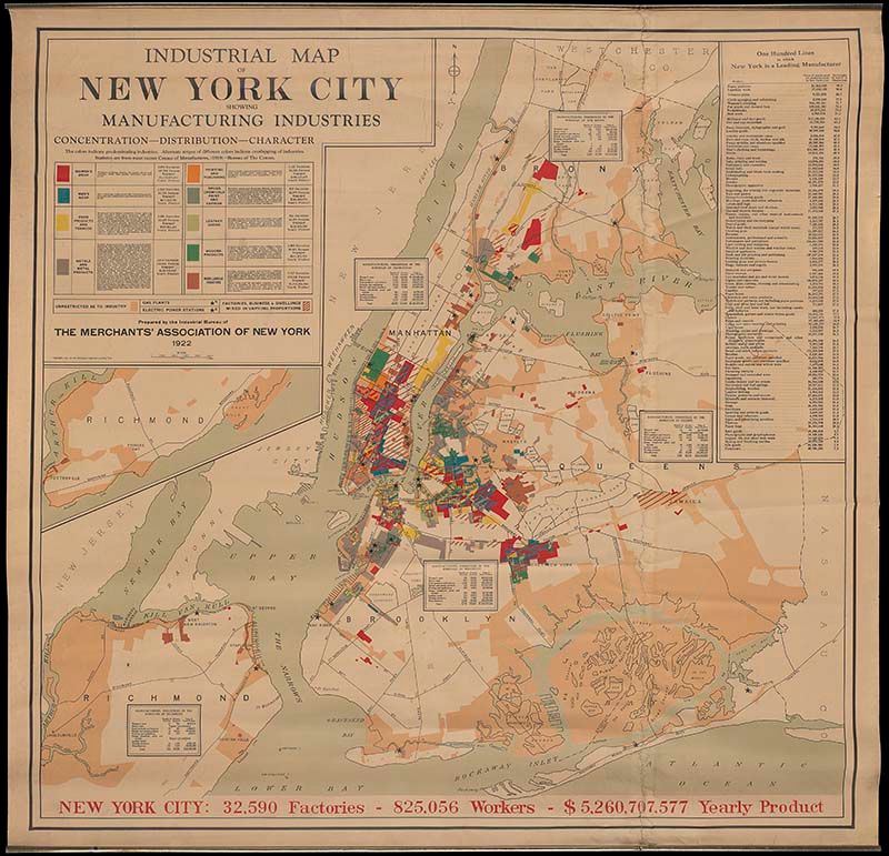
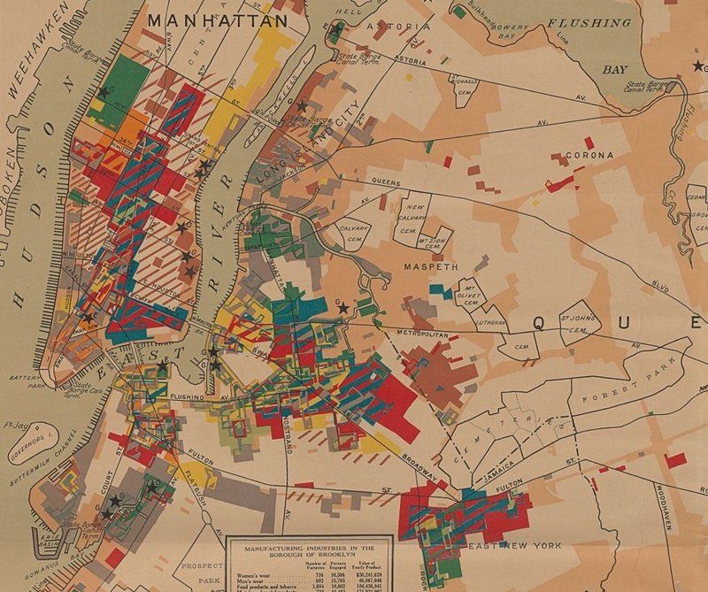
One of the maps in Mastering the Metropolis, created by the Merchants’ Association of New York in 1922 utilizing 1919 Census data shows the diversity of manufacturing industries in New York City at turn of the Roaring ’20s.
Map at the Museum of the City of New York, gift of McKim, Mead & White
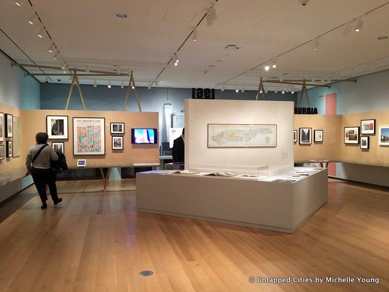
This is a great exhibit to take in conjunction with New York At its Core, a landmark exhibit about 400 Years of New York City’s history and a lab about its future that inhabits the entire first floor of the museum. More maps from the Museum’s collections are digitized and presented in interactive screens.
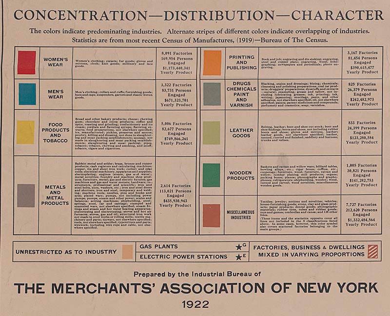
Here is the key to the map, which shows the important categories in this time period as defined by the Census of Manufactures:
As Sarah Henry, Deputy Director and Chief Curator at the Museum of the City of New York told us:
There’s massive amount of production going on. It’s hidden in plain sight in New York City, but unlike cities that are famous for manufacturing, but were much smaller like Detroit or Pittsburgh, those places were dominated by a single industry and they were producing things in very large factories. In New York, there were many many different industries and the factories tended to be small so even though they employed many more people and produced much more product, you couldn’t necessarily see it.”
Women’s clothing brought in over $866 million a year, producing over 71% of the country’s production in that category. Men’s clothing $531.5 million a year, but was a smaller percentage of overall national production at 42%. These categories do not include other clothing categories like fur, millinery and lace goods, hats, shirts, buttons and more. New York City produced almost 96% of the country’s paper patterns (for construction clothing), almost 81% of the country’s tobacco pipes, and 90% of the country’s lapidary work (stone engraving).
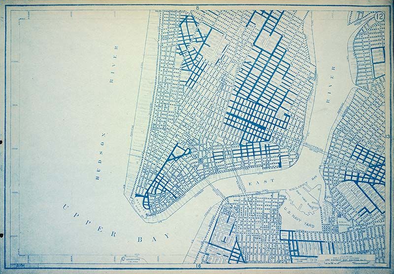
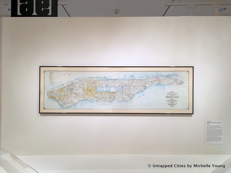
New York (N.Y.). Board of Estimate and Apportionment, Use District Map Section No. 12, 1916 Courtesy of The Lionel Pincus and Princess Firyal Map Division, The New York Public Library, Astor, Lenox and Tilden Foundations
These two exhibits alone are well worth the trip uptown, but the museum has many more great exhibits on concurrently including Gay Gotham, In the South Bronx with photography by Mel Rosenthal, and Timescapes. Check out the next event for New York At its Core: 400 Years of History, Live from New York! with Sarah Henry and Steven Jaffe, two of the lead curators of “New York at Its Core,” for a conversation with Greg Young and Tom Meyers of The Bowery Boys. The next public event for Mastering the Metropolis: Zoning for Public Good is on January 26th.

Subscribe to our free newsletters
Free Newsletters
Get the best stories and things to do sent straight to your inbox.