How to Make a Subway Map with John Tauranac
Hear from an author and map designer who has been creating maps of the NYC subway, officially and unofficially, for over forty years!

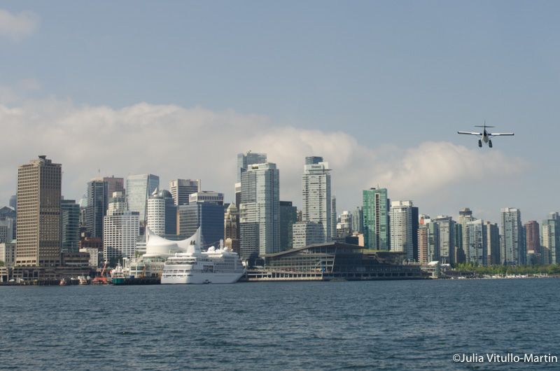
Is “a New York state of mind” the right mentality for Vancouver, British Columbia in handling its transportation issues? “Yes,” says Vancouver Courier’s Mike Klassen, who is urging for millions of dollars to be spent more on street improvements to attract pedestrians, cyclists, and shoppers. To the naked eye, however, Vancouver already looks like a pretty big, transportation-oriented city, with an abundance of ferries, sea planes, bike lanes, pedestrian plazas, pleasant buses, and a new-ish light-rail, the SkyTrain, that connects crucial points, including the waterfront and the airport.

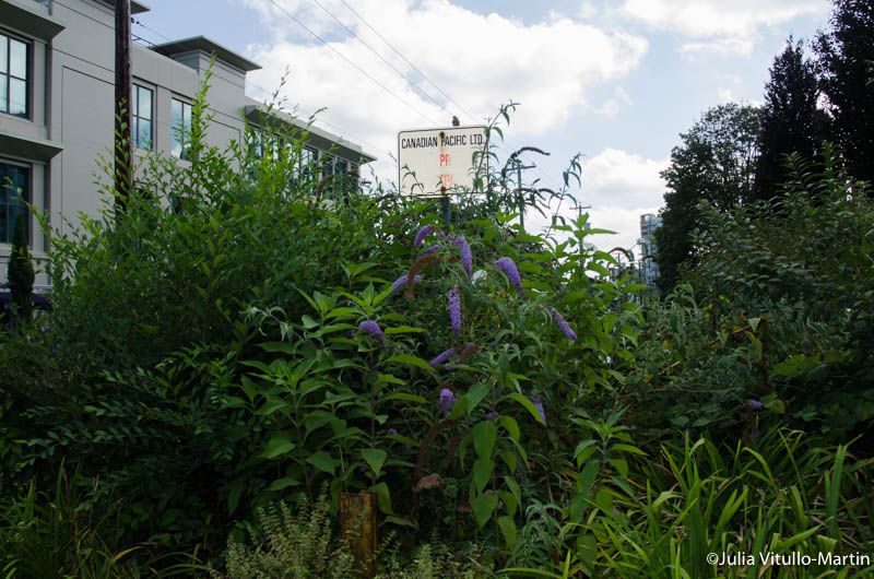
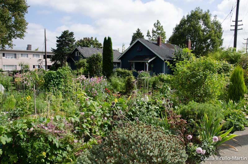
But Vancouver isn’t finished. Last fall, it bought the Arbutus Corridor for $55 million from a reluctant seller, the Canadian Pacific Railroad, which had been demanding a price closer to the estimated value of $100 million—or even 5 times higher, according to some accounts. A 42-acre, 11-mile stretch of former rail tracks and land, the Arbutus Corridor snakes through and alongside some of Vancouver’s nicest neighborhoods. After the Canadian Pacific stopped running freight trains on it in 2001, the corridor was informally colonized by walkers, bikers, and, most beautifully, by community gardeners.

But before capitulating, the railroad fought back in 19th-century robber-baron style, erecting no-trespassing signs on the disused corridor, ripping out the community gardens, and threatening dog walkers and bikers. It was their property, after all, bequeathed to them by the province of British Columbia in 1886. But they had neglected it for years, leaving it in “disgraceful condition,” says transportation economic Stephen Rees. No one would ever be able to run freight on those lines again without entirely rebuilding the tracks and, equally unlikely, finding new freight customers. The poorly performing Canadian Pacific has neither the capital resources nor the will to do either.
Having triumphed over the railroad, Mayor Gregor Robertson now calls the corridor “Vancouver’s chance to have a New York-style High Line,” the phenomenally successful park on Manhattan’s West Side, that was built on a former, elevated rail line. In truth, Vancouver is going one step further than New York because it intends to introduce a rail transit component to its greenway. Glorious as the High Line is, it’s only for walking.
This is also Vancouver’s chance to host a rip-roaring public policy prizefight. All the elements are there: valuable land, limited resources, competing and perhaps incompatible uses, and influential neighbors. And indeed it was a neighbor, Pamela Sauder, who decisively threw down an early gauntlet by opposing public transit in her pristine area: “We are the people that live in your neighborhood. We are dentists, doctors, lawyers, professionals, CEOs of companies. We are the crème de la crème in Vancouver. We live in a very expensive neighborhood, and we’re well educated and well informed. And that’s what we intend to be.”

Vancouver’s former chief planner, Brent Toderian, who is now a renowned and thoughtful commentator on urban issues, scoffs. Not only is transit “a crucial ingredient of city building” but “here in Vancouver, proximity to neighborly transit is seen as a positive thing. Nothing in Vancouver increases property values faster than immediate access to transit.”
He does not doubt that light rail will be built; nor does Lon LaClaire, Vancouver’s director of transportation, who says, “Anything on the corridor other than transportation? You can rule that out. Our official development plan has been clear for 17 years: this is a transportation corridor, meaning no trucks or buses, but walking, cycling, light rail.”
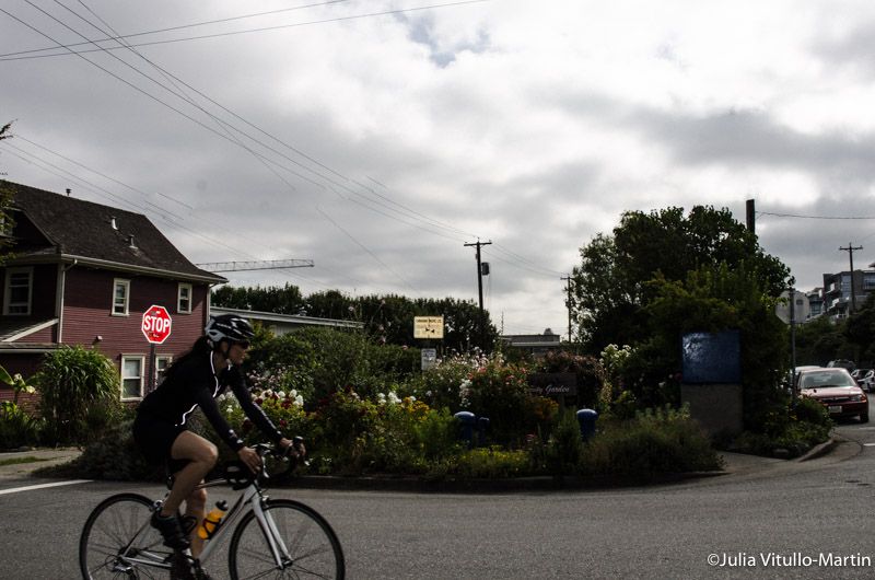
Walking and cycling, however, are not always allies. As blogger Stephen Hui comments, “You might think that paving the corridor, allowing bikes along the route, would be a no-brainer. But in Vancouver, cycling is politically polarizing. When you take space away from pedestrians and cars people can get very upset. This is especially true when the space seems to be given over to young urban professionals on fancy bikes.”

“A lot of bike lanes were brought into Vancouver very quickly,” notes Michael Heeney, a principal with Bing Thom Architects. “So many that the mayor was called the Robert Moses of bike lanes. Now we’re going to be a little more incremental, taking time to pause and monitor how biking is going, looking at any serious conflicts between bikes and other uses.” Because Vancouver has definitely acquired the corridor it can pause and contemplate what should happen next.
Surrounded by single-family homes and low-grade commercial development, Arbutus is a mile and a half from downtown. “For now you can’t justify anything more than bus lines,” says Heeney. “Eventually we’ll have density like New York City’s, and then we’ll be so grateful that we have a mayor and council with the foresight to preserve this arterial route for the future.”
Such serious planning seems remarkable, but there’s more. “In my world, a lot of people express concern about how much attention we give cycling as a transportation mode,” muses transportation director LaClaire. “As the guy working on it, the fact that cycling is our number two priority was not reflected too long ago in the streets. Cycling is the furthest behind in Vancouver even as walking, except for a few missing links, is almost complete. But the biking network fails just as you get toward where you want to be.” If cycling is Vancouver’s second transportation priority, does that mean pedestrians are the first?
LaClaire responds: “Yes!” Pedestrians first in a big city: now there is a revolutionary transportation policy that New York might contemplate.
Next, check out the Top 10 Secrets of the High Line and look back at the History of The High Line in NYC. Julia Vitullo-Martin is a Senior Fellow at the Regional Plan Association. Get in touch with her @JuliaManhattan.
Subscribe to our newsletter