Last Chance to Catch NYC's Holiday Notalgia Train
We met the voices of the NYC subway on our nostalgia ride this weekend!


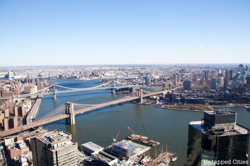
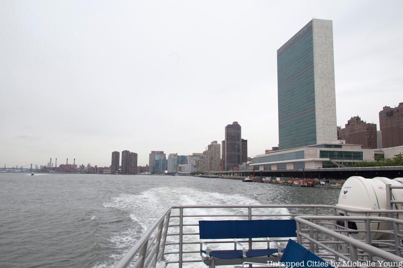
The East River flows beneath some of our most iconic bridges, but the waterway itself is a hallmark of New York City. The 16-mile span, which connects Upper New York Bay on its south end to Long Island Sound on its north end, has been the focus of urban development plans like the Citywide Ferry Service in recent years. However, it’s also a picturesque fixture of the city that draws thousands of visitors to the waterfront on a daily basis.
New York City apparently has a knack for incorrectly labeling its geological fixtures. Previously, we explained why the Hudson River is not technically a river, but an estuary. Similarly, the East River is actually a “salt water tidal strait” since it’s not comprised of any fresh water. While inland rivers travel in one direction, the East River’s direction of flow changes with the time of day; sometimes, you’ll find it heading North-East to Connecticut, and other times, it’s flowing South to New Jersey.
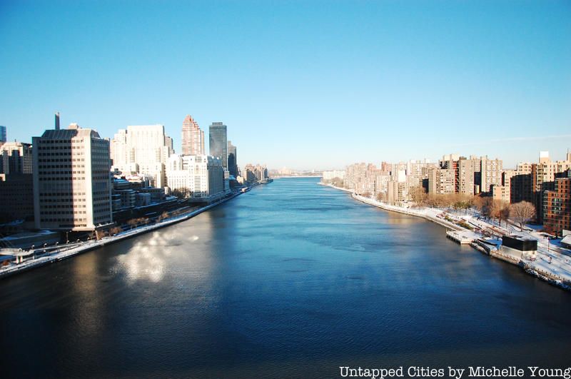
You may be tempted to take a dip in the East River, but its waters are still dangerous to swim in due to heavy pollution. Although it’s cleaner than it had been for decades, the NYC Department of Environmental Protection (DEP) categorizes the lower East River under “Use Classification I.” As of 2010, it’s only safe for secondary contact activities like boating and recreational fishing (although that doesn’t stop some people from tackling the annual “Brooklyn Bridge Swim“).

In 2009, a “bloated, pig-like carcass” was uncovered beneath the Brooklyn Bridge, sparking theories of mutant river monsters living in the East River. The Parks Department was quick to classify the creature as a discarded cooked pig, but its hoof-less claws seemed to suggest otherwise, said photographer Denise Ginley, who discovered the carcass. Others have described it as a rodent, a shell-less sea turtle or a small dog that became waterlogged with decay. See photos here.
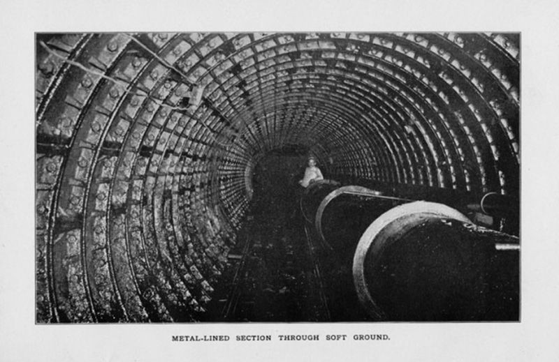
Photograph of the metal lined section of the tunnel. From “A General Report Upon the Initiation and Construction of the Tunnel Under the East River. In Public Domain.
We take tunnels for granted these days, but prior to the 20th century, only one tunnel existed; a small tube built in 1892 by the East River Gas Company to supply gas to Manhattan, which is still in use today. As the first company to ever attempt such an engineering feat, it needed to know what type of material they would be tunneling through as they crossed under the East River from East 71st Street to Ravenswood in Long Island City.
Since the East River reverses its flow between ebb and flood tides, the engineers would only have about 15 minutes of “still water” between the tides to drill holes into the floor of the river to get the information they needed. Ultimately, they calculated that the tunnel would need to be 111 feet below the surface of the river. To be precise, it would be 135 feet below the surface on the Manhattan end and 147 feet below on the Long Island City end.
Construction progressed from each end of the tunnel simultaneously; when the two headings finally joined together underground, the shaft centerlines were within ½ inch in each direction and less than two inches difference in depth, an engineering feat that’s still marveled today for its burrowing accuracy without modern-day computers and GPS.
One hundred and twenty years later, the tunnel is still very much utilized. It currently carries two gas supply pipelines, a fuel oil pipeline, a steam distribution pipeline, multiple electric feeders, and several telecommunication cables.
Read more about the first East River tunnel here.
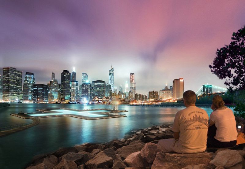
Rendering via + POOL
For those awaiting something a little more world-class than a barge pool, + POOL is a proposed floating pool whose walls will filter millions of gallons of the East River daily. It’s designed in partnership with a team of engineers at ARUP and designers at IDEO, with the aid of an impressive list of advisors, who range from senators to Olympic swimmers.
Paul Kelterborn, one of the project’s board members told Untapped “+ POOL is one of the most exciting new grassroots ideas for making NYC more livable. It simultaneously cleans the river–one of our city’s best assets–while creating an incredible new amenity that is fun and innovative. New York is a crowded place and so pushing ourselves to rethink boundaries is brilliant!”
Read more about + POOL here.
Over the years, the depths of the East River have been known to harbor a collection of unexpected finds, including a fleet of auto carcasses and a formica dinette. As part of its New York: A Portrait in Sound series, WNYC has published an entire episode focused on finds uncovered by professional diver Barney Sweeney, who braved the waters of New York Harbor in the 1950s and 60s. Throughout the length of his career, he’s come across washing machines, dead bodies, a murder weapon and even a diamond worth $25,000. You can find his testimony here.

Image via Wikimedia: CSIRO
According to Concrete Jungle: New York City and Our Last Best Hope for a Sustainable Future by Niles Eldredge and Sidney Horenstein, the East River is home to one of the ten worst invasive species: the European green crab, which was discovered on the Atlantic coast in 1817. During the mid-1900’s, they contributed to a noticeable decline in shellfish (clams, oysters and scallops) harvests. After all, one green crab can consume 40 half-inch clams a day.

Plan showing the Inboard profile plan as proposed for Hussar (1763). Image via Wikimedia Commons from Royal Museums Greenwich.
A while back, Untapped Cities reader, Alex Quintana, tweeted us about the shipwreck of the HMS Hussar after reading our article about the abandoned North Brother Island. The HMS Hussar was a British ship that sank in 1780 after it hit Pot Rock in the difficult waters of Hell Gate passage near the Bronx. The frigate was reportedly carrying 960,000 British pounds in gold when it sank. According to the Bank of England inflation calculator, that’s almost 146 million pounds (in 2012 currency). The New York Times also reports that an international coin dealer estimated the bullion could be worth $576 million. But others believe only two to four million in gold were on board.
There is no official location of where it actually sank, and there are some conflicting reports. The New York Times reported that it sank in the East River in an article from 1985 when a salvage expert believed he had located the wreck off the Bronx shore. A 2002 New York Times piece puts the shipwreck between Port Morris in the Bronx and North Brother Island. The Wiki entry (accurate or not) says the HMS Hussar finally sank off the Connecticut shore, citing David Hepper’s British Warship Losses in the Age of Sail, 1650-1859. There is belief that the ship, or what is left of it after various dynamite blasts in Hells Gate for navigation purposes, may be under landfill in the Bronx.
Though the British denied there was gold aboard the ship, they made at least three salvage attempts, according to The World’s Greatest Treasure Hunt. An expedition reportedly turned up some gold but nothing to the extent of what supposedly went down. A cannon from the ship was donated to Central Park in 1865, and was discovered to be fully loaded in 2013.
Meanwhile, the fate of the ten HMS Hussar ships in British Royal Navy history have not been too fortunate. Three were shipwrecked. Four were captured by other countries. One was accidentally sunk by the Royal Air Force. One was deliberately destroyed as target practice.

The General Slocum slowly sinks in the East River. Image via Wikimedia Commons
On June 15, 1904, over 1,300 passengers boarded the General Slocum for a Sunday church picnic on Long Island. The outing turned into a tragedy when the steamship caught fire shortly after it set sail. In less than 15 minutes, the ship burned and sank just off North Brother Island, killing over 1,000 members of St. Mark’s Evangelical Lutheran Church. The origin of the fire is unknown, but it’s thought to have been a discarded cigarette or match. The event was the deadliest naval tragedy until the Titanic, and the deadliest disaster in New York City until September 11th. The huge death toll also contributed to the decline of New York’s Little Germany community.
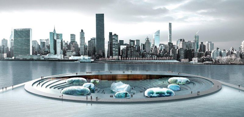
Image via Lissoni Architettura
Arch Out Loud’s recent design competition gave way to a series of futuristic ideas for tourist attractions for New York City’s waterfronts. One of our favorites (and the winner) is the “NYC Aquarium,” created by architecture firm Lissoni Architettura. If built, the underwater aquarium would be located at Anable Basin along the East River in Long Island City.
“The main idea is to generate an environment whereby visitors feel that they themselves are entering the water to discover the beauty of the marine life on display,” the website writes. “…[A] living shell that opens to the sky during the day to reveal the sea worlds and which closes as darkness falls to take on a “second life” as a planetarium, protecting the arena and the biome domes within, like a shell protects the pearl.”
While the aquarium remains just a concept at this time, it still hints at the future possibilities for the waterfront.
Next, discover the Top 10 Secrets of Hudson River Park and see 10 Historical Secrets of the Waterfront that the Citywide Ferry will Unlock in NYC.
Subscribe to our newsletter