Last Chance to Catch NYC's Holiday Notalgia Train
We met the voices of the NYC subway on our nostalgia ride this weekend!


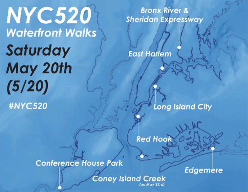
New York City boasts 520 miles of waterfront — that’s more mileage than Miami, Boston, Los Angeles and San Francisco combined. Yet, in a city covered with skyscrapers, we tend to forget that most New Yorkers actually live on an island. To get us thinking about the waterfront, the NYC Department of City Planning and various partners are hosting NYC520 guided walks on May 20th. Take part in an event near you to celebrate the city’s waterfront, its history and plans for its future.
“This idea behind this is to highlight the incredible size and diversity of NYC’s waterfront. It’s not just the places you see on postcards, but also these lesser visited neighborhoods and places along the shoreline where there are interesting things happening and plenty of people with fascinating stories,” said Mary Kimball, the Senior Resiliency Manager at NYC Department of City Planning.
“The background to this is also the City’s Comprehensive Waterfront Plan, which was last updated in 2011, and is due for an update in 2020. We’re at the point now of looking back on what’s happened since 2011, what has been successful, what hasn’t, and what has happened in the last 5+ years that is unexpected.”
The line up this year includes a Red Hook neighborhood history tour with John McGettrick, the Co-chair of the Red Hook Civic Association, an exploration of Edgemere in Queens and an “experiential waterfront walk” with artist Clarinda Mac Low, where participants will delve into the past, present and future of the East River waterfront in East Harlem. See the full list of events here.
Next, check out the Top 10 Secrets of the East River and discover 10 Under the Radar NYC Waterfront Parks Across the 5 Boroughs.
Subscribe to our newsletter