
Welcome back to our regular column on “Must Visit Places” in NYC’s neighborhoods. This installment on Inwood is by Untapped Cities contributor Jeff Reuben, who lives in the neighboring Washington Heights.
For the resident or the visitor, Inwood is a neighborhood for all seasons. Whether it’s canoeing in the summer, hiking in a primeval forest as colors change in the fall, celebrating Christmas in an 18th century farmhouse, or enjoying lively restaurants and bars all year round, there’s always something to check out.
Located north of Washington Heights, Inwood is the northernmost neighborhood on the island of Manhattan. Bounded by Dyckman Street on the south, the Hudson River to the west, the Harlem Ship Canal to the north, and the Harlem River to the east, it is linked to the Bronx mainland by four bridges, two for cars, one for trains, and a double-decker crossing carrying cars below and the subway above. These roads and rails lead to a neighborhood that is both bustling and bucolic. Inwood is a NYC neighborhood like no other — here are 20 spots to see.
Native American Historic Sites
Shorakkopoch Rock
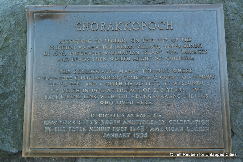
Inwood includes the site of a Lenape village called Shorakkopoch (also spelt “Shorakapkok”), which depending on the source meant “sitting down place,” “edge of the water,” or “in between the hills.” Legend has it — though historians are doubtful — that this was where Peter Minuit purchased Manhattan from the locals for the equivalent of $24 in 1626. Shorakkopoch Rock marks the putative spot of the deal with a historic plaque. The boulder is a remnant of even older history as it was one of many carried to Inwood by glaciers thousands of years ago.
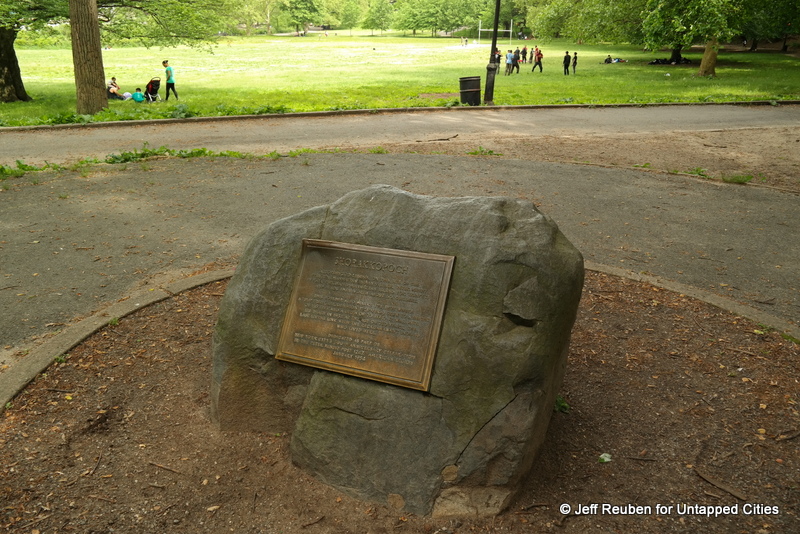
Shorakkopoch Rock is located inside Inwood Hill Park, several hundred feet west of Indian Road and W. 214th Street, southwest of a soccer field. Drums Along the Hudson, an annual one-day festival held in June, celebrates Native American culture and the site’s historic significance.
Indian Rock-Shelters
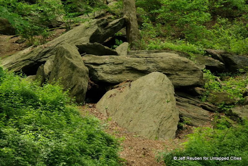
A few minutes walk southwest of Shorakkopoch Rock, “Indian Caves” used as shelter by the Lenape are still present although not marked. However, to call these caves is a misnomer, they are actually recesses among large rock formations dating from the times of the glaciers. They were rediscovered in the late 1800s and early 1900s and archaeological investigations yielded many artifacts of Native activities. Reportedly, local kids found arrowheads there as late as the 1950s.
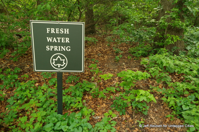
Besides shelter, this area also offered its original inhabitants a natural water spring and proximity to Spuyten Duyvil Creek to the north where fishing provided a food source. While the caves have survived, the setting has not. The creek was substantially altered in the late 1800s and early 1900s to create the Harlem River Ship Canal, which straightened and widened the water connection between the Harlem and Hudson rivers. Other areas once covered by water, including the nearby soccer field, were filled to expand parkland in the 1930s, a legacy of Robert Moses.