Vintage 1970s Photos Show Lost Sites of NYC's Lower East Side
A quest to find his grandmother's birthplace led Richard Marc Sakols on a mission to capture his changing neighborhood on film.


At 3.2 miles long, New York State’s Tappan Zee Bridge up in the Hudson Valley is undergoing a major change. This past Saturday, after four years of construction and 20 years of governmental squabbling, the new Tappan Zee Bridge opened. In honor of this momentous occasion, we bring you the 10 secrets of both the old and new bridge.
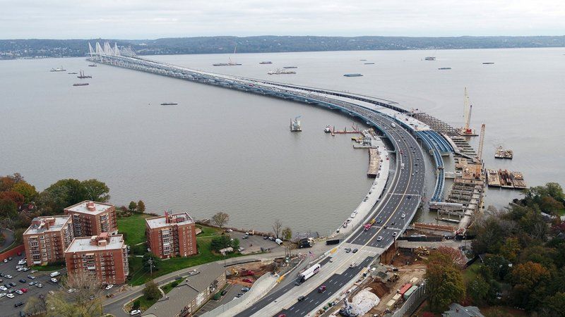
Photo Credit: New York State Thruway Authority.
One has to wonder why a bridge was even considered being built on one of the widest parts of the Hudson River. Would it not be more practical and economical to build the Tappan Zee across a more narrow section towards the south? The answer: if it was built 25 miles south of where the current bridge stands, it would have been in Port Authority territory, which means the they would have gotten the revenue from the bridge and not New York State.
Former Governor Thomas E. Dewey was planning an expansive New York State Thruway, a project, that at the time, would be one first highway systems in the country. While the Port Authority did have a proposal for a bridge a little further down in a narrower spot, Governor Dewey was able to kill their proposal. According to NPR, he “wanted that money to help pay for the rest of the thruway.” Dewey put the bridge as close as he could to Port Authority Territory without crossing over into it, but the location forced him to build a the exisiting three-mile long bridge. Had he gone a little further up, it would have been four.
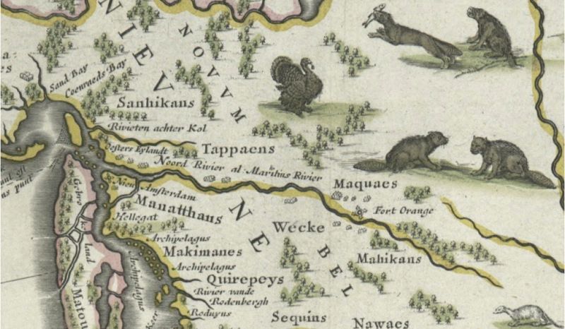
Map c.1635. Tappans lived primarily on the west side of the Hudson River in what has become Bergen County, New Jersey and Rockland County, New York. Image via Wikimedia Commons.
While the full name of the original brigde is Governor Malcolm Wilson–Tappan Zee Bridge, it is more colloquially known as just the Tappan Zee Bridge. The origin of the name combines the name of a Native American tribe from the area called Tappan, and the Dutch word zee meaning “sea.”
New York State Governor Malcolm Wilson’s name was added to the bridge in 1994. However, with the completion of the new bridge almost upon us, by a new state law, it has been renamed to the Governor Mario M. Cuomo Bridge after Gov. Andrew Cuomo’s father. Katharine Wilson Conroy, Malcolm Wilson’s daughter opposed the renaming, recalling fond childhood memories and her father’s personal connection to it. She explained how proud and excited her father was about the Tappan Zee and how changing it would be just be very emotional.
The new name will officially be dropping the Tappan Zee title, but getting people to call it otherwise might be a little difficult.
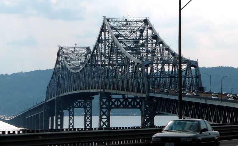
Original Tappan Zee bridge. Image via Wikimedia Commons.
After Governor Dewey spent months intensely fighting for the thruway project and getting the Port Authority to drop their alternative proposal, he remained largely vague on the details behind the cost and construction of the bridge. In a New York Times article published May 12, 1950, Dewey had “refused to enlarge on his announcement and cautioned against the speculation of the cost or type of bridge” the Tappan Zee would be.
However, he did give an impression that new engineering technology from World War II would be utilized. There was no elaboration and promised to give more concrete details in 60 days. The promises of using WWII engineering would not go completely abandoned as you will read in one of our upcoming secrets.
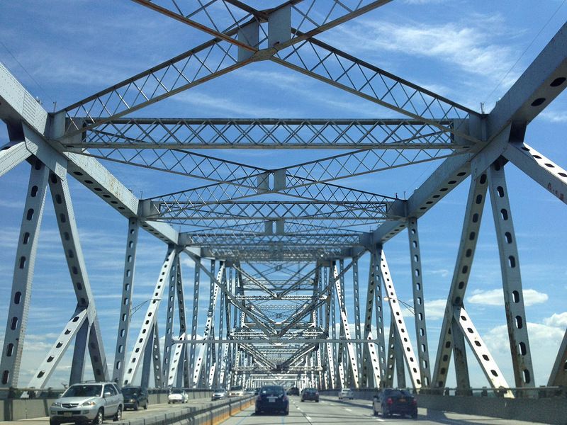
Tappan Zee Bridge in New York heading toward Westchester. Image via Wikimedia Commons.
The reason the bridge became such a huge infrastructural danger in the past few years is because Tappan Zee was deliberately built only to last 50 years. It passed its expected expiration date in 2005. The reason for the short timeline? There was a material shortage during construction because of the Korean War, so the project was built on the cheap from the beginning at a low budget of $81 million.
Many people were worried that the structure would collapse on itself. There were cracks in the concrete columns, while the rest of the metal rusted away with the decks almost worn through. But now drivers can rest easy with a solid, new structure ready and open for driving.
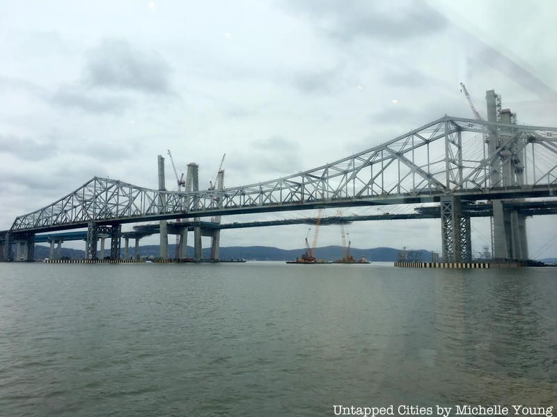
Emil Praeger, the designer of the original Tappan Zee, entered into World War II as the design manager for the US Navy’s Bureau of Yards and Docks. He served as a senior officer in charge of all civilian and military design for a committee to implement Winston Churchill’s plan to protect harbors from invasion in Europe.
Praeger designed these rectangular concrete breakwaters that would form a protective harbor for the supply and landing operations in Normandy. He later adapted the idea behind those concrete blocks for his design of the Tappan Zee.
Praeger’s other designs include the structural engineering for the General Assembly, Meeting Hall and underground parking garage of the United Nations, and was chief engineer of the proposed extension of the West Side Highway.
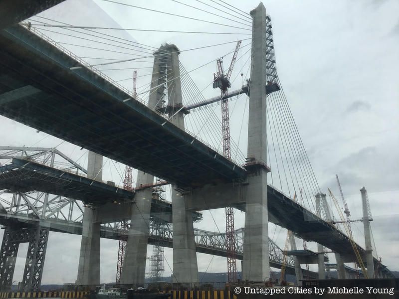
The seriousness of the bridge’s deteriorating condition prompted the New York Metropolitan Transportation Council to apply for federal funding in August 2012. The overwhelming safety concerns, especially after the 2007 collapse of Minnesota’s I-35W Mississippi River bridge, led the US Department of Transportation to fast-track the project proposal in an approval process that took 10 months versus the multi-year process traditionally taken.
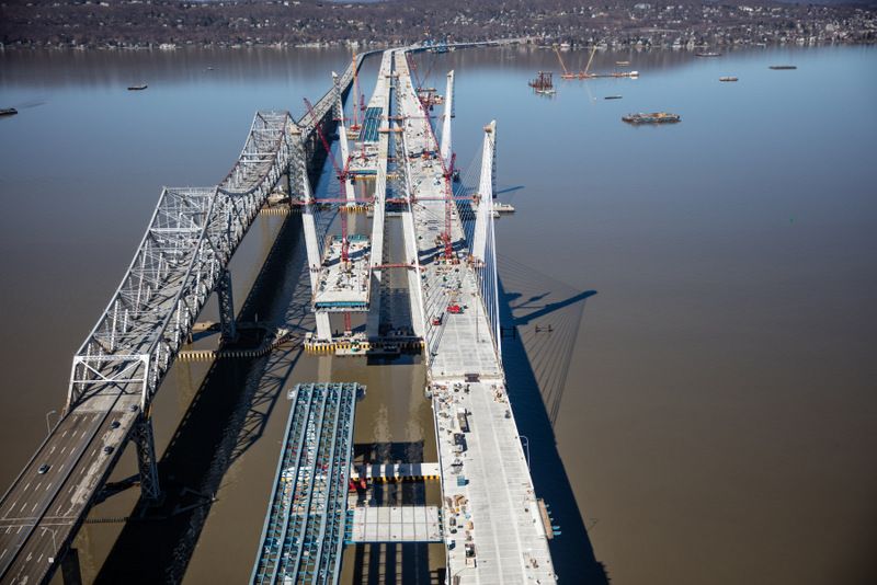
April 9, 2017 – Roadway connections between the eastbound and westbound spans will allow emergency access. Photo Credit: New York State Thruway Authority.
The last opening of a bridge of this scale in the New York area was in 1964 for the Verrazano-Narrows Bridge connecting Brooklyn and Staten Island. What’s different about how the budget was decided for this massive project was that instead of the state creating its own design, a new approach was taken where the design and construction were put out to bid. The Tappan Zee Constructors consortium won the bid with a plan that came in $1 billion under what the state had anticipated would cost. In the end, Gov. Cuomo explained that the entire project ‘cost $4 billion to build, “on time and on budget.”‘
To celebrate the opening of the new span of the new Tappan Zee Bridge, Governor Andrew Cuomo took a ceremonial ride across in a 1955 Corvette. He was joined by Sleepy Hollow resident Armando “Chick” Galella, veteran and Bronze Star recipient who survived the attack on Pearl Harbor on December 7, 1941. Galella had driven the same model year corvette on December 15, 1955 for the inaugural drive across the original Tappan Zee.
Those driving west from Westchester and Rockland Counties will be able to cross the newly opened span, while those traveling east into Westchester will continue to use the existing bridge for another two or three months.
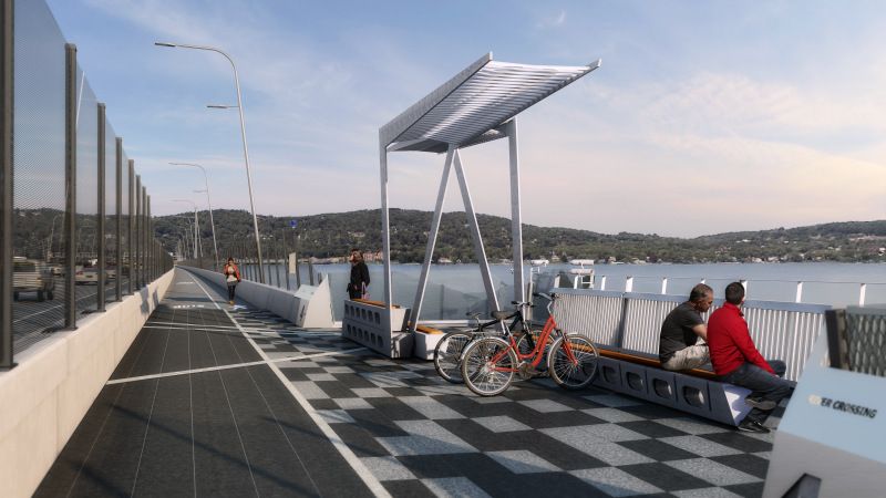
Rendering of the New Tappan Zee Bridge bike and pedestrian path. Image via the New NY Bridge.
There will not be a rail line on the new Tappan Zee Bridge, but it will feature a shared-use bike and pedestrian path. This path will include six resting points (belvederes) that according to The New NY Bridge will “will reflect the culture and history of the Lower Hudson Valley.” This recreational opportunity does not currently exist in Rockland or Westchester Counties.
While cars and mass transit will get the chance to start using the new bridge, biking enthusiasts will have to wait until 2018 to use the shared bike path.
https://www.youtube.com/watch?v=l5HwNctJJsY
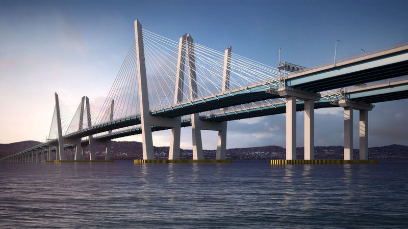
Rendering of the completed new Tappan Zee. Photo Credit: New York State Thruway Authority.
The question probably on everybody’s mind is what will happen to the toll price. Currently, the toll is $5, a welcome price compared to the $15 toll on the George Washington Bridge heading into the city. As of now, Governor Cuomo has promised to keep the $5 toll the same until 2020. After that remains unclear.
Like bridges and fun facts? Join us on our upcoming Secrets of the Brooklyn Bridge Walking Tour. Next, check out the Top 12 Secrets of NYC’s Kosciuszko Bridge Between Brooklyn and Queens.
Subscribe to our newsletter