The Berkshires Bowling Alley that Inspired "The Big Lebowski"
It’s been 36 years since the release of The Big Lebowski, the irreverent cult comedy by Joel and Ethan
It’s been 36 years since the release of The Big Lebowski, the irreverent cult comedy by Joel and Ethan

Find exciting new ways to rediscover your city with Untapped New York tours and events!

Get an exclusive look inside the Lott House, one of the oldest buildings in Brooklyn!


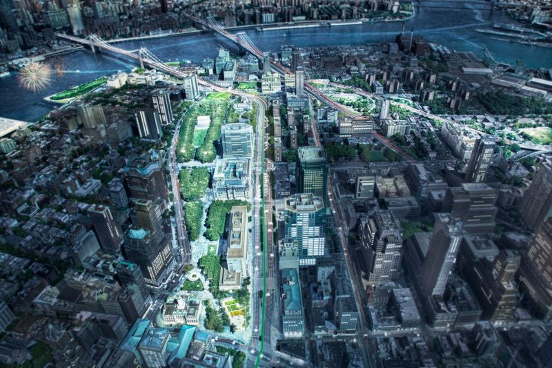
Concept aerial rendering of the Brooklyn Strand. Image credit: WXY architecture + urban design.
In an effort to further the successful growth of Downtown Brooklyn, a coalition of more than 40 local Brooklyn stakeholder groups have announced their community vision to reimagine the 50 acres of city-owned land between Downtown Brooklyn, DUMBO, and the Brooklyn Navy Yard known as the Brooklyn Strand.
As part of one of the initiatives Mayor Bill de Blasio announced in July 2014 to create a more thriving, 21st Century Downtown Brooklyn, the Brooklyn Strand Community Vision looks to transform the quality of public space in the area by better connecting people of the surrounding neighborhoods, and making the waterfront more accessible between Downtown Brooklyn, DUMBO, and the Brooklyn Navy Yard.
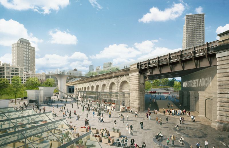
Concept rendering of Anchorage Market. Image credit: WXY architecture + urban design.
Currently, the area sits in a disparate area of disconnected parks, greenways and plazas, leading into a grand promenade and gateway into Brooklyn. People who visit the area are certainly familiar with the awkward and unpleasant walk it takes to get around the area.
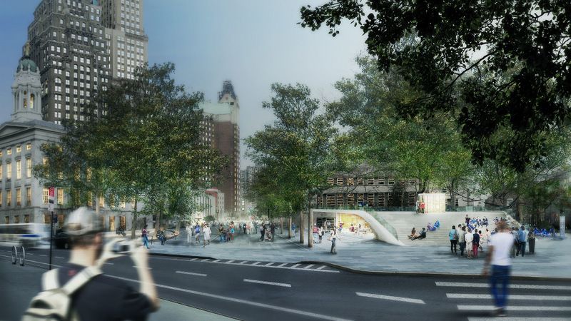
Concept rendering of Borough Hall Park from Joralemon St. Image credit: WXY architecture + urban design.
In the last two years, the Brooklyn Strand Community Vision has developed into a sizable project of 250 community stakeholders consisting of residents, community groups, business leaders, elected officials and City agencies such as Brooklyn Bridge Park. Led by WXY Architecture + Urban Design, an intensive planning process resulted in 50 site walkthroughs, numerous meetings and several public workshops to create this vision.
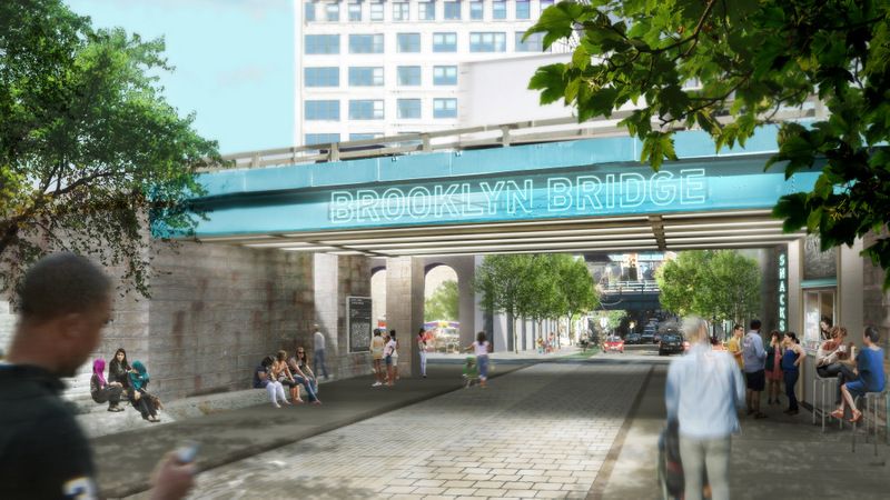
Concept rendering of the Gateway to Brooklyn. Image credit: WXY architecture + urban design.
Recommendations by the community for this new vision seek to build stronger connections between and improve the quality of the existing series of parks, plazas and open spaces throughout Borough Hall Park, Cadman Plaza, Commodore Barry Park, and the Bridge Parks, among others; reopening of the long-closed Brooklyn War Memorial to the public; creation of a permanent market at Anchorage Plaza to give local businesses an increased opportunity to thrive.
Concept rendering of the Brooklyn War Memorial and Cadman Plaza Park. Image credit: WXY architecture + urban design.
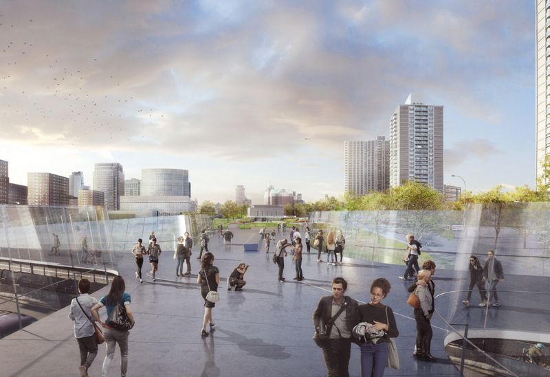
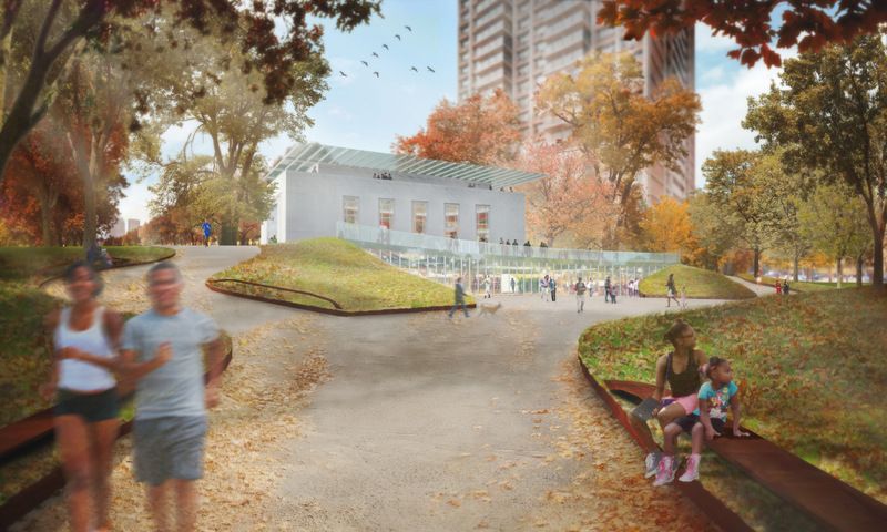
Concept rendering of Bridge Parks 3 and 2. Image credit: WXY architecture + urban design.
Additional recommendations include widening of sidewalks for an enhanced biking network and more pedestrian activity, installation of innovative public art, and examining opportunities to realign portions of the BQE to improve connectivity across neighborhoods.
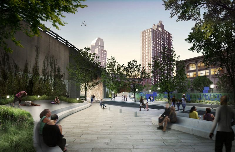
Concept rendering of Brooklyn Bridge Plaza. Image credit: WXY architecture + urban design.
Here at Untapped Cities, we are very excited to see a project like this coming into fruition and bringing the good news to our readers. We are excited to announce a walking tour of the Brooklyn Strand on Saturday, October 28. On this tour, you will have the opportunity to track these wonderful and much-needed proposed changes and see the future of an already thriving Downtown Brooklyn.
Sign up using the button below!
Walking Tour of the Brooklyn Strand
Next, See Renderings of the Second Phase of NYC’s Essex Crossing Mega Development in the Lower East Side and check out The Top 10 Secrets of the Creation of Brooklyn Bridge Park.
Subscribe to our newsletter