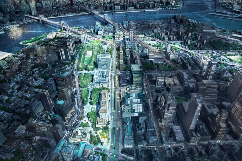
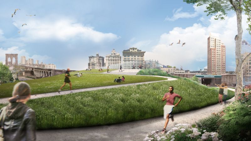
Concept aerial rendering of the Brooklyn Strand. Image credit: WXY architecture + urban design.
Brooklyn is one of the most famous places in the world — yet, its gateway is a confusing network of disconnected parks and narrow sidewalks, which pedestrians are forced to navigate. In an effort to transform the quality of public space in the area, more than 250 community stakeholders have worked together to develop the Brooklyn Strand Community Vision — an herculean project to reimagine the 50 acres of city-owned land between Downtown Brooklyn, DUMBO and the Brooklyn Navy Yard (collectively referred to as the Brooklyn Strand).
Although still in its infancy stages, the community-driven plan seeks to transform the quality of public space in the area by better connecting people of the surrounding neighborhoods, and by making the waterfront more accessible. Here are 5 highlights of the project, which you can learn more about on our upcoming tour hosted in partnership with WXY Architecture + Urban Design:
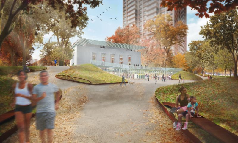
Concept rendering of the Brooklyn War Memorial and Cadman Plaza Park.Image credit: WXY architecture + urban design.
Dedicated in 1951, the Brooklyn War Memorial is a 10,000-square-foot, granite and limestone structure located in the north end of Cadman Plaza Park. Built in honor of the “heroic men and women of the borough of Brooklyn” who served in World War II, the memorial displays 11,500 names of Brooklyn service members who died during the war. For a quarter of a century, however, it has been closed off to the public.
As part of the Brooklyn Strand Community Vision, the Brooklyn War Memorial building would be rehabilitated and reopened as both a memorial and a learning center. In addition, the space and landscape surrounding the building will also be re-graded to make it more inviting for the community.
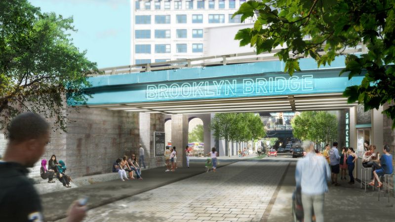
The Brooklyn Strand Urban Design Action Plan notes that visitors are “greeted with an abysmal entrance” when entering Brooklyn off the Brooklyn Bridge pedestrian walkaway. Currently, the Brooklyn side of the Brooklyn Bridge stair entrance is located under the bridge on Cadman Plaza East at Prospect Street. It is narrow and not easily discernible for visitors and locals alike.
To the south of this entrance sits Cadman Plaza Park, which ends at the Brooklyn Bridge southbound Cadman Plaza West exit ramp. This creates a unique opportunity to create a pedestrian friendly walkway as the northeast tip of the Park slopes up while Cadman Plaza West slopes down. Bridging this space will provide continuous pedestrian access from the park to the Brooklyn Bridge promenade.
The spaces underneath access ramps and parkland next to the Bridge would all be activated — possibly used for public markets or recreation space.
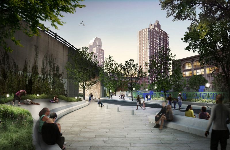
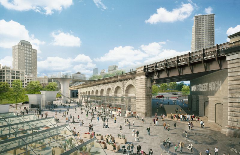
Wrapping around the base of the Brooklyn Bridge, Anchorage Plaza is comprised of the area under Main Street Arch, and the area east and west of the Brooklyn Bridge. Altogether, the 75,000-square-feet space is mostly utilized by the DOT Bridges Repair Unit.
Although Anchorage Plaza is currently closed off to the public, it is located in an ideal location to serve as a new civic commons that includes a public market. The Brooklyn Bridge Promenade stair and Cadman Plaza Park are situated to the south; DUMBO is located northeast and Brooklyn Bridge Park’s Pier 1 is northwest.
The proposal for Anchorage Plaza would active the space, which — in turn — would improve access along Old Fulton Street, connect the surrounding communities and support local businesses.
2. Bridge Parks
Concept rendering of Bridge Parks 3 and 2. Image credit: WXY architecture + urban design.
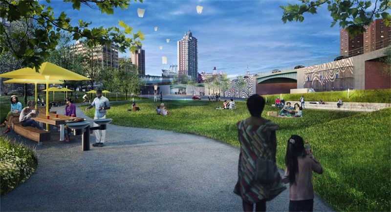
Wrapping around the base of the Brooklyn Queens Expressway (BQE), Bridge Parks 1, 2 and 3 are moderately used as small pocket parks. However, they are underutilized, characterized by cracked asphalt, chain-link fences and poor lighting. Due to their proximity to Manhattan Bridge subway lines, the parks are also subjected to loud noises.
The Brooklyn Strand Community Vision notes that there is a clear desire to walk through Bridge Park 2 to access the York St. Station on the F train. Some of the proposed changes to improve and connect the parks include lighting updates, new seating areas, the construction of a formal playground and the addition of green spaces, as well as a green wall that would dampen noise levels by wrapping the BQE wall.
Located on Nassau St., between the Manhattan Bridge and the BQE, Trinity Park is a pocket park that is situated nearby a large swath of publicly inaccessible, Park-owned land. The space is cut off by BQE access ramps and traffic infrastructure predominantly occupies it.
There is potential to unlock the area through streetscaping and the reconfiguration of the BQE-Manhattan Bridge interchange. This would ultimately transform the space into a usable, pedestrian + bike friendly area, ideal for public art installations, events, gatherings and park facilities.
These changes are just the top of the iceberg for the Brooklyn Strand Community Vision. To learn more about what’s in store, join us for our upcoming tour on October 28th:


 Concept rendering of Anchorage Market. Image credit: WXY architecture + urban design.