


Central Park was a grand vision by New York City’s civic leaders, executed by landscape architects Frederick Law Olmsted and Calvert Vaux. 843 acres of what was once swamps and farms (even a small village) was transformed into a naturalistic, experiential public space. But not everything in the park was shaped anew with the monumental effort. There are a number of ruins and remnants, and original landscape features, that remain to this day.
1. Ruins of the Academy of Mount St. Vincent

The stone walls behind the Conservatory Gardens at 105th Street are the ruins of the Academy of Mount St. Vincent, founded in 1847 by the Sisters of Charity of Saint Vincent de Paul of New York. According to Mount St. Vincent history, it was the first institution for higher learning for women in New York, even before public colleges or high schools were open to women. As the school notes, “The Academy was no finishing school,” and was dedicated to a liberal arts education.
Starting in 1855, land was acquired for the creation of Central Park, so the school moved to a new campus in Riverdale, in the Bronx. According to Melvin Kalfus in the book Frederick Law Olmsted: The Passion of a Public Artist, Olmsted and his family lived in the Academy buildings during the construction of Central Park. In 1881, a fire destroyed the buildings, but the stone wall foundations remain to this day. The illustration on a plaque in the Conservatory Gardens (above) today shows just how large the academy, situated on a hill, was.
2. McGowan’s Pass Tavern Remnants
The Academy of Mount St. Vincent was built at the site of a former tavern, called the Black Horse Tavern but popularly referred to as McGowan’s (or McGown’s), the name of the family that ran the establishment. The road that ran by, McGowan’s Pass, was denoted in maps that date from the Revolutionary War into the early 20th century.
The original buildings of the Academy were repurposed as a hotel, a restaurant, a Civil War Hospital, and a museum but after the complex burned down, another tavern was constructed on the site, called McGown’s Pass Tavern that operated until its demolition between 1915 and 1917. According to the Central Park Conservancy, the driveway and foundation of the tavern remain in a section used by the Conservancy for mulching and composting. Following Hurricane Sandy, the spot was used as a temporary dumping site for park debris caused by the storm.
3. Seneca Village Remnants
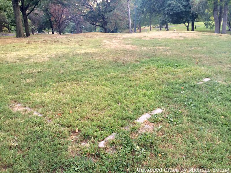
There was once a thriving village called Seneca located in what is now Central Park, between 81st and 89th Street on the West Side. It wasn’t a shantytown or slum – this was a full fledged middle class town with over 260 residents, several churches, and a school. With wooden houses on assigned lots, it gave Black residents what they need to vote – their own land. However, in 1853 the city passed the bill authorizing the takeover of the land to build Central Park and paid the settlers off. By 1857, when the park officially opened, the settlement was gone.
The granite bricks near the West 85th Street entrance are often erroneously said to be the remnants of a foundation of a building in Seneca Village, but from speaking to the Central Park Conservancy Historian, Marie Warsh, it’s been determined they’re actually from a 1930s sandbox. There are foundations and other remnants hidden much further underground though!
4. The Hidden Survey Bolt

The bolt is believed to be one of the original survey bolts from when the Manhattan grid was first planned in 1811. Led by John Randel, surveyors had the task of marking each future street intersection aligned with the grid. They used marble monuments or iron bolts where there was exposed bedrock. As Central Park was not a part of the original plan for Manhattan, street intersection points may have been marked but left to remain since no intersection was actually built here.
The bolt is known to be in the park, but the exact location is kept a secret for fear that it will be stolen or destroyed.
5. Revolutionary War-Era cannon Found Fully Loaded
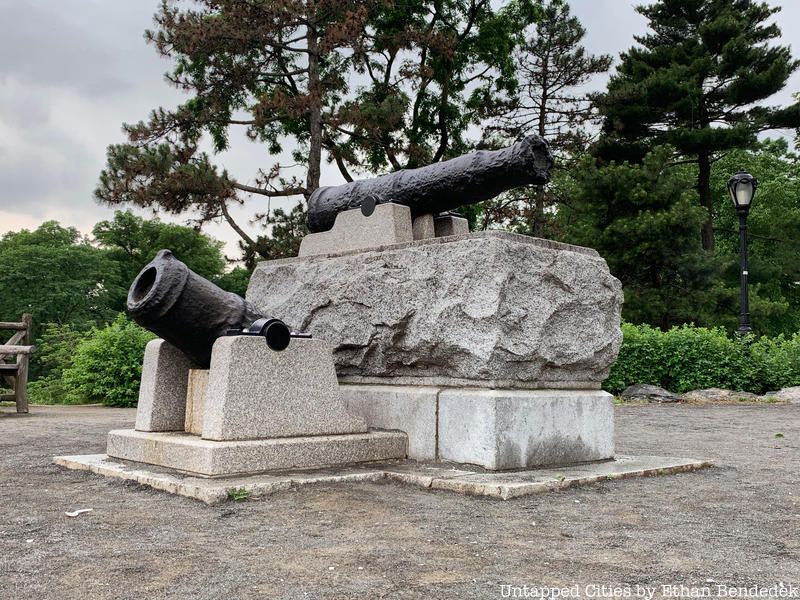
This cannon was used on a British ship, possibly the HMS Hussar, which sank in the East River. After an anonymous donation in 1865, it was installed at Fort Clinton in 1905 where it remained on public display until 1996 when the Central Park Conservancy brought it inside a shed at the Ramble to protect it from vandalism. In January 2013, workers were cleaning it when they found it was fully loaded with gunpowder and a cannonball. CBS News reported that more than 800 grams of black powder were found, still capable of firing.
6. Original Manhattan Schist

Not everything in Central Park is man-made and in fact, it is one of the best locations to take in Manhattan schist (and Hartland Schist), the original rock of Manhattan, both in terms of large outcroppings, like at Belvedere Castle and Umpire Rock near 63rd Street and Central Park West, and glacial striations. As described by the Central Park Conservancy:
The schist was formed from sedimentary shale by intense subterranean heat and pressure some 450 million years ago in the Paleozoic Era. While the schist of Umpire Rock was being formed, it was twisted and folded by upheavals in the earth’s depths. Minerals scattered in the former shale were fused into crystals of quartz, mica, feldspar and garnet within the schist. Lighter-colored veins of granite and coarser granite pegmatite are visible across the grain. These inlays were actually once liquefied rock from the earth’s interior before they were injected into fissures in the schist and cooled into bands of solid rock.
7. Remnants of the Old Yorkville Reservoir
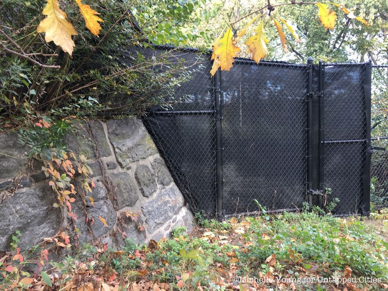
Before Olmstead and Vaux got their hands on the Central Park site, a rectangular reservoir had been built in 1842, known as the Yorkville Reservoir. According to the Times, the architects felt “cursed” by the gawky thing and designed around it. It was filled in and covered in the 1930s but you can see several parts of the reservoir walls when you walk on the 85th Street Transverse police station inside the park – a long wall that is runs from the NYC Parks maintenance facility continues through the new police station extension, where it is has been deliberately left exposed in the training room and the detective’s offices. You can also see parts of the same wall from the southern end of the Great Lawn.
Another spot the wall can be seen is on the east side of the Great Lawn. There’s also a historic marker near the Delacorte theater.
8. The Ramble Cave in Central Park
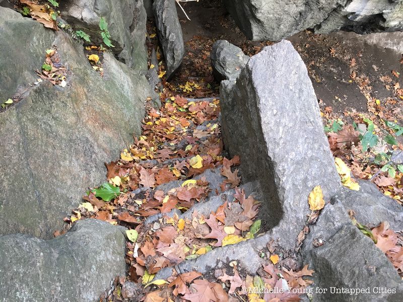
The Ramble Cave, also known as the Indian Cave, was created from a natural cave discovered during park construction and used by lake rowers who could leave their boats to explore the area. Unfortunately, in the early 1900s, the cave was the site of several crimes and at least one suicide. In 1929 The New York Times reported that 335 men had been arrested for “annoying women” in the park, especially at the cave. Eventually, the cave became too dangerous to maintain, so it was sealed at both ends and the inlet was filled. Today, the cave is inaccessible but the stairway entrance is visible from the path above and it adds a feeling of mystery to the area.
9. The Central Park Blockhouse

The Blockhouse was one of many fortifications built in New York City during the War of 1812 to protect against British attack, thus predating the construction of the park. Assuming that the British would attack from the harbor, New Yorkers originally built forts along the waterfront at the southern part of Manhattan. When the British attacked from Long Island instead, New Yorkers realized that they weren’t prepared to defend northern or eastern Manhattan.
Hastily, as evident in the Blockhouse’s uneven stonework, General George Swift ordered the construction of new fortifications (another one was located in what is now Morningside Park, another Olmsted and Vaux creation). By examining the fort, you can see the gunports soldiers used to spot the British. The Central Park Conservancy writes that “the rugged stone structure once had a sunken wooden roof and mobile cannon that could be deployed quickly. Today, the Blockhouse is empty, roofless, and securely locked.”
With the signing of the Treating of Ghent in 1814 signaling the end of the war, the Blockhouse was promptly abandoned. Olmsted and Vaux designed around the blockhouse, leaving it as a ruin from the past. For a while it was used to store ammunition, and functioned as a celebration venue for patriotic holidays in the early 1900s before it fell into disuse again.
10. The Central Park Arsenal
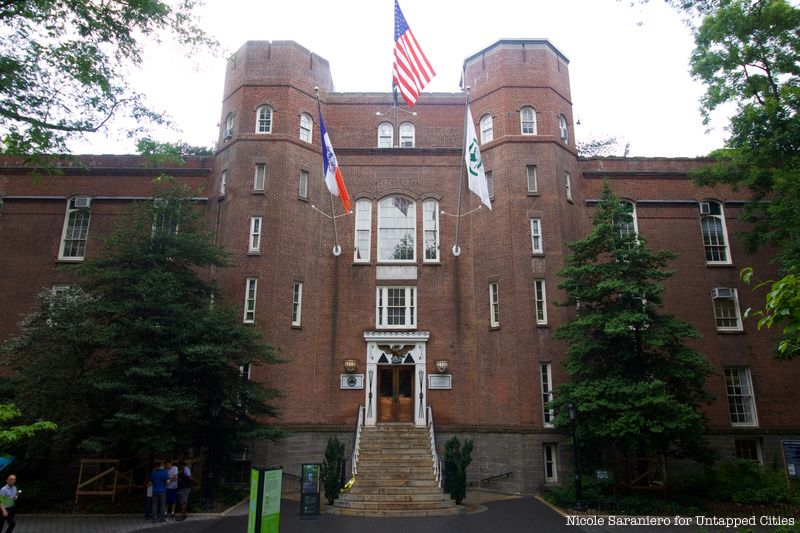
The Central Park Arsenal, at 64th Street and Fifth Avenue, is one of the two buildings (the other being the Blockhouse) left in the park that predate the park’s formation. Although its medieval architecture doesn’t quite match the park’s aesthetic, the 167-year-old Arsenal has survived multiple demolition attempts by providing a diverse array of functions, from its original usage as a state munitions facility, to the site of the Museum of Natural History, to its current role as home to the Department of Parks and Recreation and headquarters of the Central Park Zoo.
The medieval-style building, designed by architect Martin Thompson, was built between 1847 and 1851. In 1857, four years after the State designated the large plot of land under the building as Central Park, New York City officials bought the Arsenal for $275,000. After removing all the weapons, the city converted the structure to function as the park’s administrative building, which it did until 1914. Also in 1857, the 11th Police Precinct’s station took up residence in part of the building.
Next, check out the Top 10 Secrets of Central Park. This article was co-written by Michelle Young, Rachel Fawn Alban, Samantha Sokol, and Sabrina Romero.

